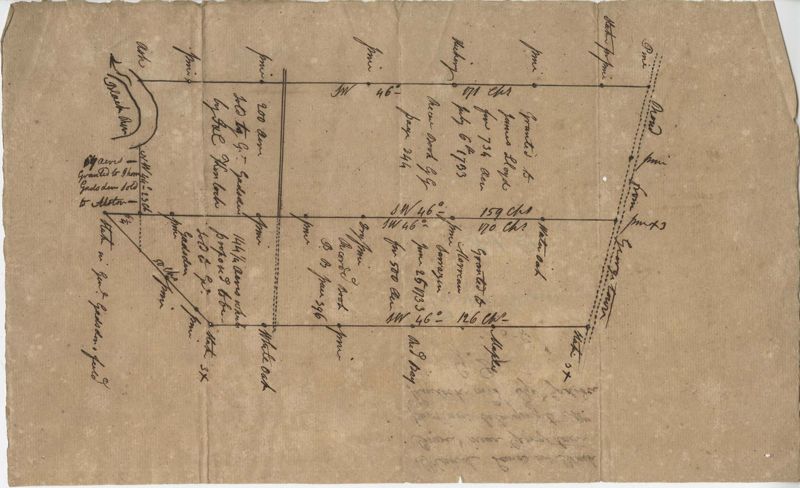
Black River Plat 1888
Title:
Black River Plat 1888
Date:
1888
Description:
Plan of approximately 1500 acres on Black River near Georgetown part now belonging to Kinloch and Gadsden. Names associated with this plat are Gadsden, Kinloch, Alston, Thomas Gadsden, James Lloyd, and Morreau [?] Sarrazin.
Collection Title:
John McCrady Plats and Deeds Collection Contributing Institution:
South Carolina Historical Society Media Type:
Maps Topical Subject:
Conveyancing--South Carolina , Maps , and Surveying--South Carolina Geographic Subject:
Georgetown (S.C.) and Black River (S.C.) S.C. County:
Georgetown County (S.C.)
Language:
English
Shelving Locator:
510.00, Box 1, Folder 57
Date Digital:
2016-02-22
Digitization Specifications:
400 dpi, 24-bit depth, color, Bookeye 4 Basic, Archival masters are tiffs.
Internet Media Type:
image/jpeg
Copyright Status Statement:
Public Domain.
Access Information:
For more information and re-use requirements contact the South Carolina Historical Society, Charleston, SC, 29401.
Admin ID:
223214