City Engineers's Plat Book, 1671-1951, Page 259
Close Viewer
- Title:
- City Engineers's Plat Book, 1671-1951, Page 259
- Date:
- 1940
- Description:
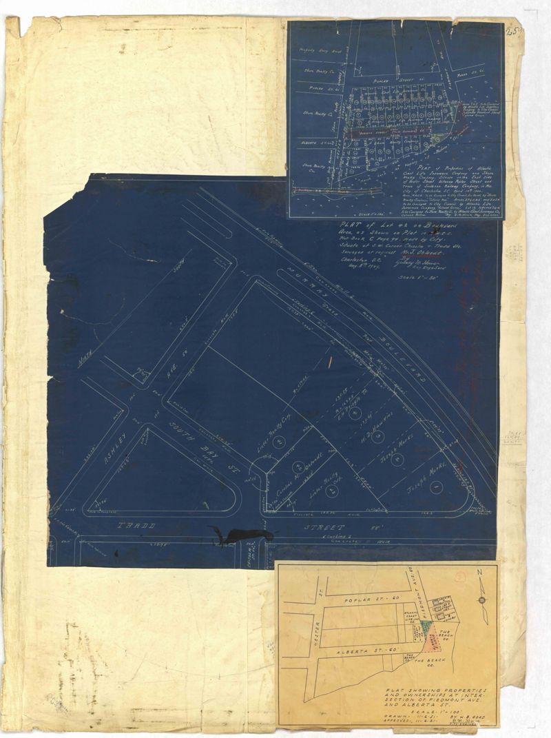
- Page 259 of the City Engineer's Plat Book with three plats. Plat 1 shows lots located between Hester Street and Piedmont Street. Plat 1 also shows Alberta Street, Poplar Street, and a stretch of marsh land. Plat 2 shows lots located between Tradd Street, Ashley Street, and Murray Boulevard. Plat 2 also shows South Bay Street. Plat 3 shows a city block between Hester Street and Piedmont Avenue, and between Poplar Street and Alberta Avenue.
- Collection Title:
- City Engineers's Plat Book, 1671-1951
- Contributing Institution:
- The Charleston Archive at CCPL and City of Charleston
- Media Type:
- Maps
- Topical Subject:
- Cadastral maps and Surveys
- Geographic Subject:
- Charleston (S.C.)
- S.C. County:
- Charleston County (S.C.)
- Language:
- English
- Date Digital:
- 2023
- Digitization Specifications:
- 300 dpi, 24-bit depth, color, i2S SupraScan Quartz A0. Archival masters are tiffs.
- Format:
- image/jpeg
- Copyright Status Statement:
- Copyright status undetermined.
- Access Information:
- This City of Charleston has placed this collection on permanent loan with the Charleston County Public Library. For more information and reuse requirements contact The Charleston Archive at Charleston County Public Library, 68 Calhoun Street, Charleston, SC 29411.
- Admin ID:
- 296890
Permalink