City Engineers's Plat Book, 1671-1951, Page 40
Close Viewer
- Title:
- City Engineers's Plat Book, 1671-1951, Page 40
- Date:
- 1858
- Description:
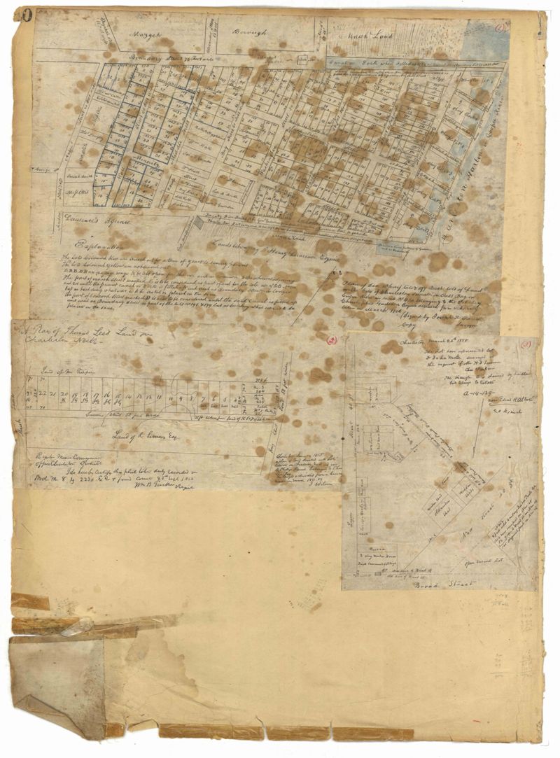
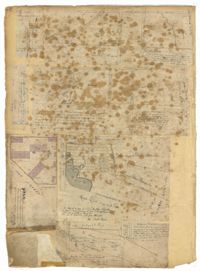
- Page 40 of the City Engineer's Plat Book with three plats. Plat 1 shows lots located between Laurence Street and Boundary Street, and Anson Street and the Charleston Harbor on the Cooper River. Plat 1 also shows East Bay Street, Washington Street, Concord Street, several wharfs, marshland, and a label reading "Mazyck Borough." Plat 2 shows lots on Simmons Street, between King Street and a stretch of marshland. Plat 3 shows lots of land between New Street and Logan Street, and several buildings.
- Collection Title:
- City Engineers's Plat Book, 1671-1951
- Contributing Institution:
- The Charleston Archive at CCPL and City of Charleston
- Media Type:
- Maps
- Personal or Corporate Subject:
- Barbot, Louis J.
Purcell, Joseph (Cartographer)
Parker, Charles - Topical Subject:
- Cadastral maps and Surveys
- Geographic Subject:
- Charleston (S.C.)
- S.C. County:
- Charleston County (S.C.)
- Language:
- English
- Date Digital:
- 2023
- Digitization Specifications:
- 300 dpi, 24-bit depth, color, i2S SupraScan Quartz A0. Archival masters are tiffs.
- Format:
- image/jpeg
- Copyright Status Statement:
- Public domain.
- Access Information:
- This City of Charleston has placed this collection on permanent loan with the Charleston County Public Library. For more information and reuse requirements contact The Charleston Archive at Charleston County Public Library, 68 Calhoun Street, Charleston, SC 29411.
- Admin ID:
- 296575
Permalink