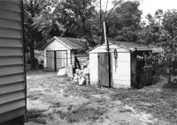
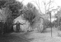
Sheds behind house on site affected by the widening of U.S. Route 17. Presumably located in Mount Pleasant or vicinity. Surveyor notations on back of photo: "Dkt.: 10.597. Property owner: Julia B. Simmons. Tract: 54. Station: 301±30 Lt. Date: Sept. 17, 1968." [See collection description for explanation of surveyor notations.]
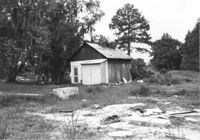
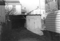
Shed and/or garage on site affected by the widening of U.S. Route 17. Presumably located in southern Charleston County. Surveyor notations on back of photo: "Dkt.: 10.600. Property owner: Vernon A. Ellis. Tract: 3. Station: 512± - 514± Rt. Date: Sept. 18, 1968." [See collection description for explanation of surveyor notations.]
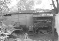
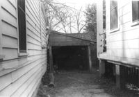
Shed behind house on site affected by the construction of Interstate 26 (I-26). Address: 5 Carolina Street. Surveyor notations on back of photo: "Dkt.: 10.517. Property owner: I.S. Keith Ellsworth, Sr. Tract: 128. Station: 22+50 Rt. (Line "1"). Date: November 4, 1965. Backyard with shed, entirely in R/W." [See collection description for explanation of surveyor notations.]
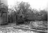
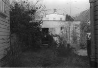
Lot and outbuildings on site affected by the construction of the Crosstown. On Cooper Street; address unknown. Surveyor notations on back of photo: "Dkt.: 10.518. Property owner: Louise McLead Drayton. Tract: 30-B. Station: 14+60 Lt. (Cooper Street). 41+70 Rt. (U.S. Rt. 17). Date: Apr. 20, 1965. Partially in R/W." [See collection description for explanation of surveyor notations.]
Shed and backyard on site affected by the construction of the Crosstown. Address: 112 Sheppard Street. Surveyor notations on back of photo: "Dkt.: 10.524. Property owner: Alston O. Crum, Est. Tract: 146. Station: 19+60 Lt. S.B. lane. Date: Dec. 2, 1964. Proximity." [See collection description for explanation of surveyor notations.]
Shed on site affected by the construction of the Crosstown. Address: 118 Sheppard Street. Surveyor notations on back of photo: "Dkt.: 10.524. Property owner: John H. Jenkins. Tract: 143. Station: 18+60 Lt. S.B. lane. Date: Dec. 2, 1964. Outside R/W." [See collection description for explanation of surveyor notations.]
Shed on site affected by the construction of the Crosstown. Address: 116 Sheppard Street. Surveyor notations on back of photo: "Dkt.: 10.524. Property owner: Margaret Oree. Tract: 144. Station: 18+95 Lt. S.B. lane. Date: Dec. 2, 1964. Outside R/W." [See collection description for explanation of surveyor notations.]
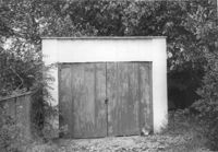
Shed or garage on site affected by the construction of the Crosstown. Address: 287 Coming Street. Surveyor notations on back of photo: "Dkt.: 10.524. Property owner: John T. Bowden. Tract: 152. Station: 21+10 Lt. S.B. lane. Date: Dec. 2, 1964. In R/W - Bought." [See collection description for explanation of surveyor notations.]
Shed, on site affected by the construction of the Crosstown. Address: 259 Ashley Avenue. Surveyor notations on back of photo: "Dkt.: 10.524. Property owner: Madeline H. LaRoache, et al. Tract: 76. Station: 77+90 Rt. Date: Oct. 14, 1964. In R/W - Bought." [See collection description for explanation of surveyor notations.]
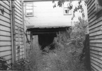
Shed in rear of house, on site affected by the construction of the Crosstown. Address: 11 Kennedy Street. Surveyor notations on back of photo: "Dkt.: 10.524. Property owner: J. Arthur Brown. Tract: 87. Station: 80+45 Rt. Date: Oct. 14, 1964. Behind house." [See collection description for explanation of surveyor notations.]