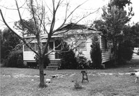
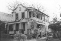
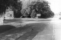
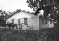
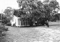
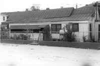
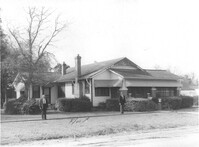
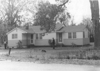
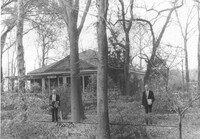
House (rear view) on site affected by the widening of U.S. Route 17. Presumably located in southern Charleston County. Surveyor notations on back of photo: "Dkt.: 10.600. Property owner: R. Arnold Postell. Tract: 14. Station: 610±35 Rt. Date: Sept. 18, 1968." [See collection description for explanation of surveyor notations.]
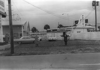
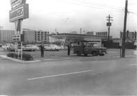
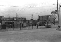
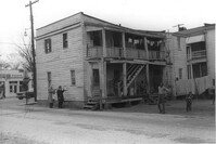
Lot and Kentucky Fried Chicken, on site affected by the construction of the Crosstown. Address: 223 Spring Street. Patio [restaurant?] in background. Surveyor notations on back of photo: "Dkt.: 10.524. Property owner: Arco Investment Co. Tract: 160 and 161. Station: 17±50 Rt. Spring Street. Date: Dec. 2, 1964." [See collection description for explanation of surveyor notations.]
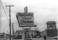
Sign for Kentucky Fried Chicken, on site affected by the construction of the Crosstown. Address: 223 Spring Street. Everett's Motel in background. Surveyor notations on back of photo: "Dkt.: 10.524. Property owner: Arco Investment Co. Tract: 160 and 161. Station: 17±50 Rt. Spring Street. Date: Dec. 2, 1964." [See collection description for explanation of surveyor notations.]
Partial view of The Fork (restaurant) and lot on site affected by the construction of the Crosstown. Address: 223 Spring Street. James Hotel [Hotel James] in background. Surveyor notations on back of photo: "Dkt.: 10.524. Property owner: The Fork Co. Inc. Tract: 156. Station: 13±00 Rt. Spring Street. Date: Dec. 2, 1964." [See collection description for explanation of surveyor notations.]
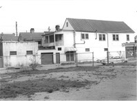
Side of building on site affected by the construction of the Crosstown. Address: 186 Spring Street. (See following two photographs.) Lot across the street in foreground. Surveyor notations on back of photo: "Dkt.: 10.524. Property owner: Mona G. Sokol. Tract: 25. Station: 65+60 CL Lt. Date: Oct. 13, 1964. In R/W - Bought." [See collection description for explanation of surveyor notations.]
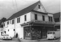
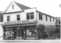
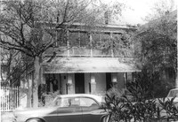
Basser's Friendly Self Service (corner view) on site affected by the construction of the Crosstown. Address: 186 Spring Street. View of street corner. Surveyor notations on back of photo: "Dkt.: 10.524. Property owner: Mona G. Sokol. Tract: 25. Station: 65+60 CL Lt. Date: Oct. 13, 1964. In R/W - Bought." [See collection description for explanation of surveyor notations.]
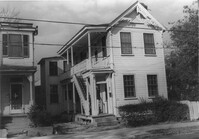
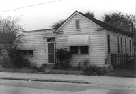
Basser's Friendly Self Service, on site affected by the construction of the Crosstown. Address: 186 Spring Street. Surveyor notations on back of photo: "Dkt.: 10.524. Property owner: Mona G. Sokol. Tract: 25. Station: 65+60 CL Lt. Date: Oct. 13, 1964. In R/W - Bought." [See collection description for explanation of surveyor notations.]
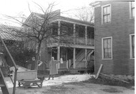
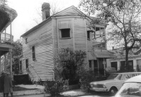
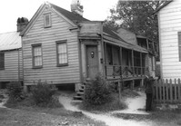
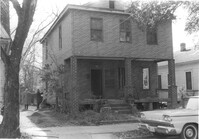
House on site affected by the construction of the Crosstown. Address: 106 Sheppard Street. Surveyor notations on back of photo: "Dkt.: 10.524. Property owner: Annie H. Powers. Tract: 149. Station: 20+65 Rt. S.B. lane. Date: Dec. 2, 1964. In R/W - Bought." [See collection description for explanation of surveyor notations.]
House on site affected by the construction of the Crosstown. Address: 106 Sheppard Street. Surveyor notations on back of photo: "Dkt.: 10.524. Property owner: Annie H. Powers. Tract: 149. Station: 20+65 Rt. S.B. lane. Date: Dec. 2, 1964. In R/W - Bought." [See collection description for explanation of surveyor notations.]
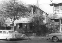
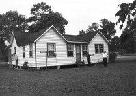
House on site affected by the construction of the Crosstown. Address: 104 Sheppard Street. Surveyor notations on back of photo: "Dkt.: 10.524. Property owner: Rachel Bailey. Tract: 150. Station: 20+95 Rt. S.B. lane. Date: Dec. 2, 1964. In R/W - Bought." [See collection description for explanation of surveyor notations.]
House on site affected by the construction of the Crosstown. Address: 104 Sheppard Street. Surveyor notations on back of photo: "Dkt.: 10.524. Property owner: Rachel Bailey. Tract: 150. Station: 20+95 Rt. S.B. lane. Date: Dec. 2, 1964. In R/W - Bought." [See collection description for explanation of surveyor notations.]
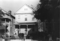
House on site affected by the construction of the Crosstown. Address: 108 Sheppard Street. Surveyor notations on back of photo: "Dkt.: 10.524. Property owner: Abe Kirshtein. Tract: 148. Station: 20+20 Rt. S.B. lane. Date: Dec. 2, 1964. In R/W - Bought." [See collection description for explanation of surveyor notations.]
House on site affected by the construction of the Crosstown. Address: 117 Sheppard Street. Surveyor notations on back of photo: "Dkt.: 10.524. Property owner: Julia Sharpe, et al., Est. Tract: 140. Station: 17+85 Rt. N.B. lane. Date: Dec. 2, 1964. Condemned." [See collection description for explanation of surveyor notations.]
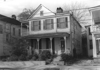
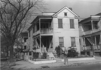
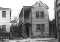
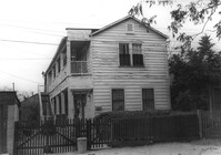
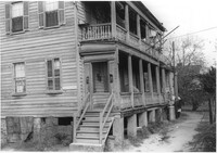
House on Sheppard Street on site affected by the widening of U.S. Route 17. Address 131 Sheppard Street. Surveyor notations on back of photo: "Dkt.: 10.524. Property owner: William Delestine, et al. Tract: 127. Station: 90+20 CL. Date: Dec. 2, 1964. In R/W - Bought." [See collection description for explanation of surveyor notations.]
House on site affected by the construction of the Crosstown. Address: 127 Sheppard Street. Surveyor notations on back of photo: "Dkt.: 10.524. Property owner: Essie W. Jenkins. Tract: 129. Station: 91+50 Rt. Date: Dec. 2, 1964. In R/W - Bought." [See collection description for explanation of surveyor notations.]
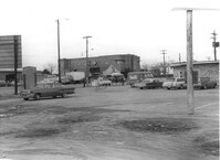
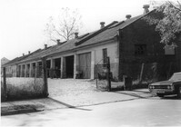
City Garage, on site affected by the construction of the Crosstown. Address: 134 Line Street. Surveyor notations on back of photo: "Dkt.: 10.524. Property owner: City of Charleston. Tract: 128. Station: 90+50 CL Rt. Date: Dec. 2, 1964. Partially in R/W." [See collection description for explanation of surveyor notations.]
City Garage, on site affected by the construction of the Crosstown. Address: 134 Line Street. Surveyor notations on back of photo: "Dkt.: 10.524. Property owner: City of Charleston. Tract: 128. Station: 90+50 CL Rt. Date: Dec. 2, 1964. Partially in R/W." [See collection description for explanation of surveyor notations.]
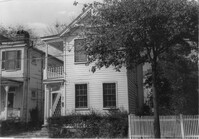
Houses on Sheppard Street (rear view) on site affected by the construction of the Crosstown. Address: 131½ Sheppard Street [131 Sheppard Street]. Surveyor notations on back of photo: "Dkt.: 10.524. Property owner: William Delestine, et al. Tract: 127. Station: 89+60 Rt. Date: Dec. 2, 1964. Proximity." [See collection description for explanation of surveyor notations.]
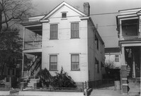
House on site affected by the construction of the Crosstown. Address: 506 Rutledge Avenue. Surveyor notations on back of photo: "Dkt.: 10.524. Property owner: Stephen B. Graham, et al. Tract: 113. Station: 86+50 Lt. Date: Dec. 1, 1964. In R/W - Bought." [See collection description for explanation of surveyor notations.]
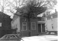
House on site affected by the construction of the Crosstown. Address: 4 Norman Street. Surveyor notations on back of photo: "Dkt.: 10.524. Property owner: Madeline B. Allen, et al. Tract: 23. Station: 66+55 Lt. Date: Oct. 13, 1964. In R/W - Bought." [See collection description for explanation of surveyor notations.]
House on site affected by the construction of the Crosstown. Address: 2 Norman Street. Surveyor notations on back of photo: "Dkt.: 10.524. Property owner: Sadie Belle Weathers. Tract: 24. Station: 66+35 CL Lt. Date: Oct. 13, 1964. In R/W - Bought." [See collection description for explanation of surveyor notations.]
House on site affected by the construction of the Crosstown. Address: 2 Norman Street. Surveyor notations on back of photo: "Dkt.: 10.524. Property owner: Sadie Belle Weathers. Tract: 24. Station: 66+35 CL Lt. Date: Oct. 13, 1964. In R/W - Bought." [See collection description for explanation of surveyor notations.]
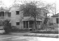
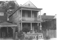
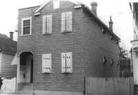
House on site affected by the construction of the Crosstown. Address: 184 Spring Street. Surveyor notations on back of photo: "Dkt.: 10.524. Property owner: Laura H. Middleton. Tract: 26. Station: 65+40 Rt. Date: Oct. 13, 1964. In R/W - Bought." [See collection description for explanation of surveyor notations.]
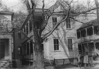
Rear view of house on site affected by the construction of the Crosstown. Address: 508 Rutledge Avenue. Surveyor notations on back of photo: "Dkt.: 10.524. Property owner: W.C. Hayes, Est. Tract: 112. Station: 86+60 Lt. Date: Dec. 1, 1964. In R/W - Bought." [See collection description for explanation of surveyor notations.]
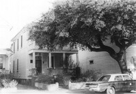
House on site affected by the construction of the Crosstown. Address: 504 Rutledge Avenue. Surveyor notations on back of photo: "Dkt.: 10.524. Property owner: Florence Britton Jones. Tract: 114. Station: 86+30 Rt. Date: Dec. 1, 1964. In R/W - Bought." [See collection description for explanation of surveyor notations.]
House on site affected by the construction of the Crosstown. Address: 504 Rutledge Avenue. Surveyor notations on back of photo: "Dkt.: 10.524. Property owner: Florence Britton Jones. Tract: 114. Station: 86+30 Rt. Date: Dec. 1, 1964. In R/W - Bought." [See collection description for explanation of surveyor notations.]
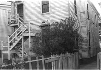
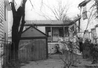
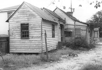
Storage shed or garage and backyard in rear of house on site affected by the construction of the Crosstown. Address: 160½ Line Street [160 Line Street]. Surveyor notations on back of photo: "Dkt.: 10.524. Property owner: John Meyer, Est. Tract: 101. Station: 83+65 Lt. Date: Dec. 1, 1964. In R/W - Bought." [See collection description for explanation of surveyor notations.]
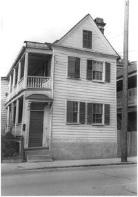
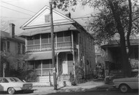
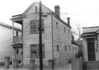
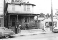
House on site affected by the construction of the Crosstown. Address: 158 Line Street. First story appears to be a store (or office) front. Signs for W.L. Metz, Jr. and H.L. Davis in window. Surveyor notations on back of photo: "Dkt.: 10.524. Property owner: William A. Williams. Tract: 102. Station: 83+70 CL. Date: Dec. 1, 1964. In R/W - Bought. [See collection description for explanation of surveyor notations.]
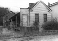
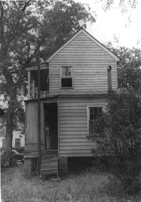
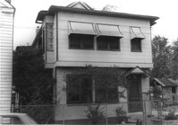
House (freedman's cottage) on site affected by the construction of the Crosstown. Address: 162½ Line Street [162 Line Street]. Surveyor notations on back of photo: "Dkt.: 10.524. Property owner: Frederick J. Cook. Tract: 99. Station: 82+65 Lt. Date: Dec. 1, 1964. In R/W - Bought." [See collection description for explanation of surveyor notations.]
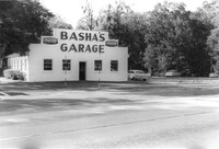
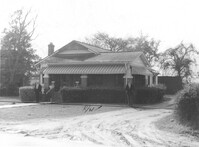
Lot and building (Basha's Garage) on site affected by the widening of U.S. Route 17. Posted signs for Basha's Garage. Presumably located in Mount Pleasant or vicinity. Surveyor notations on back of photo: "Dkt.: 10.439. Property owner: Ernest P. Basha, et al. Tract: 22-A. Station: 246+94 Lt. Date: Jul. 22, 1965. Looking from west at range poles on 33' & 50' R/W with trees in R/W." [See collection description for explanation of surveyor notations.]
Basha's Garage on site affected by the widening of U.S. Route 17. Building facade has stepped parapet. Presumably located in Mount Pleasant or vicinity. Surveyor notations on back of photo: "Dkt.: 10.439. Property owner: Ernest P. Basha, et al. Tract: 22-A. Station: 246+94 Lt. Date: Jul. 22, 1965. Proximity." [See collection description for explanation of surveyor notations.]
Hardee's (side view), on site affected by the construction of the Crosstown. Address: 223 Spring Street. Surveyor notations on back of photo: "Dkt.: 10.524. Property owner: Sarah Chinnis Sanders. Tract: 157. Station: 14+60 Rt. Spring Street. Date: Dec. 2, 1964." [See collection description for explanation of surveyor notations.]
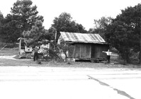
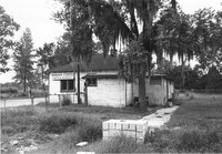
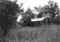
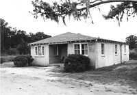
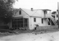
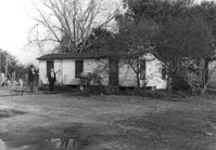
House in dilapidated condition and small outbuilding on site affected by the widening of U.S. Route 17. Presumably located in Mount Pleasant or vicinity. Surveyor notations on back of photo: "Dkt.: 10.597. Property owner: Fay Collington, Estate. Tract: 38. Station: 286± Lt. Date: Sept. 17, 1968." [See collection description for explanation of surveyor notations.]
House on site affected by the widening of U.S. Route 17. Charleston Oil Co. billboard in background. Presumably located in Mount Pleasant or vicinity. Surveyor notations on back of photo: "Dkt.: 10.597. Property owner: Luke Scoff, Est. Tract: 29. Station: 273± Rt. Date: Sept. 17, 1968." [See collection description for explanation of surveyor notations.]
Lot and building on site affected by the widening of U.S. Route 17. Billboard for Busch Bavarian [beer] in background. Presumably located in Mount Pleasant or vicinity. Surveyor notations on back of photo: "Dkt.: 10.439. Property owner: Marie Basha. Tract: 22. Station: 245+45 to 246+45 Lt. Date: Jul. 22, 1965. Range poles on pres. & 50'R/W. Trees in R/W." [See collection description for explanation of surveyor notations.]
House on site affected by the construction of the Crosstown. Address: 16 Todd Street. View of street corner (corner of Todd Street and Sheppard Street). Surveyor notations on back of photo: "Dkt.: 10.524. Property owner: Wilmot J. Frasier. Tract: 125. Station: 88+80 Lt. Date: Dec. 2, 1964. In R/W - Bought." [See collection description for explanation of surveyor notations.]
House on site affected by the construction of the Crosstown. Address: 16 Todd Street. View of street corner (corner of Todd Street and Sheppard Street). Surveyor notations on back of photo: "Dkt.: 10.524. Property owner: Wilmot J. Frasier. Tract: 125. Station: 88+80 Lt. Date: Dec. 2, 1964. In R/W - Bought." [See collection description for explanation of surveyor notations.]
House on site affected by the construction of the Crosstown. Address: 120 Sheppard Street. View of street corner. Surveyor notations on back of photo: "Dkt.: 10.524. Property owner: Jackson T. Rhodes. Tract: 142. Station: 18+25 Lt. S.B. lane. Date: Dec. 2, 1964. Condemned." [See collection description for explanation of surveyor notations.]
House on site affected by the construction of the Crosstown. Address: 506 Rutledge Avenue. Surveyor notations on back of photo: "Dkt.: 10.524. Property owner: Stephen B. Graham, et al. Tract: 113. Station: 86+50 Lt. Date: Dec. 1, 1964. In R/W - Bought." [See collection description for explanation of surveyor notations.]
House on site affected by the construction of the Crosstown. Address: 120 Sheppard Street. Surveyor notations on back of photo: "Dkt.: 10.524. Property owner: Jackson T. Rhodes. Tract: 142. Station: 18+25 Lt. S.B. lane. Date: Dec. 2, 1964. Condemned." [See collection description for explanation of surveyor notations.]
House on site affected by the construction of the Crosstown. Address: 128 Sheppard Street. Surveyor notations on back of photo: "Dkt.: 10.524. Property owner: Kawarsuan, Inc. Tract: 133. Station: 16+40 Lt. S.B. lane. Date: Dec. 2, 1964. Condemned." [See collection description for explanation of surveyor notations.]
House on site affected by the construction of the Crosstown. Address: 130 Sheppard Street. Surveyor notations on back of photo: "Dkt.: 10.524. Property owner: Charles J. Brendt. Tract: 132. Station: 91+90 Lt. Date: Dec. 2, 1964. In R/W - Bought." [See collection description for explanation of surveyor notations.]
House on site affected by the construction of the Crosstown. Address: 127 Sheppard Street. Surveyor notations on back of photo: "Dkt.: 10.524. Property owner: Essie W. Jenkins. Tract: 129. Station: 91+50 Rt. Date: Dec. 2, 1964. In R/W - Bought." [See collection description for explanation of surveyor notations.]
House on site affected by the construction of the Crosstown. Address: 130 Sheppard Street. Surveyor notations on back of photo: "Dkt.: 10.524. Property owner: Charles J. Brendt. Tract: 132. Station: 91+90 Lt. Date: Dec. 2, 1964. In R/W - Bought." [See collection description for explanation of surveyor notations.]
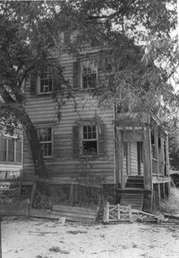
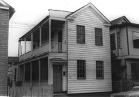
Rear view of house (freedman's cottage) on site affected by the construction of the Crosstown. Address: 7 Rosemont Street. Surveyor notations on back of photo: "Dkt.: 10.524. Property owner: Lauretta Izzard. Tract: 52. Station: 72+70 Rt. Date: Oct. 14, 1964. In R/W - Bought." [See collection description for explanation of surveyor notations.]
House (freedman's cottage) on site affected by the construction of the Crosstown. Address: 7 Rosemont Street. Surveyor notations on back of photo: "Dkt.: 10.524. Property owner: Lauretta Izzard. Tract: 52. Station: 72+70 Rt. Date: Oct. 14, 1964. In R/W - Bought." [See collection description for explanation of surveyor notations.]
House (rear view) and cinder block wall on site affected by the construction of the Crosstown. Address: 145 President Street. Surveyor notations on back of photo: "Dkt.: 10.524. Property owner: John A. Williams, et al. Tract: 30. Station: 67+30 Rt. Date: Oct. 13, 1964." [See collection description for explanation of surveyor notations.]
House (rear view) on site affected by the construction of the Crosstown. Address: 79 Kracke Street. Surveyor notations on back of photo: "Dkt.: 10.524. Property owner: Ella Lawrence, Est. Tract: 70. Station: 77+20 Lt. Date: Oct. 14, 1964. In R/W - Bought." [See collection description for explanation of surveyor notations.]
House on site affected by the construction of the Crosstown. Address: 79 Kracke Street. Surveyor notations on back of photo: "Dkt.: 10.524. Property owner: Ella Lawrence, Est. Tract: 70. Station: 77+20 Lt. Date: Oct. 14, 1964. In R/W - Bought." [See collection description for explanation of surveyor notations.]
House on site affected by the construction of the Crosstown. Address: 120 Bogard Street. Surveyor notations on back of photo: "Dkt.: 10.524. Property owner: James Green. Tract: 59. Station: 79+25 Lt. Date: Oct. 14, 1964. In R/W - Bought." [See collection description for explanation of surveyor notations.]
House on site affected by the construction of the Crosstown. Address: 118½ Bogard Street [118 Bogard Street]. Surveyor notations on back of photo: "Dkt.: 10.524. Property owner: George Weston. Tract: 61. Station: 74+85 Lt. Date: Oct. 14, 1964." [See collection description for explanation of surveyor notations.]
House on site affected by the construction of the Crosstown. Address: 118½ Bogard Street [118 Bogard Street]. Surveyor notations on back of photo: "Dkt.: 10.524. Property owner: George Weston. Tract: 61. Station: 74+85 Lt. Date: Oct. 14, 1964." [See collection description for explanation of surveyor notations.]
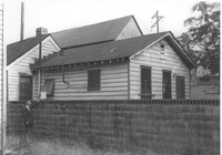
Bargain Center Supermarket (side/corner view, rear) on site affected by the widening of U.S. Route 17. Presumably located in southern Charleston County. Surveyor notations on back of photo: "Dkt.: 10.600. Property owner: Vernon A. Ellis. Tract: 3. Station: 512± - 514± Rt. Date: Sept. 18, 1968." [See collection description for explanation of surveyor notations.]
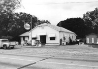
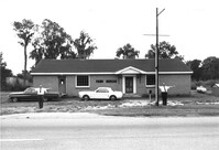
Esso gas station on site affected by the widening of U.S. Route 17. Presumably located in Mount Pleasant or vicinity. Surveyor notations on back of photo: "Dkt.: 10.597. Property owner: Mary B. McConnell. Tract: 79. Station 444+00 Lt. Date: Sept. 17, 1968." [See collection description for explanation of surveyor notations.]
Esso gas station on site affected by the widening of U.S. Route 17. Presumably located in Mount Pleasant or vicinity. Surveyor notations on back of photo: "Dkt.: 10.597. Property owner: Mary B. McConnell. Tract: 79. Station 444+00 Lt. Date: Sept. 17, 1968." [See collection description for explanation of surveyor notations.]
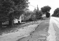
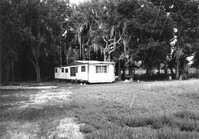
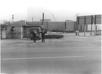
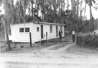
Mobile home on site affected by the widening of U.S. Route 17. Presumably located in southern Charleston County. Surveyor notations on back of photo: "Dkt.: 10.600. Property owner: John D. Postell, Jr. Tract: 15. Station: 623± Rt. Date: Sept. 18, 1968." [See collection description for explanation of surveyor notations.]
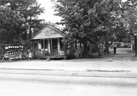
House and sweetgrass basket stand on site affected by the widening of U.S. Route 17. Presumably located in Mount Pleasant or vicinity. Surveyor notations on back of photo: "Dkt.: 10.597. Property owner: Linda Huger, Estate. Tract 84 & 85. Station: 448± Lt. Date: Sept. 17, 1968." [See collection description for explanation of surveyor notations.]
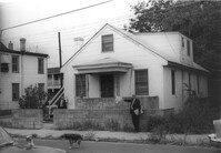
House in dilapidated condition and lot on site affected by the widening of U.S. Route 17. Presumably located in Mount Pleasant or vicinity. Surveyor notations on back of photo: "Dkt.: 10.597. Property owner: F. Gregorie, Estate. Tract: 93. Station: 458±10 Rt. Date: Sept. 17, 1968." [See collection description for explanation of surveyor notations.]
House (corner view, rear) on site affected by the widening of U.S. Route 17. Presumably located in Mount Pleasant or vicinity. Surveyor notations on back of photo: "Dkt.: 10.597. Property owner: Prince and Wilhelmina Gilliard. Tract: 92. Station: 457±10 Rt. Date: Sept. 17, 1968." [See collection description for explanation of surveyor notations.]
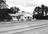
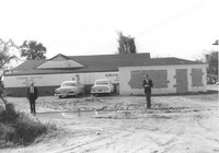
Farm Bureau building, on site affected by the widening of U.S. Route 17. Presumably located in southern Charleston County. Surveyor notations on back of photo: "Dkt.: 10.600. Property owner: Charleston County Farm Bureau. Tract: 2. Station: 507±30 Lt. Date: Sept. 18, 1968." [See collection description for explanation of surveyor notations.]
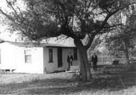
House on site affected by the widening of U.S. Route 17. Presumably located in Mount Pleasant or vicinity. Surveyor notations on back of photo: "Dkt.: 10.597. Property owner: John Gailliard. Tract: 102. Station: 466±40 Rt. Date: Sept. 17, 1968." [See collection description for explanation of surveyor notations.]
House on site affected by the widening of U.S. Route 17. Presumably located in Mount Pleasant or vicinity. Surveyor notations on back of photo: "Dkt.: 10.597. Property owner: Charles Dingle. Tract: 98. Station 462±50 Rt. Date: Sept. 17, 1968." [See collection description for explanation of surveyor notations.]
House on site affected by the widening of U.S. Route 17. Presumably located in Mount Pleasant or vicinity. Surveyor notations on back of photo: "Dkt.: 10.597. Property owner: F. Gregorie, Estate. Tract: 93. Station: 460± Rt. Date: Sept. 17, 1968." [See collection description for explanation of surveyor notations.]
House on site affected by the widening of U.S. Route 17. Presumably located in Mount Pleasant or vicinity. Surveyor notations on back of photo: "Dkt.: 10.597. Property owner: F. Gregorie, Estate. Tract: 93. Station: 460± Rt. Date: Sept. 17, 1968." [See collection description for explanation of surveyor notations.]
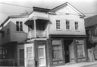
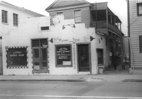
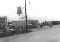
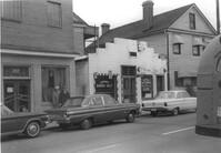
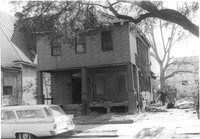
Building, on site affected by the construction of the Crosstown. Address: 209 Spring Street. Friendly Barber Shop and Spot Light Radio TV Service. Front facade has stepped parapet. Surveyor notations on back of photo: "Dkt.: 10.524. Property owner: Maybell Fields. Tract: 166. Station: 20+00 Rt. Spring Street. Date: Dec. 2, 1964." [See collection description for explanation of surveyor notations.]
Building, on site affected by the construction of the Crosstown. Address: 207 Spring Street. Sew-U-Save Shop. Surveyor notations on back of photo: "Dkt.: 10.524. Property owner: Olympia Papaeilidow. Tract: 167. Station: 20+35 Rt. Spring Street. Date: Dec. 2, 1964." [See collection description for explanation of surveyor notations.]
Shell gas station (rear view) on site affected by the construction of the Crosstown. Address: 233 Spring Street. Surveyor notations on back of photo: "Dkt.: 10.524. Property owner: Shell Oil Co. Tract: 155. Station: 9+00 Rt. Spring Street. Date: Dec. 2, 1965." [See collection description for explanation of surveyor notations.]
Hardee's, on site affected by the construction of the Crosstown. Address: 223 Spring Street. Surveyor notations on back of photo: "Dkt.: 10.524. Property owner: Sarah Chinnis Sanders. Tract: 157. Station: 14+60 Rt. Spring Street. Date: Dec. 2, 1964." [See collection description for explanation of surveyor notations.]
House on site affected by the construction of the Crosstown. Address: 114 Bogard Street. Surveyor notations on back of photo: "Dkt.: 10.524. Property owner: Francis Jenkins, et al. Tract: 64. Station: 75+70 CL Rt. Date: Oct. 14, 1964. In R/W - Bought." [See collection description for explanation of surveyor notations.]
House on site affected by the construction of the Crosstown. Address: 112 Bogard Street. Surveyor notations on back of photo: "Dkt.: 10.524. Property owner: Susan D. Butler, Est. Tract: 65. Station: 76+00 CL Rt. Date: Oct. 14, 1964. In R/W - Bought." [See collection description for explanation of surveyor notations.]
House on site affected by the construction of the Crosstown. Address: 116 Bogard Street. Surveyor notations on back of photo: "Dkt.: 10.524. Property owner: Arletha Powers. Tract: 63. Station: 75+40 CL. Date: Oct. 14, 1964. In R/W - Bought." [See collection description for explanation of surveyor notations.]
House on site affected by the construction of the Crosstown. Address: 116 Bogard Street. Surveyor notations on back of photo: "Dkt.: 10.524. Property owner: Arletha Powers. Tract: 63. Station: 75+40 CL. Date: Oct. 14, 1964. In R/W - Bought." [See collection description for explanation of surveyor notations.]
Building, on site affected by the construction of the Crosstown. Address: 209 Spring Street. Friendly Barber Shop and Spot Light Radio TV Service. Front facade has stepped parapet. Neighboring buildings on either side seen; Address 207 Spring Street and 211 Spring Street. Surveyor notations on back of photo: "Dkt.: 10.524. Property owner: Maybell Fields. Tract: 166. Station: 20+00 Rt. Spring Street. Date: Dec. 2, 1964." [See collection description for explanation of surveyor notations.]
Side view of The Fork (restaurant) and lot on site affected by the construction of the Crosstown. Address: 223 Spring Street. Signs for the Castle Pinckney Motel and The Fork Restaurant at right. Presumably on Spring Street. Surveyor notations on back of photo: "Dkt.: 10.524. Property owner: The Fork Co. Inc. Tract: 156. Station: 13±00 Rt. Spring Street. Date: Dec. 2, 1964." [See collection description for explanation of surveyor notations.]
Side view of The Fork (restaurant) and lot on site affected by the construction of the Crosstown. Address: 223 Spring Street. Surveyor notations on back of photo: "Dkt.: 10.524. Property owner: The Fork Co. Inc. Tract: 156. Station: 13±00 Rt. Spring Street. Date: Dec. 2, 1964." [See collection description for explanation of surveyor notations.]
House (rear corner view) on site affected by the construction of the Crosstown. Address: 110 Bogard Street. Surveyor notations on back of photo: "Dkt.: 10.524. Property owner: Thomassina Elizabeth McCray. Tract: 72. Station: 76+60 Rt. Date: Oct. 14, 1964. In R/W - Bought." [See collection description for explanation of surveyor notations.]
House on site affected by the construction of the Crosstown. Address: 71 Kracke Street. Surveyor notations on back of photo: "Dkt.: 10.524. Property owner: William Henry Godfrey. Tract: 66. Station: 76+10 Lt. Date: Oct. 14, 1964. Portion in R/W to be removed." [See collection description for explanation of surveyor notations.]
House (rear view) and lot on site affected by the construction of the Crosstown. Address: 18-20 Wescott Street. Surveyor notations on back of photo: "Dkt.: 10.524. Property owner: Ralph E. Thornley, et al. Tract: 11. Station: 62+10 Lt. Date: Oct. 13, 1964." [See collection description for explanation of surveyor notations.]
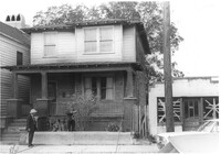
Side view of house on site affected by the construction of the Crosstown. Address: 119 Bogard Street. Surveyor notations on back of photo: "Dkt.: 10.524. Property owner: Rebecca S. Cooper. Tract: 55. Station: 73+90 Rt. Date: Oct. 14, 1964. In R/W - Bought." [See collection description for explanation of surveyor notations.]
House on site affected by the construction of the Crosstown. Address: 110 Bogard Street. Surveyor notations on back of photo: "Dkt.: 10.524. Property owner: Thomassina Elizabeth McCray. Tract: 72. Station: 76+60 Rt. Date: Oct. 14, 1964. In R/W - Bought." [See collection description for explanation of surveyor notations.]
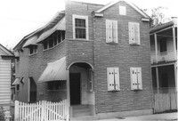
House on site affected by the construction of the Crosstown. Address: 190 Spring Street. Surveyor notations on back of photo: "Dkt.: 10.524. Property owner: E.H. Heidman, Est. Tract: 18. Station: 24± Lt. (Spring Street). Date: Oct. 13, 1964. Portion in R/W to be removed." [See collection description for explanation of surveyor notations.]
House on site affected by the construction of the Crosstown. Address: 190 Spring Street. Surveyor notations on back of photo: "Dkt.: 10.524. Property owner: E.H. Heidman, Est. Tract: 18. Station: 24± Lt. (Spring Street). Date: Oct. 13, 1964. Portion in R/W to be removed." [See collection description for explanation of surveyor notations.]
House on site affected by the construction of the Crosstown. Address: 22 Wescott Street. Surveyor notations on back of photo: "Dkt.: 10.524. Property owner: Ida J. Gantt. Tract: 10. Station: 61+20 Lt. Date: Oct. 13, 1964." [See collection description for explanation of surveyor notations.]
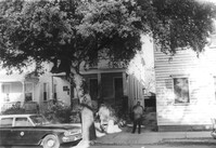
House (rear and side view) on site affected by the construction of the Crosstown. Address: 215 Spring Street. Corner of Spring Street and Vaughan Street. Paint and hardware store across the street. Surveyor notations on back of photo: "Dkt.: 10.524. Property owner: Ruby E. Jacobs. Tract: 163. Station: 18+85 Rt. Spring Street. Date: Dec. 2, 1964. Partially In R/W - Bought." [See collection description for explanation of surveyor notations.]
House (freedman's cottage) on site affected by the construction of the Crosstown. Address: 26 Kracke Street. Surveyor notations on back of photo: "Dkt.: 10.524. Property owner: Julia Brown. Tract: 68. Station: 77+55 Lt. Date: Oct. 14, 1964. Proximity." [See collection description for explanation of surveyor notations.]
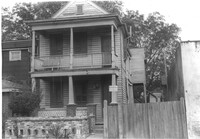
House on site affected by the construction of the Crosstown. Address: 121 Sheppard Street. Surveyor notations on back of photo: "Dkt.: 10.524. Property owner: Erline B. Wertan. Tract: 138. Station: 17+05 Rt. N.B. lane. Date: Dec. 2, 1964. In R/W - Bought." [See collection description for explanation of surveyor notations.]
House on site affected by the construction of the Crosstown. Address: 121 Sheppard Street. Surveyor notations on back of photo: "Dkt.: 10.524. Property owner: Erline B. Wertan. Tract: 138. Station: 17+05 Rt. N.B. lane. Date: Dec. 2, 1964. In R/W - Bought." [See collection description for explanation of surveyor notations.]
House on site affected by the construction of the Crosstown. Address: 119 Sheppard Street. Surveyor notations on back of photo: "Dkt.: 10.524. Property owner: Scott M. Boyle. Tract: 139. Station: 17+45 Rt. N.B. lane. Date: Dec. 2, 1964. In R/W - Bought." [See collection description for explanation of surveyor notations.]
House on site affected by the construction of the Crosstown. Address: 119 Sheppard Street. Surveyor notations on back of photo: "Dkt.: 10.524. Property owner: Scott M. Boyle. Tract: 139. Station: 17+45 Rt. N.B. lane. Date: Dec. 2, 1964. In R/W - Bought." [See collection description for explanation of surveyor notations.]
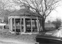
Gazebo, on site affected by the widening of Route 171 (Folly Road). Surveyor notations on back of photo: "Dkt.: 10.494. Property owner: Sophie Sabel, Est. Tract: 97. Station: 370+50 Lt. Date: Mar. 21, 1962. In R/W - Bought. [See collection description for explanation of surveyor notations.]
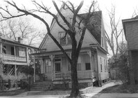
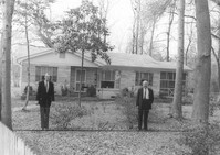
House on site affected by the widening of Route 171 (Folly Road). Surveyor notations on back of photo: "Dkt.: 10.494. Property owner: H.W. Halter, et al. Tract: 79. Station: 299+00 Rt. Date: Mar. 21, 1962. Proximity. [See collection description for explanation of surveyor notations.]
House on site affected by the widening of Route 171 (Folly Road). Surveyor notations on back of photo: "Dkt.: 10.494. Property owner: D.J. Byrd, et al. Tract: 73. Station: 280+60 Rt. Date: Mar. 21, 1962. Proximity. [See collection description for explanation of surveyor notations.]
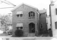
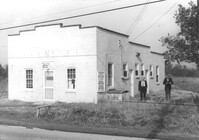
Building, on site affected by the widening of Route 171 (Folly Road). Dave Richardson and Son General Contractor. Front facade has stepped parapet. Surveyor notations on back of photo: "Dkt.: 10.494. Property owner: Dave Richardson, et al. Tract: 93. Station: 314+40 Lt. Date: Mar. 21, 1962. To be cut off at R/W by SCHD [SC Highway Department?]. [See collection description for explanation of surveyor notations.]
House on site affected by the widening of Route 171 (Folly Road). Surveyor notations on back of photo: "Dkt.: 10.494. Property owner: Sophie Sabel, Est. Tract: 97. Station: 372+20 Lt. Date: Mar. 21, 1962. To be cut off at R/W by SCHD [SC Highway Dept.?]. [See collection description for explanation of surveyor notations.]
House on site affected by the widening of Route 171 (Folly Road). Surveyor notations on back of photo: "Dkt.: 10.494. Property owner: G.L. Brown, et al. Tract: 69. Station: 218+90 Rt. Date: Mar. 21, 1962. Proximity. [See collection description for explanation of surveyor notations.]
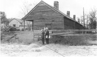
Building on site affected by the widening of Route 171 (Folly Road). Surveyor notations on back of photo: "Dkt.: 10.494. Property owner: John Harleston. Tract: 62. Station: 195+50 Rt. Date: Mar. 21, 1962. Moving item. [See collection description for explanation of surveyor notations.]
House on site affected by the widening of Route 171 (Folly Road). Surveyor notations on back of photo: "Dkt.: 10.494. Property owner: Sophie Sabel, Est. Tract: 97. Station: 372+20 Lt. Date: Mar. 21, 1962. To be cut off at R/W by SCHD [SC Highway Dept.?]. [See collection description for explanation of surveyor notations.]
H.W. Halter Cheese Butter Oleo Poultry Eggs [company], on site affected by the widening of Route 171 (Folly Road). Surveyor notations on back of photo: "Dkt.: 10.494. Property owner: H.W. Halter, et al. Tract: 78. Station: 209+20 Rt. Date: Mar. 21, 1962. Proximity. Loss of parking space. [See collection description for explanation of surveyor notations.]
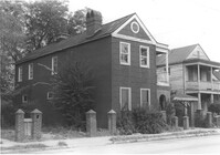
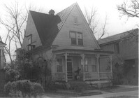
House named "Shady Grove," on site affected by the widening of Route 171 (Folly Road). Surveyor notations on back of photo: "Dkt.: 10.494. Property owner: Mrs. Martha A. Gibson. Tract: 72. Station: 279+80 Rt. Date: Mar. 21, 1962. Proximity. [See collection description for explanation of surveyor notations.]
House on site affected by the widening of Route 171 (Folly Road). Surveyor notations on back of photo: "Dkt.: 10.494. Property owner: H.W. Halter, et al. Tract: 79. Station: 299+00 Rt. Date: Mar. 21, 1962. Proximity. [See collection description for explanation of surveyor notations.]