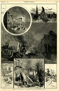
Main caption: 'Incidents of the Earthquake at Charleston.--drawn by Schell and Hogan.--[see page 590.]' Caption top left: 'In front of the Charleston Hotel.' Caption top right: 'looking over the roofs.' Caption middle: 'A camp on the East Battery.' Caption bottom left: 'The front wall gone.' Caption bottom center: 'In a rich man's garden.' Caption bottom right: ' On the track.' [full date September 11, 1886.]
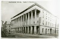
Charleston Earthquake scene. Possibly a copy of No.11 of Cook's Earthquake Views. Shows damage to the Charleston Hotel, demolished in 1960, which stood at 200 Meeting Street. 'Charleston Hotel, Hayne & Pinckney' is typewritten onto the image. Hayne and Pinckney Streets were two of the boundary streets that surrounded the hotel.
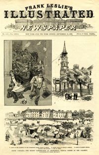
Caption: 'South Carolina.--The recent earthquakes at Charleston--typical scenes of the calamity. From sketches by C. Upham--see page 71. 1. Scene on the stairway of the Charleston Hotel during a shock. 2. Taking down St. Philip's Steeple. 3. Scene on Marion Square, opposite the Citadel--a city of tents.' [full date September 18, 1886.]
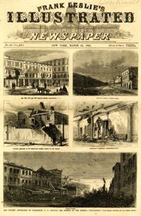
Main caption: 'The present appearance of Charleston, S.C., showing the effects of the Federal bombardment.--from recent sketches by our special artist.' Caption top left: 'Nos.165, 167 and 169 Meeting Street, Charleston, S.C.' Caption top right: 'East Bay Street, looking south.' Caption middle left: 'Kitchen attached to 53 Wentworth Street--effect of two shells.' Caption middle right: 'Gentleman's ordinary, Charleston Hotel.' Caption bottom: 'Vendue Range.' [full date March 25, 1865.]
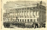
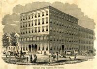
Caption: 'General McGowan addressing the Abbeville Volunteers in front of the Charleston Hotel--from a sketch by our Special Artist now in Charleston.' [full date February 23, 1861.]
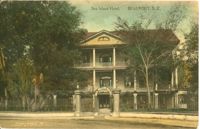
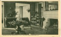
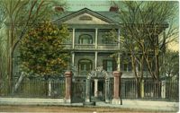
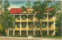
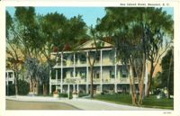
Black and white postcard of the Sea Island Hotel in Beaufort, South Carolina. Postmarked March 3, 1906 with correspondence on the front of the postcard.
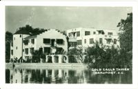
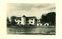
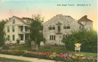
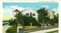
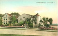
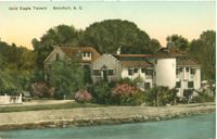
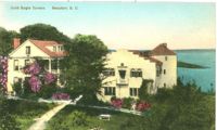
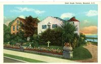
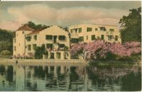
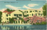
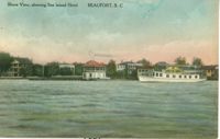
Photographic image of the view of Gold Eagle Tavern and the sea wall from the water. Kate Gleason extensively remodeled the DeSaussure house into a hotel.
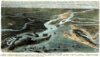
[Color image.] Caption (in French): 'Evenements des Etats-Unis: Charleston et ses fortifications. [Events of the United States: Charleston and its fortifications.] 1--Charleston. 2--Riviere Ashley [Ashley River]. 3--Chemin de fer de Savannah [Savannah Railway]. 4--Riviere Cooper [Cooper River]. 5--Riviere Wando [Wando River]. 6--Fort Pinkney [Castle Pinckney]. 7--Fort Ripley. 8--Fort Johnson (ile James) [James Island]. 9--Riviere Stone [Stono River]. 10--Fort Sumter. 11--Fort Moultrie. 12--Batterie Gregg (pointe de Gumming) [Battery Gregg (Cummings Point)]. 13--Fort Wagner. 14--Batteries rasantes du general Gilmore [grazed batteries of General Gilmore]. 15--Ouvrages pris par les federaux. [Works undertaken by the Federals]. 16--Phare Inlet [Lighthouse inlet]. 17--Batteries federales (ile Folly) [Federal Batteries (Folly Island)]. 18--Canonnieres et vaisseaux cuirasses [gunboats and ironclads]. 19--Hotel. 20--Ile et batteries Sullivan [Sullivan Island and Batteries]. 21--Moultrie. 22--Mont Pleasant [Mount Pleasant]. 23--Breach Inlet. 24--Shem Creek. 25--Batteries construite par les confederes sur l'ile James, dans le voisinage du fort Johnson [Batteries built by the Confederates on James Island, in the vicinity of Fort Johnson].