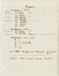
This one-page typed document provides information regarding the property at the East end of Calhoun Street, known as Gadsden's Wharf. The land ownership is traced back to 1696 under Issac Mazyck. Land development beginning in 1746 under Captain George Anson is also discussed, including the construction of a canal and wharf in Charleston. Changes in street names since the city's early days are also mentioned.
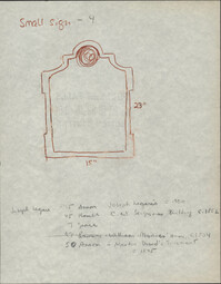
In this one-page typed document, Historic Charleston Foundation Director Mrs. S. Henry Edmunds provides a thorough description of 75 Anson Street, The Joseph Legare House, and the accompanying outbuildings, all of which were for sale at the time. Recommended renovations for the property and buildings are included.
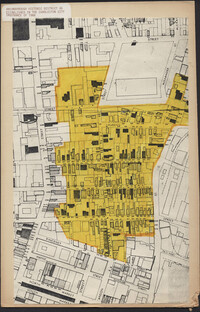
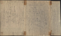
Map of Ansonborough showing Meeting Street, King Street, Hasell Street, Maiden Street, Old Church Street, Bay Street, and others. A small piece of paper taped to the back reads: "Kindness of: Mr. Gedney M. Howe."
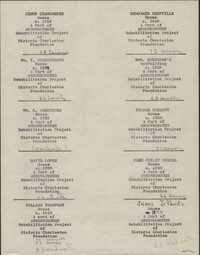
This nineteen-page typed document was created for tour guides in the seven-block area of Historic Charleston Foundation's Ansonborough Rehabilitation Project.
This twelve-page typed document is a draft of material used for fundraising efforts by Historic Charleston Foundation, using the success of the Ansonborough Rehabilitation Project as an example of work accomplished by the Foundation.
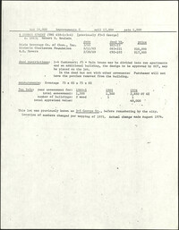
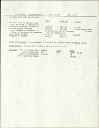
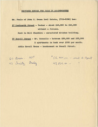
This 13-page typed document details information about the Ansonborough neighborhood, specific properties within it, and Historic Charleston Foundation's fundraising efforts to be used for its rehabilitation.