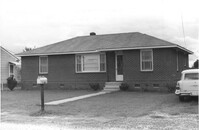
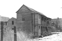
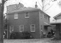
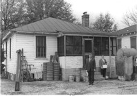
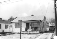
House on site affected by the construction of Interstate 26 (I-26). Surveyor notations on back of photo: "Dkt.: 10.471. Property owner: T.M. Evans. Tract: 153. Station: 5485+00 Lt. Date: Aug. 23, 1960. In R/W - Bought." [See collection description for explanation of surveyor notations.]
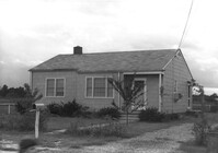
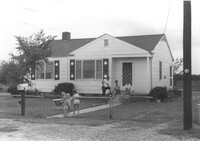
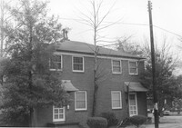
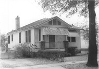
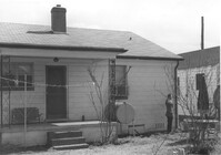
House on site affected by the construction of Interstate 26 (I-26). Surveyor notations on back of photo: "Dkt.: 10.471. Property owner: Andrew J. Hovanec. Tract: 154. Station: 5485+50 Lt. Date: Aug. 23, 1960. Proximity." [See collection description for explanation of surveyor notations.]
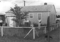
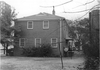
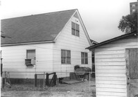
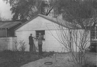
House (rear view) on site affected by the construction of Interstate 26 (I-26). Surveyor notations on back of photo: "Dkt.: 10.471. Property owner: Andrew J. Hovanec. Tract: 154. Station: 5485+50 Lt. Date: Aug. 23, 1960. Proximity." [See collection description for explanation of surveyor notations.]
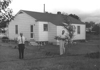
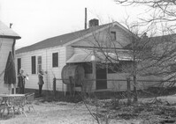
House (rear view) on site affected by the construction of Interstate 26 (I-26). Surveyor notations on back of photo: "Dkt.: 10.471. Property owner: Jacquelyne E. Kaylor. Tract: 156. Station: 5486+75 Lt. Date: Aug. 23, 1960. Proximity." [See collection description for explanation of surveyor notations.]
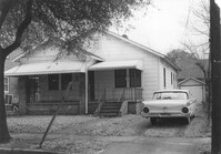
House (review view) on site affected by the construction of the Crosstown. Address: 76 Cooper Street. Surveyor notations on back of photo: "Dkt.: 10.518. Property owner: Lewis Rosen. Tract: 11. Station: 5965+10 CL Line 3, S.B. lane Route 17. Date: Mar. 6, 1963. In R/W - Bought. [See collection description for explanation of surveyor notations.]
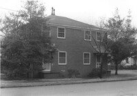
House on site affected by the construction of Interstate 26 (I-26). Surveyor notations on back of photo: "Dkt.: 10.471. Property owner: Jacquelyne E. Kaylor. Tract: 156. Station: 5486+75 Lt. Date: Aug. 23, 1960. Proximity." [See collection description for explanation of surveyor notations.]
House on site affected by the construction of Interstate 26 (I-26). Address: 40 Enston Avenue [40 North Enston Avenue]. Surveyor notations on back of photo: "Dkt.: 10.503. Property owner: George Stamos, et al. Tract: 2. Station: 5891+35 Rt. Date: Feb. 19, 1963. In R/W - Bought." [See collection description for explanation of surveyor notations.]
House (rear view) on site affected by the construction of Interstate 26 (I-26). Address: 40 Enston Avenue [40 North Enston Avenue[. Surveyor notations on back of photo: "Dkt.: 10.503. Property owner: George Stamos, et al. Tract: 2. Station: 5891+35 Rt. Date: Feb. 19, 1963. In R/W - Bought." [See collection description for explanation of surveyor notations.]
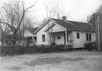
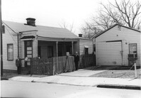
Dwelling (rear view) on site affected by the construction of Interstate 26 (I-26). Address: 39-43 Mount Pleasant Street. Surveyor notations on back of photo: "Dkt.: 10.503. Property owner: Joyce L. Darby, et al. Tract: 3. Station: 5891+00 Rt. Date: Feb. 19, 1963. Portion in R/W to be removed." [See collection description for explanation of surveyor notations.]
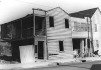
Dwelling on site affected by the construction of Interstate 26 (I-26). Address: 39-43 Mount Pleasant Street. Appears to be a duplex. Surveyor notations on back of photo: "Dkt.: 10.503. Property owner: Joyce L. Darby, et al. Tract: 3. Station: 5891+00 Rt. Date: Feb. 19, 1963. Portion in R/W to be removed." [See collection description for explanation of surveyor notations.]
Dwelling (rear view) on site affected by the construction of Interstate 26 (I-26). Address: 39-43 Mount Pleasant Street. Surveyor notations on back of photo: "Dkt.: 10.503. Property owner: Mary Ellen Long Way. Tract: 4. Station: 5891+80 Lt. Date: Feb. 19, 1963. In R/W - Bought." [See collection description for explanation of surveyor notations.]
Dwelling on site affected by the construction of Interstate 26 (I-26). Address: 39-43 Mount Pleasant Street. Appears to be a duplex. Surveyor notations on back of photo: "Dkt.: 10.503. Property owner: Mary Ellen Long Way. Tract: 4. Station: 5891+80 Lt. Date: Feb. 19, 1963. In R/W - Bought." [See collection description for explanation of surveyor notations.]
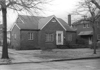
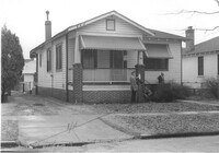
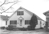
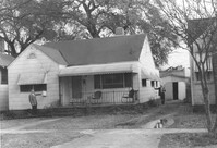
House on site affected by the construction of Interstate 26 (I-26). Address: 169 Laurel Avenue. Surveyor notations on back of photo: "Dkt.: 10.503. Property owner: Ernestine L. Captain. Tract: 5. Station: 5892+10 Rt. Date: Feb. 19, 1963. In R/W - Bought." [See collection description for explanation of surveyor notations.]
House (corner view, rear) on site affected by the construction of Interstate 26 (I-26).Address: 169 Laurel Avenue. Joseph Floyd Manor (Mount Pleasant Street and King Street) in background. Surveyor notations on back of photo: "Dkt.: 10.503. Property owner: Ernestine L. Captain. Tract: 5. Station: 5892+10 Rt. Date: Feb. 19, 1963. In R/W - Bought." [See collection description for explanation of surveyor notations.]
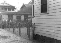
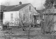
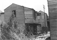
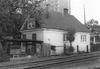
Backyard area and neighboring houses on site affected by the construction of Interstate 26 (I-26). Address: Laurel Avenue (?). Surveyor notations on back of photo: "Dkt.: 10.503. Property owner: Francis D. Guzzell. Tract: 7. Station: 5894+55 Rt. Date: Feb. 19, 1963. Proximity." [See collection description for explanation of surveyor notations.]
House on site affected by the construction of the Crosstown. Address: 76 Cooper Street. Surveyor notations on back of photo: "Dkt.: 10.518. Property owner: Lewis Rosen. Tract: 11. Station: 5965+10 CL Line 3, S.B. lane Route 17. Date: Mar. 6, 1963. In R/W - Bought. [See collection description for explanation of surveyor notations.]
House (rear view) on site affected by the construction of Interstate 26 (I-26). Waverly Novels, Tales of a Grandfather; being stories taken from Scottish history, 2nd series in 2 volumes, vol. I. 160 Laurel Avenue. Surveyor notations on back of photo: "Dkt.: 10.503. Property owner: Joseph A. Pippin. Tract: 8. Station: 5894+40 Rt. Date: Feb. 19, 1963. In R/W - Bought." [See collection description for explanation of surveyor notations.]
House on site affected by the construction of Interstate 26 (I-26). Address: 160 Laurel Avenue. Surveyor notations on back of photo: "Dkt.: 10.503. Property owner: Joseph A. Pippin. Tract: 8. Station: 5894+40 Rt. Date: Feb. 19, 1963. In R/W - Bought." [See collection description for explanation of surveyor notations.]
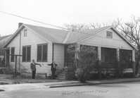
House on site affected by the construction of Interstate 26 (I-26). Address: 162 Laurel Avenue. Number 22 on porch column. Surveyor notations on back of photo: "Dkt.: 10.503. Property owner: David E. O'Brien. Tract: 9. Station: 5894+15 Rt. Date: Feb. 19, 1963. In R/W - Bought." [See collection description for explanation of surveyor notations.]
House (rear view) on site affected by the construction of Interstate 26 (I-26). Address: 162 Laurel Avenue. Surveyor notations on back of photo: "Dkt.: 10.503. Property owner: David E. O'Brien. Tract: 9. Station: 5894+15 Rt. Date: Feb. 19, 1963. In R/W - Bought." [See collection description for explanation of surveyor notations.]
House (rear view) on site affected by the construction of Interstate 26 (I-26). Address: 164 Laurel Avenue. Surveyor notations on back of photo: "Dkt.: 10.503. Property owner: J.W. Johnson, Jr. Tract: 10. Station: 5894+00 Rt. Date: Feb. 19, 1963. In R/W - Bought." [See collection description for explanation of surveyor notations.]
House on site affected by the construction of Interstate 26 (I-26). Address: 164 Laurel Avenue. Surveyor notations on back of photo: "Dkt.: 10.503. Property owner: J.W. Johnson, Jr. Tract: 10. Station: 5894+00 Rt. Date: Feb. 19, 1963. In R/W - Bought." [See collection description for explanation of surveyor notations.]
House on site affected by the construction of Interstate 26 (I-26). Address: 166-168 Laurel Avenue. Surveyor notations on back of photo: "Dkt.: 10.503. Property owner: J.W. Johnson, Jr. Tract: 10. Station: 5894+00 Rt. Date: Feb. 19, 1963. In R/W - Bought." [See collection description for explanation of surveyor notations.]
House (rear view) on site affected by the construction of Interstate 26 (I-26). Address: 166-168 Laurel Avenue. Surveyor notations on back of photo: "Dkt.: 10.503. Property owner: J.W. Johnson, Jr. Tract: 10. Station: 5894+00 Rt. Date: Feb. 19, 1963. In R/W - Bought." [See collection description for explanation of surveyor notations.]
House (rear view) on site affected by the construction of Interstate 26 (I-26). Address: 170 Laurel Avenue. Surveyor notations on back of photo: "Dkt.: 10.503. Property owner: Eula Mae Ryan. Tract: 12. Station: 5893+40 Lt. Date: Feb. 19, 1963. In R/W - Bought." [See collection description for explanation of surveyor notations.]
House on site affected by the construction of Interstate 26 (I-26). Address: 170 Laurel Avenue. Number 28 on porch column. Surveyor notations on back of photo: "Dkt.: 10.503. Property owner: Eula Mae Ryan. Tract: 12. Station: 5893+40 Lt. Date: Feb. 19, 1963. In R/W - Bought." [See collection description for explanation of surveyor notations.]
Houses on site affected by the construction of the Crosstown. Address: 74½ Cooper Street [74 Cooper Street]. Surveyor notations on back of photo: "Dkt.: 10.518. Property owner: Beatrice Hayward. Tract: 12. Station: 5965+30 Rt. Line 3, S.B. lane of Route 17. Date: Mar. 6, 1963. In R/W - Bought. [See collection description for explanation of surveyor notations.]
House on site affected by the construction of Interstate 26 (I-26).Address: 172 Laurel Avenue. Surveyor notations on back of photo: "Dkt.: 10.503. Property owner: Marguerite E. Jacques. Tract: 13. Station: 5893+20 Lt. Date: Feb. 19, 1963. In R/W - Bought." [See collection description for explanation of surveyor notations.]
House (rear view) on site affected by the construction of Interstate 26 (I-26). Address: 172 Laurel Avenue. Surveyor notations on back of photo: "Dkt.: 10.503. Property owner: Marguerite E. Jacques. Tract: 13. Station: 5893+20 Lt. Date: Feb. 19, 1963. In R/W - Bought." [See collection description for explanation of surveyor notations.]
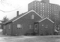
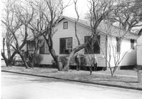
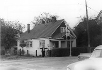
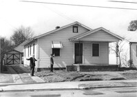
House (side view) on site affected by the construction of Interstate 26 (I-26). Address: 29 Mount Pleasant Street. Joseph Floyd Manor (Mount Pleasant Street and King Street) faintly in background. On corner of on Mount Pleasant Street and King Street. Surveyor notations on back of photo: "Dkt.: 10.503. Property owner: Charles B. Cromer, et al. Tract: 14. Station: 5892+90 Lt. Date: Feb. 19, 1963. In R/W - Bought." [See collection description for explanation of surveyor notations.]
House on site affected by the construction of Interstate 26 (I-26). Address: 29 Mount Pleasant Street. Surveyor notations on back of photo: "Dkt.: 10.503. Property owner: Charles B. Cromer, et al. Tract: 14. Station: 5892+90 Lt. Date: Feb. 19, 1963. In R/W - Bought." [See collection description for explanation of surveyor notations.]
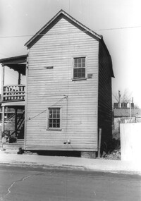
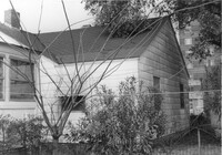
Garage building on site affected by the construction of Interstate 26 (I-26). Address: 29 Mount Pleasant Street. Surveyor notations on back of photo: "Dkt.: 10.503. Property owner: Charles B. Cromer, et al. Tract: 14. Station: 5893+35 Lt. Date: Feb. 19, 1963. Bought." [See collection description for explanation of surveyor notations.]
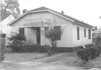
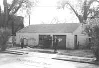
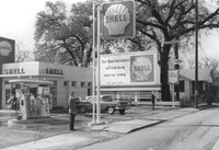
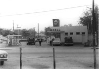
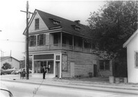
Shell gas station on site affected by the construction of Interstate 26 (I-26). Address: 1227 King Street. Surveyor notations on back of photo: "Dkt.: 10.503. Property owner: Shell Oil Co. Tract: 14-A. Station: 5893+80 Lt. Date: Feb. 19, 1963." [See collection description for explanation of surveyor notations.]
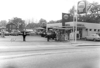
Shell gas station on site affected by the construction of Interstate 26 (I-26). Address: 1227 King Street. Surveyor notations on back of photo: "Dkt.: 10.503. Property owner: Shell Oil Co. Tract: 14-A. Station: 9+50 Rt. (Mt. Pleasant St.). Date: Apr. 20, 1965." [See collection description for explanation of surveyor notations.]
Shell gas station on site affected by the construction of Interstate 26 (I-26). Address: 1227 King Street. Surveyor notations on back of photo: "Dkt.: 10.503. Property owner: Shell Oil Co. Tract: 14-A. Station: 9+50 Rt. (Mt. Pleasant St.). Date: Apr. 20, 1965." [See collection description for explanation of surveyor notations.]
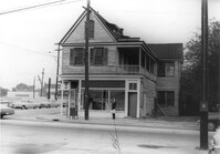
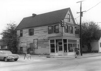
House on site affected by the construction of Interstate 26 (I-26). Address: 1226 King Street. View of street corner; corner of King Street and Mount Pleasant Street. First story is Sanex Cleaners. Surveyor notations on back of photo: "Dkt.: 10.503. Property owner: Mary E. Lea Ward. Tract: 14-B. Station: 11+50 Rt. (Mt. Pleasant St.). Date: Apr. 20, 1965. Partially in R/W." [See collection description for explanation of surveyor notations.]
House (corner view) on site affected by the construction of Interstate 26 (I-26). Address: 1226 King Street. View of street corner; corner of King Street and Mount Pleasant Street. First story is Sanex Cleaners. Sign for Coastal Carolina Fair posted on side of building. Surveyor notations on back of photo: "Dkt.: 10.503. Property owner: Mary E. Lea Ward. Tract: 14-B. Station: 11+50 Rt. (Mt. Pleasant St.). Date: Apr. 20, 1965." [See collection description for explanation of surveyor notations.]
Houses (rear view) on site affected by the construction of the Crosstown. Address: 74½ Cooper Street [74 Cooper Street]. Surveyor notations on back of photo: "Dkt.: 10.518. Property owner: Beatrice Hayward. Tract: 12. Station: 5965+30 Rt. Line 3, S.B. lane of Route 17. Date: Mar. 6, 1963. In R/W - Bought. [See collection description for explanation of surveyor notations.]
House (corner view) on site affected by the construction of Interstate 26 (I-26). Address: 1226 King Street. View of street corner; corner of King Street and Mount Pleasant Street. First story is Sanex Cleaners. Directional sign for St. John Hotel and sign for Coastal Carolina Fair posted on side of building. Surveyor notations on back of photo: "Dkt.: 10.503. Property owner: Mary E. Lea Ward. Tract: 14-B. Station: 11+50 Rt. (Mt. Pleasant St.). Date: Apr. 20, 1965." [See collection description for explanation of surveyor notations.]
House (side view) on site affected by the construction of Interstate 26 (I-26). Address: 1226 King Street. View of street corner; corner of King Street and Mount Pleasant Street. First story is Sanex Cleaners. Directional sign for St. John Hotel and sign for Coastal Carolina Fair posted on side of building. Surveyor notations on back of photo: "Dkt.: 10.503. Property owner: Mary E. Lea Ward. Tract: 14-B. Station: 11+50 Rt. (Mt. Pleasant St.). Date: Apr. 20, 1965." [See collection description for explanation of surveyor notations.]
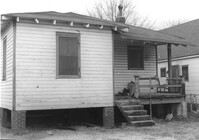
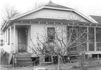
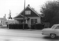
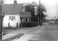
House on site by the construction of Interstate 26 (I-26). Address; 35 Mount Pleasant Street. Number 7 on porch column. At corner of railroad tracks and Mount Pleasant Street. Surveyor notations on back of photo: "Dkt.: 10.503. Property owner: Henry Fritz. Tract: 14-C. Station: 12+10 Rt. (Mt. Pleasant St.). Date: Apr. 20, 1965." [See collection description for explanation of surveyor notations.]
House on site by the construction of Interstate 26 (I-26). Address: 35 Mount Pleasant Street. Corner view from railroad tracks at Mount Pleasant Street. Surveyor notations on back of photo: "Dkt.: 10.503. Property owner: Henry Fritz. Tract: 14-C. Station: 12+10 Rt. (Mt. Pleasant St.). Date: Apr. 20, 1965." [See collection description for explanation of surveyor notations.]
House on site by the construction of Interstate 26 (I-26). Address: 35 Mount Pleasant Street. Corner (rear) view from railroad tracks in foreground. Joseph Floyd Manor (Mount Pleasant Street and King Street) in background. Surveyor notations on back of photo: "Dkt.: 10.503. Property owner: Henry Fritz. Tract: 14-C. Station: 12+10 Rt. (Mt. Pleasant St.). Date: Apr. 20, 1965." [See collection description for explanation of surveyor notations.]
House (side view) on site by the construction of Interstate 26 (I-26). Address: 35 Mount Pleasant Street. View of house from railroad tracks at Mount Pleasant Street. View of street corner, looking down King Street. Surveyor notations on back of photo: "Dkt.: 10.503. Property owner: Henry Fritz. Tract: 14-C. Station: 12+10 Rt. (Mt. Pleasant St.). Date: Apr. 20, 1965." [See collection description for explanation of surveyor notations.]
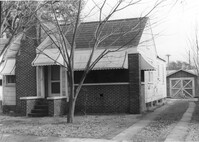
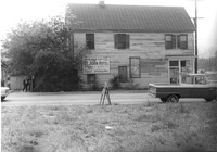
House on site by the construction of Interstate 26 (I-26). Address: 1215 King Street. Surveyor notations on back of photo: "Dkt.: 10.503. Property owner: Mary M.J. Clifton. Tract: 15. Station: 5894+60 Lt. Date: Feb. 19, 1963. In R/W - Bought." [See collection description for explanation of surveyor notations.]
Garage on site by the construction of Interstate 26 (I-26). Address: 1215 King Street. Surveyor notations on back of photo: "Dkt.: 10.503. Property owner: Mary M.J. Clifton. Tract: 15. Station: 5894+05 Lt. Date: Feb. 19, 1963. In R/W - Bought." [See collection description for explanation of surveyor notations.]
House (rear view) on site by the construction of Interstate 26 (I-26). Address: 1215 King Street. Surveyor notations on back of photo: "Dkt.: 10.503. Property owner: Mary M.J. Clifton. Tract: 15. Station: 5894+60 Lt. Date: Feb. 19, 1963. In R/W - Bought." [See collection description for explanation of surveyor notations.]
House (rear view) on site by the construction of Interstate 26 (I-26). Address: 1213 King Street. Surveyor notations on back of photo: "Dkt.: 10.503. Property owner: Robert C. Benke, et al. Tract: 16. Station: 5894+90 Lt. Date: Feb. 19, 1963. In R/W - Bought." [See collection description for explanation of surveyor notations.]
Houses on site affected by the construction of the Crosstown. Address: 73 Cooper Street. Surveyor notations on back of photo: "Dkt.: 10.518. Property owner: Centeur Corp. Tract: 13. Station: 5963+90 Rt. Line 3 of the S.B. lane of Route 17. Date: Mar. 6, 1963. Proximity. [See collection description for explanation of surveyor notations.]
House on site by the construction of Interstate 26 (I-26). Address: 1213 King Street. Surveyor notations on back of photo: "Dkt.: 10.503. Property owner: Robert C. Benke, et al. Tract: 16. Station: 5894+90 Lt. Date: Feb. 19, 1963. In R/W - Bought." [See collection description for explanation of surveyor notations.]