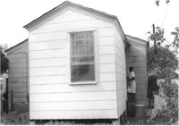
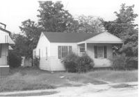
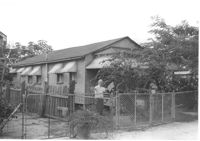
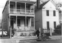
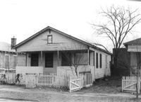
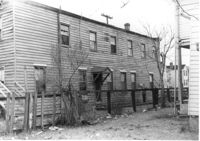
House (rear view) on site affected by the construction of Interstate 26 (I-26). Address: 2133 Weaver Avenue. Swing set in foreground with boy on swing. Surveyor notations on back of photo: "Dkt.: 10.490. Property owner: Arthur P. Jones. Tract: 199. Station: 5889+35 Rt. Date: May 15, 1962. In R/W - Bought." [See collection description for explanation of surveyor notations.]
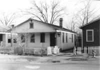
House (rear view) on site affected by the construction of Interstate 26 (I-26). Address: 2117 Weaver Avenue. See also I-26 Photos 1444-1445. Surveyor notations on back of photo: "Dkt.: 10.490. Property owner: Mrs. Lucretia Nowak. Tract: 191. Station: 5888+85 Lt. Date: May 15, 1962. In R/W - Bought." [See collection description for explanation of surveyor notations.]
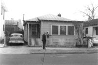
House (rear view) on site affected by the construction of Interstate 26 (I-26). Address: 2122 Weaver Avenue. Surveyor notations on back of photo: "Dkt.: 10.490. Property owner: Olar C. Verdier [Ola C. Verdier]. Tract: 189. Station: 35' Lt. Sta. 5887+45. Date: May 15, 1962. In R/W - Bought." [See collection description for explanation of surveyor notations.]
House (rear view) on site affected by the construction of Interstate 26 (I-26). Address: 2119 Weaver Avenue. Surveyor notations on back of photo: "Dkt.: 10.490. Property owner: Marion Butler, et al. Tract: 192. Station: 5888+50 on CL. Date: May 15, 1962. In R/W - Bought." [See collection description for explanation of surveyor notations.]
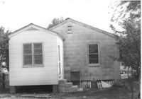
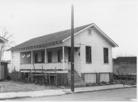
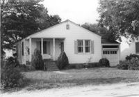
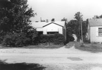
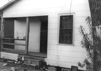
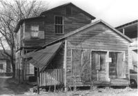
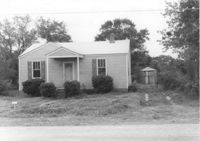
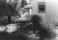
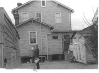
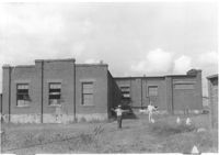
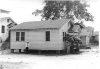
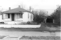
House on site affected by the construction of Interstate 26 (I-26). Address: 2124 Weaver Avenue. Surveyor notations on back of photo: "Dkt.: 10.490. Property owner: Harry L. Rumph, Jr. Tract: 188. Station: 5887+20 on CL. Date: May 15, 1962. In R/W - Bought." [See collection description for explanation of surveyor notations.]
House on site affected by the construction of Interstate 26 (I-26). Address: 2124 Weaver Avenue. Surveyor notations on back of photo: "Dkt.: 10.490. Property owner: Harry L. Rumph, Jr. Tract: 188. Station: 5887±00 Lt. Date: August 29, 1962. In R/W - Bought." [See collection description for explanation of surveyor notations.]
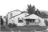
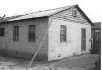
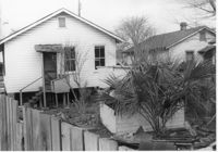
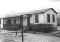
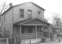
House on site affected by the construction of Interstate 26 (I-26). Address: 2126 Weaver Avenue. Surveyor notations on back of photo: "Dkt.: 10.490. Property owner: J.L. Duffy. Tract: 187. Station: 5887±00 Rt. Date: August 29, 1962. In R/W - Bought." [See collection description for explanation of surveyor notations.]
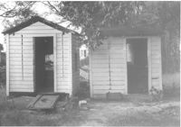
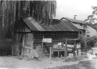
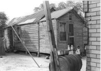
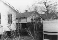
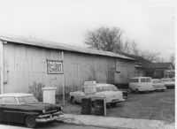
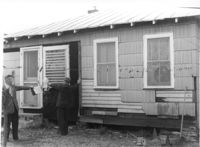
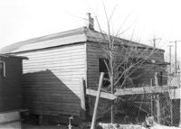
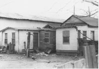
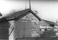
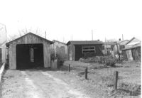
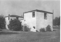
Two sheds on site affected by the construction of Interstate 26 (I-26).Address: 2124 Weaver Avenue. Surveyor notations on back of photo: "Dkt.: 10.490. Property owner: Harry L. Rumph, Jr. Tract: 188. Station: 5887±00 Lt. Date: August 29, 1962. In R/W - Bought." [See collection description for explanation of surveyor notations.]
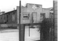
Half Moon Cafe on site affected by the construction of Interstate 26 (I-26). Front facade has stepped parapet. Building address number 1995. Surveyor notations on back of photo: "Dkt.: 10.490. Property owner: Illa G. Feldman. Tract: 35. Station: 5796+30 Rt. and Lt. Line 'A'. Date: September 11, 1962. In R/W - Bought." [See collection description for explanation of surveyor notations.]
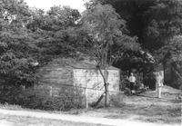
Shed on site affected by the construction of Interstate 26 (I-26). Surveyor notations on back of photo: "Dkt.: 10.490. Property owner: Leah D. Governor. Tract: 58. Station: 5800+60 Rt. Line 'G'. Date: September 12, 1962. In R/W - Bought." [See collection description for explanation of surveyor notations.]
House (rear view) on site affected by the construction of Interstate 26 (I-26). [Building address number 2209. 2209 Delano.] Surveyor notations on back of photo: "Dkt.: 10.490. Property owner: Dantzler H. Gardner, Est. Tract: 81. Station: 5824+00 Lt. Date: March 22, 1962. In R/W - Bought." [See collection description for explanation of surveyor notations.]
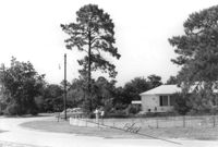
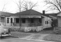
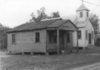
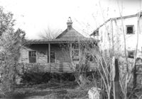
House associated with Francis Brown Methodist Church, on site affected by the construction of Interstate 26 (I-26). Surveyor notations on back of photo: "Dkt.: 10.490. Property owner: Francis Brown Meth. Church. Tract: 52. Station: 5800+20 Lt. Line 'F'. Date: September 12, 1962. Proximity to rear." [See collection description for explanation of surveyor notations.]
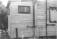
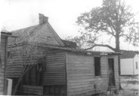
Exterior wall of house on site affected by the construction of Interstate 26 (I-26). Surveyor notations on back of photo: "Dkt.: 10.490. Property owner: William Parineau, et al. Tract: 54. Station: 5800+80 Lt. Line 'F'. Date: September 12, 1962. In R/W - Bought." [See collection description for explanation of surveyor notations.]
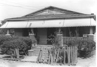
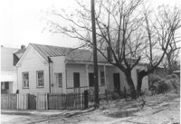
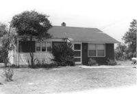
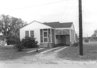
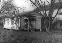
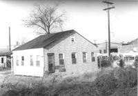
House on site affected by the construction of Interstate 26 (I-26). Surveyor notations on back of photo: "Dkt.: 10.490. Property owner: Lillian Ferguson. Tract: 43. Station: 5799+00 Rt. Line 'G.' Date: September 12, 1962. In R/W - Bought." [See collection description for explanation of surveyor notations.]
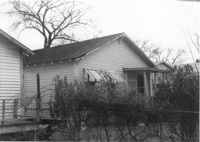
House on site affected by the construction of Interstate 26 (I-26). Surveyor notations on back of photo: "Dkt.: 10.490. Property owner: Nathaniel Phoenix. Tract: 46. Station: 5800+00 Rt. Line 'G'. Date: September 11, 1962. In R/W - Bought." [See collection description for explanation of surveyor notations.]
Building (rear view) on site affected by the construction of Interstate 26 (I-26). [Building address number 2015.] Surveyor notations on back of photo: "Dkt.: 10.490. Property owner: Nathaniel Phoenix. Tract: 45. Station: 5799+40 Rt. Line 'G'. Date: September 11, 1962. In R/W - Bought." [See collection description for explanation of surveyor notations.]
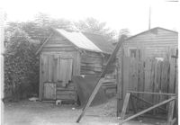
Structure (shed?) in dilapidated condition and wooden fence on site affected by the construction of Interstate 26 (I-26). Surveyor notations on back of photo: "Dkt.: 10.490. Property owner: Nathaniel Phoenix. Tract: 46. Station: 5799+60 Lt. Line 'G'. Date: September 11, 1962. In R/W - Bought." [See collection description for explanation of surveyor notations.]
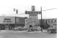
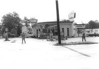
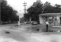
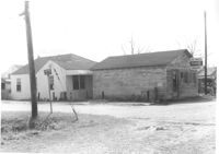
Gibson Tire Service on site affected by the construction of Interstate 26 (I-26). Address: 521 Meeting Street or 523 Meeting Street. Corner of Meeting Street and Lee Street. Sign for Dunlop Tires. View from street corner, showing intersection with directional signage for Route 17 and Route 701 and distances to nearby towns. Surveyor notations on back of photo: "Dkt.: 10.517. Property owner: Thomas P. Gibson. Tract: 59. Station: 36±00 - 37±00 Rt. & Lt. Route 17. Date: February 21, 1963. All in R/W." [See collection description for explanation of surveyor notations.]
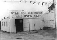
McKethan Oldsmobile / Used Cars / Value Rated, on site affected by the construction of Interstate 26 (I-26). Address: 646 King Street, southeast corner of Sheppard Street and King Street. Surveyor notations on back of photo: "Dkt.: 10.517. Property owner: W.L. McCrary, et al. Tract: 79. Station: 29+40 CL - Northbound Lane. Date: March 5, 1963. In R/W - Bought." [See collection description for explanation of surveyor notations.]
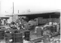
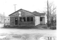
Commercial or industrial building (rear view) on site affected by the construction of Interstate 26 (I-26). Address: 71 Sheppard Street. Trash, scraps, and oil drums in foreground. Surveyor notations on back of photo: "Dkt.: 10.517. Property owner: Alex Goldberg, et al. Tract: 76. Station: 30+45 CL - Northbound Lane. Date: March 5, 1963. All in R/W." [See collection description for explanation of surveyor notations.]
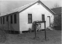
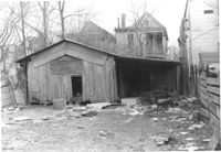
Shed or garage on site affected by the construction of Interstate 26 (I-26). Address: 85 Sheppard Street. Surveyor notations on back of photo: "Dkt.: 10.517. Property owner: Douglas E. Holmes. Tract: 86. Station: 26+40 Lt. Northbound Lane Route 17. Date: March 5, 1963. In R/W - Bought." [See collection description for explanation of surveyor notations.]
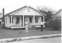
House on Coming Street near Sheppard Street, on site affected by the construction of Interstate 26 (I-26). Address: 276 Coming Street (L) and its neighbor, 274 Coming Street (R). Surveyor notations on back of photo: "Dkt.: 10.517. Property owner: William B. Hogan. Tract: 100. Station: 22+00 Rt. Northbound Lane Route 17. Date: March 5, 1963. Men on R/W (fence)." [See collection description for explanation of surveyor notations.]
House (rear view) on site affected by the construction of Interstate 26 (I-26). Address: 141 Cooper Street. (1951 Sanborn map indicates the address is 81 Cooper Street.) Surveyor notations on back of photo: "Dkt.: 10.517. Property owner: John D. Bendt Jr. Tract: 68. Station: 5958+70 Rt. - Line 4. Date: March 5, 1963. In R/W - Bought." [See collection description for explanation of surveyor notations.]
House (rear view) on site affected by the construction of Interstate 26 (I-26). Address: 143 Cooper Street. (1951 Sanborn map indicates the address is 93 Cooper Street) Surveyor notations on back of photo: "Dkt.: 10.517. Property owner: Annie L. Spell. Tract: 67. Station: 5958+80 Lt. - Line 3. Date: March 5, 1963. In R/W - Bought." [See collection description for explanation of surveyor notations.]
House on site affected by the construction of Interstate 26 (I-26). Address: 143 Cooper Street. (1951 Sanborn map indicates the address is 93 Cooper Street.) Surveyor notations on back of photo: "Dkt.: 10.517. Property owner: Annie L. Spell. Tract: 67. Station: 5958+80 Lt. - Line 3. Date: March 5, 1963. In R/W - Bought." [See collection description for explanation of surveyor notations.]
Side view of Paul's Seat Covers (industrial-type building) and its parking lot, on site affected by the construction of Interstate 26 (I-26). Address: 92 Cooper Street. Surveyor notations on back of photo: "Dkt.: 10.517. Property owner: Abe Goldberg. Tract: 66. Station: 5958+20 Lt. - Lane 4. Date: March 5, 1963. In R/W - Bought." [See collection description for explanation of surveyor notations.]
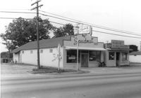
The Spudnut Shop [3646 Dorchester Road], on site affected by the construction of Interstate 26 (I-26). Front facade has stepped parapet. Neighboring building, Pick & Pay Grocery, also in photo. Surveyor notations on back of photo: "Dkt.: 10.480. Property owner: John C. Gelegotes, et al. Tract: 164. Station: 5681+50 on CL. Date: May 30, 1961. In R/W - Bought." [See collection description for explanation of surveyor notations.]
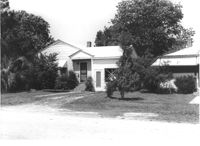
House on Dorchester Road, on site affected by the construction of Interstate 26 (I-26). Building address number 7. Surveyor notations on back of photo: "Dkt.: 10.480. Property owner: Fred M. Skipper. Tract: 179. Station: 132+90 Rt. (Route 642) [Dorchester Road]. Date: May 30, 1961. In R/W - Bought." [See collection description for explanation of surveyor notations.]
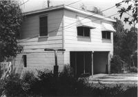
House on site affected by the construction of Interstate 26 (I-26). Partially obscured by trees. Garage (2-story) at end of driveway. Surveyor notations on back of photo: "Dkt.: 10.480. Property owner: Eugene J. Poteat. Tract: 201. Station: 5689+50 Lt. Date: May 31, 1961. In R/W - Bought." [See collection description for explanation of surveyor notations.]
House on Dorchester Road, on site affected by the construction of Interstate 26 (I-26). Building address number 7. Surveyor notations on back of photo: "Dkt.: 10.480. Property owner: Fred M. Skipper. Tract: 179. Station: 132+90 Rt. (Route 642) [Dorchester Road]. Date: May 30, 1961. In R/W - Bought." [See collection description for explanation of surveyor notations.]
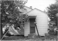
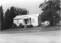
House at curve in road, on site affected by the construction of Interstate 26 (I-26). Surveyor notations on back of photo: "Dkt.: 10.480. Property owner: Mrs. Hazel McSherley Barton. Tract: 185. Station: 5684+65± Rt. (Line D). Date: May 31, 1961. Damage to fence and loss of pine tree." [See collection description for explanation of surveyor notations.]
House on corner of Harvey Avenue, on site affected by the construction of Interstate 26 (I-26). Street sign for Harvey Ave. at right. Surveyor notations on back of photo: "Dkt.: 10.480. Property owner: Renkin Finance Co. Tract: 188. Station: 5686+00 Lt. Date: May 31, 1961. In R/W - Bought." [See collection description for explanation of surveyor notations.]
House on Dorchester Road, on site affected by the construction of Interstate 26 (I-26). Surveyor notations on back of photo: "Dkt.: 10.480. Property owner: Mrs. Margaret H. Patterson. Tract: 181. Station: 134+00 (Rt. (Route 642) [Dorchester Road]. Date: May 31, 1961. In R/W - Bought." [See collection description for explanation of surveyor notations.]
House on site affected by the construction of Interstate 26 (I-26). Partially obscured by trees. Surveyor notations on back of photo: "Dkt.: 10.480. Property owner: Sallie Mae Penninger. Tract: 198. Station: 5688+95 Lt. Date: May 31, 1961. In R/W - Bought." [See collection description for explanation of surveyor notations.]
Property and structure (shed?) on Dorchester Road, on site affected by the construction of Interstate 26 (I-26). Surveyor notations on back of photo: "Dkt.: 10.480. Property owner: Mrs. Dorothy V. Bartee. Tract: 178. Station: 132+42 Rt. (Route 642) [Dorchester Road]. Date: May 30, 1961. In R/W - Bought." [See collection description for explanation of surveyor notations.]
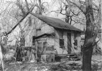
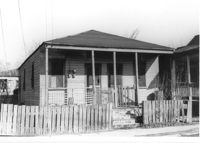
House in dilapidated condition (freedman's cottage) (rear view) on site affected by the construction of Interstate 26 (I-26). Address: 24 Poinsett Street. Surveyor notations on back of photo: "Dkt.: 10.503. Property owner: Frank Brown, Est. Tract: 104. Station: 5921+70 Rt. Date: Feb. 20, 1963. In R/W - Bought." [See collection description for explanation of surveyor notations.]
House (freedman's cottage) on site affected by the construction of Interstate 26 (I-26). Address: 21 Addison Street. Surveyor notations on back of photo: "Dkt.: 10.503. Property owner: Andrew R. Bland. Tract: 97. Station: 5919+90 Rt. Date: Feb. 20, 1963. In R/W - Bought." [See collection description for explanation of surveyor notations.]
House (rear view) on site affected by the construction of Interstate 26 (I-26). Address: 11 Maple Street. Surveyor notations on back of photo: "Dkt.: 10.503. Property owner: James L. Tyler. Tract: 54. Station: 5907+50 Rt. Date: Feb. 19, 1963. In R/W - Bought." [See collection description for explanation of surveyor notations.]
House on site affected by the construction of Interstate 26 (I-26). Address: 9 Maple Street. Surveyor notations on back of photo: "Dkt.: 10.503. Property owner: Kiki Zicoupolis, et al. Tract: 55. Station: 5907+45 CL. Date: Feb. 19, 1963. In R/W - Bought." [See collection description for explanation of surveyor notations.]
House on site affected by the construction of Interstate 26 (I-26). Building address number 109. Surveyor notations on back of photo: "Dkt.: 10.480. Property owner: Tujax, Inc. Tract: 283. Station: 5732+70 Lt. (Line B). Date: May 30, 1961. In R/W - Bought." [See collection description for explanation of surveyor notations.]
House (rear view) on site affected by the construction of Interstate 26 (I-26). Address: 5 Maple Street. Surveyor notations on back of photo: "Dkt.: 10.503. Property owner: Harry B. Chassereau. Tract: 57. Station: 5907+35 Lt. Date: Feb. 19, 1963." [See collection description for explanation of surveyor notations.]
House on site affected by the construction of Interstate 26 (I-26). Address: 7 Maple Street. Surveyor notations on back of photo: "Dkt.: 10.503. Property owner: James M. Knox. Tract: 56. Station: 5907+45 Lt. Date: Feb. 19, 1963. In R/W - Bought." [See collection description for explanation of surveyor notations.]
House on site affected by the construction of Interstate 26 (I-26). Address: 11 Maple Street. Surveyor notations on back of photo: "Dkt.: 10.503. Property owner: James L. Tyler. Tract: 54. Station: 5907+50 Rt. Date: Feb. 19, 1963. In R/W - Bought." [See collection description for explanation of surveyor notations.]
House on site affected by the construction of Interstate 26 (I-26).Address: 5 Maple Street. Surveyor notations on back of photo: "Dkt.: 10.503. Property owner: Harry B. Chassereau. Tract: 57. Station: 5907+35 Lt. Date: Feb. 19, 1963." [See collection description for explanation of surveyor notations.]
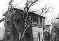
Dilapidated dwelling (rear view) on site affected by the construction of Interstate 26 (I-26). Address: 22½ Poinsett Street. Surveyor notations on back of photo: "Dkt.: 10.503. Property owner: J.W. Blanchard, Est. Tract: 102. Station: 5921+80 Lt. Date: Feb. 20, 1963. In R/W - Bought." [See collection description for explanation of surveyor notations.]
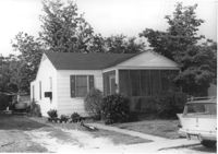
House on site affected by the construction of Interstate 26 (I-26). Building address number 191. Driveway leads to garage/shed. Surveyor notations on back of photo: "Dkt.: 10.480. Property owner: John S. Singleton. Tract: 132. Station: 5652+80 Rt. Date: May 1, 1961. In R/W - Bought." [See collection description for explanation of surveyor notations.]
Free Kindergarten on site affected by the construction of Interstate 26 (I-26). Address: 20 Huger Street. Surveyor notations on back of photo: "Dkt.: 10.503. Property owner: Free Kindergarten Assoc. of Chas. Tract: 113. Station: 5936+50 Rt. & Lt. CL. Date: Feb. 20, 1963. In R/W - Bought." [See collection description for explanation of surveyor notations.]
Dilapidated dwelling on site affected by the construction of Interstate 26 (I-26). Address: 22½ Poinsett Street (rear). Surveyor notations on back of photo: "Dkt.: 10.503. Property owner: J.W. Blanchard, Est. Tract: 102. Station: 5921+00 Lt. Date: Feb. 20, 1963. In R/W - Bought." [See collection description for explanation of surveyor notations.]
Dilapidated dwelling on site affected by the construction of Interstate 26 (I-26). Address: 22½ Poinsett Street. Surveyor notations on back of photo: "Dkt.: 10.503. Property owner: J.W. Blanchard, Est. Tract: 102. Station: 5921+80 Lt. Date: Feb. 20, 1963. In R/W - Bought." [See collection description for explanation of surveyor notations.]
House (rear view) on site affected by the construction of Interstate 26 (I-26). Address: 22 Riker Street. Surveyor notations on back of photo: "Dkt.: 10.503. Property owner: Gibbs Mitchell, Est. Tract: 66. Station: 5910+50 Rt. Date: Feb. 20, 1963. In R/W - Bought." [See collection description for explanation of surveyor notations.]
House on site affected by the construction of Interstate 26 (I-26). Building address number 209. Surveyor notations on back of photo: "Dkt.: 10.480. Property owner: Donald L. Gibson, et al. Tract: 141. Station: 5658+30 Rt. Date: May 2, 1961. In R/W - Bought." [See collection description for explanation of surveyor notations.]
House on site affected by the construction of Interstate 26 (I-26). Address: 22 Riker Street. Surveyor notations on back of photo: "Dkt.: 10.503. Property owner: Gibbs Mitchell, Est. Tract: 66. Station: 5910+50 Rt. Date: Feb. 20, 1963. In R/W - Bought." [See collection description for explanation of surveyor notations.]
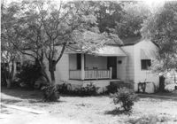
House on site affected by the construction of Interstate 26 (I-26). Neighboring church in background. Surveyor notations on back of photo: "Dkt.: 10.480. Property owner: Joseph Perry. Tract: 35. Station: 5507+40 Lt. Date: May 1, 1961. In R/W - Bought." [See collection description for explanation of surveyor notations.]
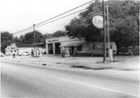
Corner grocery store? (side view) on site affected by the construction of Interstate 26 (I-26). Address: 506 Meeting Street (northwest corner of Meeting Street and Sheppard Street). Signage for a gas station in background (partially visible). Surveyor notations on back of photo: "Dkt.: 10.517. Property owner: Rose D. Brady. Tract 64. Station: 5963+50 Lt. - Line 6. Date: March 5, 1963. Partially in R/W." [See collection description for explanation of surveyor notations.]
House (freedman's cottage) and neighboring structures (rear view) on site affected by the construction of Interstate 26 (I-26). Address: 146 Cooper Street. (1951 Sanborn map indicates the address is 94-92A Cooper Street.) Surveyor notations on back of photo: "Dkt.: 10.517. Property owner: Felix J. McKnight, et al. Tract: 65. Station: 5957+85 Lt. - Line 4. Date: March 5, 1963. All in R/W." [See collection description for explanation of surveyor notations.]
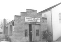
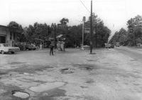
Collins Auto Glass Service on site affected by the construction of Interstate 26 (I-26). Address: 91 Lee Street. Front facade has stepped parapet. Surveyor notations on back of photo: "Dkt.: 10.517. Property owner: W.H. Yon. Tract: 56. Station: 34+30 Lt. - Route 17. Date: February 21, 1963." [See collection description for explanation of surveyor notations.]
House (corner view, rear) on site affected by the construction of Interstate 26 (I-26). Address: 95 Lee Street. Surveyor notations on back of photo: "Dkt.: 10.517. Property owner: Church of God of Prophecy. Tract: 54. Station: 5955+00 CL. Date: February 21, 1963. In R/W - Bought." [See collection description for explanation of surveyor notations.]
House (rear view) on site affected by the construction of Interstate 26 (I-26). Surveyor notations on back of photo: "Dkt.: 10.480. Property owner: Eugene J. Poteat. Tract: 201. Station: 5689+50 Lt. Date: May 31, 1961. In R/W - Bought." [See collection description for explanation of surveyor notations.]
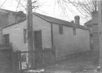
House (rear view) on site affected by the construction of Interstate 26 (I-26). Surveyor notations on back of photo: "Dkt.: 10.480. Property owner: Joseph A. Elsey. Tract: 200. Station: 5689+70 Rt. Date: May 31, 1961. In R/W - Bought." [See collection description for explanation of surveyor notations.]
House on site affected by the construction of Interstate 26 (I-26). Surveyor notations on back of photo: "Dkt.: 10.480. Property owner: Crider O. Murray. Tract: 202. Station: 5689+90 Lt. Date: May 31, 1961. In R/W - Bought." [See collection description for explanation of surveyor notations.]
House on site affected by the construction of Interstate 26 (I-26). Surveyor notations on back of photo: "Dkt.: 10.480. Property owner: Joseph A. Elsey. Tract: 200. Station: 5689+70 Rt. Date: May 31, 1961. In R/W - Bought." [See collection description for explanation of surveyor notations.]
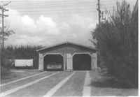
Two-story garage (corner view) on site affected by the construction of Interstate 26 (I-26). Surveyor notations on back of photo: "Dkt.: 10.480. Property owner: Eugene J. Poteat. Tract: 201. Station: 5689+50 Lt. Date: May 31, 1961. In R/W - Bought." [See collection description for explanation of surveyor notations.]
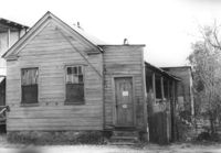
House in dilapidated condition (freedman's cottage) on site affected by the construction of Interstate 26 (I-26). Address: 7 Poinsett Street. Number 23 painted on door. Surveyor notations on back of photo: "Dkt.: 10.503. Property owner: Manuel F. Fernandez. Tract: 106. Station: 5923+50 Lt. Date: Feb. 20, 1963. In R/W - Bought." [See collection description for explanation of surveyor notations.]
Shed (railroad building) along railroad tracks, on site affected by the construction of Interstate 26 (I-26). Address: 19½ Poinsett Street (rear). Trolley barn on 665 Meeting Street, and buses, in background. Surveyor notations on back of photo: "Dkt.: 10.503. Property owner: S.A.L.R.R. Tract: 105. Station: 5924+40 Rt. & Lt. Date: Feb. 20, 1963." [See collection description for explanation of surveyor notations.]
House in dilapidated condition (freedman's cottage) (rear view) on site affected by the construction of Interstate 26 (I-26). Address: 7 Poinsett Street. Surveyor notations on back of photo: "Dkt.: 10.503. Property owner: Manuel F. Fernandez. Tract: 106. Station: 5923+50 Lt. Date: Feb. 20, 1963. In R/W - Bought." [See collection description for explanation of surveyor notations.]
House (corner view, rear) on site affected by the construction of Interstate 26 (I-26). Unnumbered house, on unnamed road, behind 35 Poinsett Street. Trolley barn on 665 Meeting Street, and buses, in background. Surveyor notations on back of photo: "Dkt.: 10.503. Property owner: Manuel F. Fernandez. Tract: 106. Station: 5923+80 Lt. Date: Feb. 20, 1963. In R/W - Bought." [See collection description for explanation of surveyor notations.]
House (rear view) on site affected by the construction of Interstate 26 (I-26). Address: 12 Maple Street. Surveyor notations on back of photo: "Dkt.: 10.503. Property owner: Atlantic Coast Life Ins. Co., et al. Tract: 52. Station: 5906+45 Rt. Date: Feb. 19, 1963. In R/W - Bought." [See collection description for explanation of surveyor notations.]
House (rear view) on site affected by the construction of Interstate 26 (I-26). Address: 8 Maple Street. Surveyor notations on back of photo: "Dkt.: 10.503. Property owner: Atlantic Coast Life Ins. Co., et al. Tract: 50. Station: 5906+30 Rt. Date: Feb. 19, 1963. In R/W - Bought." [See collection description for explanation of surveyor notations.]
House (rear view) on site affected by the construction of Interstate 26 (I-26). Address: 10 Brigard Street. Surveyor notations on back of photo: "Dkt.: 10.503. Property owner: Nathan Williams. Tract: 43. Station: 5905+30 Rt. Date: Feb. 19, 1963. In R/W - Bought." [See collection description for explanation of surveyor notations.]
House (rear view) on site affected by the construction of Interstate 26 (I-26). Address: 5 Lenox Street. Surveyor notations on back of photo: "Dkt.: 10.503. Property owner: Estelle Thompson. Tract: 40. Station: 5902+60 Lt. Date: Feb. 19, 1963. In R/W - Bought." [See collection description for explanation of surveyor notations.]
House on site affected by the construction of Interstate 26 (I-26). Address: 11 Brigade Street. Surveyor notations on back of photo: "Dkt.: 10.503. Property owner: Ada Williams. Tract: 42. Station: 5905+20 Rt. Date: Feb. 19, 1963. In R/W - Bought." [See collection description for explanation of surveyor notations.]
Garage on or in vicinity of King Street Extn., on site affected by the construction of Interstate 26 (I-26). Surveyor notations on back of photo: "Dkt.: 10.490. Property owner: V.C. Chemical Co. Tract: 1. Station: 5807+80 Rt. (Line F). Date: September 11, 1962. In R/W - Bought." [See collection description for explanation of surveyor notations.]
Multi-family housing on Pickens Street (312 Pickens Street), on site affected by the construction of Interstate 26 (I-26). Surveyor notations on back of photo: "Dkt.: 10.490. Property owner: Ashley Development Co. Tract: 1-A. Station: 5769+37 to 5771+00 Rt. Date: September 11, 1962. In R/W - Bought." [See collection description for explanation of surveyor notations.]
House (side view) on or in vicinity of King Street Extn., on site affected by the construction of Interstate 26 (I-26). Surveyor notations on back of photo: "Dkt.: 10.490. Property owner: V.C. Chemical Co. Tract: 1. Station: 5808+50 Rt. (Line F). Date: September 11, 1962. In R/W - Bought." [See collection description for explanation of surveyor notations.]
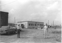
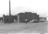
Virginia-Carolina Chemical Corp. building on site affected by the construction of Interstate 26 (I-26). [VC Chemical Corp. was located on King Street Extn.] Surveyor notations on back of photo: "Dkt.: 10.490. Property owner: V.C. Chemical Co. Tract: 1. Station: 5798+20 Rt. Date: September 11, 1962. Wash room. Outside R/W." [See collection description for explanation of surveyor notations.]
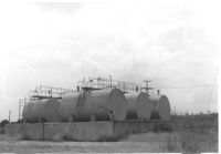
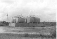
Virginia-Carolina Chemical Corp. tanks on site affected by the construction of Interstate 26 (I-26). [VC Chemical Corp. was located on King Street Extn.] Surveyor notations on back of photo: "Dkt.: 10.490. Property owner: V.C. Chemical Co. Tract: 1. Station: 5803+20 on CL. Date: September 11, 1962. In R/W. Bought. Tank 'farm.'" [See collection description for explanation of surveyor notations.]
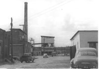
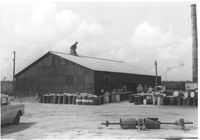
Virginia-Carolina Chemical Corp. buildings on site affected by the construction of Interstate 26 (I-26). [VC Chemical Corp. was located on King Street Extn.] Surveyor notations on back of photo: "Dkt.: 10.490. Property owner: V.C. Chemical Co. Tract: 1. Station: 5798±5799± Rt. Date: September 11, 1962. TCP tower outside R/W." [See collection description for explanation of surveyor notations.]
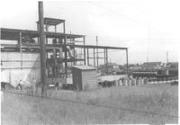
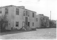
Virginia-Carolina Chemical Corp. structures on site affected by the construction of Interstate 26 (I-26). [VC Chemical Corp. was located on King Street Extn.] Surveyor notations on back of photo: "Dkt.: 10.490. Property owner: V.C. Chemical Co. Tract: 1. Station: 5800+00 Rt. Date: September 11, 1962. To be cut off at R/W." [See collection description for explanation of surveyor notations.]
Virginia-Carolina Chemical Corp. structures on site affected by the construction of Interstate 26 (I-26). [VC Chemical Corp. was located on King Street Extn.] Surveyor notations on back of photo: "Dkt.: 10.490. Property owner: V.C. Chemical Co. Tract: 1. Station: 5800+00 Rt. Date: September 11, 1962. To be cut off at R/W." [See collection description for explanation of surveyor notations.]
Virginia-Carolina Chemical Corp. building on site affected by the construction of Interstate 26 (I-26). [VC Chemical Corp. was located on King Street Extn.] Surveyor notations on back of photo: "Dkt.: 10.490. Property owner: V.C. Chemical Co. Tract: 1. Station: 5798+20 Rt. Date: September 11, 1962. Outside R/W." [See collection description for explanation of surveyor notations.]
Crown gas station, on site affected by the widening of State Road 13 (Remount Road). Johnny's in back. Possibly the corner of North Rhett Avenue and Remount Road. Surveyor notations on back of photo: "Dkt.: 10.562. Property owner: Corco Realty Co. (Crown). Tract: 142. Date: Jul. 19, 1967." [See collection description for explanation of surveyor notations.]
Crown gas station, on site affected by the widening of State Road 13 (Remount Road). Possibly the corner of North Rhett Avenue and Remount Road. Surveyor notations on back of photo: "Dkt.: 10.562. Property owner: Corco Realty Co. (Crown). Tract: 142. Date: Jul. 19, 1967." [See collection description for explanation of surveyor notations.]
Esso gas station, on site affected by the widening of State Road 13 (Remount Road). Louie's Speed shop in background. Surveyor notations on back of photo: "Dkt.: 10.562. Property owner: Harry R. Williams. Tract: 113. Date: Jul. 19, 1967." [See collection description for explanation of surveyor notations.]
Atlantic gas station, on site affected by the widening of State Road 13 (Remount Road). Surveyor notations on back of photo: "Dkt.: 10.562. Property owner: Atlantic Refining Co. Tract: 37. Date: Jul. 19, 1967." [See collection description for explanation of surveyor notations.]
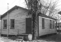
House(rear view) on site affected by the construction of Interstate 26 (I-26). Address: 2171 Heriot Street. Surveyor notations on back of photo: "Dkt.: 10.490. Property owner: Louise S. Carter. Tract: 152. Station: 30' Lt. Sta. 5879+50. Date: May 15, 1962. In R/W - Bought." [See collection description for explanation of surveyor notations.]
House on site affected by the construction of Interstate 26 (I-26). Address: 2171 Heriot Street. Surveyor notations on back of photo: "Dkt.: 10.490. Property owner: Louise S. Carter. Tract: 152. Station: 30' Lt. Sta. 5879+50. Date: May 15, 1962. In R/W - Bought." [See collection description for explanation of surveyor notations.]
House on site affected by the construction of Interstate 26 (I-26). Address: 3 Carters Court. Surveyor notations on back of photo: "Dkt.: 10.490. Property owner: Louise S. Carter. Tract: 148. Station: 100' Lt. Sta. 5880+25. Date: May 15, 1962. In R/W - Bought." [See collection description for explanation of surveyor notations.]
House on site affected by the construction of Interstate 26 (I-26). Address: 3 Carters Court. Surveyor notations on back of photo: "Dkt.: 10.490. Property owner: Louise S. Carter. Tract: 148. Station: 100' Lt. Sta. 5880+25. Date: May 15, 1962. In R/W - Bought." [See collection description for explanation of surveyor notations.]
House on site affected by the construction of Interstate 26 (I-26). Address: 2153 Heriot Street. Surveyor notations on back of photo: "Dkt.: 10.490. Property owner: J.C. Locklair. Tract: 147-D. Station: 5879± Lt. Date: august 29, 1962. Proximity." [See collection description for explanation of surveyor notations.]
Joe Smith's Grocery, at the corner of Doscher Avenue and Farwell Street, on site affected by the construction of Interstate 26 (I-26). [Building address number 1934.] House to its rear also in photo. Surveyor notations on back of photo: "Dkt.: 10.490. Property owner: Joseph F. Smith. Tract: 21. Station: 5819+00 Rt. Line "G." Date: March 22, 1962. In R/W - Bought." [See collection description for explanation of surveyor notations.]
Joe Smith's Grocery [at the corner of Doscher Avenue and Farwell Street] on site affected by the construction of Interstate 26 (I-26). Building address number 1934. Surveyor notations on back of photo: "Dkt.: 10.490. Property owner: Joseph F. Smith. Tract: 21. Station: 5819+00 Rt. Line "G." Date: March 22, 1962. In R/W - Bought." [See collection description for explanation of surveyor notations.]
Garage or shed on site affected by the construction of Interstate 26 (I-26). Surveyor notations on back of photo: "Dkt.: 10.490. Property owner: Joseph F. Smith. Tract: 20. Station: 5819+82 on Lt. of line "G." Date: March 22, 1962. In R/W - Bought." [See collection description for explanation of surveyor notations.]
House on site affected by the construction of Interstate 26 (I-26). Building address number 2202. Surveyor notations on back of photo: "Dkt.: 10.490. Property owner: Julius A. Cercoply. Tract: 17. Station: 5818+20 Lt. Date: March 22, 1962. In R/W - Bought." [See collection description for explanation of surveyor notations.]
Virginia-Carolina Chemical Corp. tanks on site affected by the construction of Interstate 26 (I-26). [VC Chemical Corp. was located on King Street Extn.] Surveyor notations on back of photo: "Dkt.: 10.490. Property owner: V.C. Chemical Co. Tract: 1. Station: 5803+20 on CL. Date: September 11, 1962. In R/W. Bought. Tank 'farm.'" [See collection description for explanation of surveyor notations.]
Virginia-Carolina Chemical Corp. building on site affected by the construction of Interstate 26 (I-26). [VC Chemical Corp. was located on King Street Extn.] Surveyor notations on back of photo: "Dkt.: 10.490. Property owner: V.C. Chemical Co. Tract: 1. Station: 5801+60 Rt. Date: September 11, 1962. To be cut off at R/W." [See collection description for explanation of surveyor notations.]
Virginia-Carolina Chemical Corp. building on site affected by the construction of Interstate 26 (I-26). [VC Chemical Corp. was located on King Street Extn.] Surveyor notations on back of photo: "Dkt.: 10.490. Property owner: V.C. Chemical Co. Tract: 1. Station: 5798+20 Rt. Date: September 11, 1962. Lab. Outside R/W." [See collection description for explanation of surveyor notations.]
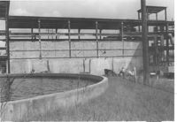
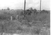
Virginia-Carolina Chemical Corp. fixtures and land, on site affected by the construction of Interstate 26 (I-26). [VC Chemical Corp. was located on King Street Extn.] Surveyor notations on back of photo: "Dkt.: 10.490. Property owner: V.C. Chemical Co. Tract: 1. Station: 5804+15 Lt. Date: September 11, 1962. All in R/W." [See collection description for explanation of surveyor notations.]
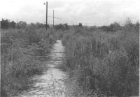
Virginia-Carolina Chemical Corp. land, on site affected by the construction of Interstate 26 (I-26). [VC Chemical Corp. was located on King Street Extn.] Surveyor notations on back of photo: "Dkt.: 10.490. Property owner: V.C. Chemical Co. Tract: 1. Station: 5804+00 and 5805+00 Rt. Date: September 11, 1962. All in R/W." [See collection description for explanation of surveyor notations.]
Two two-story dwellings (rear view) on site affected by the construction of Interstate 26 (I-26). Address: 1317 King Street. Presumably part of the Rose Garden Tourist Court; see I-26 Photo 1467. Surveyor notations on back of photo: "Dkt.: 10.490. Property owner: The Long Corporation. Tract: 200. Station: 5+50 & 6+20 Lt. (Mt. Pleasant Street). Date: September 11, 1962. In R/W - Bought." [See collection description for explanation of surveyor notations.]
Two two-story dwellings (rear view) on site affected by the construction of Interstate 26 (I-26).Address: 1317 King Street. Presumably part of the Rose Garden Tourist Court; see I-26 Photo 1467. Surveyor notations on back of photo: "Dkt.: 10.490. Property owner: The Long Corporation. Tract: 200. Station: 5889+00 to 5890+00 Lt. Date: September 11, 1962. In R/W - Bought." [See collection description for explanation of surveyor notations.]