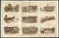
Various illustrations of forts during the Civil War in Charleston. Captions of illustration, top row, left to right: 'View of terre-plein of the gorge of Fort Sumter', 'Parade of Fort Moultrie', 'North Western Angle of Fort Moultrie.' Captions of illustrations, middle row, left to right: 'View of terre-plein and parapet of eastern flank of Fort Sumter,' 'Barracks on north face of parade, Fort Moultrie,' 'South-western angle of Fort Moultrie.' Captions of illustrations, bottom row, left to right: 'Officers quarters, eastern portion of parade, Fort Moultrie', Western barracks, Fort Moultrie,' 'Channel face and south-western angle of the ramparts of Fort Moultrie.'
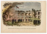
A sketch of Fort Sumter after the bombardment. Soldiers are shown standing and moving material as a fire burns in the background. On the verso is a partial sketch entitled 'A Scene on the Potomac River- Part of a Gunboat Fortilla.'
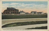
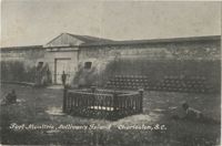
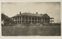
A postcard of the Parade Ground of Fort Moultrie. The back of the postcard reads, "The parade ground of Fort Moultrie, situated on Sullivan's Island was first called Fort Sullivan and later named after General Moultrie. It was originally built of palmetto logs and sand, and here Sergeant Jasper amidst shot and shell, jumped over parapets onto the beach, rescued the flag and put in place again."
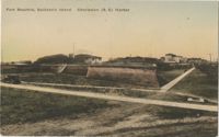
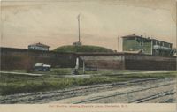
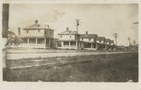
A postcard of Fort Moultrie near the Charleston Harbor on Sullivan's Island. The back of the postcard reads, "This fort is built on the site of the palmetto log and sand bag fort which repulsed the British fleet on June 28, 1776."