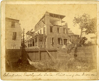
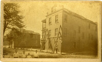
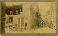
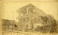
Caption: 'Charleston Earthquake. Photographs by Dr. E.P. Howland, taken on his visit to Charleston and the earthquake region of Ten Mile Hill and Summervile. Over 150 Photographs were taken. House of Mrs. Snowden, President of Confederate Home.'
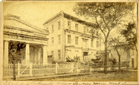
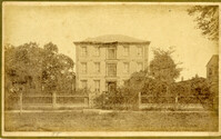
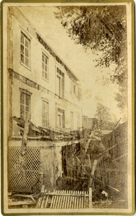
Caption: 'Cook's Earthquake Views of Charleston and Vicinity. Taken after the 31st of August, 1886. No.61, Mrs. B.D. Lazarus, Hasel [sic] St.' Charleston city directory for 1886 shows Mrs. B.D. Lazarus at 64 Hassell Street.
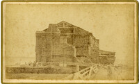
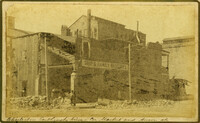
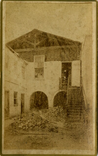
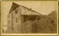
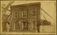
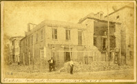
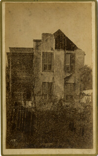
Caption: ' Cook's Earthquake Views of Charleston and Vicinity. Series No.2. No.164, Storehouse of Bennett's Mill.' Note on the catalog card show storehouse located at East end of Wentworth Street.
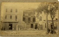
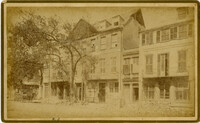
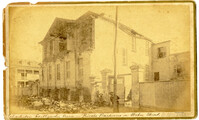
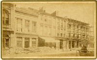
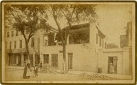
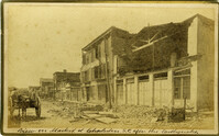
Caption: 'Cook's Earthquake Views of Charleston and Vicinity. Taken after the 31st of August, 1886. No.136, Meeting Street, cor. [of] Market.' Henry Steitz Produce is pictured. Charleston City directory for 1886 lists Henry Steitz, Fruits & Produce, at 113-115 Market Street.
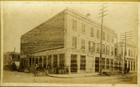
Caption: 'Cook's Earthquake Views of Charleston and Vicinity. Taken after the 31st of August, 1886. No.115, Corner [of] Market and Anson Streets.' Sign on building reads: 'Ship & Family Groceries.' Written on front, at bottom: 'Charleston Earthquake view - cor. Market and Anson sts.'
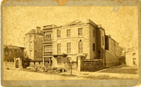
Charleston Earthquake scene. Written on reverse: 'East Battery, just below Atlantic Street. Edmonston [sic] House, later the Charles Alston residence. Now (1947) the residence of J.J. Pringle Smith. Old Holmes house on left. Earthquake of 1886 - Charleston, S.C.'
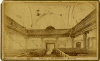
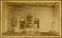
Caption: 'Cook's Earthquake Views of Charleston and Vicinity taken after the 31st of August, 1886. No.2, St. Michael's Church, Interior.' Handwritten along bottom: 'Charleston Earthquake scene - interior of St. Michael's Church.' Very similar to MK 4133.
Charleston Earthquake scene. Possibly from Cook's Earthquake views, No.31, Tenement houses on East Bay. Written on front, at bottom: 'Charleston Earthquake scene - house on East Bay near Tradd.' Sign on building at left, reads: 'Ship & Family Groceries' known to be at the corner of East Bay and Queen. Sign on building at right, reads: '65' and possibly 'Sahlmann.' 1886 Charleston city directory lists L. Sahlmann, Hay & Grain, at 83 East Bay.
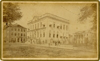
Caption: 'Cook's Earthquake Views of Charleston and Vicinity. Taken after the 31st of August, 1886. No.36, Court House, City Hall, and Fireproof Building.'
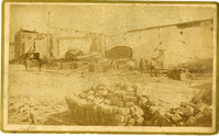
Caption: 'Cook's Earthquake Views of Charleston and Vicinity. Series No.2.' No.156, Scene near Brown's Wharf.' Charleston city directory for 1886 lists Brown's Wharf as opposite Vendue Range.
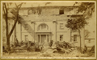
Caption: 'Cook's Earthquake Views of Charleston and Vicinity. Taken after the 31st of August, 1886. No. 55, Major R.C. Gilchrist, Bee St[reet].' Charleston city directory for 1886 shows Robert C. Gilchrist at 12 Bee Street.
Caption: 'Cook's Earthquake Views of Charleston and Vicinity. Series No.2. No.190, Kerr's Wharf. Charleston city directory for 1886 lists Kerr's Wharf as opposite Cordes.
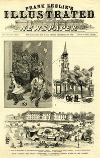
Caption: 'South Carolina.--The recent earthquakes at Charleston--typical scenes of the calamity. From sketches by C. Upham--see page 71. 1. Scene on the stairway of the Charleston Hotel during a shock. 2. Taking down St. Philip's Steeple. 3. Scene on Marion Square, opposite the Citadel--a city of tents.' [full date September 18, 1886.]
Caption: 'Cook's Earthquake Views of Charleston and Vicinity. Taken after the 31st of August, 1886. No.40, Bishop's house, Broad Street.' Handwritten at bottom, front: 'Charleston Earthquake scene - Bishop Northrup's Residence.' Charleston city directory for 1886 shows Bishop Henry P. Northrop at 114 Broad Street.
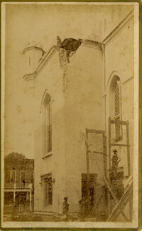
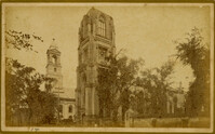
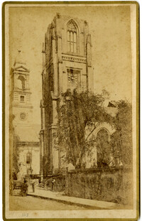
Caption: 'Cook's Earthquake Views of Charleston and Vicinity. Taken after the 31st of August, 1886. No.150, Mariner's Church, exterior." Also, handwritten at bottom of image: 'Charleston Earthquake scene - Mariners' Church, Church Street ? East Bay'
Caption: Cook's Earthquake View of Charleston and Vicinity. Taken after the 31st of August, 1886. No.151, Mariner's Church, interior.' Also, handwritten at bottom, front: 'Charleston Earthquake scene - Interior of Mariners' Church, on Church Street.'
Caption: 'Cook's Earthqauke Views of Charleston and Vicinity. Taken after the 31st of August, 1886. No.126, East Bay, corner Queen Street.' Sign on building reads: 'Ship & Family Groceries.' Possibly J.J.W. Luden, retail grocers and ship chandlers, located 167-169 East Bay, according to the 1886 Charleston city directory.
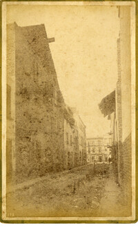
Caption: 'Cook's Earthquake Views of Charleston and Vicinity. Taken after the 31st of August, 1886. No.22, Broad Street, north side.' Charleston Insurance & Trust, Co. is shown to the left. Charleston city directory for 1886 lists it as Ravenel, Johnson & Co. at 12 Broad Street.
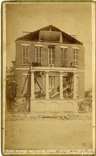
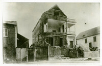
Charleston Earthquake scene, residence on Ashley Street. Handwritten on reverse: 'The residence of the Mayor of Charleston shattered by the Earthquake, Aug[us]t 31st 1886 and occupied by the Mayor's family unitl May 1887. Courtnay's [sic] residence. E.V.V. made bust of this man.'
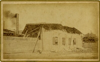
Caption: 'Cook's Earthquake Views of Charleston and Vicinity. Taken after the 31st of August, 1886. No.38, Bagging Factory, East end.' Charleston city directory for 1886 shows the office of the Charleston Bagging Manufacturing Company at 110 East Bay. Written on front, at bottom: 'Charleston Earthquake Scene - Rear of Bagging Factory.'
Caption: 'Cook's Earthquake Views of Charleston and Vicinity. Taken after the 31st of August, 1886. No.67, G.W. Williams, Jr., Atlantic Street.' Charleston city directory for 1886 shows George W. Williams, Jr. at 2 Atlantic Street.
Caption: 'Cook's Earthquake Views of Charleston and Vicinity. Taken after the 31st of August, 1886. No.5, Medical College.' Handwritten at bottom, front: 'Charleston Earthquake scene - Charleston Medical College. Queen Street.'
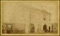
Caption: 'Cook's Earthquake Views of Charleston and Vicinity. Taken after the 31st of August, 1886. No.24, Market Street, north side.' Charleston Port Society building is pictured. Written on front, at bottom: 'View on Market St. at Charleston, S.C. after the Earthquake.'
Caption: 'Cook's Earthquake Views of Charleston and Vicinity. Taken after the 31st of August, 1886. No.131, residence J.N. Robson, south side.' Charleston city directory for 1886 shows James N. Robson at 200 Coming Street.
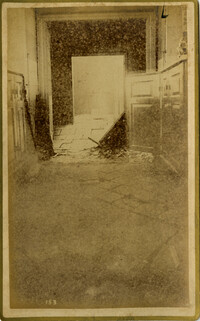
Caption: 'Cook's Earthquake Views of Charleston and Vicinity, Series No.2. No.153, Main aisle of St. Michael's Church, showing fissures and upheavals.'
Charleston Earthquake scene. Possibly from Cook's Earthquake Views. No.68, John Kenney, Tradd Street. Charleston city directory for 1886 shows listing for John B. Kenney at 142 Tradd.
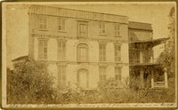
Charleston Earthquake Scene. Possibly from Cook's Earthquake Views, No.56, Alderman Murray's residence, Wentworth Street.' Charleston city directory for 1886 shows Andrew B. Murray at 175 Wentworth.
Charleston Earthquake scene. Written on front, at bottom: 'Charleston Earthquake scene - warehouse on Atlantic Wharf.' Charleston city directory for 1886 lists Atlantic Wharf at the rear of the Post Office.
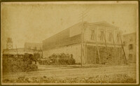
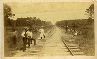
Charleston Earthquake scene. Handwritten on reverse: '9 mile bottom - South Carolina railroad - chasm on left. Track was originally a tangent. Caused by earthquake, 1886. Track cut of line.'
Caption: 'Cook's Earthquake Views of Charleston and Vicinity. Taken after the 31st of August, 1886. No.93, No.11 King Street.' Written on front, at bottom: 'Charleston Earthquake scene - Private residence on King St. near South Battery.'
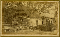
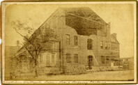
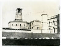
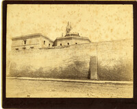
Caption: 'Charleston Earthquake. Photographs by Dr. E.P. Howland, taken on his visit to Charleston and the earthquake region of Ten Mile Hill and Summerville. Over 150 Photographs were taken. Charleston Jail and cracked wall, unsafe and condemned.'