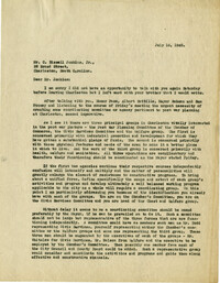
Letter from George W. Simons, Jr. to Robert N.S. Whitelaw enclosing his observations on Charleston planning and asking for his reactions (Dec. 13, 1943).
A letter to Homer M. Pace from Robert N.S. Whitelaw (Dec. 2, 1946) outlining his thoughts on city planning in Charleston, the need for a photographic record of Charleston, and historic preservation.
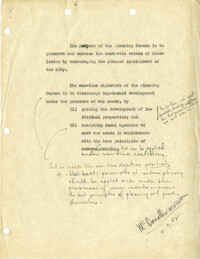
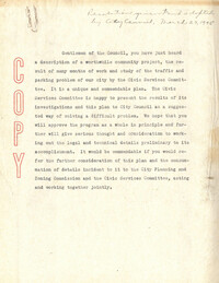
Memorandum from Robert N.S. Whitelaw to the members of the Civic Services Committee and the Carolina Art Association (Jan. 28, 1946) outlining his thoughts how the CSC should proceed with regard to city planning and historic preservation, fundraising, and his agreement with Kenneth Chorley that there is a need to incorporate a "Charleston Foundation."
Letter to George W. Simons from Robert N.S. Whitelaw (Aug. 4, 1943) enclosing informational material and asking if Whitelaw and Fred McDonald may consult with him about city planning matters in Charleston.
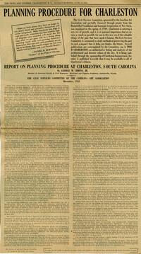
A document that addresses the need for city planning and historic preservation in Charleston and about the work of the Planning Committee of the Carolina Art Association. (May be an editorial.)
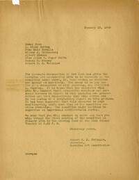
Memorandum to the Committee (Homer Pace, E. Milby Burton, John Mead Howells, Sidney J. Rittenberg, Albert Simons, Alice R. Huger Smith, Samuel G. Stoney, Robert N.S. Whitelaw) written by Robert N.S. Whitelaw (Jan. 10, 1940) about the funding from Carnegie Corporation given to the committee to pay the fee of Frederick Law Olmsted as a city planning consultant.
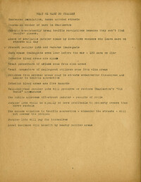
"Main Points of Talk Given by H.P. Staats Before the William Bird Company, July 3, 1956," about the status of city planning in Charleston. Attachment entitled "Outline: Some Specific Problems Demanding Cooperative Action.
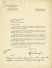
Letter in response to Charles F. Colbert, Jr. from Robert N.S. Whitelaw (May 21, 1945) expressing appreciation for Colbert's interest in CSC's programs.
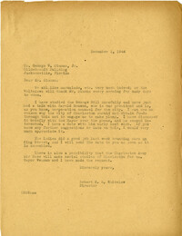
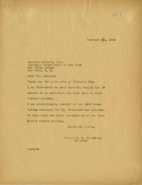
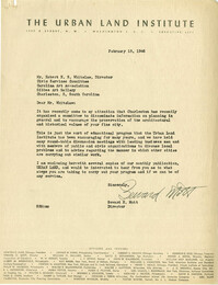
Letter to Robert N.S. Whitelaw from Seward H. Mott (Urban Land Institute) (Feb. 15, 1946) enclosing copy of ULI publication and acknowledging the work of CSC.
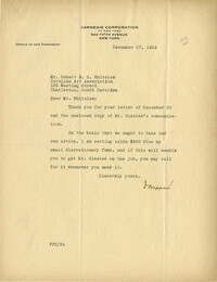
Letter to Robert N.S. Whitelaw from Frederick P. Keppel (Dec. 27, 1939) regarding funding to retain Frederick Law Olmsted as a city planning consultant.
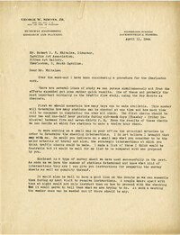
Letter to Robert N.S. Whitelaw from Charles F. Colbert, Jr. (Pittsburgh Metallurgical Co.) (April 21, 1945) congratulating CSC for city planning publication.
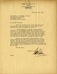
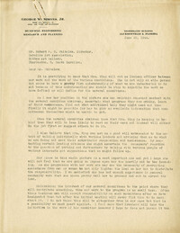
Letter to Robert N.S. Whitelaw from architect Robert D. Kohn (Feb. 13, 1940) praising the capabilities of Albert Simons with regard to the proposed city planning project.
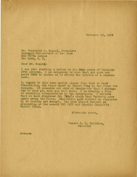
Letter to Frederick P. Keppel from Robert N.S. Whitelaw (Dec. 29, 1939) thanking him for the consultant fee and recommending he read "Charleston, the Great Myth" by Edward Twig.
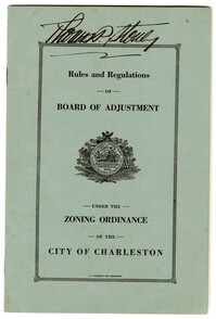
A pamphlet containing the Rules and Regulations of the Board of Adjustment Under the Zoning Ordinance of the City of Charleston; the 1921 Act of the General Assembly of South Carolina Providing for a Zoning Ordinance; and the 1931 Zoning Ordinance of the City of Charleston.
Letter to George W. Simons from Robert N.S. Whitelaw (Sept. 30, 1943) seeking his assistance in formulating an active citizens committee to tackle city planning.
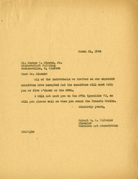
Letter to Robert N.S. Whitelaw from George W. Simons enclosing article entitled "Cities in Action" by S.B. Zisman (Survey Graphic, Oct. 1943) (Mar. 31, 1944).
Letter to Nathan Rosen from Robert N.S. Whitelaw regarding the reorganization of the Planning Board within the Civic Services Committee (March 9, 1945).
Letter to Robert N.S. Whitelaw from Frederick H. McDonald (Sept. 21, 1942), advising RNSW about procedures for city planning that the CSC should consider.
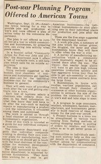
Letter to Robert N.S. Whitelaw from Congressman Ranulf Compton (Jan. 20, 1943) regarding bill H.R. 7782 [use of funds for state and local post-war planning introduced by Congressman Beiter].
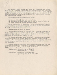
Resolution given to and adopted by Charleston City Council, March 27, 1945, regarding off-street parking studies by the Civic Services Committee and city planning; includes list of CSC Board members present at the hearing, list of the members of the CSC, and list of the Metropolitan Council.
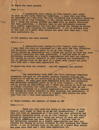
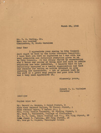
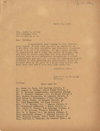
Document with sample letters to Board members, Civic Services Committee members, people who are members of neither organization, each regarding the outcome of the City Council meeting at which off-street parking plan was presented and the resolution passed
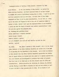
Report of an off-the-record meeting between Mr. Mouzon, Mayor Wehman, Mr. Todd, Mr. Krawcheck, Mr. Julian Mitchell, and Robert N.S. Whitelaw regarding planning problems in Charleston.
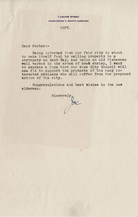
Letter dated Jan. 27, 1945, from Porter Williams of Carolina Savings Bank [City of Charleston Alderman] to Dr. Joseph I. Waring in support of the opposition to selling the South Adgers Wharf property to a shrimpery and keeping the neighborhood residential.
Letter dated Jan. 24, 1945, from Robert N.S. Whitelaw to George W. Simons regarding the CSC's urging of the City Council not to sell property piecemeal.
Transcript copy of letter from Joseph I. Waring to Porter Williams [City of Charleston Alderman] expressing opposition to the proposed selling of waterfront property at South Adgers Wharf and East Bay Street to a shrimpery.
Newspaper articles and letters to the editor regarding the proposed sale of public lands at Adgers Wharf and vicinity (Jan. 23-Feb. 14, 1945). Includes letters from Henry P. Staats, St. Julien R. Childs, Samuel G. Stoney, Ferdinanda L. Waring, and Alston Deas.
The 1896 Olmsted, Olmsted, and Eliot report commissioned by Charleston for the board of park commissioners. The report was created after the group's second visit to Charleston. This is the first report of many as the Parks Commissioners worked in tandem with the Olmstead group up through the twentieth century. The report outlines advice for the advancement of downtown Charleston's parks, general aesthetics, and public roadways. The projects outlined in the report are: Battery Park, Waterfront park, Ashely Ave, Chicora Parkway, and Chicora Park.
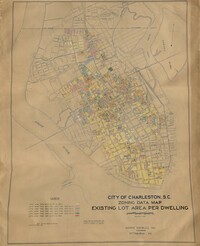
Hand-colored, linen map showing Charleston peninsula existing lot area per dwelling from Murray Boulevard to the northern limits of the city at Mount Pleasant Road. The maps shows lots less than 1,000 square feet; lots more than 1,000 square feet and less than 1,500 square feet; lots more than 1,500 square feet and less than 2,500 square feet; lots more than 2,500 square feet and less than 3,000 square feet; lots more than 3,000 square feet and less than 4,500 square feet; and lots greater than 4,500 square feet. Map measure 47" by 63".
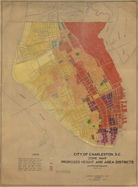
Hand-colored, linen map showing proposed height and area districts for the city of Charleston. Map shows eight height and area districts from Murray Boulevard to the northern limits of the city at Mount Pleasant Road. Map measures 42" by 60".
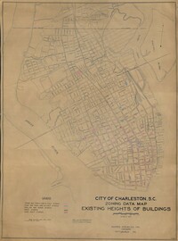
Hand-colored, linen map showing Charleston peninsula heights of buildings from Murray Boulevard to the northern limits of the city at Mount Pleasant Road. Height in stories is indicated by color coding. Map shows buildings of three stories or more. Map measures 42" by 60".
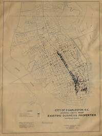
Hand-colored, linen map showing Charleston peninsula existing business properties, public garages, and gasoline service stations from Murray Boulevard to the northern limits of the city at Mount Pleasant Road. Map measures 46.75" by 63".
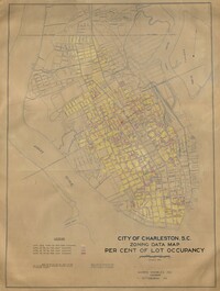
Hand-colored, linen map showing Charleston peninsula lot occupancy from Murray Boulevard to the northern limits of the city at Mount Pleasant Road. Map is color coded to show lot occupancy percentages on the peninsula. Map measures 46.5" x 63".
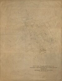
Linen map showing distribution of schools in Charleston from Murray Boulevard to the northern limits of the city at Mount Pleasant Road. Map shows school district lines, developed and undeveloped school properties and racial population disbursement indicated by white circles for white residents and black circles for black residents. Map is found on page 11 of the Report of the City Planning and Zoning Commission. Map measures 41.25" by 59".
Linen map showing existing and proposed parks; thoroughfares; schools; residential, business, and industrial districts; and suggested streets from Murray Boulevard to the northern limits of the city at Mount Pleasant Road. Residential districts are identified by racial makeup and labeled as white residence and colored residence districts. Map is found on page 11 of the Report of the City Planning and Zoning Commission. Map measure 41" by 59".
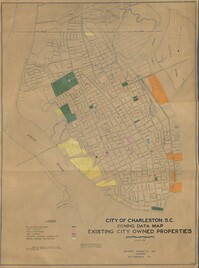
Hand-colored, linen map showing existing city properties including parks, playgrounds, port utilities, public buildings, fire stations, municipal service properties, and miscellaneous properties from Murray Boulevard to the northern limits of the city at Mount Pleasant Road. Map measures 42" by 60".
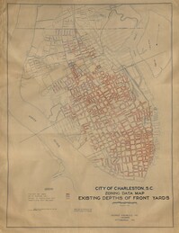
Hand-colored, linen map showing Charleston peninsula existing depths of front yards (5 feet and under, 6 to 14 feet, 15 to 24 feet, 25 feet and over). Map reflects Murray Boulevard to the northern limits of the city at Mount Pleasant Road. Map measures 47" by 63".
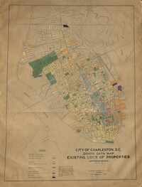
Hand-colored, linen map showing Charleston peninsula existing lot uses from Murray Boulevard to the northern limits of the city at Mount Pleasant Road. Map shows one, two, and multiple dwelling units, service stations, garages, industrial sites, and railroads. Information on map was compiled during field observations made from October through December 1930. Map measures 46.25" by 63."