Search Home
Search in
search for
Simple Search
Page Content Search
Title Search
Creator Search
Subject Search
Search
search icon
Search
Search Constraints
Start Over
You searched for:
Subject (Geographic)
South Carolina--Maps--Early works to 1800
✖
Remove constraint Subject (Geographic): South Carolina--Maps--Early works to 1800
1
-
2
of
2
Sort
by Relevance
Relevance
Title
Date (Newest)
Date (Oldest)
Number of results to display per page
10
per page
10
per page
20
per page
50
per page
100
per page
View results as:
list icon
List
masonry icon
Masonry
Search Results
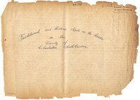
William Henry Johnson Scrapbook, vol. 1
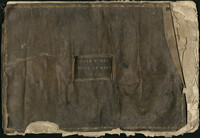
Jonah Horry Book of Maps, 1793
Limit your search
Collection
Colleton County Memorial Library Map Collection
1
William Henry Johnson Scrapbook
1
Contributing Institution
Colleton County Memorial Library
1
South Carolina Historical Society
1
Media Type
Manuscripts
1
Maps
1
Subject (Topic)
Alligators--South Carolina
1
Churches--South Carolina
1
Eutaw Springs, Battle of, S.C., 1781
1
Forts & fortifications
1
Gravestones
1
Gullah dialect
1
Indian warfare
1
Plantations--South Carolina
1
Real property--South Carolina--Colleton County--Maps
1
Sermons, American--19th century
1
more
Subject (Topic)
»
Subject (Geographic)
South Carolina--Maps--Early works to 1800
✖
[remove]
2
1775-1783
1
1861-1865--South Carolina'Charleston
1
American Revolutionary War
1
Berkeley County (S.C.)--Social life and customs--20th century--Anecdotes
1
Charleston (S.C.)
1
Cooper River Region (S.C.)--History--Miscellanea
1
Low Country
1
Santee River Valley (S.C.)--Description and travel'Anecdotes
1
South Carolina--History--1775-1865
1
more
Subject (Geographic)
»
Date
1793
1
1920
1
Date Range (beta)
View distribution
Current results range from
1793
to
1920
Date Range (beta) range begin
Date Range (beta) range end
View larger »