Copy of a plat of 250 acres laid out to Abraham Michau on the north side of Santee River and “now belonging to John Pedro." Names associated with this plat are Abraham Michau, John Pedro, George Hunter and James Glen. Notable geographic locations include the Santee River, Prince Frederick Parish and Georgetown District.
Plat of two tracts of land (1000 acres) adjoining each other on the north side of the Santee River now belonging to the estate of Brown. Copy from the plat annexed to the orginal grants from the Lords Proprietors. Names associated with this plat are Peter Gaillard, Brown, Henry Bruneau and The Lords Proprietors. Notable geographic locations include the Santee River and Dohov Swamp and Creek.
Three separate 211 acre plots (633 total) of land that are budding and bounding on the south side by the Santee River, shows some trees at the property border and surrounding neighbors. Names associated with this plat are Major Ladson and William Moultrie. Notable geographic locations include the Santee River.
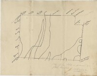
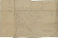
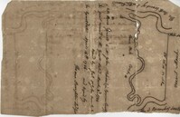
Sketch of land with no measurements or names, shows some trees and unnamed road/creeks. Names associated with this plat are John Michael and J.H. Alston. Notable geographic locations include Santee River and St. James Parish.
The Mouzon Plat Book surveys lands held by various individuals and families in Craven County [now in parts of Berkeley, Charleston, Georgetown, and Williamsburg counties], Colleton County and Berkeley County in South Carolina. Plats are drawn in pencil and ink. Book includes an index at the beginning and at the end are two pages of accounts and also lands to be resurveyed for the estate of Henry Mouzon Jr.
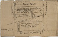
Elias Horry's 454 acre plot in the St. James parish near the Santee River, shows property boundaries, no details on the property or type of land. Names associated with this plat include Elias Horry, Daniel Horry and A. Bonneau.
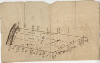
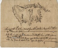
Plat of 222 acres granted to and acquired by Elias Horry on the Santee River. Names associated with this plat are Elias Horry and Izard. Names associated with this plat are Elias Horry and Izard. Notable geographic locations are Santee River, Toby Creek, Wild Hook Creek.
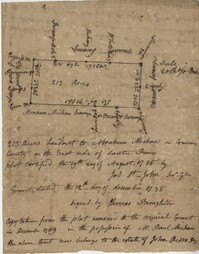
Copy of plat granted to John Atchison. "The plat annexed to the grant dated March 2, 1736." Names associated with this plat are John Atchison, James St. John, Thomas Broughton, J. Branch and Middleton. Notable geographic locations include Santee, Four Mile Creek, Santee River, and Cravens County [now in parts of Berkeley, Charleston, Georgetown, and Williamsburg counties].
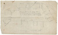
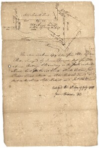
250 acre plot given to Peter Lesesne on the 20th of February 1760, butting and bounding on the south side of the Santee River. Names associated with this plat are Peter Lesesne, James Thomson, Peter Robert, Joseph Manap [?], and Phippes.