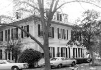
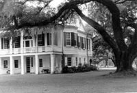
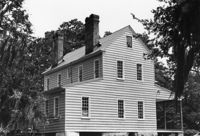
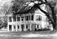
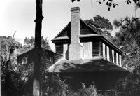
The Grove Plantation (Ernest F. Hollings ACE Basin National Wildlife Refuge). View of East (Side) elevation. Adams Run, S.C.;6.5" x 10" B/W photo. Box 15, Folder 2-11-1. One copy.
The Grove Plantation (Ernest F. Hollings ACE Basin National Wildlife Refuge). View of West (Side) elevation. Adams Run, S.C.;6.5" x 10" B/W photo. Box 15, Folder 2-11-1. One copy.
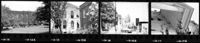
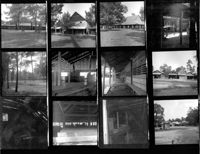
Cathedral of St. Luke and St. Paul, 126 Coming Street. Contact Sheet 8 - Views of Educational Building and Church. Charleston, S.C.;1" x 6" B/W photo. Box 20, Folder: Miscellaneous Photos: Scanned Contact Sheets. One copy.
Fireproof Building (South Carolina Historical Society), 100 Meeting Street. View of SW (Side and Front) elevation. Charleston, S.C.;3.5" x 5" B/W photo. Box 5, Folder 2-1-1. One copy.
Fireproof Building (South Carolina Historical Society), 100 Meeting Street. View of SW (Front and Side) elevation. Charleston, S.C.;3.5" x 5" B/W photo. Box 5, Folder 2-1-1. One copy.
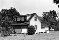
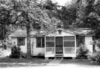
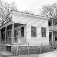
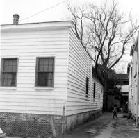
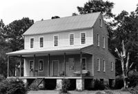
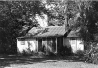
Unidentified House (ca. 20th century) - Non-contributory to Historic District. View of Side and Front elevation. McClellanville Historic District. McClellanville, S.C.;6.5" x 10" B/W photo. Box 14, Folder 2-10-5. Three copies.
Unidentified House (ca. 20th century) - Non-contributory to Historic District. View of Front and Side elevation. McClellanville Historic District. McClellanville, S.C.;6.5" x 10" B/W photo. Box 14, Folder 2-10-5. One copy.
Unidentified House (ca. 20th century) - Non-contributory to Historic District. View of Front elevation. McClellanville Historic District. McClellanville, S.C.;6.5" x 10" B/W photo. Box 14, Folder 2-10-5. One copy.
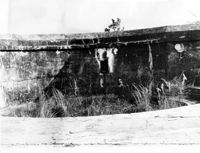
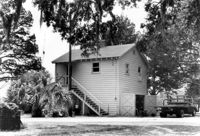
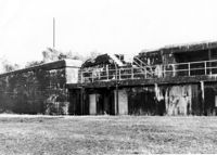
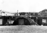
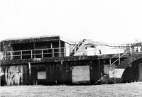
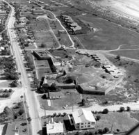
Battery Thomson, 2013 I'on Avenue. View of Armaments Section, North (Front) elevation. Sullivans Island, S.C.;6.5" x 10" B/W photo. Box 16, Folder 2-13-7. One copy.
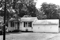
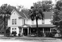
Eugenia I. Graham House (ca. 1904), Oak Street. View of Front elevation. McClellanville Historic District. McClellanville, S.C.;6.5" x 10" B/W photo. Box 14, Folder 2-10-5. One copy.
Battery Thomson, 2013 I'on Avenue. View of Gun Platform, North (Front) elevation. Sullivans Island, S.C.;6.5" x 10" B/W photo. Box 16, Folder 2-13-7. One copy.
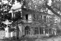
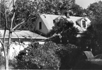
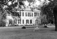
Lowndes Grove Plantation, 260 St. Margaret Street. Main House - View of NW (Front and Side) elevation. Charleston, S.C.;6.5" x 10" B/W photo. Box 8, Folder 2-1-148. One copy.
Lowndes Grove Plantation, 260 St. Margaret Street. Main House - View of NE (Front and Side) elevation. Charleston, S.C.;6.5" x 10" B/W photo. Box 8, Folder 2-1-148. One copy.
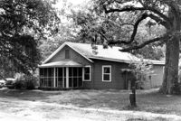
Lowndes Grove Plantation, 260 St. Margaret Street. Kitchen House - View of North (Front) elevation. Charleston, S.C.;10" x 6.5" B/W photo. Box 8, Folder 2-1-148. One copy.
John T. Hills House (ca. 1919). View of Front elevation. McClellanville Historic District. McClellanville, S.C.;6.5" x 10" B/W photo. Box 14, Folder 2-10-5. One copy.
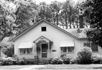
Baker House (ca. 1913). View of Front elevation. McClellanville Historic District. McClellanville, S.C.;6.5" x 10" B/W photo. Box 14, Folder 2-10-5. One copy.
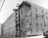
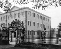
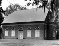
Old Citadel (South Carolina State Arsenal, Embassy Suites Hotel), 337 Meeting Street. View of NW (Side and Rear) elevation. Charleston, S.C.;8" x 10" B/W photo. Box 5, Folder 2-1-5. One copy.
Lowndes Grove Plantation, 260 St. Margaret Street. Main House - View of SW (Side and Rear) elevation. Charleston, S.C.;6.5" x 10" B/W photo. Box 8, Folder 2-1-148. One copy.
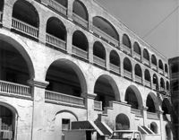
Old Citadel (South Carolina State Arsenal, Embassy Suites Hotel), 337 Meeting Street. View of Interior Courtyard. Charleston, S.C.;8" x 10" B/W photo. Box 5, Folder 2-1-5. One copy.
Lowndes Grove Plantation, 260 St. Margaret Street. Main House - View of North (Front) elevation. Charleston, S.C.;6.5" x 10" B/W photo. Box 8, Folder 2-1-148. One copy.
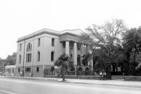
Charleston County Courthouse, 77 Meeting Street. View from Washington Square Park - NE (Front and Side) elevation. Charleston, S.C.;8" x 10" B/W photo. Box 5, Folder 2-1-8. One copy.
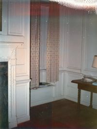
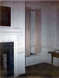
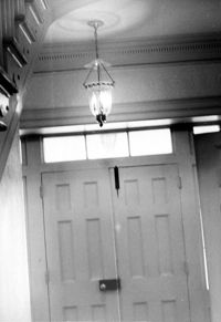
The Grove Plantation (Ernest F. Hollings ACE Basin National Wildlife Refuge). Interior View - 1st Floor. Detail of Front Door. Adams Run, S.C.;10" x 6.5" B/W photo. Box 15, Folder 2-11-1. One copy.
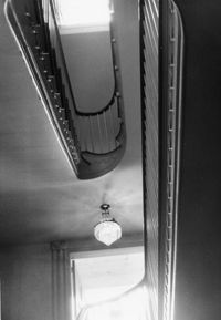
The Grove Plantation (Ernest F. Hollings ACE Basin National Wildlife Refuge). Interior View - 1st Floor. Detail of Stairwell. Adams Run, S.C.;10" x 6.5" B/W photo. Box 15, Folder 2-11-1. One copy.
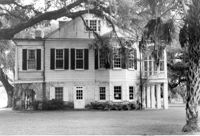
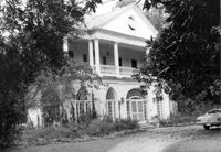
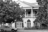
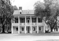
The Grove Plantation (Ernest F. Hollings ACE Basin National Wildlife Refuge). View of SE (Front and Side) elevation. Adams Run, S.C.;6.5" x 10" B/W photo. Box 15, Folder 2-11-1. Three copies.
The Grove Plantation (Ernest F. Hollings ACE Basin National Wildlife Refuge). View of SE (Front and Side) elevation. Adams Run, S.C.;6.5" x 10" (and 8" x 10") B/W photo. Box 15, Folder 2-11-1. Two copies.
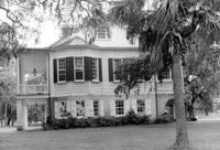
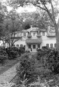
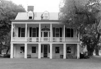
The Grove Plantation (Ernest F. Hollings ACE Basin National Wildlife Refuge). View of South (Front) elevation. Adams Run, S.C.;6.5" x 10" B/W photo. Box 15, Folder 2-11-1. Three copies.
The Grove Plantation (Ernest F. Hollings ACE Basin National Wildlife Refuge). View of South (Front) elevation. Adams Run, S.C.;6.5" x 10" B/W photo. Box 15, Folder 2-11-1. One copy.
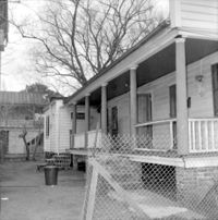
William Cain House, ca. 1834 - Pivotal to Historic District. View of Side and Front elevations. Pinopolis Historic District North. Pinopolis, S.C.;5" x 7" B/W photo. Box 3, Folder 1-10-1 (II). One copy.
Unidentified House, ca. Early 20th century - Contributory to Historic District. Front elevation. Pinopolis, S.C.;5" x 7" B/W photo. Box 3, Folder 1-10-1 (II). One copy.
Unidentified House, ca. 1910 - Contributory to Historic District. Front elevation. Pinopolis Historic District South. Pinopolis, S.C.;5" x 7" B/W photo. Box 3, Folder 1-10-1 (II). One copy.
Lowndes Grove Plantation, 260 St. Margaret Street. Main House - View of East (Side) elevation. Charleston, S.C.;6.5" x 10" B/W photo. Box 8, Folder 2-1-148. One copy.
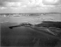
Lowndes Grove Plantation, 260 St. Margaret Street. View of Ashley River, West elevation. Charleston, S.C.;6.5" x 10" B/W photo. Box 8, Folder 2-1-148. One copy.