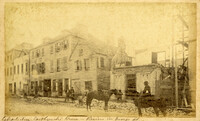
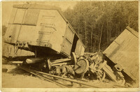
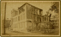
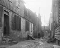
Caption: 'Cook's Earthquake Views of Charleston and Vicinity. Taken after the 31st of August, 1886. No.116, wreck in George Street.' Written on front, at bottom: 'Charleston Earthquake view - Ruins in George St.'
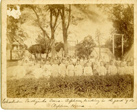
Caption: 'Charleston Earthquake. Photographs by Dr. E.P. Howland, taken on his visit to Charleston and the earthquake region of Ten Mile Hill and Summerville. Over 150 photographs were taken. Orphans and tents in which they lived.' Written on front, at bottom: 'Charleston Earthquake scene - orphans, standing the yard of the Orphan House.'
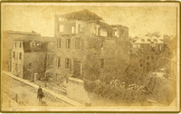
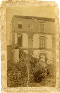
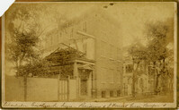
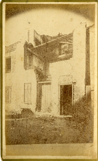
Written on reverse: 'House in which young Mr. Robson was killed. Two young ladies were buried in the ruins were rescued. Coming near Cannon.' Possibly from Cook's Earthquake Views, No.132, residence of J.N. Robson, from west. Written on front, at bottom: 'Charleston Earthquake view. Residence of Mr. J.N. Robson, whose eldest son was killed.' Charleston city directory for 1886 shows James N. Robson at 200 Coming Street.
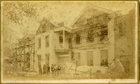
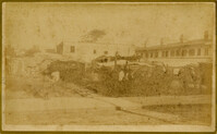
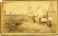
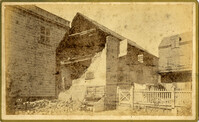
Caption: 'Cook's Earthquake Views of Charleston and Vicinity. Taken after the 31st of August, 1886. No.149, Robb's Lot.' Handwritten on reverse: ' Robb's Lot E. side [of] King bet[ween] Market & Horlbeck.'
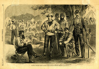
Caption: 'Colonel William Wilson and his staff (Wilson's Fighting Brigade)--[see page 311].' Identified in image: Quartermaster Bradley, Lieutenant Colonel Creighton, Adjutant James J. Hearey, Paymaster Peter Duffy, Col. William Wilson, Surgeon D.C. Pease and Major William Newby. [full date May 18, 1861.]
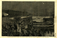
Caption: 'Reinforcement of Fort Pickens by Company A, First Artillery, on Saturday morning, April 13--Sketched by an Engineer Officer of the "Brooklyn."--[See Next Page].' [full date May 18,1861.]
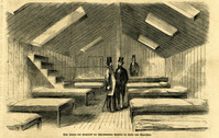
Caption (in German): 'Das Innere des Hospitals der schwimmenden Batterie im hafen von Charleston.' {Interior of the hospital of the Floating Battery in Charleston Harbor}
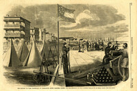
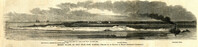
Caption: 'The Battery or Park Promenade at Charleston, South Carolina, during the bombardment of Fort Sumter--Sketched by our Special Artist--[see next page].' [full date May 18, 1861.]
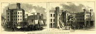
Caption: 'Military Prisons at Charleston, South Carolina.--Sketched by Lieutenant F. Milward--[See Page 110]' The Jail and Work-House are both identified.
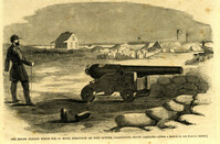
Caption: 'Caption: 'The rifled cannon which did so much execution on Fort Sumter, Charleston, South Carolina'--[From a Sketch by our Special Artist.]' [full date May 18,1861.]
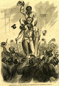
Caption: 'A detachment of the First South Carolina (Colored) Federal Volunteers, Colonel Beard, repelling an attack of the Confederate troops in the vicinity of Doboy River, Ga. From a sketch by Colonel Brewerton.'
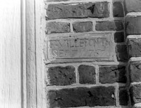
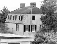
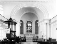
Berkeley County, St. Stephen's Church, ca. 1767. Detail View of plaque bearing architect/builder's name (F. Villepontoux), South (Side) elevation (located to right of door jamb). 4" x 5" B/W photo.
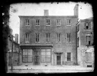
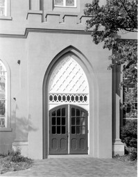
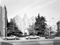
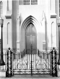
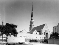
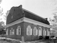
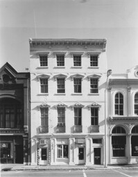
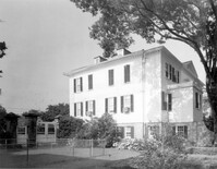
405 King Street, St. Matthews Lutheran Church, ca. 1867. Sunday School Building and Office Building - View of East (Front) elevation. 4" x 5" B/W photo.
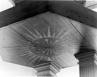
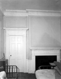
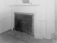
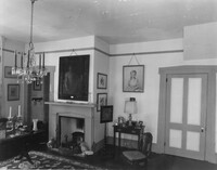
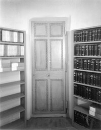
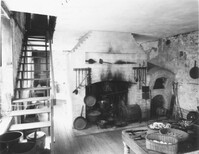
286 Calhoun Street, Jonathan Lucas House, ca. 1809. Main House - Interior View. 1st Floor - SE Room, Detail of door and mantle, North elevation. 4" x 5" B/W photo.
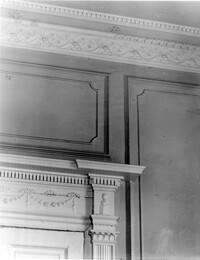
286 Calhoun Street, Jonathan Lucas House, ca. 1809. Main House - Interior View. 1st Floor - SE Room, Detail of cornice and door entablature. 4" x 5" B/W photo.
Black and white negative of the exterior of slave quarters located on the property of the Berners Barnwell Sams House, number 2; Postcard series #23; Negative has turned green, 1940; 17 x 12 cm.
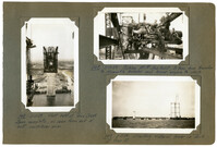
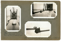
Image #147 (4.5" x 2.75"): "3-11-29. West half of Town Creek Span complete, as seen from end of east cantilever arm."; Image #148 (2.75" x 4.5"): "3-11-29. Picking 150 HP Gas. Hoist, 31 tons, from traveler to dismantle traveler and lower engine to deck."; Image #149 (2.75" x 4.5"): "3-11-29. Erecting material tower on dock at Pier 13.";Three 4.5" x 2.75" B/W photos numbered 147, 148, 149
Image #474 (4.5" x 2.75"): "6-21-29. Erecting the last bottom chord section L19' L21', north truss, east half of suspended span."; Image #475 (2.75" x 4.5"): "6-21-29. Connecting the closing bottom chord at L21'."; Image #476 (2.75" x 4.5"): "6-21-29. Closing B.C. joint L21'. Note 6" [diameter] pin and slotted hole with 7" movement for adjustment, temperature, etc.";Three 4.5" x 2.75" B/W photos numbered 474, 475, 476
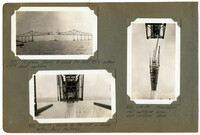
Image #471 (2.75" x 4.5"): "Progress. Ready to place the last 87 1/6" bottom chord section."; Image #472 (2.75" x 4.5"): "6-21-29. Ready for the last or closing bottom chord sections."; Image #473 (4.5" x 2.75"): "6-21-29. From below. West cantilever, below. East cantilever, above.";Three 4.5" x 2.75" B/W photos numbered 471, 472, 473
72 - 74 Tradd Street, Fotheringham-McNeil Tenements, ca. 1765. Detail View of jerkin head on gambrel roof, NW (Rear and Side) elevation. 4" x 5" B/W photo.
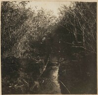
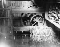
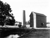
Georgetown County, Mansfield Plantation, ca. 1780. Rice Threshing Mill - Interior View. Pulleys for belt connection from boiler to thresher. 4" x 5" B/W photo.
Caption: 'Morris Island, as seen from Fort Sumter.--[drawn by an Officer of Major Anderson's Command.]' Also identified with captions: 'Battery from which the "Star of the West" was fired upon. Cumming's Point. Sand Battery, connected by covered gallery with...iron-clad battery.' [full date March 2, 1861.]
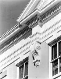
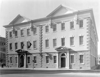
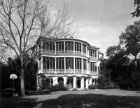
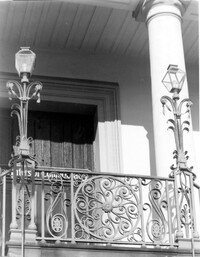
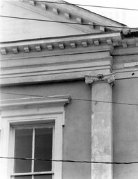
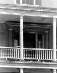
48 Elizabeth Street, Aiken-Rhett House, ca.1818. Main House - Detail View of portico and door to 2nd Floor Hall, South (Front) elevation. 4" x 5" B/W photo.
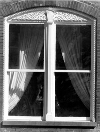
48 Elizabeth Street, Aiken-Rhett House, ca.1818. Main House - Detail View of 1st Floor triple window exterior shutter and architrave. 4" x 5" B/W photo.
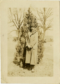
An unidentified woman wearing a long coat stands in front of tree. There is a vehicle in the background. Inscription reads “March 4, 1926. To Miriam and Uncle Herbert.”