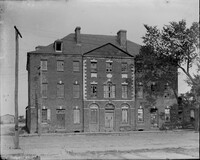
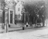
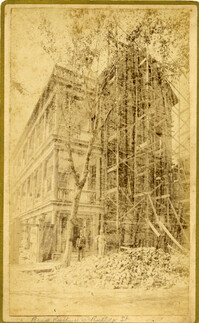
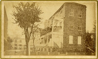
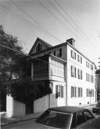
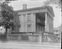
Caption: 'Cook's Earthquake Views of Charleston and Vicinity. Taken after the 31st of August, 1886. No.133, 5 and 7 Broad Street.' Written on front, at bottom: 'Walker, Evans & Cogswell, Broad St.' Charleston City Directory for 1886 shows Walker, Evans & Cogswell at 3-5 Broad Street. Etiwan[Phosphate] Company is at 7 Broad.
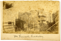
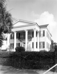
Charleston Earthquake scene. Possibly from Cook's Earthquake Views, no.63. William Ravenel, East Battery, rear. Written on front, at bottom: 'Wm Ravenel's, East Battery.'
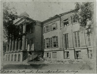
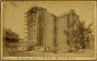
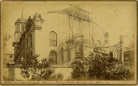
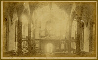
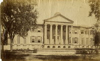
Caption: 'Cook's Earthquake Views of Charleston and Vicinity. Taken after the 31st of August, 1886. No.129, College as torn down.' Handwritten at bottom, front: 'Charleston Earthquake views - Charleston College. Both wings gone.'
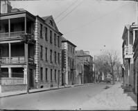
Caption: 'Cook's Earthquake Views of Charleston and Vicinity. Series No.2. No.181, Beresford Street.' This may be Beresford Alley which is also known as Clifford Street.
Caption: 'Cook's Earthquake Views of Charleston and Vicinity. Taken after the 31st of August, 1886.' Possibly No.178, but corresponding captioning is missing. Handwritten on reverse: 'Formerly St. Luke's Episcopal now [New Tabernacle] Fourth Baptist Church, 22 Elizabeth Street.' Handwritten at bottom, front: 'Charleston Earthquake scene - St. Luke's Episcopal Church.'
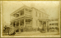
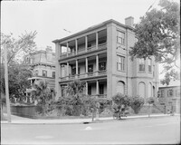
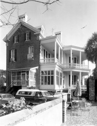
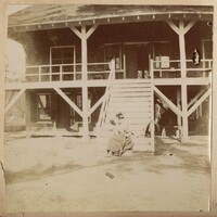
Caption: 'Cook's Earthquake Views of Charleston and Vicinity. Taken after the 31st of August, 1886. No.65, _____ Holmes, East Battery.' Written on front, at bottom: 'Charleston Earthquake scene - Holmes residence, East Battery.' Charleston city directory for 1886 shows Charles R. Holmes, Jr., at 19 East Battery.
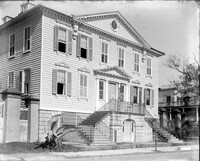
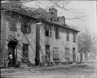
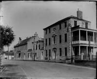
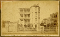
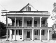
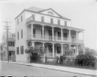
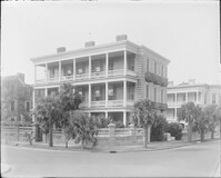
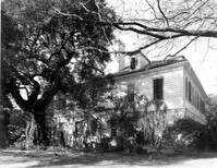
Caption: 'Cook's Earthquake Views of Charleston and Vicinity. Series No.2. No.170, Buist residence, Rutledge Street.' Written on front, at bottom: Buist Residence, 43 Rutledge St.' Charleston city directory for 1886 shows listing for Samuel S. Buist at 43 Rutledge Avenue.
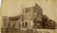
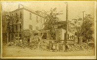
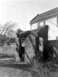
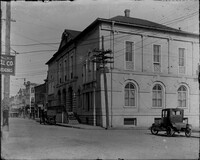
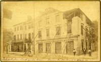
Caption: 'Cook's Earthquake Views of Charleston and Vicinity. Taken after the 31st of August, 1886. No.135, Corner State and Chalmers Streets.' Written on front, at bottom: 'Charleston Earthquake views - ruins cor[ner] Chalmers & State Str.'
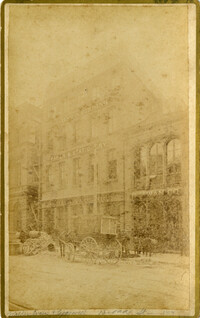
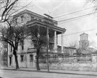
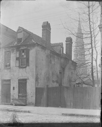
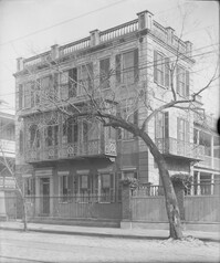
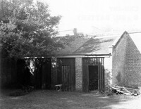
Caption: 'Cook's Earthquake Views of Charleston and Vicinity. Series No.2. No.187, residence of Mr. A. Lengnick.' Charleston city directory for 1886 shows Albert Lengnick at 11 Pitt Street.
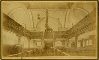
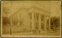
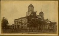
Caption: 'Cook's Earthquake Views of Charleston and Vicinity. Taken after the 31st of August, 1886. No.99, Rear of Scotch Church.' Handwritten at bottom, front: 'Charleston Earthquake scene - Rear of First Presbyterian Church.'
Caption: 'Cook's Earthquake Views of Charleston and Vicinity. Taken after the 31st of August, 1886. No.99, Rear of Scotch Church.' First (Scots) Presbyterian Church on Meeting Street.
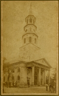
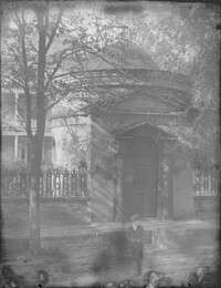
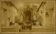
Caption: 'Cook's Earthquake Views of Charleston and Vicinity. Taken after the 31st of August, 1886. No.79, St. Mary's Church. [And handwritten] Hasell Street.'
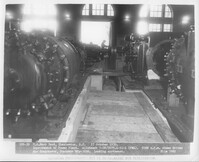
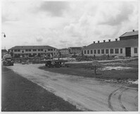
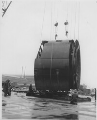
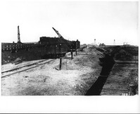
Under tab "Power Plant". Printing on bottom states, "586-39 US Navy Yard, Charleston, SC 17 October 1939. Improvement of Power Plant. Allotment 7-08/0679.1-91-1 (PWA). 5000 c.f.m. steam driven Air Compressor. Contract NOy-3216. Looking northeast. File 7880."
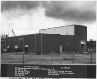
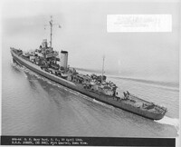
Printing on bottom states, "(1) Non-Classified (2) EST-629 (3) Charleston Naval Shipyard, Charleston, South Carolina (4) 25 May 1966 (5) Nuclear Service Building (6) Not Applicable (7) Exterior of Bldg & Compound (8) Looking East (9) NBy-608020 (10) NBy-EST."
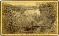
Caption: 'Cook's Earthquake Views of Charleston and Vicinity. Taken after the 31st of August, 1886. No.148, Landslide on the Ashley.' Handwritten at bottom, front: 'Charleston Earthquake view - Land slide near Summerville, S.C.'
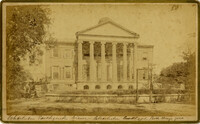
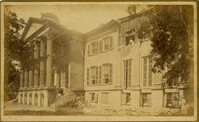
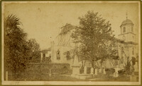
Charleston Earthquake scene. Possibly from Cook's Earthquake Views. Series No.2. No.169, College of Charleston, front [captioning missing, 'Cook No.169' handwritten on reverse].
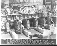
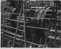
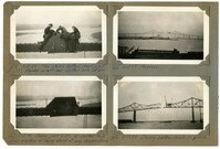
Image #159 (2.75" x 4.5"): "3-13-29. The closing bottom chord joint at L17! Member on left has slotted hole at pin."; Image #160 (2.75" x 4.5"): " Closing joint at L17! 4" slotted hole allows erection of closing chord at any temperature."; Image #161 (2.75" x 4.5"): "3-13-29 Progress."; Image #162 (2.75" x 4.5"): "3-3-29. Closing bottom chords in place.";Four 4.5" x 2.75" B/W photos numbered 159, 160, 161, 162
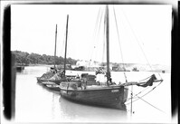
Black and white print of the Amphritrite, a floating hotel docked at the Sinclair dock in order to relieve the housing shortage in Beaufort during World War II, 1942; 16.5 x 11 cm.
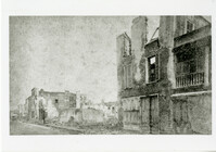
Caption: 'Quarters of the Union officers exposed to the Federal fire in Charleston.--sketched by one of the Officers.--[see page 550.]' [full date August 27, 1864.]
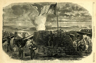
Caption: 'The Siege of Charleston--the morning call to the Rebels.--sketched from the naval battery by Mr. Theodore R. Davis.--[see page 603.]' [full date September 19, 1863.]
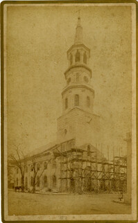
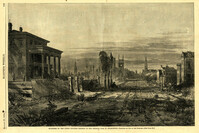
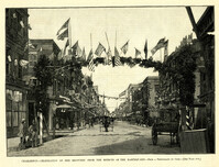
Caption: 'Charleston--Celebration of her recovery from the effects of the Earthquake.--from a photograph by Cook.--[see page 818.]' [full date November 12, 1887.]