Search
« Previous |
201 - 250 of 1,656
|
Next »
Search Results
Date:
1970-1979
Description:
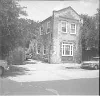
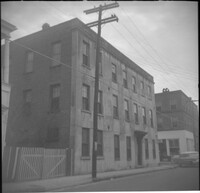
Black-and-white photograph of 131 Market Street (Boswick's Auto Service), corner view of building (northeast elevation). Now the site of the entrance to a parking lot. Billboard for Historic Savannah posted on side of building.
Date:
1970-1979
Description:
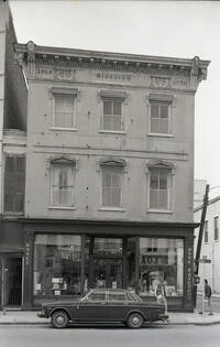
Black-and-white photograph of 243 (Siegling Music House), showing the corner of King Street and Beaufain Street. Signage on building for "Books" and "Book Basement."
Date:
1970-1979
Description:
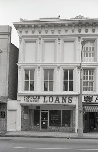
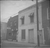
Black-and-white photograph of 246 King Street, street (front) elevation, Popular Finance Loans.
Date:
1970-1979
Description:
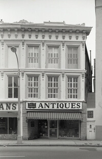
Black-and-white photograph of 244 King Street, street (front) elevation, Annette Sandburg Antiques.
Date:
1970-1979
Description:
Black-and-white photograph of 239½ King Street (WDI Design Center). Edge of 241 King Street at right.
Date:
1970-1979
Description:
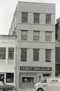
Black-and-white photograph of 241 King Street (Charles Town Gallery), street (front) elevation.
Date:
1970-1979
Description:
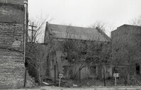
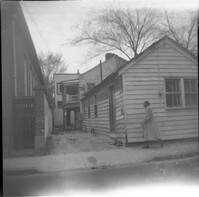
One of three black-and-white photographs of the structures at the rear of 238-242 King Street up to the rear of the buildings at about 199-203 Meeting Street, bordering what was the northern boundary of the Belk parking lot, and on the site where Charleston Center would be constructed.
Date:
1970-1979
Description:
One of three black-and-white photographs of the side elevations of (possibly) 87 Hasell Street and its neighbor to the east at the time, 85 Hasell Street (gone). (87 Hasell Street currently borders the Hasell Street entry to Charleston Place and its parking garage.)
Date:
1970-1979
Description:
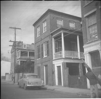
Black-and-white photograph of 231 King Street (Rachel Lazarus Building), street (front) elevation, with signage for J Street Tavern.
Date:
1970-1979
Description:
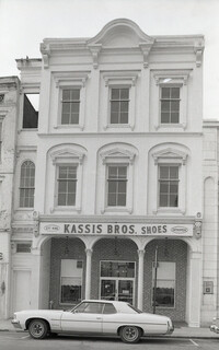
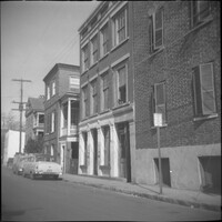
Black-and-white photograph of 237 King Street (Kassis Brothers Shoes), street (front) elevation of building.
Date:
1970-1979
Description:
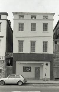
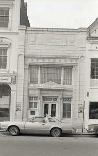
Black-and-white photograph of 239 King Street (First National Bank), street (front) elevation.
Date:
1970-1979
Description:
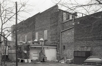
One of two black-and-white photographs of the brick work on the south wall of 238-242 King Street.
Date:
1970-1979
Description:
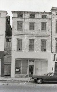
Black-and-white photograph of 233 King Street (Rachel Lazarus Building), street (front) elevation.
Date:
1970-1979
Description:
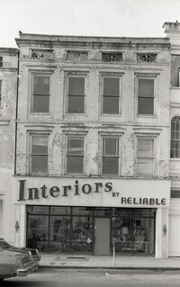
Black-and-white photograph of 235 King Street, street (front) elevation, Interiors by Reliable.
Date:
1970-1979
Description:
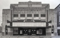
Black-and-white photograph of the Riviera Theater (227 King Street), street (front) elevation.
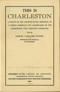
Date:
1944
Description:
Title page of This is Charleston. [Note: Only the title page has been scanned here. Book is available at HCF and other libraries.]
Date:
1960
Description:
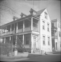
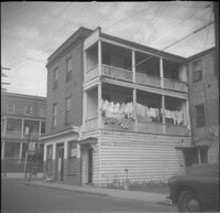
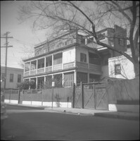
28 Wentworth Street, located at the northeast corner of Wentworth Street and Anson Street. Also features 26 Wentworth Street (right edge) and 53 Anson Street (William Thompson Tenement) (at left). Note, the Wentworth Street elevation of 53 Anson Street is 30 Anson Street.
Date:
1960
Description:
Right to left: 38 Society Street and 40 Society Street (Juliana Dupre House). Partial view of 42 Society Street at left edge.
Date:
1960
Description:
Left to right: 42 Society Street (Juliana Dupre House), 40 Society Street (Juliana Dupre House), and partial view of 38 Society Street.
Date:
1960
Description:
42 Society Street (Juliana Dupre House). Partial view of 40 Society Street at right.
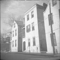
Date:
1960
Description:
55 Hasell Street (left) and partial view of 57 Hasell Street.
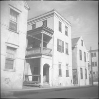
Date:
1960
Description:
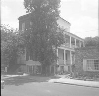
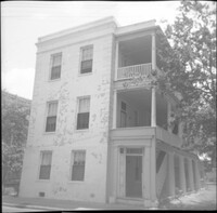
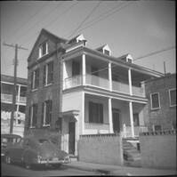
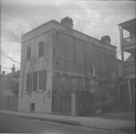
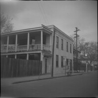
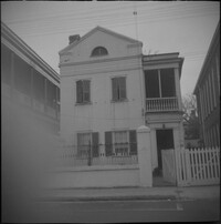
54 Hasell Street (Col. William Rhett House).
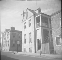
Date:
1960
Description:
57 Hasell Street.
Date:
1960
Description:
58 Hasell Street.
Date:
1960
Description:
53 Hasell Street.
Date:
1960
Description:
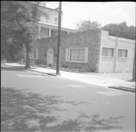
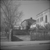
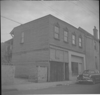
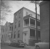
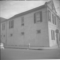
78 Anson Street (Royal Food Market), corner store located at the northeast corner of Anson and Laurens Streets, before its demolition.
Date:
1960
Description:
Right to left: 64 Anson Street (later demolished), 66 Anson Street (Chazal House), and 72 Anson Street (Kohne-Leslie House).
Date:
1960
Description:
Right to left: 64 Anson Street (later demolished) and 66 Anson Street (Chazal House).
Date:
1960
Description:
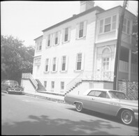
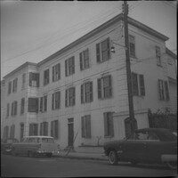
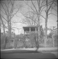
60 Anson Street (Robert M. Venning House), located at the southeast corner of Anson and Society Streets.
Date:
1960
Description:
58 Anson Street (Robert M. Venning House).
Date:
1960
Description:
58 Anson Street (Robert M. Venning House).
Date:
1960
Description:
57 Anson Street (Ann Hunt's House).
Date:
1960
Description:
57 Anson Street (Ann Hunt's House).
Date:
1960
Description:
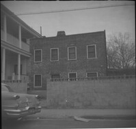
54 Anson Street.
Date:
1960
Description:
Left to right: 46 Wentworth Street and 44 Wentworth Street. Partial view of the Central Fire Station parking lot also in view at left.
Date:
1960
Description:
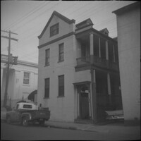
45 Wentworth Street, later demolished.
Date:
1960
Description:
45 Wentworth Street, later demolished.
Date:
1960
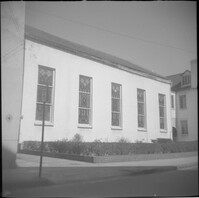
Description:
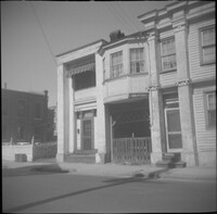
34-36 Wentworth Street (St. Peter's Roman Catholic Church and Rectory)
Date:
1960
Description:
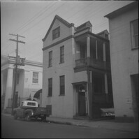
43 Society Street (Robert M. Venning House). 41 Society Street also in view at left.
Date:
1960
Description:
51 Society Street. Partial view of 49 Society Street at left.
Date:
1960
Description:
46 Society Street (Jonah M. Venning House).
Date:
1960
Description:
48 Society Street (Susan Robinson Tenements).
Date:
1960
Description:
44 Society Street.
Date:
1960
Description:
32 Anson Street, which had been located at the northeast corner of Anson and Hasell Streets, later demolished. 45 Hasell Street at right.
Date:
1960
Description:
32 Anson Street, which had been located at the northeast corner of Anson and Hasell Streets, later demolished.
Date:
1960
Description:
Right to left: 48-50 Anson Street and 52 Anson Street (Thomas Wallace and Martin Dowd Tenements).
Date:
1960
Description:
45 Anson Street, later demolished.
Date:
1960
Description:
35 Wentworth Street
Date:
1960
Description:
Wentworth Street elevation of 52 Anson Street, located at the southeast corner of Anson and Wentworth Streets.
Date:
1960
Description:
Right to left: 42 Anson Street and 44 Anson Street (Galloway's Grocery).