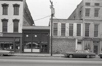
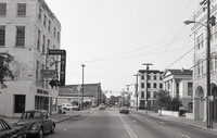
Black-and-white photograph of the view north on Meeting Street toward Market Street, from the parking lot of the White Horse Inn. The Golden Eagle Motor Inn next door is also in view.
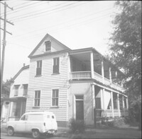
In this one-page typed document eight houses and gardens are added to the walking tour through the Ansonborough Neighborhood: 19 Wentworth Street, 57 Anson Street, 46 Society Street,43 Society Street, 63 Anson Street, 75 Anson Street, and 79 Anson Street. An approximate date of when the buildings on the property were built, as well as ownership information, is included.
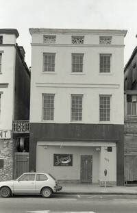
Black-and-white photograph of the Meeting Street elevation (west elevation) of what would become the Indigo Inn. Signage atop protective construction walkway says "[illegible] Development by Limehouse Properties: Indigo Inn, 47 Luxurious Units Opening Nov. 1 to Accommodate the Most Discriminating." Building is located at the southeast corner of Meeting Street and Pinckney Street, with the current address 1 Maiden Lane.
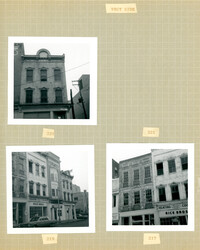
Three B&W photographs of buildings on the west side of King Street, demolished for the construction of Majestic Square: Top left: 223 King Street (Ocean Grill); Top right: 221 King Street (photograph is missing); Bottom left (219-223): 219 King Street (Rice Bros.), 221 King Street, and 223 King Street (Ocean Grill); Bottom right (217-219): 217 King Street and 219 King Street (Rice Bros.).
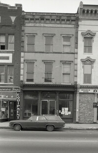
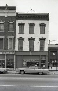
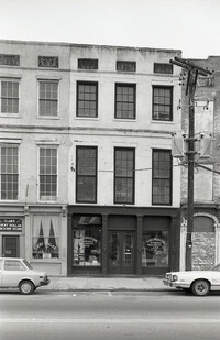
Black-and-white photograph of 219 Meeting Street (Mari Anne [restaurant]), 221 Meeting Street, street (front) elevation. Portions of adjacent buildings on either side, 217 Meeting Street (Wolper Shoe Co.) and 223 Meeting Street (Clair's Lucky Dollar Grocery Store) also in view.
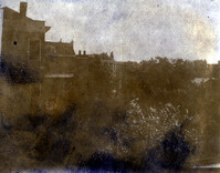
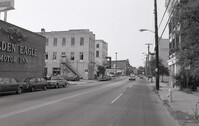
Black-and-white photograph of the view north on Meeting Street toward Market Street, from the Golden Eagle Motor Inn. Madren Paint Co. (177 Meeting) also in view.
Black-and-white photograph of 220 King Street (Nathan Hart Building), street (front) elevation, with signage for Blue Knight Gallery. Also shows view of street corner (Market Street and King Street).
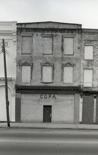
Two B&W photographs of buildings on the east side of King Street, both demolished for the construction of Charleston Place: Left (224-226): 224 King Street and 226 King Street (Ritz Hotel); Right: 222 King Street (Copa Lounge) (northeast corner of King and Market).
Four B&W photographs of buildings on the east side of King Street, including some that were demolished for the construction of Charleston Place: Top left (244-246): 244 Coastal Finance Loans and 246 King Street (The Linen Shop) demolished; Top right: 238-242 King Street (J.C. Penney Company) ? demolished; Bottom left (226-230): 226 King Street (Ritz [Hotel]), 228 King Street (Little Town), and 230 King Street demolished; Bottom right: 316 King Street (Rosalie Meyers) [labeled 318 on album page].
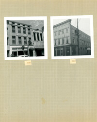
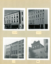
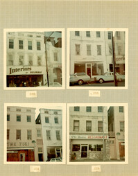
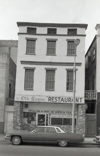
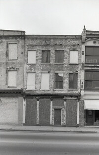
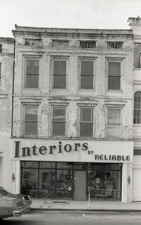
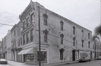
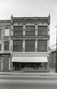
Four color photographs of buildings on the west side of King Street: Top left: 235 King Street (Interiors); Top right: 233 King Street; Bottom left: 231 King Street (The Tiki); Bottom right: 229 King Street (Old Towne Restaurant)
Black-and-white photograph of the view north from the intersection of Meeting Street and Market Street. Madren Paint Co. (177 Meeting) at left; First Citizens Bank (182 Meeting), Market Hall, and 112 North Market at right.
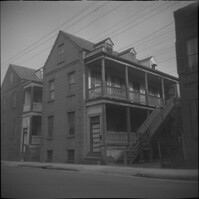
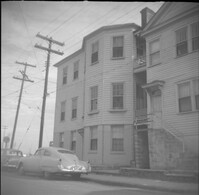
Left to right: 23 Society Street and 25 Society Street, later demolished. The houses were at the southwest corner of Society Street and East Bay Street.
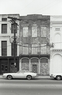
Black-and-white photograph 231 Meeting Street (Copa), 233 Meeting Street, and 235 Meeting Street, street (front) elevation. Shows the southwest corner of Meeting Street and Hasell Street, Kerrison's building in background.
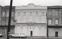
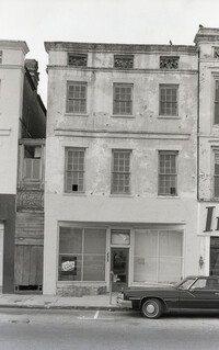
Black-and-white photograph of 232 Meeting Street (Western Union), located at the southeast corner of Meeting Street and Hasell Street. (Currently the site of FIG restaurant.)
Black-and-white photograph of the northwest elevation of 235 Meeting Street. Shows the corner of Meeting and Hasell Streets and the north elevation of the building that extends west on Hasell Street. "Picture Framing" signage over window. Also shows neighboring buildings to the south in the view down Meeting. (Currently the site of Sticky Fingers Restaurant.)
Black-and-white photograph of the view looking north on Meeting Street from the corner of Meeting and Hasell Streets. The Best Western King Charles Hotel (237 Meeting) is in foreground. Meeting Street buildings leading to Wentworth Street at right.
Black-and-white photograph of the view looking east on Hasell Street showing the Hasell Street elevation (south elevation) of the Best Western King Charles Hotel (237 Meeting Street).
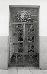
Decorative ironwork door, the side entry to 238-242 King Street. Ironwork features circular Washington Light Infantry emblem "Valor and Virtue - Washington - W.L.I. 1807," with six small iron panels with the years 1812, 1836, 1847, 1861, 1917, and [1941?].
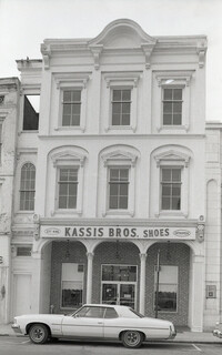
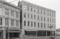
Black-and-white photograph of 238-242 King Street (previously the Hotel Calhoun) and 244 King Street (Annette Sandburg Antiques), street (front) elevation. Now the site of Charleston Place. Street sign for the intersection of Beaufain and King in foreground.
Black-and-white photograph of the view looking north across what was the location of Belk Department Store and parking lot (232 King Street), now the site of Charleston Place (formerly known as Charleston Center). Shows the southeast elevation of 238-242 King Street.
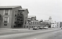
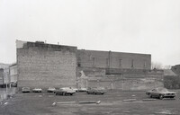
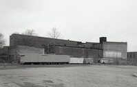
One of three black-and-white photographs of the structures at the rear of 238-242 King Street up to the rear of the buildings at about 199-203 Meeting Street, bordering what was the northern boundary of the Belk parking lot, and on the site where Charleston Center would be constructed.