Search
« Previous |
301 - 400 of 1,656
|
Next »
Search Results
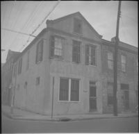
Date:
1960
Description:
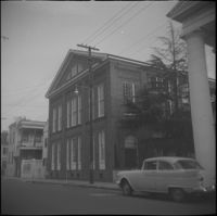
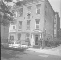
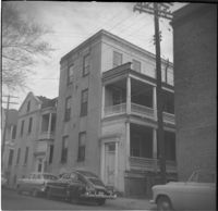
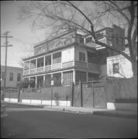
332 East Bay Street (Robert Primerose House).
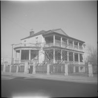
Date:
1960
Description:
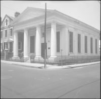
332-334 Meeting Street (L. Mendel Rivers Federal Building).
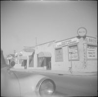
Date:
1960
Description:
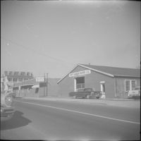
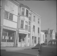
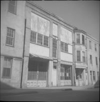
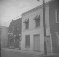
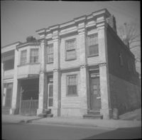
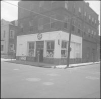
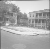
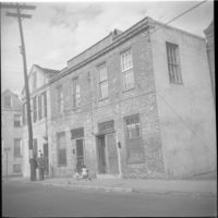
Businesses located at the northeast corner of East Bay Street and Vernon Street: Milbren's Laundry and Dry Cleaning (334 East Bay Street) and Fort Sumter Paper Co. (336 East Bay Street), since demolished.
Date:
1960
Description:
Fort Sumter Paper Co. (336 East Bay Street) and Sam Solomon Co. (338 East Bay Street), since demolished.
Date:
1960
Description:
34 Society Street. (30 Society Street also in view at right.)
Date:
1960
Description:
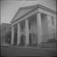
34-36 Wentworth Street (St. Peter's Roman Catholic Church and Rectory)
Date:
1960
Description:
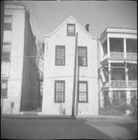
34 Charlotte Street.
Date:
1960
Description:
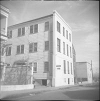
34 Anson Street (Mary Lanneau House), flanked by 36-40 Anson Street which was later demolished.
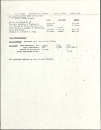
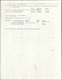
Description:
This one-page typed document provides financial and ownership history for 34 Anson Street.
Date:
1960
Description:
34-36 Wentworth Street (St. Peter's Roman Catholic Church and Rectory)
Date:
1960
Description:
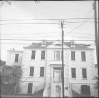
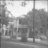
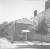
34 Hasell Street.
Date:
1960
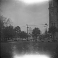
Description:
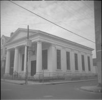
View of Second Presbyterian Church (342 Meeting Street) from Marion Square.
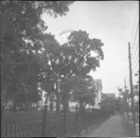
Date:
1960
Description:
Second Presbyterian Church (342 Meeting Street). View obstructed by trees.
Date:
1960
Description:
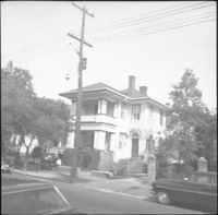
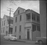
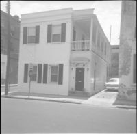
35 Hasell Street (John McNellage House).
Date:
1960
Description:
35 Wentworth Street
Date:
1960
Description:
35 Charlotte Street (Schachte House).
Date:
1960
Description:
35 Wentworth Street
Date:
1990 and 1999
Description:
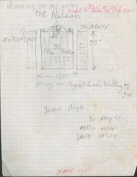
Original graphite sketching (8 1/2" x 11" drafting paper) of walkway gate (49" x 70")
Date:
1960
Description:
36 Society Street (Henry Street House).
Date:
1960
Description:
36-40 Anson Street, later demolished. 34 Anson Street at far right.
Date:
1960
Description:
36 Charlotte Street (Rebecca Cordes House).
Date:
1960
Description:
36 Hasell Street.
Date:
1960
Description:
37 Wentworth Street. View of 33 Wentworth at far left, partial view of 35 Wentworth at immediate left, and a column of St. Johannes Lutheran Church at right.
Date:
1960
Description:
37 Charlotte Street.
Date:
1960
Description:
37 Hasell Street (Jones-Howell House).
Date:
1960
Description:
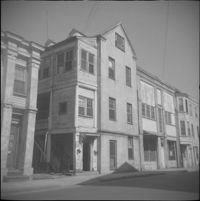
Right to left: 38 Society Street and 40 Society Street (Juliana Dupre House). Partial view of 42 Society Street at left edge.
Date:
1960
Description:
38 Society Street, flanked by partial views of 40 Society Street (Juliana Dupre House) (left) and 36 Society Street (Henry Street House) (right).
Date:
1960
Description:
38 Charlotte Street.
Date:
1960
Description:
Left to right: 40 Wentworth Street (McIntosh Auto Top Shop) and 38 Wentworth Street.
Date:
1960
Description:
38 Hasell Street.
Date:
1960
Description:
38 Hasell Street.
Date:
1960
Description:
39 Society Street. Partial view of 35 Society Street at left.
Date:
1960
Description:
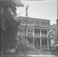
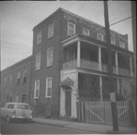
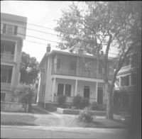
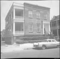
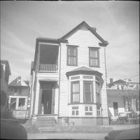
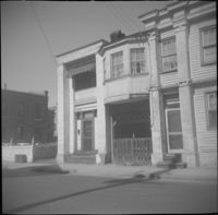
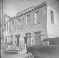
4 George Street (James W. Brown House).
Date:
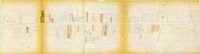
1967
Description:
One of four maps of King Street building footprints, hand-colored to designate status. This map illustrates area conditions of buildings on King Street from Calhoun Street to Columbus Street.
Date:
1960
Description:
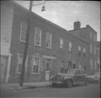
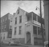
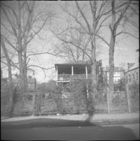
4 Wentworth Street.
Date:
1960
Description:
40 Charlotte Street (Jonah M. Venning House).
Date:
1960
Description:
Left to right: 42 Society Street (Juliana Dupre House), 40 Society Street (Juliana Dupre House), and partial view of 38 Society Street.
Date:
1960
Description:
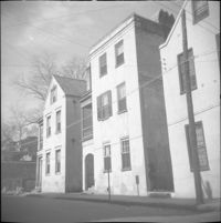
Left to right: 40 Hasell Street, partial view of 38 Hasell Street.
Date:
1960
Description:
40 Wentworth Street (McIntosh Auto Top Shop), flanked by partial view of 42 Wentworth Street (left) and by 38 Wentworth Street (right).
Date:
1960
Description:
41 Society Street. 39 Society Street also in view at left.
Date:
1960
Description:
41 Hasell Street.
Date:
1960
Description:
42 Society Street (Juliana Dupre House). Partial view of 40 Society Street at right.
Date:
1960
Description:
Right to left: 42 Anson Street and 44 Anson Street (Galloway's Grocery).
Date:
1960
Description:
42 Hasell Street (George Cannon House).
Description:
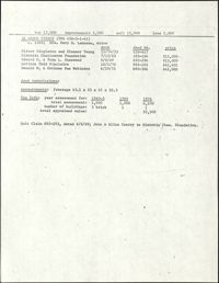
This one-page typed document provides financial and ownership history for 42 Society Street.
Date:
1960
Description:
42 Wentworth Street, flanked at right by 40 Wentworth Street and 38 Wentworth Street. Partial view of 44 Wentworth also in view at left edge.
Date:
1960
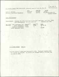
Description:
43 Laurens Street.
Date:
1960
Description:
43 Society Street (Robert M. Venning House). 41 Society Street also in view at left.
Date:
1960
Description:
43 Charlotte Street (William A. Hussey House).
Date:
1960
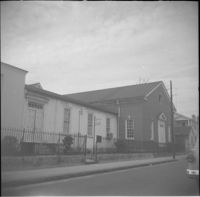
Description:
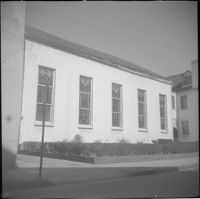
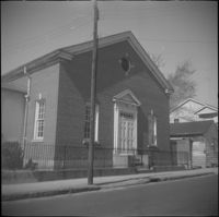
43 Wentworth Street (St. Andrew's Lutheran Church).
Date:
1960
Description:
43 Wentworth Street (St. Andrew's Lutheran Church).
Date:
1960
Description:
43 Anson Street.
Date:
1960
Description:
43 Hasell Street.
Description:
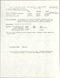
This one-page typed document, which contains information from two cards, provides financial and ownership history for 43 Laurens Street.
Date:
1960
Description:
43 Anson Street.
Date:
1960
Description:
44 Charlotte Street (William Henry Houston House).
Description:
This one-page typed document provides financial and ownership history for 44 Society Street.
Date:
1960
Description:
Left to right: 46 Wentworth Street and 44 Wentworth Street. Partial view of the Central Fire Station parking lot also in view at left.
Date:
1960
Description:
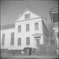
44 Society Street.
Date:
1960
Description:
44 Hasell Street (James Stocker House).
Date:
1960
Description:
Left to right: 46 Wentworth Street and 44 Wentworth Street.
Date:
1960
Description:
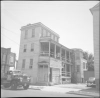
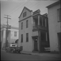
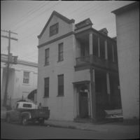
45 Wentworth Street, later demolished.
Date:
1960
Description:
45 Wentworth Street, later demolished.
Date:
1960
Description:
45 Anson Street, later demolished.
Date:
1960
Description:
45 Charlotte Street.
Description:
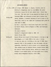
This one-page typed document, is a compilation of notes from an investigation into the ownership history of the property at 45 Hasell Street, tracing the property deed back to 1837.
Description:
This one-page typed document, which contains information from two cards, provides financial and ownership history for 45 Laurens Street.
Date:
1960
Description:
45 Laurens Street (Thomas Wallace House).
Date:
1960
Description:
45 Hasell Street (Charles W. Seignious Building),Lucky Dollar Market, located at the southeast corner of Hasell Street and Anson Street.
Date:
1960
Description:
46 Society Street (Jonah M. Venning House).
Date:
1960
Description:
46 Anson Street (Thomas Wallace House).
Date:
1960
Description:
46 Anson Street (Thomas Wallace House).
Date:
1960
Description:
Northeast corner of Hasell Street and Anson Street, the site where 46 Anson Street once stood. Now a parking lot
Date:
1960
Description:
47 Laurens Street.
Date:
1960
Description:
47 Hasell Street, located at the southwest corner of Hasell Street and Anson Street.
Description:
This one-page typed document discusses the historical background and describes the architecture of the building at 48 Hasell Street, St. Johannes Lutheran Church. The unknown writer references Beatrice Ravenel's book, The Architects of Charleston.
Description:
This one-page typed document provides financial and ownership history for 48 and 50 Anson Street.
Date:
1960
Description:
48 Hasell Street (St. Johannes Lutheran Church), located at the northwest corner of Hasell Street and Anson Street.
Date:
1960
Description:
Right to left: 48-50 Anson Street and 52 Anson Street (Thomas Wallace and Martin Dowd Tenements).
Date:
1960
Description:
48 Society Street (Susan Robinson Tenements).
Date:
1960
Description:
Right to left: 48-50 Anson Street and 52 Anson Street (Thomas Wallace and Martin Dowd Tenements).
Description:
48 Laurens Street (Simon Jude Chancognie House).
Description:
This one-page typed document provides financial and ownership history for 48 Laurens Street.
Date:
1960
Description:
48 Hasell Street (St. Johannes Lutheran Church), located at the northwest corner of Hasell Street and Anson Street.
Date:
1960
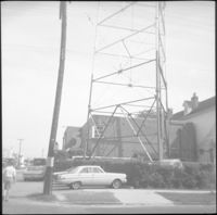
Description:
WCSC Channel 5 building (485 East Bay Street) and tower.
Date:
1960
Description:
49 Laurens Street (William Monies House).
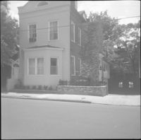
Date:
1960
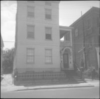
Description:
South side of Society street from the corner of Anson Street. Features 49 Society Street (center) and partial views of 60 Anson Street (left edge), 59 Anson Street (Society Street elevation) (adjacent and to the left of 49 Society), and partial view of 51 Society Street (right edge).
Date:
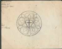
1990 and 1999
Description:
Original Simmons graphite sketch(8 1/2 x 11) of "Luther's seal" at Saint John's Lutheran Church
Date:
1960
Description:
5 Maiden Lane, located at the southwest corner of Maiden Lane and Hasell Street.
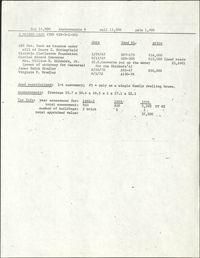
Description:
This one-page typed document provides financial and ownership history for 5 Alexander Street.
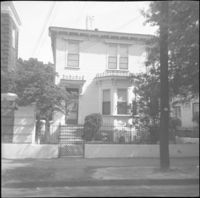
Date:
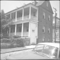
1960
Description:
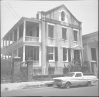
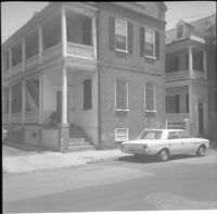
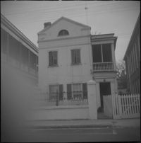
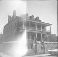
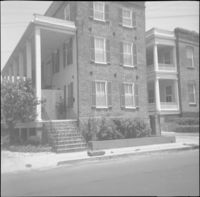
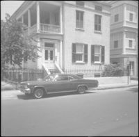
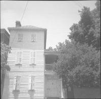
5 George Street (Robert Roulain House), now known as 9 George Street.
Description:
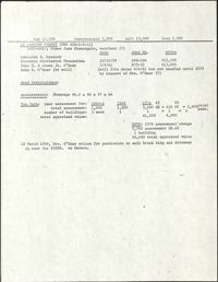
This one-page typed document provides financial and ownership history for 5 Maiden Lane.
Date:
1960
Description:
50 Laurens Street (Adams-Ingraham House)
Date:
1960
Description:
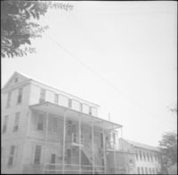
50 Hasell Street (St. Johannes Lutheran Church Rectory).
Date:
1960
Description:
51 Society Street. Partial view of 49 Society Street at left.
Date:
1960
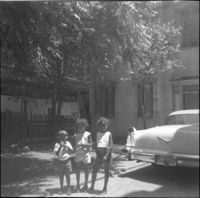
Description:
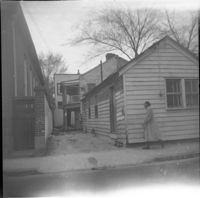
51 Laurens Street. Three children stand by a car in the driveway.
Date:
1960
Description:
51 Laurens Street.
Date:
1960
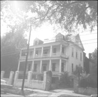
Description:
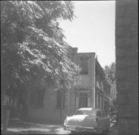
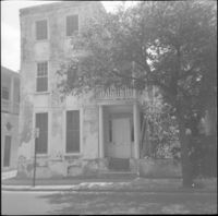
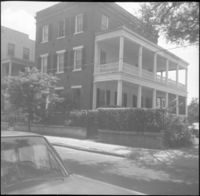
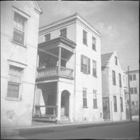
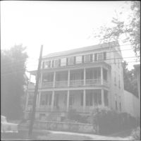
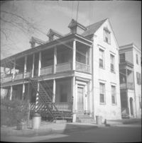
51 Hasell Street (Glover House/Mary Baker Eddy House).
Date:
1960
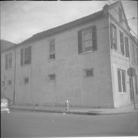
Description:
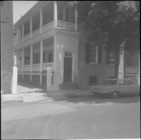
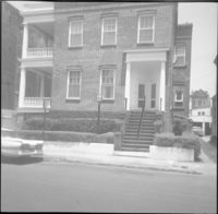
Wentworth Street elevation of 52 Anson Street, located at the southeast corner of Anson and Wentworth Streets.
Date:
1960
Description:
52 Anson Street, located at the southeast corner of Anson and Wentworth Streets.


![5 George Street [9 George Street]](https://iiif.library.cofc.edu/iiif/2/36331/full/200,/0/default.jpg)