Black-and-white photograph of 199 Meeting Street (Ace Liquors Inc, formerly known as The Horse Shoe bar) and the view west across what was the location of Belk Department Store (232 King Street) and parking lot, now the site of Charleston Place (f/k/a Charleston Center). Shows buildings on the west side of King Street: 231 King, 233 King, 235 King, and 237 King.
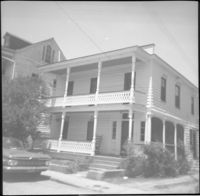
Black-and-white photograph of 190-194 Meeting Street, street (west) elevation. 190 Meeting Street [112 North Market] is located at the northeast corner of Meeting and Market Streets. 190 Meeting Street (Hornik Dry Goods & Ready-to-Wear / M. Hornik & Co.) and 194 Meeting Street formerly was the Regular Veterans Association Post 479 building. Front of Market Hall at left.
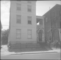
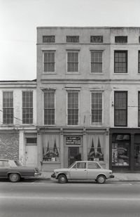
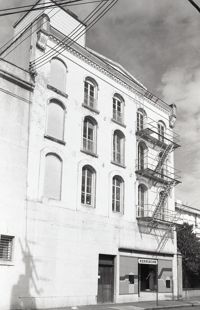
Black-and-white photograph of 207 Meeting Street, street (front) elevation before its demolition for the construction of Charleston Place (formerly known as Charleston Center). (At the time of this photograph, Its neighbor at 205 Meeting Street had already been demolished.)
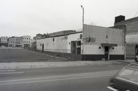
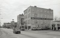
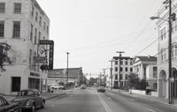
Black-and-white photograph of the west side of the 170 block of Meeting Street, looking south from the corner of Market Street. Shows Parson's Gulf Station (181-183 Meeting), Madren Paint Company (177 Meeting Street, 173 Meeting Street, and the Golden Eagle Motor Inn. (Currently the site of the Wells Fargo Banking Center.)
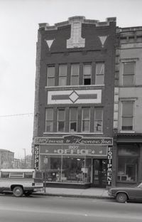
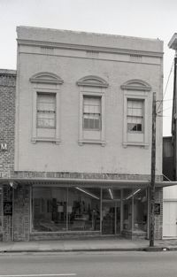
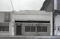
Black-and-white photograph of 248 King Street, street (front) elevation. Appears to be part of C.B. Prentiss Carpets Draperies Linoleum next door (250 King), formerly My Shop women's clothing store.
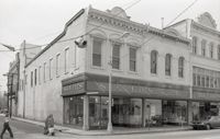
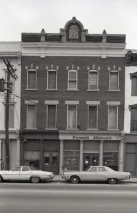
Black-and-white photograph of 245-247 King Street, street (front) elevation, showing the northwest corner of King Street and Beaufain Street, Silver's 5 & 10 & 1.00 Store.
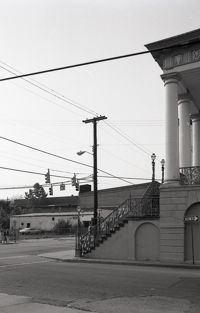
Black-and-white photograph of the view northwest from the corner of Market and Meeting Streets to the northwest corner of Meeting and Market. Columns and stairs to Market Hall in foreground.
Black-and-white photograph of the view north from the intersection of Meeting Street and Market Street. Madren Paint Co. (177 Meeting) at left; First Citizens Bank (182 Meeting), Market Hall, and 112 North Market at right.
One of three black-and-white photographs of the side elevations of (possibly) 87 Hasell Street and its neighbor to the east at the time, 85 Hasell Street (gone). (87 Hasell Street currently borders the Hasell Street entry to Charleston Place and its parking garage.)
One of three black-and-white photographs of the side elevations of (possibly) 87 Hasell Street and its neighbor to the east at the time, 85 Hasell Street (gone). (87 Hasell Street currently borders the Hasell Street entry to Charleston Place and its parking garage.)
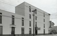
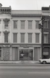
Black-and-white photograph of 92 Hasell Street [also known as 94 Hasell Street], the side entrance to Kerrison's Department Store, street (front) elevation. (The Kerrison's Building is an L-shaped building at 260 King).
Black-and-white photograph of 97 Hasell Street, the graveyard for St. Mary's Roman Catholic Church, showing the parking lot for C.B. Prentiss (250 King Street).
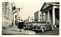
Scene on Meeting Street just south of the "Four Corners of Law" on Broad Street. Features the Federal Courthouse and Post Office and St. Michael's Church in foreground, and the County Courthouse and City Hall in background. Numerous cars are parked in front of the Federal Courthouse, with pedestrians on the sidewalk.
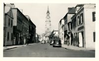
Looking north on Church Street from the northeast corner of Chalmers Street. Features buildings on the west side of the street: 129 Church, 131 Church, and the Dock Street Theater). Also in view are buildings on the east side of the street: 18 Chalmers Street, 132 Church Street, and St. Philip's Church). Cars are parked on the street.
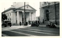
View of the intersection of Broad and Meeting Streets, featuring the Federal Courthouse and Post Office and St. Michael's Church. A car, motorcycle, and bus are on the street the street. Also shows pedestrian activity.
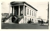
View of Market Hall, southwest elevation, including market sheds, and the corner of Market and Meeting Streets. Cars on street and pedestrian crossing the street. Cravens Delco Radio [store] on North Market Street at left.
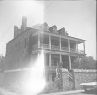
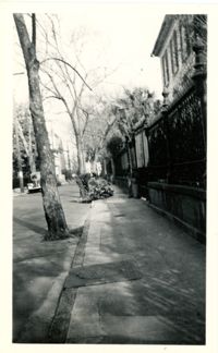
Looking north on Legare Street at 22 Legare Street (Charles Elliott House), a portion of which can be seen in the foreground (right). Man gathering leaves on the sidewalk. Car parked in background.
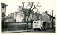
Looking west on Tradd Street at the outbuildings of 32 Legare Street (Sword Gate House). West End Dairy truck parked on street. Pedestrian on sidewalk and person riding a bike on street.
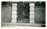
In this one-page typed memorandum from Samuel G. Stoney to Historic Charleston Foundation, the history of the property at 32 Society Street is traced back to 1846, when the home on the lot was built. The ownership history of the property is also discussed.
This one-page typed bulletin to the Ansonborough community announces a meeting of the Board of Adjustment to review the proposed multi-family building on the corner of Meeting and George Streets. Historic Charleston Foundation asks for support in opposing the proposed structure.
In this one-page typed letter from B. L. Tucker to Mrs. Henry S. Edmunds, Tucker thanks the Historic Charleston Foundation for their efforts in the Ansonborough neighborhood and provides financial investment information for the renovations at 17 Wentworth Street.
In this one-page typed document submitted by Samuel G. Stoney, the ownership histories of 328 East Bay Street, 61 Laurens Street, 76 Anson Street, 18 Wentworth Street, and 32 Wentworth Street are discussed.
This one-page typed document discusses the historical background and describes the architecture of the building at 48 Hasell Street, St. Johannes Lutheran Church. The unknown writer references Beatrice Ravenel's book, The Architects of Charleston.
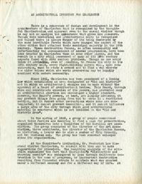
This half-page typed document discusses the Ansonborough Area Rehabilitation Program, the Revolving Fund, and restrictive covenants. The architecture of the Chancognie House at 48 Laurens Street and the home's current owner are also discussed.