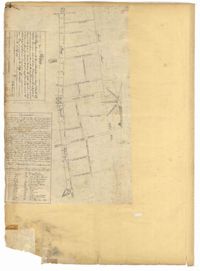
Page 14 of the City Engineer's Plat Book with one plat. The plat shows land between Bay Street and Church Street, including stretches of Tradd Street, Broad Street, and Queen Street.
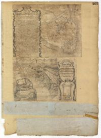
Page 207 of the City Engineer's Plat Book with two plats. Plat 1 is titled "The Plan of Charles Town With its Entrenchments and those made during the Siege by the English 1780," and shows Queen Street, Church Street, Tradd Street, King Street, Broad Street, the State House, the Market, the Arsenal, an "Old Church" and a "New Church." It also shows certain geographic features, including "Cummins Point," Cannons Point, and Hampstead Hill. Plat 2 has a label reading "This Map In every particular copied with a Pen from an Old Plat of Charles Town dated 1671 found in a Book of Plats of various parts of U.S.A. printed in London 1671." Plat 2 shows several geographic features such as rivers and islands, and features numerous illustrations. The largest illustration depicts two groups of people interacting from either side of a stream. Each group holds a single spear.
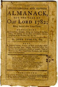
Published in 1782, the Tobler almanac for South Carolina and Georgia contains a Charleston City Directory and listing of the Charleston Board of Police in addition to weather forecasts, planting information, tide table, household remedies, and other folklore. The almanac is 32 pages long and contains one illustration concerning the anatomy of a man's body governed by the twelve constellations.
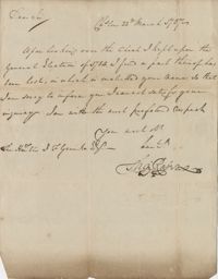
A letter written to John F. Grimke from Alexander Chisolm in Charleston, South Carolina. Chisolm commends Grimke for his "kind interference" in a business manner. Chisolm writes that he will make a payment on a debt presently.
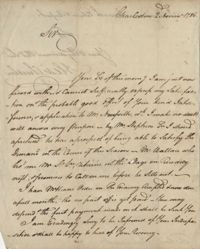
A short note to John F. Grimke from Charleston's Sheriff[?], James Kennedy stating that a "Sugar House" on Broad Street is ready for the arrival of "Negroes" for incarceration.
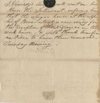
A short note to John F. Grimke from Charleston's Sheriff[?], James Kennedy inviting the City Constables and the Seargeant with the City Guard to attend an execution.
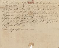
A short letter written to John F. Grimke from Thomas Roper regreting to inform Grimke that he was unable to satisfy an inquiry regarding the General Election of 1784 due to a missing document.
876 acres of land west of Murray Road in St. John's Parish. Names associated with this plat are Chas Johnston, Ben Castell, William Simpson, Verth, and J.G. Wiare. Notable geographic locations include Wadboo Barony.
Plat of land of 64 acres laid out for Allard Belin situated on Sandy Island. Names associated with this plat are Allard Berlin, John Hardwick and D.T. Waring.