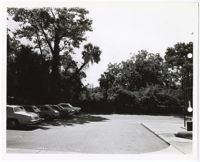
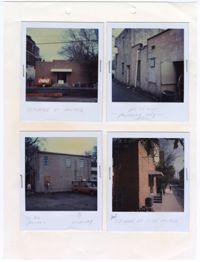
Black and white photograph of a parking lot in Charleston, South Carolina. There is a white border around the photograph with two holes punched through the right side of the photograph. The photograph shows five cars parked to the left of the parking lot. There is a sidewalk shown at the bottom and on the right side of the photograph. There is a metal structure to the right. There are trees and foliage in the background of the photograph.
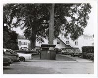
Black and white photograph of a parking lot in Charleston, South Carolina. There is a white border around the photograph with two holes punched through the left of the photograph. There are ten vehicles shown in the photograph, located in either the parking lot, driveway, and yard of the structure in the background. There is a dumpster in the center of the photograph.
Page 203 of the City Engineer's Plat Book with one plat. An illustrated title card reads "A Plan of Charles Towne Copied with a Pen from an Old Dilapidated Plat without a Date," and depicts a harbor scene with Europeans and enslaved people. The plat labels landmarks and streets using capital and lowercase letters. These locations include Broad Street, the "State House," several churches, Boundary Street, the Exchange, an armory, and a beef market.
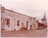
Colored photograph of a brick structure at No. 1 Charlotte Street. The photograph shows a two story brick structure with the bricks painted white. There is a projecting brick band on the visible elevation. Below the band are four arches which sit above four openings varying in function. The two closest openings contain windows. The third opening contains a door with stairs leading up to a platform that accesses the door. The fourth archway is open and leads to a nonvisible area. The arches connect with each other at Doric pilasters in between each openings. On the same brick structure, past the arches are four openings, two on the second story and two on the first story. The opening on the first story closest to the arches is a doorway. The three other openings are windows. Beyond the brick structure, there is an attached structure. The structure is an open air structure with brick columns holding up wooden beams and a covered pitched roof. There is a truck parked in front of the structure. Beyond both structures, in the background of the photograph, there is a large metal structure, known as a quay crane, and electric lines and poles. The ground is paved.
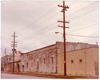
Colored photograph of attached brick and cement structures at No. 1 Charlotte Street. The photograph shows a one story cement structure located on the bottom right of the photograph. The structure is beige with a tiled roof. There are two small windows and exterior piping on the south elevation. There is a two story brick structure attached to the west elevation of the cement structure. The brick structure has a symmetrical receding roofline on its east elevation. There is a projecting brick band on the south elevation. Below the band are four arches which sit above four window openings varying between size and placement. The arches connect with each other at Doric pilasters in between each opening. On the same brick structure beyond the arches are four openings. There are two on the second story and two on the first story. The opening on the first story that is furthest away from the viewer is a doorway. The three other openings are windows. There is another brick structure attached to the eastern elevation of the closest brick structure. This structure has a pitched roof. Beyond the attached structures is a multi-story white structure. There are electric poles and lines in front of the structures lining the road and sidewalk.
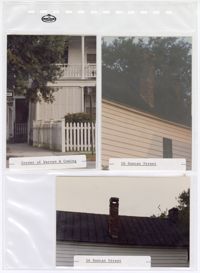
Three colored photographs of No. 16 Duncan Street and No. 138 Coming Street: Top left (north elevation of No. 138 Coming Street on the corner of Warren Street and Coming Street); Top right (west elevation roofline of No. 16 Duncan Street); Bottom (west elevation roofline of No. 16 Duncan Street). The photographs are placed in a clear plastic sheet with pockets for each photograph. The plastic sheet has a stamp that reads "The Holson Company." There are multiple holes ranging in size on the sheet surrounding the photographs. The photograph of No. 138 Coming Street shows the structure's two story piazza and fenced yard. The first story of the piazza is partially covered with shutters. There is a sidewalk leading to a door attached to the structure. The photographs of No. 16 Duncan Street show the structure's brick chimney on the west elevation roofline. The roof is a black tin pitched roof. The chimney projects from the slope of the pitched roof. The exterior of the structure consists of white horizontal paneling.
Colored photograph of multiple structure at No. 1 Charlotte Street. The photograph shows two cement structures in the center of the photograph. The cement structure to the left is a one story structure with two openings on the east elevation. The opening to the left is a door and the one to the right is a boarded up window. The cement structure to the right is a second story structure. There is detail in the cornice at the roofline. There are two openings on the east elevation. The opening on the second story is a window and the one on the first story is a door. There are objects projecting from the south elevation of the two story cement structure. There is a multi-story white building beyond both cement structures. The white structure located on the left side of the photograph has a sign above the first floor and a colorful logo on the very top of the structure. There is an electric substation in between the cement structures and the white structure. There is a trailer to the left of the one story cement structure. There is a truck parked in the bottom right of the photograph. There are materials scattered across the ground in front of the two story cement structure. The ground is paved.
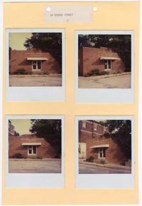
Four colored photographs of No. 34 George Street: Top left (front facade/north elevation); Top right (side elevation); Bottom left (side elevation); Bottom right (corner of front facade/north elevation and east elevation). There is a white border surrounding each of the photographs. The photographs are stapled to a beige sheet of paper with two holes punched through the top. The paper is not labeled but each of the photographs have handwritten notes on the lower part of their white border. The photographs show a one story brick structure with a symmetrical receding parapet on the front facade. There are quoins bordering the front entryway up to the parapet. An awning covers the front entryway. The side elevations are made up of cement blocks without ornamentation. According to the handwritten notes under each photograph, the purpose of this file is to request to paint the exterior of the structure.
Four colored photographs of No. 34 George Street: Top left (front facade/north elevation); Top right (angle of front facade/north elevation); Bottom left (front facade/north elevation); Bottom right (angle of front facade/north elevation with neighboring structure in background). There is a white border surrounding each of the photographs. The photographs are attached to a beige sheet of paper with two holes punched through the top. The paper is labeled "34 George Street," with George spelled incorrectly. The structure at No. 34 George Street was a one story brick structure. The roofline has a parapet that is slightly more elevated in the center of the facade. There are quoins along the boarders of the projected center of the structure in which the front entryway sits between. There is an awning over the glass double doors. There is a short set of stairs leading to the doors from both sides of the sidewalk. There is a metal railing along the stairs.
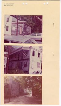
Three colored photographs of No. 18 Duncan Street: Top (front facade of outbuilding); Middle (corner of front facade/north elevation and east elevation); Bottom (side elevation). The photographs are stapled to a beige sheet of paper with four holes punched through the top. The paper is labeled "18 Duncan Street" with the application number "BAR #8410-24-1." The structure at No. 18 Duncan Street is a two-and-a-half story Charleston Single style structure. The structure has a pitched roof with a sloped awning on the east elevation. The awning is supported by wooden beams angled against the structure. The openings on the front facade/north elevation are missing windows on the second story and boarded up on the first story. The outbuilding is a one story structure with a parapet. The paint is peeling and all of the openings have been boarded shut.
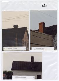
Three colored photographs of No. 8 Duncan Street, No. 15 Duncan Street, and No. 16 Duncan Street: Top left (east elevation roofline of No. 8 Duncan Street); Top right (roofline of No. 15 Duncan Street); Bottom (west elevation roofline of No. 16 Duncan Street). The photographs are placed in a clear plastic sheet with pockets for each photograph. The plastic sheet has a stamp that reads "The Holson Company." There are multiple holes ranging in size on the sheet surrounding the photographs. The photographs each show the brick chimneys of the different structures. The roofs are each pitched and constructed from black tin. Each structure's exterior consists of white horizontal paneling.
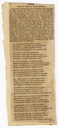
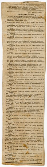
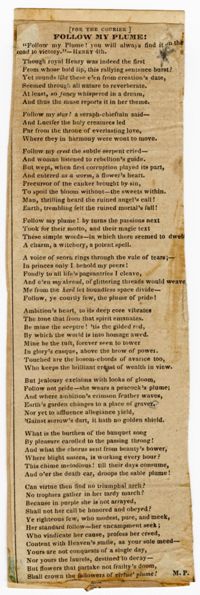
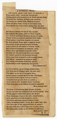
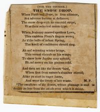
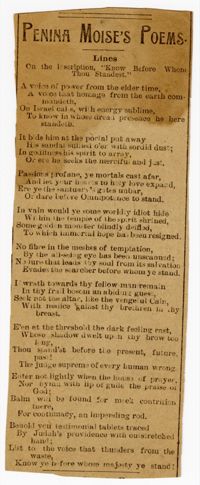
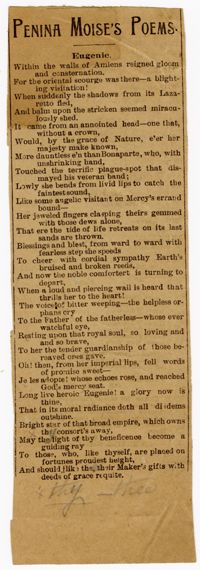
Poem by Penina Moise entitled, "Lines-Upon the following question, contained in one of?" First line of the poem reads, "?What is the hour in thy day..."
Poem by Penina Moise entitled, "On Converting the Theatre into an Anatomical Studio." First line of the poem reads, "Talk ye no more of transformations rare..."
Poem by Penina Moise entitled, "Lines-Written upon reading Mrs. Osgood's beautiful song of 'Call me pet-names.'" First line of the poem reads, "For pet-names, sweet minstrel, canst thou even plead..."
Poem by Penina Moise entitled, "Lines-Upon the following interesting incident:" First lines of the poem reads, "The parting hour is at hand-farewell must now be spoken..."
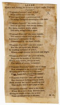
Poem by Penina Moise entitled, "Lines-Upon a seal, having for its device a lyre-motto Toujours d'accord." First line of the poem reads, "'Toujours d'accord' alas! I feel..."
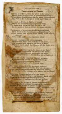
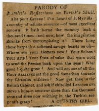
Prose by Penina Moise entitled, "Parody of Hamlet's Reflections on Yorick's Skull." First line of the prose reads, "Alas poor Greece! I've heard of it Myrtilla..."
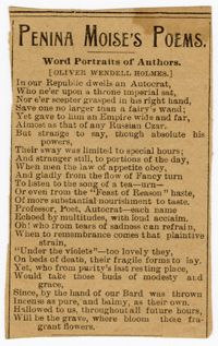
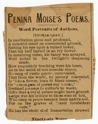
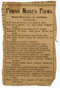
Poem by Penina Moise entitled, "Word Portraits of Authors [Oliver Wendell Holmes]." First line of the poem reads, "In our Republic dwells an Autocrat..."
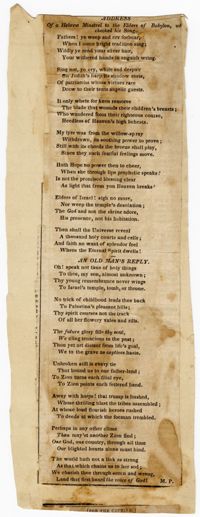
Poem by Penina Moise entitled, "Address-Of a Hebrew Minstrel to the Elders of Babylon, who Checked his Song." First line of the poem reads, "Fathers! Ye weep and cry forbear..."
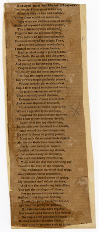
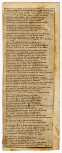
Poem by Penina Moise entitled, "Imaginary Conversation Amongst the Flowers." First line of the poem reads, "Said Carnation to Lily, why comes not the friend..."
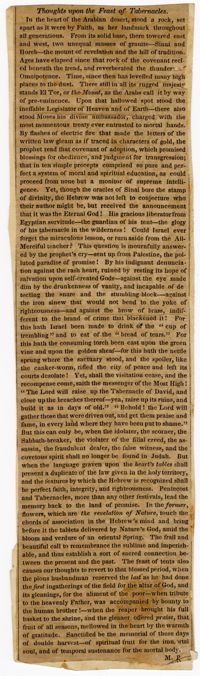
Prose by Penina Moise entitled, "Thoughts upon the Feast of Tabernacles." First line of the prose reads, "In the heart of the Arabian desert, stood a rock..."
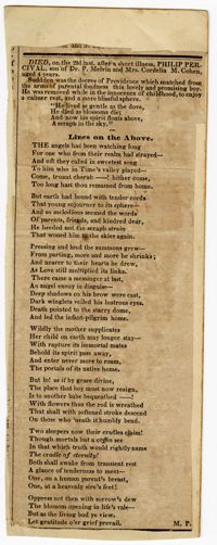
Poem by Penina Moise entitled, "Lines on the Above," regarding a quote on the death of Philip Percival. First line of the poem reads, "The angels had been watching long..."
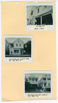
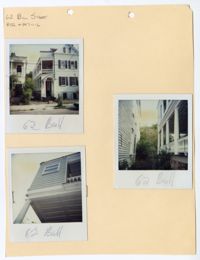
Three colored polaroid photographs of No. 62 Bull Street and its neighboring structures: Top (rear view of No. 62 Bull Street); Middle (facade of No. 60 Bull Street); Bottom (facade of No. 64 Bull Street). The photographs are attached to a beige paper with two holes punched through the top. There are handwritten labels for each photograph that have been attached beneath each polaroid identifying the photograph. The top photograph shows a rear view No. 62 Bull Street. In this photograph, the porch is visible. The middle photograph shows the north elevation of No. 60 Bull Street. The structure at No. 60 Bull Street is a first floor storefront with a closed space and porch on the second floor. The bottom photograph shows the facade of a structure with porches spanning the entirety of the first and second floors.
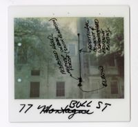
Colored polaroid photograph shows the south elevation of No. 77 Bull Street. There are hand-drawn black marks show a circle attached to a vertical line ending with a rectangle. There is an arrow pointing at the rectangle. The arrow is labeled as "Elbow." There is another arrow pointing to the rectangle with the label "Proposed new-meter under porch (south elevation)." There is an arrow pointing to the vertical line labeled as "Additional conduit of weatherhead adjacent existing." The photograph was originally labeled at "77 Montague" but was crossed out and renamed "77 Bull St." There are trees in front of the south elevation at the top of the photograph.
Three colored polaroid photographs of No. 62 Bull Street: Top left (front facade/north elevation facing Bull Street); Right (piazza on east elevation and the west elevation of the neighboring building); Bottom left (white coffered ceiling of the piazza and west elevation). The photographs are stapled to a beige paper with two holes punched through the top. The paper is labeled as "62 Bull Street BAR #847-11-6." The structure is a two-and-a-half-story raised Charleston Single style structure with a two-story piazza. The structure has a pitched gable roof with dormer windows. The entryway into the piazza is covered by a pediment and columns on the sides. The horizontal exterior paneling is blue.
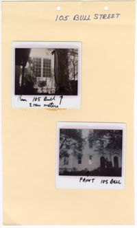
Two colored polaroid photographs of No. 105 Bull Street: Top (north elevation); Bottom (front façade/south elevation). The two photographs are attached to a beige paper with two holes punched through the top. The paper is labeled "105 Bull Street." The front facade of the structure indicates that No. 105 Bull Street is a blue row house. There are handwritten descriptions on each polaroid photograph. The top photograph has an arrow drawn within the photograph pointing upwards with a handwritten note indicating the new location for two meters. The handwritten label on the top photograph labels the photograph as “Rear 105 Bull.” The handwritten label on the bottom photograph labels the photograph as “Front 105 Bull.”
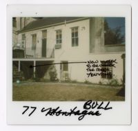
Colored polaroid photograph shows the outbuilding of No. 77 Bull Street. There is a handmade black line that extends horizontally across the middle of the image and ends with a star. The hand-drawn star is located underneath the porch area shown in the photograph. The marks are labeled as "New meter to be under the porch/existing." The photograph was originally labeled as "77 Montague" but was crossed out and renamed "77 Bull."
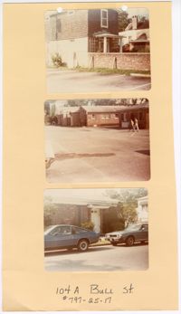
Three colored photographs of No. 104A Bull Street and its neighboring buildings to the west: Top (north and east elevations of No. 104A Bull Street); Middle (series of buildings located to the west of No. 104A Bull Street); (façade of building located to the west of No. 104A Bull Street). The three photographs are attached to a beige paper with two holes punched through the top. The paper is labeled "104A Bull St. #797-25-17." The outbuilding known as No. 104A Bull Street is a two-story structure. The exterior of the outbuilding consists of dark shingles and white ornamentation. The structures to the west of No. 104A Bull Street are single story brick structures.
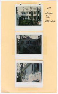
Three colored polaroid photographs of No. 100 Bull Street: Top (front facade/north elevation); Middle (building elevation); Bottom (close up of windows on building elevation). The three photographs are taped to a beige paper with holes punched through the top. The paper is labeled "100 Bull St. #8012-10-18." The top photograph shows the two-and-a-half-story structure with porches spanning the entire first and second floors of the facade. The middle and bottom photographs show the blue exterior and blue shutters of the structure.
Two colored photographs of the side elevation of No. 101 Bull Street; Left (side elevation with black marks drawn around equipment); Right (side elevation). The two photographs are attached to a beige paper with two holes punched through the top. The paper is labeled as "101 Bull Street SR84-106." The photographs show the side elevation containing both a brick and panel exterior. The section of white horizontal paneling is separated from the brick by a white piazza. The photograph on the left has a handmade drawing that was made around the outdoor housing equipment.
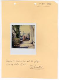
Colored polaroid photograph of a wall at No. 84 Bull Street. The photograph is attached to a beige paper with two holes punched through the top. The paper is labeled as "84 Bull Street." There is a note on the bottom that reads "Approval to leave eastern wall of garage given by staff. 3/16/84." The note is then signed by "D. Smith."
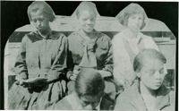
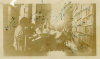
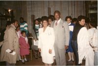
Photograph of five female Avery students seated on a set of bleachers. Several girls are holding reading material. Image appears to be cut out for a scrapbook.
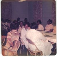
Photograph of a group of Avery students studying in a classroom or a library. The students are surrounded by bookshelves and sit in chairs around tables.
Unpublished typed manuscript copy written by Jacob S. Raisin entitled, "Washington the Mason." The manuscript relates Raisin's thoughts on George Washington and the Freemasons.
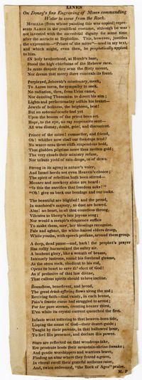
Poem by Penina Moise entitled, "Lines-On Doney's fine Engraving of Moses commanding Water to issue from the Rock." First line of the poem reads, "In holy brotherhood, at Horeb's base..."
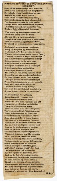
Poem by Penina Moise entitled, "dialogue Between the Oak Tree and the Mulberry." First line of the poem reads, "Stand off sir Morris-though no ill it work us..."
Poem by Penina Moise entitled, "Lines upon the Death of Daniel Webster." First line of the poem reads, "Thrice, star-crown'd Freedom, in her halls of State..."
A page relating the Annual Report of the Tract Commission submitted by Samuel H. Goldenson to the Board of Managers of Synagogue and School Extension in Pittsburgh, PA. The report notes a tract to be published by Rabbi Dr. Jacob S. Raisin entitled, "Kindness to Animals."
Postcard of a Charleston home. Back of postcard reads, "Here is the Charlestonian type of home, reflecting the early desire for privacy. Note particularly the long veranda facing the southern sea breezes isolated from the publich by a heavy, solid, street door, generally locked, often located at the sidewalk, blocking people from freely entering the porch. Further privacy is provided by the high walls, wrought iron grill work and bushes."
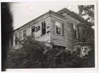
Black and white photograph of the upper section of the southwestern corner of No. 134 Bull Street. There is a white border around the photograph. There are two holes punched through the top of the photograph. The photograph shows the north and east elevations of the second floor of the two-story Charleston Single style structure. The second floor of the piazza is enclosed. The first floor is not visible due to vegetation. The structure is in disrepair with broken and missing shutters, decaying exterior paint, and large amounts of overgrowth in the landscape.
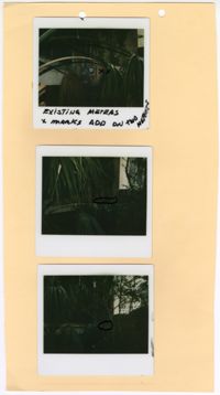
Three colored polaroid photographs of existing meters assumed to be located at No. 105 Bull Street: Top (existing meter); Middle (mark for new meter); Bottom (mark for new meter). The three photographs are attached to a beige paper with two holes punched through the top. There is writing in black ink on the top photograph indicating the existing meter. There are black marks on the middle and bottom photographs indicating the placement of the new meters. The paper is not labeled. The close up photographs each show large amounts of vegetation blocking the structure from view, limiting ability to confirm the address of the photographs.
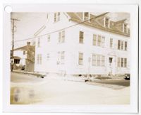
Black and white photograph of the front façade and east elevation of No. 138 Bull Street. The two-and-a-half-story structure has a sloped roof and three dormer windows on the half-story. The exterior has horizontal side paneling. The front door is centered on the front facade located on the north elevation of the structure. There is a thick wall projecting from the northwestern corner of the building. The photograph shows two cars parked in front of the north elevation. There is a white border around the photograph with a single hole punched through the top. There is a black mark above the hole punch.
Black and white photograph of the southwestern corner of No. 138 Bull Street. The photograph shows the north and east elevations of the two-and-a-half story structure. The sloped roof has three dormer windows. The exterior has horizontal side paneling. The front door is centered on the front facade located on the north elevation of the structure. There is a white border around the photograph with a hole punched in the top left corner.
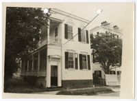
Black and white photograph of the front façade and east elevation of No. 132 Bull Street. The structure is a two-story Charleston Single style structure with a two-story piazza on the left. The structure has an elevated foundation. The structure has a missing shutter on the top left window and a damaged shutter on the bottom left window. There is a beige border around the photograph with two holes punched through the top of the photograph. There are diagonal black marks coming from the top right side of the photograph and extend towards the bottom left corner. "Palmer Property" is written on the back of the photograph.
Black and white photograph of the southwestern corner of No. 134 Bull Street. The photograph shows the north and east elevations of the Charleston Single style structure. There is a white border around the photograph. There is discoloration in the top left corner and along the right side of the photograph. The photograph shows trees and bushes in front of the piazza and bay window of the structure. There is a car in the bottom right corner of the photograph.
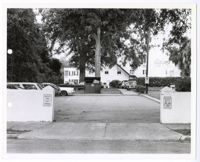
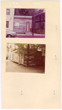
Black and white photograph of a parking lot in Charleston, South Carolina. There is a white border around the photograph with two holes punched through the left of the photograph. There a multiple vehicles shown in the photograph, located in either the parking lot, driveway, or yard of the structure in the background. There is a dumpster just beyond the parking lot in the center of the photograph. The parking lot is partially concealed by a white retaining wall and posts that act as an entryway. There are signs on the posts indicating the purpose of the lot.
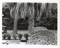
Black and white photograph of a grass area located in Charleston, South Carolina. There is a white border around the photograph with two holes punched through the left of the photograph. The photograph shows different types of trees and bushes in a grass area with a sidewalk cutting horizontally through the middle. There is a picnic table and trash can in the bottom left of the photograph.
Page 214 of the City Engineer's Plat Book with two plats. Plat 1 shows lots located between Savage Street and Chisolm Street, and between Broad Street and Tradd Street. Plat 1 also shows Rutledge Avenue. Plat 2 shows a similar area to Plat 1, but also includes New Street, Franklin Street, Trapman Street, and Lynch Street.
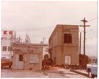
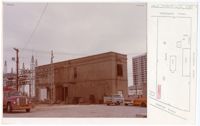
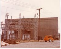
Colored photograph of an electric substation and a cement structure at No. 1 Charlotte Street. The photograph is stapled to a sheet of paper with a section of a Sanborn Fire Insurance Map on the right side. The cement structure shown in the photograph is highlighted in red on the attached Sanborn Map. The electric substation is attached to passing electric lines and electric poles. The structure contains transformers. The two story cement structure has a cornice and parapet at the roofline. There is a projecting band around the middle of the structure differentiating between the first and second stories. There are three visible openings on the south elevation and two openings on the east elevation. On the second story there is one window on each of the south and east elevations. There is one door on the first story of the east elevation. On the first story of the south elevation, there are two visible openings that are larger than the entry door on the east elevation. There are various materials scattered along the wall of the cement structure. There is a multi-story structure in the background of the photograph. There are four vehicles visible in the photograph. The ground is paved.
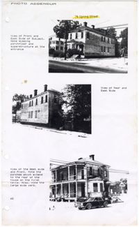
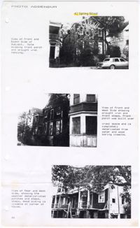
Three black and white photographs of No. 76 Spring Street: Top (corner of front facade/north elevation and west elevation); Middle (corner of south elevation and west elevation); Bottom (corner of front facade/north elevation and east elevation). The photographs are printed onto a white sheet of paper with four holes punched through the left side of the paper. The paper is labeled "Photo Addendum 76 Spring Street." Each photograph has a short description next to it. The descriptions note the view of the structure and note the porches and yard. The two story structure has a pitched roof and four chimneys. There is a piazza on the west side of the structure and a bay window on the front facade/north elevation. There are multiple openings for windows and doors. The structure is elevated above the ground.
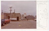
Colored photograph of a cement structure and a wooden structure at No. 1 Charlotte Street. The photograph is stapled to a sheet of paper with a section of a Sanborn Fire Insurance Map on the right side. The contents of the photograph are located within the area displayed on the Sanborn Map. The one story cement structure has multiple openings on each visible elevation. There is a circular compartment attached to one of the elevations of the cement structure. The wooden structure beyond the cement structure has vertical paneling and a pitched roof. There are five vehicles visible in the photograph. There is a man standing near the center of the photograph. There are structures in the background of the photograph. The ground is paved.
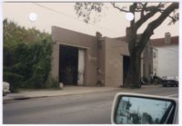
Colored photograph of No. 103 Spring Street. There are two holes punched through the top of the photograph. The photograph shows the cement block structure at No. 103 Spring Street. There is writing painted on beige walls of the north elevation identifying the structure as "Stanley's." There are large garage doors on both sides of the north elevation. The second garage door is slightly obstructed by the oak tree on the sidewalk. There is foliage growing along the west elevation. The photograph was taken from a vehicle. There is a rear view mirror in the bottom right corner of the photograph. The neighboring structures are also visible to the right of No. 103 Spring Street and in the rear view mirror.
Two colored photographs of No. 18 Duncan Street: Top (front facade of the outbuilding attached); Bottom (rear/south elevation of the outbuilding). The photographs are stapled to a beige sheet of paper with four holes punched through the top. Other staples are visible on the paper from the photographs stapled to the back of the paper. The outbuilding structure at No. 18 Duncan Street is a one story structure with a parapet. The paint is peeling and all of the openings have been boarded shut. The photograph of the rear of the outbuilding shows the horizontal wooden paneling falling off of the exterior walls.
Three black and white photographs of No. 43 Spring Street: Top (front facade/south elevation); Middle (front facade/south elevation); Bottom (north elevation). The photographs are printed onto a white sheet of paper with four holes punched through the left side of the paper. The paper is labeled "Photo Addendum 43 Spring Street." Each photograph has a short description next to it. The descriptions note the view of the structure and the damage or missing components visible in each photograph. The structure is an elevated two-and-a-half story structure. There is a pitched roof. The rear porch is in disrepair.
Colored photograph of an electric substation and a cement structure at No. 1 Charlotte Street. The electric substation is attached to passing electric lines and electric poles. The structure contains transformers. Behind the electric system structure, there is a two story cement structure. It has a cornice and parapet at the roofline. There is a projecting band around the middle of the structure differentiating between the first and second stories. The bottom right corner of the south elevation is covered in cracks or dried ivy vines. There is a pile of discarded wood and objects in the bottom left of the photograph. There is an orange, movable object next to the electric substation. The ground is paved.
Photocopy of a handwritten memo from Rev. W. T. Goodwin to Penecostal Churches, United Methodist Churches, African Methodist Churches, Presbyterian Churches, Baptist Churces, and Holliness Churches regarding the Esau Jenkins Memorial Scholarship Fund Drive and Memorial.
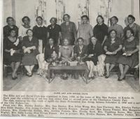
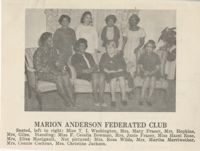
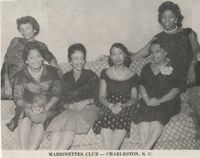
A letter from the Charleston City Federation of Colored Women's Clubs to an unknown entity. It's signed by Chairman Thelma F. Murray, Co-Chairman Mamie Fields, President T.I. Washington, and Charleston Mayor J.P. Gaillard, Honorary Chairman. The letter discusses the Southeastern Regional meeting in Durham, North Carolina and improving the City of Charleston.
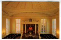
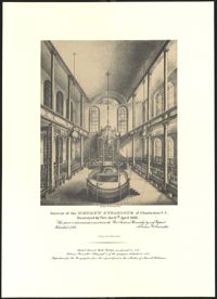
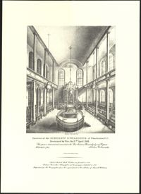
Black-and-white lithograph depicting the interior of the original building of Kahal Kadosh Beth Elohim in Charleston. From a painting by Solomon Nunes Carvalho. Lithograph printed Philadelphia: J. T. Bowen.
Black-and-white lithograph depicting the interior of the original building of Kahal Kadosh Beth Elohim in Charleston. From a painting by Solomon Nunes Carvalho. Lithograph printed Philadelphia: J. T. Bowen.