Correspondence from Esau Jenkins, President of the Citizens Committee of Charleston County, to the Ministers, to Admiral B. H. Batcheller, Commander of the Charleston Naval Shipyard, regarding an invitation to the Equal Employment Opportunity meeting on February 1, 1967.
Page 140 of the City Engineer's Plat Book with six plats. Plat 1 shows lots and structures located on and near Queen Street, between King Street and Meeting Street. Plat 2 shows lots located on Rutledge Street. Plat 3 shows lots located between George Street and Burns Lane, near where they intersect with Meeting Street. One lot is labelled "Property of Charleston High School." Plat 4 shows lots and structures located between Lynch Street and the Ashley River, near Broad Street and Beaufain Street. Plat 5 shows lots and structures located on the corner of King Street and Society Street. Plat 6 shows the same area as Plat 5, but with some changes to the structures.
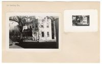
(Front) 5x8 index card survey of 141 Calhoun Street. Notes indicate the state of the dwelling. Includes thumbnail image of the dwelling. "Gone 1946". (Back) "Worthy of better repair Notable" [L.S.] A.S.
Page 141 of the City Engineer's Plat Book with four plats. Plat 1 features a lot and structures located between Lynch Steet and the Ashley River, near Broad Street. It also shows Comings Creek, a pond, and a lot labelled "Clark & Steinmeyer." Plat 2 shows lots and structures located near the intersection of College Street and Calhoun Street. Plat 3 shows a lot and structures in "the City of Charleston in Ward No. 9." Plat 4 shows lots on and near Society Street, between Meeting Street and King Street.
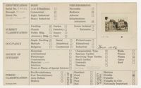
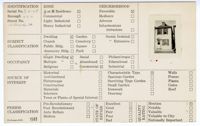
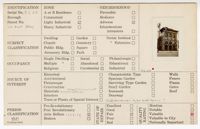
(Front) 5 x 8 index card with survey of 142 Church Street. Includes a thumbnail image of the dwelling. (Back) Brief notes and description about the property.
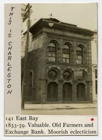
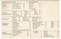
(Front) 5 x 8 index card with survey of 141 East Bay Street. Includes one thumbnail image of dwelling. (Back) Notes about the property, including speculation that the restoration is "the works of Frank Lee or of Jones and Lee," and about the design's possible inspirations.
Page 142 of the City Engineer's Plat Book with four plats. Plat 1 shows lots and structures located on the corner of Meeting Street and Burns Lane, with one lot labeled "Property of Charleston High School." Plat 2 shows lots located on Pitt Street. Plat 3 shows lots and structures located on Pitt Street. Plat 4 shows land located between Broad Street and Wentworth Street, and between Lynch Street and the Ashley River. Plat 4 also shows a line labelled "Low Water Mark of Ashley River," Comings Creek, and a "City Mud Flat, lying North of Creek."