Search
« Previous |
101 - 200 of 1,584
|
Next »
Search Results
Date:
1977-1983
Description:
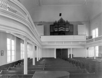
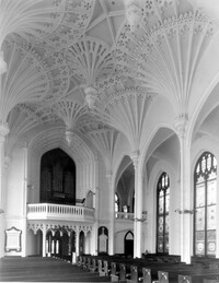
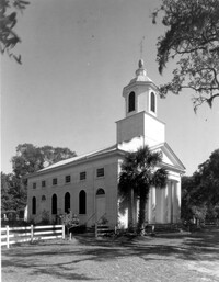
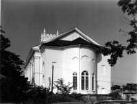
68 Spring Street, Karpeles Manuscript Library Museum (St. James United Methodist Church), ca. 1858. Interior View - Nave, looking South. 4" x 5" B/W photo.
Date:
1977-1983
Description:
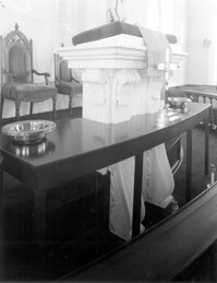
68 Spring Street, Karpeles Manuscript Library Museum (St. James United Methodist Church), ca. 1858. Interior View - Detail of pulpit. 4" x 5" B/W photo.
Date:
1977-1983
Description:
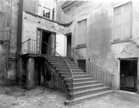
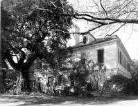
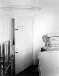
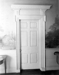
48 Elizabeth Street, Aiken-Rhett House, ca.1818. Main House - Detail View of entry to 2nd Floor Hall, SW (Front and Side) elevation. 4" x 5" B/W photo.
Date:
1977-1983
Description:
48 Elizabeth Street, Aiken-Rhett House, ca.1818. Main House - Interior View. 1st Floor - NW Room, entry from street, West elevation. 4" x 5" B/W photo.
Date:
1977-1983
Description:
48 Elizabeth Street, Aiken-Rhett House, ca.1818. Main House - Detail View of entry to 1st Floor, NW (Rear and Side) elevation. 4" x 5" B/W photo.
Date:
1977-1983
Description:
48 Elizabeth Street, Aiken-Rhett House, ca.1818. Main House - Detail View of entry, West (Side) elevation. 4" x 5" B/W photo.
Date:
1977-1983
Description:
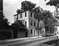
48 Elizabeth Street, Aiken-Rhett House, ca.1818. Main House - View of South (Front) elevation. 4" x 5" B/W photo.
Date:
1977-1983
Description:
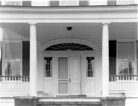
456 King Street, William Aiken House, ca. 1811. Main House - Detail View of 1st Floor portico entry to Hall, South (Side) elevation. 4" x 5" B/W photo.
Date:
1977-1983
Description:
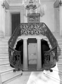
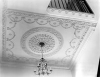
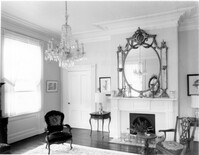
456 King Street, William Aiken House, ca. 1811. Main House - Interior View. 1st Floor - Detail of Hall ceiling medallion. 4" x 5" B/W photo.
Date:
1977-1983
Description:
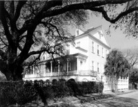
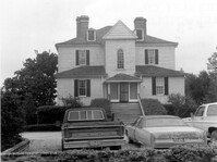
69 Barre Street, Gov. Thomas Bennett House, ca. 1822. Main House - View of SE (Front and Side) elevation. 4" x 5" B/W photo.
Date:
1977-1983
Description:
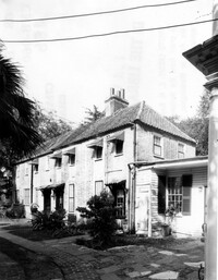
68 Broad Street, Daniel Ravenel House, ca. 1796. Dependency, View of SW (Side and Front) elevation. 4" x 5" B/W photo.
Date:
1977-1983
Description:
3 Atlantic Street, Benjamin Smith House, ca. 1820-1830. View of North (Front) elevation. 4" x 5" B/W photo.
Date:
1977-1983
Description:
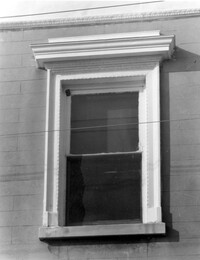
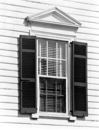
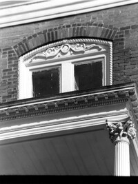
81 Rutledge Avenue, Glover-Sottile House, ca. 1826. Detail View of Ground Floor window, East (Front) elevation. 4" x 5" B/W photo.
Date:
1977-1983
Description:
81 Rutledge Avenue, Glover-Sottile House, ca. 1826. Detail View of 2nd Floor window, East (Front) elevation. 4" x 5" B/W photo.
Date:
1977-1983
Description:
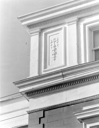
81 Rutledge Avenue, Glover-Sottile House, ca. 1826. Detail View of attic and cornice, East (Front) elevation. 4" x 5" B/W photo.
Date:
1977-1983
Description:
6 Archdale Street, Unitarian Church, ca. 1787. Interior View - East (Rear) elevation. 4" x 5" B/W photo.
Date:
1977-1983
Description:
93 Rutledge Avenue, Seabrook-Trenholm House, ca. 1819. View of South (Side) elevation, looking East. 4" x 5" B/W photo.
Date:
1977-1983
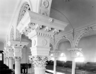
Description:
146 Church Street, St. Philip's Episcopal Church, ca. 1836. Interior View - Detail of balcony column capitals, NE (Rear and Side) elevation 4" x 5" B/W photo.
Date:
1977-1983
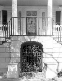
Description:
60 Montague Street, Gaillard-Bennett House, ca. 1800. Main House - Detail View of Ground Floor entry gate and 1st Floor stoop railing, South (Front) elevation. 4" x 5" B/W photo.
Date:
1977-1983
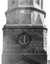
Description:
146 Church Street, St. Philip's Episcopal Church, ca. 1836. Detail View of tower base, South (Side) elevation. 4" x 5" B/W photo.
Date:
1977-1983
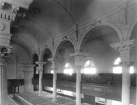
Description:
146 Church Street, St. Philip's Episcopal Church, ca. 1836. Interior View - balcony, NE (Rear and Side) elevation 4" x 5" B/W photo.
Date:
1977-1983
Description:
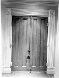
71 Church Street, Col. Robert Brewton House, ca.1732. Detail View of entry, South (Front) elevation 4" x 5" B/W photo.
Date:
1977-1983
Description:
54 Queen Street, Thomas Elfe House, ca. 1760. Interior View - 1st Floor. North Room, East wall. 4" x 5" B/W photo.
Date:
1977-1983
Description:
18 Bull Street, William Blacklock House, ca. 1800. Carriage House - View of West (Side) elevation. 4" x 5" B/W photo.
Date:
1977-1983
Description:
60 Montague Street, Gaillard-Bennett House, ca. 1800. Main House - View of South (Front) elevation. 4" x 5" B/W photo.
Date:
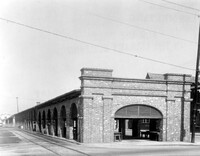
1977-1983
Description:
188 Meeting Street, Market Hall, ca. 1841. Shed #5 - View of East (Front) elevation. 4" x 5" B/W photo.
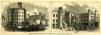
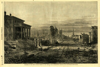
Date:
1865
Description:
Caption: 'Military Prisons at Charleston, South Carolina.--Sketched by Lieutenant F. Milward--[See Page 110]' the Jail and Work-House are both identified. [full date February 18, 1865.]
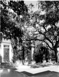
Date:
1977-1983
Description:
14 Legare Street, Simmons-Edwards House, ca. 1800. Main House - View of front entry and wood gates, West (Front) elevation. 4" x 5" B/W photo.
Date:
1977-1983
Description:
55 King Street, Grimke-Fraser Tenements, ca. 1762. Privy and Carriage House - View of SW (Side and Rear ) elevation. 4" x 5" B/W photo.
Date:
1977-1983
Description:
110 Broad Street, William Harvey House, ca. 1728.. Kitchen Building - Detail View of window, North (Rear) elevation. Top of window revealed after removal of hyphen. 4" x 5" B/W photo.
Date:
1977-1983
Description:
110 Broad Street, William Harvey House, ca. 1728. Kitchen Building - View of SE (Front and Side) elevation (after removal of hyphen). 4" x 5" B/W photo.
Date:
1977-1983
Description:
110 Broad Street, William Harvey House, ca. 1728. Main House - Interior View. SW Room, North elevation. 4" x 5" B/W photo.
Date:
1977-1983
Description:
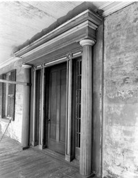
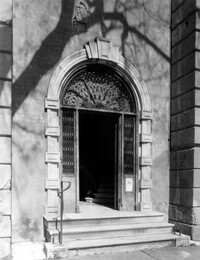
102 Broad Street, Dr. Henry Frost House, ca. 1844. Detail View of front entry, South (Front) elevation. 4" x 5" B/W photo.
Date:
1977-1983
Description:
110 Broad Street, William Harvey House, ca. 1728. Main House - View of SW (Front and Side) elevation. 4" x 5" B/W photo.
Date:
1977-1983
Description:
Berkley County, Lewisfield, ca. 1744. View of West (Rear) elevation. 4" x 5" B/W photo.
Date:
1977-1983
Description:
Berkley County, Lawson's Pond, ca. 1823. Detail View of corner portico column and cornice, SE (Side and Rear) elevation. 4" x 5" B/W photo.
Date:
1977-1983
Description:
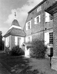
Berkley County, Mulberry Plantation, ca. 1714. Main House - View of West side and NW corner pavilion, looking North. 4" x 5" B/W photo.
Date:
1977-1983
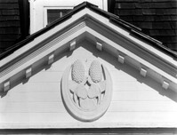
Description:
Berkley County, Mulberry Plantation, ca. 1714. Main House - Detail View of pediment ornament, South (Front) elevation. 4" x 5" B/W photo.
Date:
1977-1983
Description:
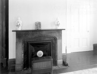
Berkley County, Lawson's Pond, ca. 1823. Interior View. 1st Floor - NW Room, North wall. Detail of door. 4" x 5" B/W photo.
Date:
1977-1983
Description:
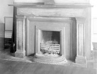
Berkley County, Lawson's Pond, ca. 1823. Interior View. 1st Floor - NW Room, South wall. Detail of mantle. 4" x 5" B/W photo.
Date:
1977-1983
Description:
Charleston County, Oak Island Plantation, ca. 1830. View of North (Rear) elevation. 4" x 5" B/W photo.
Date:
1977-1983
Description:
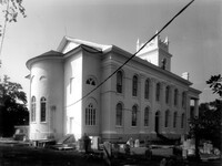
Charleston County, Edisto Island Presbyterian Church, ca. 1831. Church - View of SW (Front and Side) elevation. 4" x 5" B/W photo.
Date:
1977-1983
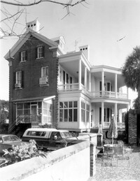
Description:
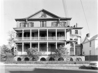
147 Wentworth Street, Francis Silas Rodgers Mansion, ca.1886. Main House - View of West (Side) elevation. 4" x 5" B/W photo.
Date:
1977-1983
Description:
14 Legare Street, Simmons-Edwards House, ca. 1800. Main House - Detail View of West entry pier caps, West (Front) elevation. 4" x 5" B/W photo.
Date:
1977-1983
Description:
14 Lamboll Street, Patrick O'Donnell Tenement, ca. 1850. Detail View of entry, SE (Front and Side) elevation. 4" x 5" B/W photo.
Date:
1977-1983
Description:
55 King Street, Grimke-Fraser Tenements, ca. 1762. Slave Quarters - View of SE (Front and Side) elevation. 4" x 5" B/W photo.
Date:
1977-1983
Description:
55 King Street, Grimke-Fraser Tenements, ca. 1762. Privy - View of SE (Front and Side) elevation. 4" x 5" B/W photo.
Date:
1977-1983
Description:
59 Meeting Street, Branford-Horry House, ca. 1751. View of SW (Rear and Side) elevation. 4" x 5" B/W photo.
Date:
1977-1983
Description:
59 Meeting Street, Branford-Horry House, ca. 1751. View of East (Front) elevation. 4" x 5" B/W photo.
Date:
1977-1983
Description:
48 Elizabeth Street, Aiken-Rhett House, ca.1818. Complex - View of fence, West (Side) elevation. 4" x 5" B/W photo.
Date:
1977-1983
Description:
48 Elizabeth Street, Aiken-Rhett House, ca.1818. Complex - View of SW (Side and Front) elevation. 4" x 5" B/W photo.
Date:
1977-1983
Description:
48 Elizabeth Street, Aiken-Rhett House, ca.1818. Main House - View of SE (Front and Side) elevation. 4" x 5" B/W photo.
Date:
1977-1983
Description:
20 South Battery, Stevens-Lathers House, ca. 1843. Main House - Detail View of entry gate, South (Front) elevation. 4" x 5" B/W photo.
Date:
1977-1983
Description:
8 South Battery, Colonel William Washington House, ca. 1768. Stable - View of SE (Front) elevation. 4" x 5" B/W photo.
Date:
1977-1983
Description:
St. Margaret, West End, William Lowndes House, date unknown. View of East (Side) elevation. 4" x 5" B/W photo.
Date:
1977-1983
Description:
179 Rutledge Avenue, Wagener House, ca. 1874. Main House - View of West (Rear) elevation. 4" x 5" B/W photo.
Date:
1977-1983
Description:
172 Tradd Street, Chisolm-Alston House, ca. 1836. View of SE (Front and Side) elevation. 4" x 5" B/W photo.
Date:
1864
Description:
Caption: 'Quarters of the Union officers exposed to the Federal fire in Charleston.--sketched by one of the Officers.--[see page 550.]' [full date August 27, 1864.]
Date:
1861
Description:
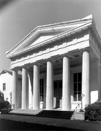
Caption: 'The principal church in Charleston, South Carolina.--see page 147.' [full date Feb. 16, 1861.]
Date:
1977-1983
Description:
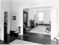
286 Calhoun Street, Jonathan Lucas House, ca. 1809. Main House - Interior View. 1st Floor - SE Room, Detail of door to hallway, West elevation. 4" x 5" B/W photo.
Date:
1977-1983
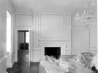
Description:
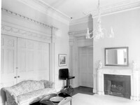
172 Rutledge Avenue, Ashley Hall, ca. 1802. Main House - Interior View. 1st Floor - SE Room, NE corner. 4" x 5" B/W photo.
Date:
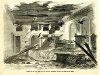
1865
Description:
Caption: 'Interior of the State Bank of South Carolina, Charleston, showing the effect of our shells.' [full date April 1, 1865.]
Date:
1977-1983
Description:
Charleston County, Oak Island Plantation, ca. 1830. Interior View. 1st Floor - South Entry Hall, looking North. 4" x 5" B/W photo.
Date:
1977-1983
Description:
Charleston County, Oak Island Plantation, ca. 1830. Interior View. 1st Floor - SW Room, North wall. 4" x 5" B/W photo.
Date:
1977-1983
Description:
Charleston County, Oak Island Plantation, ca. 1830. Detail View of portico entry, South (Front) elevation. 4" x 5" B/W photo.
Date:
1977-1983
Description:
105 Meeting Street, Hibernian Society Hall, ca. 1840. Interior View. Ground Floor - Rotunda, Detail of entry doors, West elevation. 4" x 5" B/W photo.
Date:
1977-1983
Description:
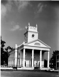
90 Hasell Street, Synagogue of Kahal Kadosh Beth Elohim, ca. 1840. View of West (Front) elevation. 4" x 5" B/W photo.
Date:
1977-1983
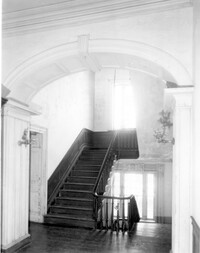
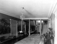
Description:
48 Elizabeth Street, Aiken-Rhett House, ca.1818. Main House - Interior View. 2nd Floor - Hall, looking North towards Stair Hall. 4" x 5" B/W photo.
Date:
1977-1983
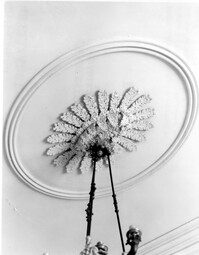
Description:
48 Elizabeth Street, Aiken-Rhett House, ca.1818. Main House - Interior View. 2nd Floor - Hall. Detail of ceiling medallion. 4" x 5" B/W photo.
Date:
1977-1983
Description:
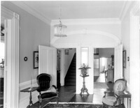
Berkley County, Mulberry Plantation, ca. 1714. Main House - Interior View. 1st Floor - SW Room. Detail of cornice, North wall. 4" x 5" B/W photo.
Date:
1977-1983
Description:
64 South Battery, William Gibbes House, ca. 1772. Main House - Interior. 1st Floor - Hall (from the front entry), North elevation. 4" x 5" B/W photo.
Date:
1977-1983
Description:
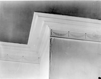
64 South Battery, William Gibbes House, ca. 1772. Main House - Interior. 1st Floor - Hall. Detail of door cornice and frieze. 4" x 5" B/W photo.
Date:
1977-1983
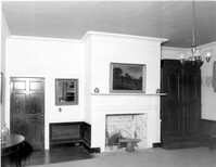
Description:
48 Elizabeth Street, Aiken-Rhett House, ca.1818. Main House - Interior View. 1st Floor - East Room. Detail of mantle. 4" x 5" B/W photo.
Date:
1977-1983
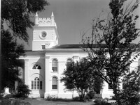
Description:
126 Coming Street, Cathedral Church of St. Luke and St. Paul, ca. 1816. View of South (Side) elevation. 4" x 5" B/W photo.
Date:
1977-1983
Description:
126 Coming Street, Cathedral Church of St. Luke and St. Paul, ca. 1816. View of North (Side) elevation. 4" x 5" B/W photo.
Date:
1977-1983
Description:
126 Coming Street, Cathedral Church of St. Luke and St. Paul, ca. 1816. View of East (Rear) elevation. 4" x 5" B/W photo.
Date:
1977-1983
Description:
126 Coming Street, Cathedral Church of St. Luke and St. Paul, ca. 1816. View of West (Front) elevation. 4" x 5" B/W photo.
Date:
1977-1983
Description:
8 South Battery, Colonel William Washington House, ca. 1768. Main House - Detail View of 1st Floor window. 4" x 5" B/W photo.
Date:
1865
Description:
[Color image.] Caption: 'Feeding 8,000 people with rations of rice and salt at West Point Mills, on the Ashley River, Charleston S.C.-- From a sketch by our Special Artist, W.T. Crane.' [full date April 15, 1865.]
Date:
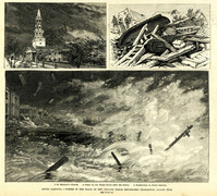
1885
Description:
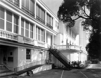
Main caption: 'South Carolina.--scenes in the track of the cyclone which devastated Charleston, August 25th. See page 43. 1. St. Michael's Church [upper left]. 2. Scene on the water front after the storm [top right]. 3. Destruction on South Battery [bottom].' [full date September 5, 1885.]
Date:
1977-1983
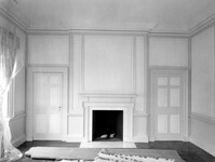
Description:
48 Elizabeth Street, Aiken-Rhett House, ca.1818. Main House - Interior View. 1st Floor - SW Room. Detail of mantle. 4" x 5" B/W photo.
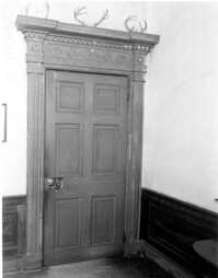
Date:
1977-1983
Description:
48 Elizabeth Street, Aiken-Rhett House, ca.1818. Main House - Interior View. 1st Floor - Detail of door and case 4" x 5" B/W photo.
Date:
1977-1983
Description:
48 Elizabeth Street, Aiken-Rhett House, ca.1818. Main House - Interior View. 1st Floor - East Room, East wall. 4" x 5" B/W photo.
Date:
1977-1983
Description:
16 Meeting Street, Calhoun Mansion, ca. 1876. Detail View of entry portico cornice and 3rd Floor center window, West (Front) elevation. 4" x 5" B/W photo.
Date:
1977-1983
Description:
Charleston County, Cassina Point Plantation, ca. 1847. Interior View. 1st Floor - SW Room, Looking to NE corner of SE Room. 4" x 5" B/W photo.
Date:
1977-1983
Description:
Charleston County, Cassina Point Plantation, ca. 1847. Interior View. 1st Floor - North Central Stair Hall, looking North. 4" x 5" B/W photo.
Date:
1977-1983
Description:
Charleston County, Cassina Point Plantation, ca. 1847. Interior View. 2nd Floor - Hall, looking South from landing. 4" x 5" B/W photo.
Date:
1977-1983
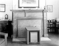
Description:
Berkley County, Loch Dhu, ca. 1812. Main House - Interior View. 1st Floor - SW Room, North wall. Detail of cornice. 4" x 5" B/W photo.
Date:
1977-1983
Description:
Berkley County, Loch Dhu, ca. 1812. Main House - Interior View. 1st Floor - SE Room, North wall. 4" x 5" B/W photo.
Date:
1977-1983
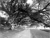
Description:
Berkley County, Mulberry Plantation, ca. 1714. Driveway - View of Live Oak trees. From West, looking East. 4" x 5" B/W photo.
Date:
1977-1983
Description:
6 Glebe Street, St. Philip's Parsonage House (Bishop Robert Smith House), ca. 1770. Interior View. 1st Floor - SW Room, North wall. 4" x 5" B/W photo.
Date:
1977-1983
Description:
6 Glebe Street, St. Philip's Parsonage House (Bishop Robert Smith House), ca. 1770. Interior View. 2nd Floor - SE Room, North wall. 4" x 5" B/W photo.
Date:
1977-1983
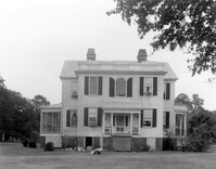
Description:
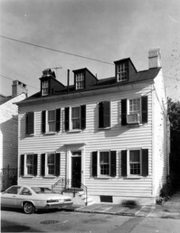
Berkley County, Stephen Williams House, ca. 1842. View of South (Rear) elevation. 4" x 5" B/W photo.
Date:
1977-1983
Description:
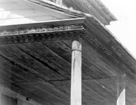
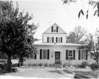
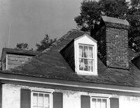
143 - 145 Church Street, Alexander Perronneau Tenements, ca. 1740. Detail View of roof, dormer, cornice and chimney, East (Front) elevation. 4" x 5" B/W photo.
Date:
1977-1983
Description:
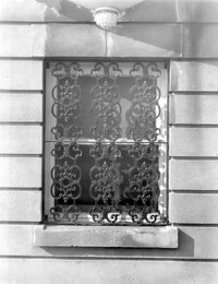
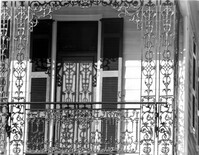
56 South Battery, Osborn-McCrady House, ca. 1770. Detail View of 2nd Floor ironwork, South (Front) elevation. 4" x 5" B/W photo.
Date:
1977-1983
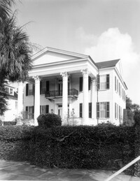
Description:
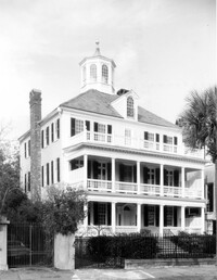
32 South Battery, Colonel John Ashe House, ca. 1762. Main House - View of SW (Front and Side) elevation. 4" x 5" B/W photo.
Date:
1977-1983
Description:
81 Rutledge Avenue, Glover-Sottile House, ca. 1826. Detail View of entry, East (Front) elevation. 4" x 5" B/W photo.
Date:
1977-1983
Description:
31 Legare Street, Hannah Heyward House, ca. 1789. Stable - View of North (Side) elevation. 4" x 5" B/W photo.
Date:
1977-1983
Description:
82 - 86 Broad Street, ca 1753. Detail View of columns (East end), South (Rear) elevation. 4" x 5" B/W photo.
Date:
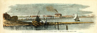
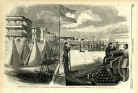
1861
Description:
Caption: 'The Battery or Park Promenade at Charleston, South Carolina, during the bombardment of Fort Sumter--Sketched by our Special Artist--[see next page].' [full date May 18, 1861.]