Search
Search Results
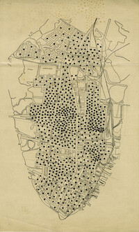
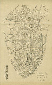
- Description:
- Map of peninsula.
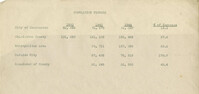
- Description:
- Document on population figures.
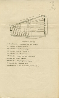
- Description:
- Map of area bounded by Archdale, Market, King and Beaufain Streets.
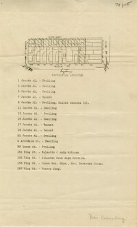
- Description:
- Map of area bounded by Jacob's Alley, Queen, King, and Archdale Street.
- Description:
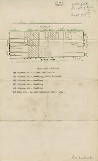
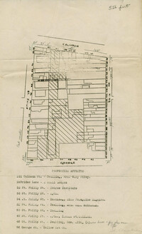
- Map of area bounded by Burns Lane, Meeting, Calhoun, and King Street.
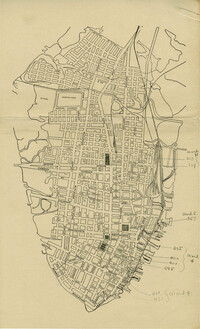
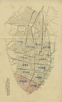
- Description:
- Map of peninsula.
- Description:
- Map of peninsula.
- Date:
- 1940
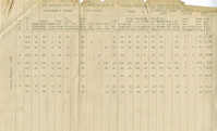
- Description:
- Document on census figures from 1940.
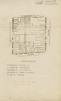
- Description:
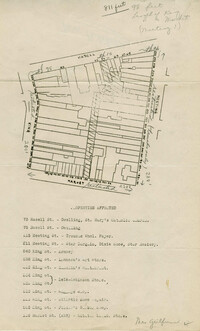
- Map of area bounded by Wentworth, Meeting, and Hasell Street.
- Description:
- Map of area bounded by Horlbeck Alley, Meeting, and Queen Street.
- Description:
- Map of peninsula.
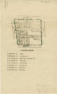
- Description:
- Map of area bounded by Beaufain, St. Philip, Wentworth, and King Street.
- Description:
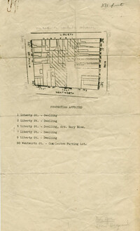
- Map of area bounded by Wentworth, King, Liberty, and St. Philip Street.
- Description:
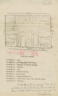
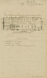
- Map of area bounded by Society, Meeting, George, and King Street.
- Description:
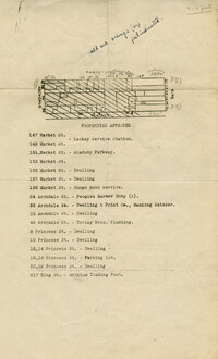
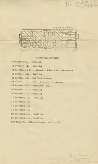
- Map of area bounded by Market, King, Princess, and Archdale Street.
- Description:
- Map of area bounded by Jacob's Alley, Archdale, Clifford, and King Street.
- Description:
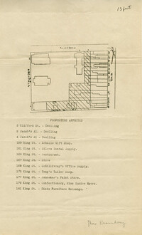
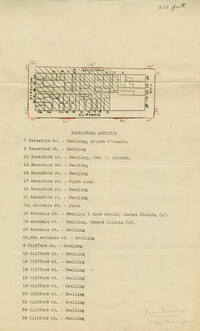
- Map of area bounded by Clifford, King, Beresford, and Archdale Street.
- Description:
- Map of area bounded by Princess, King, Beresford, and Archdale Street.
- Description:
- Map of area bounded by Liberty, King, George, and St. Philip Street.
- Description:
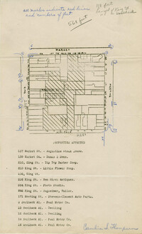
- Map of area bounded by Hasell, Meeting, King and Market Street.
- Description:
- Map of area bounded by Horlbeck Alley, King, Market, and Meeting Street.
- Description:
- Map of area bounded by George, King, Calhoun, and St. Philip Street.
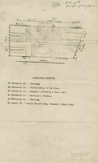
- Description:
- Map of area bounded by Wentworth, King, Beaufain, and St. Philip Street.
- Description:
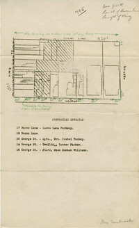
- Map of area bounded by Burns Lane, George, Meeting, and King Street.
- Description:
- Map of area bounded by Society, Meeting, Wentworth, and King Street.
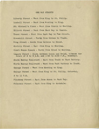
- Description:
- Document listing one way streets.
- Date:
- 1944