Search Home
Search in
search for
Simple Search
Page Content Search
Title Search
Creator Search
Subject Search
Search
search icon
Search
Search Constraints
Start Over
You searched for:
Media Type
Maps
✖
Remove constraint Media Type: Maps
Date Range (beta)
1890
to
1894
✖
Remove constraint Date Range (beta): <span class="from" data-blrl-begin="1890">1890</span> to <span class="to" data-blrl-end="1894">1894</span>
« Previous |
1
-
10
of
28
|
Next »
Sort
by Relevance
Relevance
Title
Date (Newest)
Date (Oldest)
Number of results to display per page
10
per page
10
per page
20
per page
50
per page
100
per page
View results as:
list icon
List
masonry icon
Masonry
Search Results
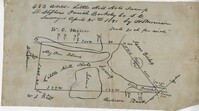
St. Stephen's Parish Plat 1891
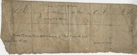
Santee River Plat 1890
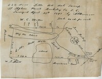
Little Hell Hole Swamp Plat 1891
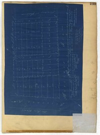
City Engineers's Plat Book, 1671-1951, Page 239
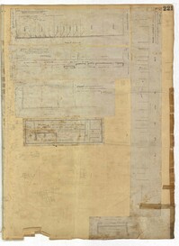
City Engineers's Plat Book, 1671-1951, Page 221
City Engineers's Plat Book, 1671-1951, Page 224
City Engineers's Plat Book, 1671-1951, Page 226
City Engineers's Plat Book, 1671-1951, Page 218
City Engineers's Plat Book, 1671-1951, Page 219
City Engineers's Plat Book, 1671-1951, Page 217
« Previous
Next »
1
2
3
Limit your search
Collection
City Engineers's Plat Book, 1671-1951
25
John McCrady Plats and Deeds Collection
3
Contributing Institution
City of Charleston
25
The Charleston Archive at CCPL
25
South Carolina Historical Society
3
Media Type
Maps
✖
[remove]
28
Subject (Topic)
Cadastral maps
25
Surveys
25
Conveyancing--South Carolina
3
Maps
3
Surveying--South Carolina
3
Subject (Geographic)
Charleston (S.C.)
25
Santee River (S.C.)
1
Date
1891
11
1893
10
1892
8
1894
4
1884
3
1871
2
1873
2
1881
2
1883
2
1890
2
more
Date
»
Date Range (beta)
1890
to
1894
✖
[remove]
28
1890
to
1890
3
1891
to
1891
10
1892
to
1892
3
1893
to
1893
10
1894
to
1894
2
Current results range from
1890
to
1894
Date Range (beta) range begin
Date Range (beta) range end
View larger »