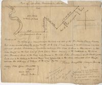
500 Acre plantation, on the northeast side of the south Edisto River, neighbors the 416/2-13 plat, the 416/2-13 is added in pencil over the writing at the bottom of the plat, no land type or detail. Names associated with this plat are John Gerardeau, Charles Craven, William Livingston, Thomas Broughton, and Charles Parker. Notable geographic locations include South Edisto River and Colleton County.
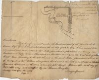
150 acre plot budding and bounding on the east side of the Edisto River, shows south Edisto River and surrounding plot owners, no land detail. Names associated with this plat are John Gerardeau, William Livingston, Charles Gruren, and Thomas Broughton. Notable geographic locations include South Edisto River and Colleton County.
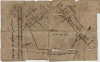
Copy of plat of 342 acres on Johns Island. Very little detail, just an outline of the property with trees on the edges. Names associated with this plat are Thomas Ladson, Hanscome, Allen, William Wallisby, Robert Murens, and Brocher. Geographic locations are the Stono River, Colleton County and Johns Island.
180 plot of land given to Elisa [Pennison], shows the budding and bounding of neighboring plantations with no land type or detail. Names associated with this plat include Thomas Pennison, Elisa Pennison, C. Perriman, Thads, Smith and Charles Grady.
Plat of 88 acres near Stono Island in Colleton County. Little detail drawn into the plat. Names associated with this plat are Francis Hoxt, Stanyard, and Hock.
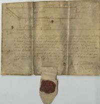
Plat of 100 acres of land conveyed by William Norman to Edward Keating situated at Goose Creek. Names associated with this plat are Edward Keating, William Norman, John Bayly, and Moultrie. Notable geographic locations are Goose Creek.
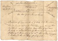
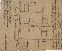
156 acres laid out to John Bayly and granted to the said John Bayly in 1698 in Colleton County. Names associated with this plat are George Mitchell, John Bayly, and John Andrews.
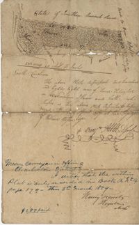
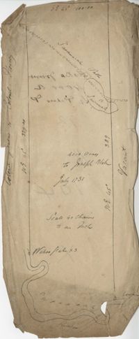
Plat consists of 4,000 acres in St. Peter’s Parish belongs to Joseph Blake granted July 1731. Names associated with this plat are Joseph Blake, Horrey and Stevens. Notable locations include St. Peter's Parish, Savannah River and Savannah Path.
1100 acres of land belonging to Thomas Woodward on the east and west side of Fish Pond Creek known as Ashepoo River. Names associated with this plat are Thomas Woodward, Elizabeth Woodward, James St. John, Billinger, and Blaky, and William. Notable geographic locations include Ashepoo River and Fish Pond Creek.
650 acres belonging to Thomas Cordes on eastwest side of Fishpond Creek/ Ashepoo River bounding northwest on Elizabeth Woodward and south by Captain John Gibbes. Names associated with this plat are Thomas Cordes, Elizabeth Woodward, Captain John Gibbes, and Robert Johnson. Notable geographic locations include Fishpond Creek, the Ashepoo River and St. Bartholomew's Parish.