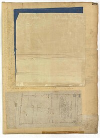
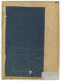
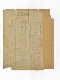
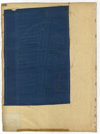
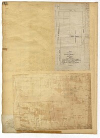
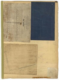
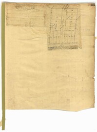
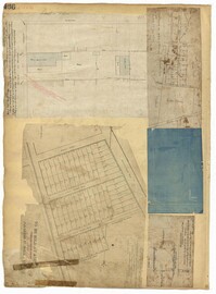
Page 241 of the City Engineer's Plat Book with one plat. The plat shows lots on and near King Street, Baxter Street, and Lenox Street. It also shows the end of Sans Souci Street.
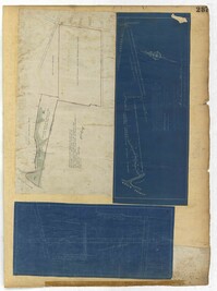
Page 259 of the City Engineer's Plat Book with three plats. Plat 1 shows lots located between Hester Street and Piedmont Street. Plat 1 also shows Alberta Street, Poplar Street, and a stretch of marsh land. Plat 2 shows lots located between Tradd Street, Ashley Street, and Murray Boulevard. Plat 2 also shows South Bay Street. Plat 3 shows a city block between Hester Street and Piedmont Avenue, and between Poplar Street and Alberta Avenue.
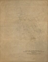
Linen map showing distribution of schools in Charleston from Murray Boulevard to the northern limits of the city at Mount Pleasant Road. Map shows school district lines, developed and undeveloped school properties and racial population disbursement indicated by white circles for white residents and black circles for black residents. Map is found on page 11 of the Report of the City Planning and Zoning Commission. Map measures 41.25" by 59".
Linen map showing existing and proposed parks; thoroughfares; schools; residential, business, and industrial districts; and suggested streets from Murray Boulevard to the northern limits of the city at Mount Pleasant Road. Residential districts are identified by racial makeup and labeled as white residence and colored residence districts. Map is found on page 11 of the Report of the City Planning and Zoning Commission. Map measure 41" by 59".
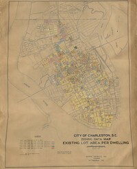
Hand-colored, linen map showing Charleston peninsula existing lot area per dwelling from Murray Boulevard to the northern limits of the city at Mount Pleasant Road. The maps shows lots less than 1,000 square feet; lots more than 1,000 square feet and less than 1,500 square feet; lots more than 1,500 square feet and less than 2,500 square feet; lots more than 2,500 square feet and less than 3,000 square feet; lots more than 3,000 square feet and less than 4,500 square feet; and lots greater than 4,500 square feet. Map measure 47" by 63".
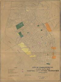
Hand-colored, linen map showing existing city properties including parks, playgrounds, port utilities, public buildings, fire stations, municipal service properties, and miscellaneous properties from Murray Boulevard to the northern limits of the city at Mount Pleasant Road. Map measures 42" by 60".
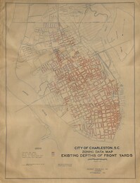
Hand-colored, linen map showing Charleston peninsula existing depths of front yards (5 feet and under, 6 to 14 feet, 15 to 24 feet, 25 feet and over). Map reflects Murray Boulevard to the northern limits of the city at Mount Pleasant Road. Map measures 47" by 63".
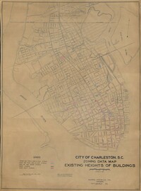
Hand-colored, linen map showing Charleston peninsula heights of buildings from Murray Boulevard to the northern limits of the city at Mount Pleasant Road. Height in stories is indicated by color coding. Map shows buildings of three stories or more. Map measures 42" by 60".
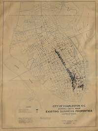
Hand-colored, linen map showing Charleston peninsula existing business properties, public garages, and gasoline service stations from Murray Boulevard to the northern limits of the city at Mount Pleasant Road. Map measures 46.75" by 63".
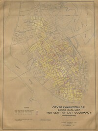
Hand-colored, linen map showing Charleston peninsula lot occupancy from Murray Boulevard to the northern limits of the city at Mount Pleasant Road. Map is color coded to show lot occupancy percentages on the peninsula. Map measures 46.5" x 63".
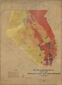
Hand-colored, linen map showing proposed height and area districts for the city of Charleston. Map shows eight height and area districts from Murray Boulevard to the northern limits of the city at Mount Pleasant Road. Map measures 42" by 60".
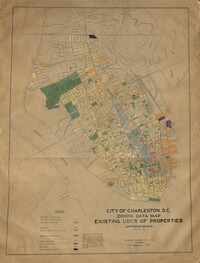
Hand-colored, linen map showing Charleston peninsula existing lot uses from Murray Boulevard to the northern limits of the city at Mount Pleasant Road. Map shows one, two, and multiple dwelling units, service stations, garages, industrial sites, and railroads. Information on map was compiled during field observations made from October through December 1930. Map measures 46.25" by 63."
Map of the Charleston peninsula with historic points of interest identified and noted. Includes a welcome to visitors by Mayor Burnet R. Maybank and a map of "The Garden Club Walk" route. "Released by the Office of Port Development." Measures 16" x 22".
Page 256 of the City Engineer's Plat Book with four plats. Plat 1 shows land located between Elliot Street and Boundary Street, near Mill Street, Bee Street, President Street, and Doughty Street. It also shows several streams, a mill pond, and a large stretch of marsh land. Plat 2 shows a lot on Brigade Street. The third plat shows a lot and building located on the corner of Grove Street and Russell Street. The fourth plat shows lots located near the intersection of Grove Street and Tracy Street.
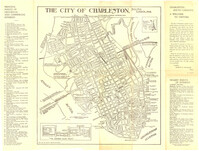
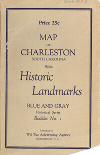
Map of the Charleston peninsula featuring points of interest. Cover title: Map of Charleston, South Carolina with historic landmarks. Blue and gray historical series, booklet no. 1. Published by Wil-Tuc Advertising Agency. Map measures 21” x 6.25” folded to create 13 pages measuring 6.25” x 3.5.
Page 257 of the City Engineer's Plat Book with two plats. Plat 1 shows lots located between St. Margaret Street and Grove Street. Plat 2 shows lots located along Marsh Street and Concord Street, near where they intersect with Laurens Street.
Page 255 of the City Engineer's Plat Book with two plats. Plat 1 features lots located between St. Margaret Street and Grove Street, and between Tenth Street and Eleventh Street. Plat 2 features lots and structures located on the intersection of Aiken Street and Hampden Court.
Page 45 of the City Engineer's Plat Book with nine plats. Plat 1 shows lots along New Street, located between Broad Street and Tradd Street, and shows an area labelled "City marshland." Plat 2 shows lots and buildings located between Queen Street and Cliffords Alley. Plat 3 shows land located near the intersection of Washington Street and Smith Street. Plat 4 shows lots and buildings located near the intersection of Green Street and "Comming Street." Plat 5 shows land located between "Boundary (Calhoun) Street" and George Street, and St. Phillip Street and "Comming Street," including a stretch of Green Street and College Street, and a lot labelled "College Lot." Plat 6 shows a lot located on the corner of Queen Street and King Street, and its buildings. Plat 7 shows lots located on Savage Street. Plat 8 shows lots located on Beaufain Street. Plat 9 shows lots near King Street, located between Boulevard Drive and South Bay Street.
Page 202 of the City Engineer's Plat Book with one plat. The plat shows lots located between Brigade Street and Williman Street, and between Meeting Street and a strip of land labelled "Atlantic Coast Line R.R." It also shows Nassau Street and Doran Street.
Page 35 of the City Engineer's Plat Book with five plats. Plat 1 shows land located near a creek with large portions marked with a different color. The plat shows a square labelled as "The Mall," and numerous streets, including Bay Street, Drake Street, America Street, Hanover Street, Columbus Street, Cooper Street, Blake Street, Amhurst Street, and Reid Street. There's also a stretch labelled as "Braggs Marsh." Plat 2 shows lots located between Congress Street and Mount Street, including a stretch of Hope Place. Plat 3 features a building labelled "Exchange," on East Bay Street, and near Gibbes Street and Champney Street. Plat 4 shows land with a partition wall and kitchen yards. Plat 5 shows land located near the "Citadel Athletic Field" and Grove Street.
Page 215 of the City Engineer's Plat Book with two plats. Plat 1 shows land located between Calhoun Street and Bull Street, and between Lynch Street and Rutledge Street. Plat 2, located inside a folding insert, shows land along Moultrie Street. Plat 2 also includes Hanover Street, Hill Street, Huger Street, Nassau Street, Meeting Street, Hampton Street, King Street, a lot labeled "Chas. Gas Light Co.," labels for high land, labels for marsh land, and a structure located on Hampton Street.
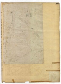
Page 210 of the City Engineer's Plat Book with two plats. Plat 1 features land set aside for a park, located between Lynch Street and Rutledge Street, and between Bennett Street and Calhoun Street. Plat 2 shows lots located between Simons Street and Gordon Street, near where they intersect with Rutledge Avenue.
Page 252 of the City Engineer's Plat Book with two plats. Plat 1 shows lots on and near Lenwood Street, between South Bay Street and Boulevard Drive. Plat 2 shows lots located on and near the intersection of Huger Street and Rutledge Avenue.
Page 250 of the City Engineer's Plat Book with one plat. The plat shows lots between Romney Street and Williman Street, and east of Meeting Street. The plat also shows Isabella Street.
Page 246 of the City Engineer's Plat Book with one plat. The plat shows lots located between Rutledge Avenue and the Ashley River. Groups of lots are labelled with red letters. The plat also shows Darlington Avenue, Ashley Avenue, Piedmont Avenue, Hester Street, Clemson Street, Maple Street, Peachtree Street, Poplar Street, Pendleton Street, and Sans Souci Street.
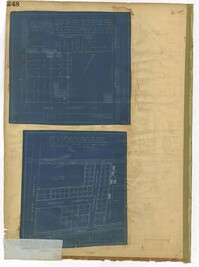
Page 248 of the City Engineer's Plat Book with two plats. Plat 1 shows lots and structures located between Wescott Court and President Street, north of Bee Street. Plat 2 shows lots on and near Huger Street, King Street, Congress Street, and Benson Street.
Page 251 of the City Engineer's Plat Book with two plats. Plat 1 shows Meeting Street, Williman Street, and Romney Street. Plat 2 shows lots located on and near America Street, Lee Street, Cooper Street, and Drake Street.
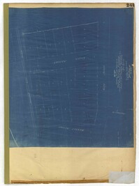
Page 244 of the City Engineer's Plat Book with three plats. Plat 1 shows lots and structures located along Maple Street, near where it intersects with Meeting Street. Plat 2 features a lot located on the east side of Tenth Street, between St. Margaret Street and Grove Street. Plat 3 shows land located near the intersection of State Street and Cumberland Street.
Page 247 of the City Engineer's Plat Book with one plat. The plat shows lots located from the west side of Ashley Avenue to King Street, between Mount Pleasant and Sans Souci Street. The plat also shows Darlington Street, Rutledge Avenue, Magnolia Street, Tracy Street, and Laurel Avenue.
Page 245 of the City Engineer's Plat Book with two plats. Plat 1 shows lots located on and near Seyle Street, between Huger Street and Moultrie Street. Plat 2 shows lots on and near Grove Street, between Rutledge Avenue and King Street. Plat 2 also shows Tracy Street.
Page 208 of the City Engineer's Plat Book with one plat. The plat shows streets located between the Ashley River and Rutledge Avenue. It also shows Dunnemann Avenue, Grove Street, and Wagener Avenue.
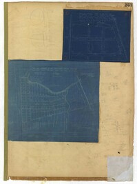
Page 243 of the City Engineer's Plat Book with three plats. Plat 1 features lots along Cumberland Street, near where it intersects with State Street. The second plat features "City Lands West of President Street and South of Congress Street." It also labels reading "Old Folks Holme," "Grave Yard Old Folks Home," "City Board of Public School Commissioners," and "Colored Industrial School." Plat 3 shows lots located west of Meeting Street, and also shows Cooper Street, Lee Street, Sheppard Street, and Sumter Street.
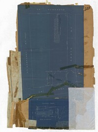
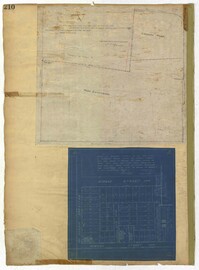
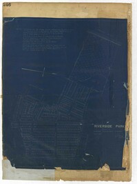
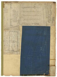
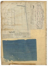
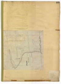
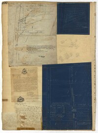
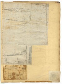
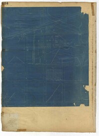
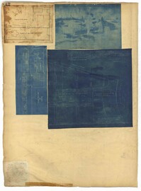
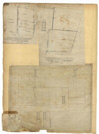
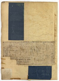
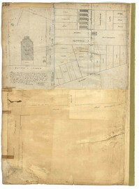
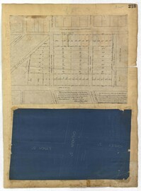
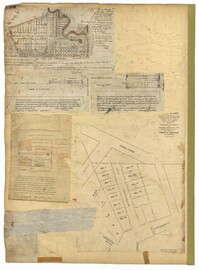
Page 240 of the City Engineer's Plat Book with one plat. The plat shows "The Property of Riverside Park Inc. and Peerless Securities Co." The streets shown include Rutledge Avenue, Sans Souci Street, Hester Street, and Ashley Avenue.
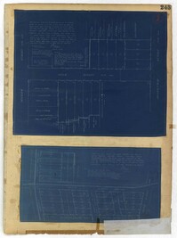
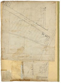
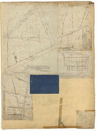
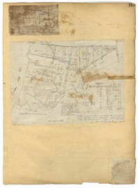
Page 242 of the City Engineer's Plat Book with one plat. The plat shows lots located on and near King Street, between Cypress Street and Romney Street. It also features a stretch of railroad track.
Page 187 of the City Engineer's Plat Book with four plats. Plat 1 shows lots and buildings located near a street. Plat 2 shows lots located on Mount Street. Plat 3 shows lots and structures located on and near King Street, between Sans Souci Road and Mount Pleasant Road. Plat 4 shows lots located on and near King Street, near its intersections with Sans Souci Street and Lenox Street.
Page 145 of the City Engineer's Plat Book with seven plats. Plat 1 shows lots located on Chapel Street, near where they intersect with Alexander Street. Plat 2 shows lots and structures located on South Street, near where it intersects with another street. Plat 3 shows lots located along Anson Street, near where it intersects with Calhoun Street. Plat 4 features lots located on the "Eastern end of Wraggs" Street. Plat 4 shows lots and structures located between Concord Street and Wharf Street, near where they intersect with Inspection Street. Plat 5 features a strip of land belonging to the Charleston Gas Light Company, located near Concord Street. It also shows a "Train-way" and a building labelled "Gas Works." Plat 7 shows lots and structures located between Line Street and Sheppard Street.
Page 192 of the City Engineer's Plat Book with five plats. Plat 1 shows lots between Congress Street and King Street, from Gadsden Street to a city block past Moultrie Street. Plat 2 shows lots between Rutledge Street and King Street, and from Moultrie Street to a lot past Gadsden Street. Plat 3 shows a city block between Moultrie Street and Huger Street, and between Payne Street and Rutledge Street. Plat 4 shows lots near Rutledge Avenue, between Grove Street and Simons Street. Plat 4 also shows a street car line on Rutledge Avenue. Plat 5 shows lots between Sumter Street and Congress Street.
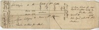
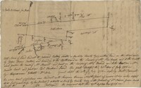
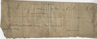
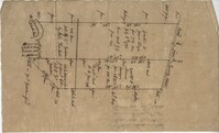
35 acres granted to John Izard in September of 1766 then sold to William B. Mitchell. Names associated with this plat are John Izard, William B. Mitchell, William Cattle, Isaac W. Mcpherson, James Brisbans, Mep Martha Miles, Samuel Wainwright, Gum Huhy [?], William Sanders. Notable geographic locations include St. Paul's Parish.
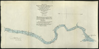
These five maps of the Waccamaw River in Horry County, S.C., show the river from Conway to Bull Creek. The surveys, dated November 1903, were performed under the direction of Captain G. P. Howell, Corps of Engineers U.S.A., and Reid Whitford, U.S. Assistant Engineer. The surveyor was William H. Johnstone.
Page 235 of the City Engineer's Plat Book with four plats. Plat 1 features a proposed right-of-way through Chicora Park, and shows a state road, Clements Avenue, Pine Avenue, and a label reading "U. S. Navy Yard." Plat 2 shows land located near the intersection of Grove Street and Rutledge Avenue, with one plot labeled "Trustees of the Endowment Fund of the Charleston Library Society." Plat 3 shows lots, structures, and marshland located on and near the Ashley River, north of Congress Street. the fourth plat is a pencil-sketched map showing land located near the intersection of Rutledge Avenue and Grove Street.
Page 236 of the City Engineer's Plat Book with one plat. The plat features lots located between Romney Street and Cypress Street, and between King Street and a stretch of railroad tracks. Writing in red reads "See Page #242."
Page 237 of the City Engineer's Plat Book with three plats. Plat 1 shows "property situated on the west side of Rutledge Avenue," most of which is situated between Grove Street and Moultrie Street. Plat 1 also marks a "Brick Dwelling" and a stretch of marsh land. Plat 2 features land labeled "Trustees of the Endowment Fund of the Charleston Library Society," located between Rutledge Avenue and the Ashley River. Plat 3 shows land located on Huger Street, between King Street and Meeting Street.
3.71 Acres of highland near marsh adjacent to Meeting Street Road. Names associated with this plat are Karl W. Ruth, A.F.C. Kramer, and S. Louis Simons.
Page 176 of the City Engineer's Plat Book with three plats. Plat 1 shows lots located between Meeting Street and land owned by the South Carolina Railroad Company. Plat 2 shows lots located near the intersection of King Street and Line Street. Plat 3 features a proposed road from Clements Ferry Road to Chicora Park. It also shows a stretch of pine woods and a stretch of land labelled as "Bottom."
Page 172 of the City Engineer's Plat Book with three plats. Plat 1 features a stretch of land located between Nassau Street and "Town Creek," and between Mary Street and Cooper Street. Plat 2 shows lots located near Division Street, Cleland Street, Union Street, and "Town Creek." Plat 3 shows lots located between President Street and Norman Street, near where it intersects with Spring Street.
Page 102 of the City Engineer's Plat Book with five plats. Plat 1 shows lots along a stretch of Rutledge Avenue from Grove Street to Sans Souci Street. Plat 2 features a projected extension of Rutledge Avenue from Mt. Pleasant Road to Heriot Street, and also shows a lot labelled "S.C. Agricultural Society." Plat 3 shows a projected extension Rutledge Avenue, extending from Sans Souci Street to Mt. Pleasant Road. Plat 4 shows a projected expansion of Rutledge Avenue through Heriot Street, and also shows a plot labelled "Agricultural Society." Plat 5 shows a projected extension of Rutledge Avenue from Grove Street to Simons Street, and also shows King Street.
Page 103 of the City Engineer's Plat Book with three plats. Plat 1 shows lots located between President Street and Norman Street, near where they intersect with Spring Street. Plat 2 shows lots and some buildings along Bogard Street, between Laurel Street and Percy Street. Plat 3 shows a lot and several buildings located on Percy Street.
Page 219 of the City Engineer's Plat Book with one plat. The plat features proposed streets on "Part of the West Point Mill Property," including an extension of Calhoun Street. The plat also shows a dam, a storehouse, and a creek.
Page 217 of the City Engineer's Plat Book with one plat. The plat features city lands known as Potters Field. It also shows streams, marshland, President Street, Mount Street, Fishburne Street, Line Street, and Congress Street.
Page 221 of the City Engineer's Plat Book with six plats. Plat 1 shows lots along Payne Street, between Mount Street and Fishburne Street. Plat 2 shows lots along Lucas Street, near its intersections with Doughty Street and Mill Street, including a lot labelled "City Hospital." Plat 3 shows lots located along Kirkland Lane, between Wentworth Street and Beaufain Street. Plat 4 shows lots located near the intersection of Gadsden Street and Beaufain Street. Plat 5 shows lots located along Lightwood Alley, between Meeting Street and Church Street. Plat 6 shows a lot and building located on Cannon Street, Between Coming Street and a label reading "Church."
Page 226 of the City Engineer's Plat Book with one plat. It shows lots located between Rutledge Avenue and King Street, and between Race Street and Sheppard Street.
Page 195 of the City Engineer's Plat Book with five plats. Plat 1 shows land located near King Street, Congress Street, and Moultrie Street. Plat 2 shows land located near the intersection of King Street and Simons Street. Plat 3 shows land located near Hassel Street and Pinckney Street. Plat 3 also shows marshland, reclaimed land, several dams, the "Cemetery of the City of Charleston." Plat 4 shows lots located between King Street and Congress Street, and between Moultrie Street and King Street. Plat 5 features lots between Drake Street and America Street, along Cooper Street.
Page 200 of the City Engineer's Plat Book with three plats and two letters written to C.S. Gadsden. Plat 1 shows lots located near President Street, between Spring Street and Line Street, and includes Boigard Street and a projected Kennedy Street. Plat 2 shows lots near President Street, between Line Street and Kennedy Street. Plat 3 shows lots between Line Street and Spring Street, near Rutledge Street.
Page 196 of the City Engineer's Plat Book with two plats. Plat 1 shows land near the intersection of King Street and Mount Pleasant Street. Plat 2 shows land located near King Street, Mount Pleasant Road, and Sans Souci Street.
Page 191 of the City Engineer's Plat Book with two plats. Plat 1, on the inside of the folded paper, shows lots located between King Street and Rutledge Avenue, and between a city block on Grover Street and a city block on Frances Street. The other plat, on the outside of the folded paper, shows a similar area with less detail.
Page 178 of the City Engineer's Plat Book with five plats. Plat 1 shows lots and structures located on and near King Street, near the intersection with "Shepheard" Street. Plat 2 shows lots located on and near Spring Street, King Street, and Meeting Street. Plat 3 shows lots and a building located near the intersection of King Street and Sheppard Street. Plat 4 shows lots located on a city block between Cooper Street and Lee Street, and between Aiken Street and America Street. One lot is labelled "Baptist Church Lot." Plat 5 shows Cooper Street, Aiken Street, Lee Street, and America Street.
Page 155 of the City Engineer's Plat Book with three plats. Plat 1 features a tract of land located between Calhoun Street and Bennett Street, and between Lynch Street and Rutledge Street. Plat 2 shows lots and structures located on Vanderhorst Street. Plat 3 shows lots and structures located on St. Philips Street.
Page 143 of the City Engineer's Plat Book with two plats. Plat 1 shows land located near the intersection of Washington Street and Chapel Street, with two wharfs and the "site of the creek in 1801." Plat 2 shows lots and structures located on the west side of Washington Street.
Page 116 of the City Engineer's Plat Book with three plats. Plat 1 shows lots and structures located near the intersection of Meeting Street and Ladson's Court. Plat 2 features a proposed extension of Ladson's Court. Plat 3 shows lots located south of Tradd Street. Plat 3 also shows Gibbes Street, Council Street, a line marking the low water, and a line marking the edge of the channel.
Page 218 of the City Engineer's Plat Book with two plats. Plat 1 features a proposed extension to Boigard Street, located between Ashley Street and Rutledge Avenue. Plat 1 also shows Payne Street, Line Street, and a lot labeled "Thompson's Garden." Plat 2 shows lots and structures located between St. Philips Street and King Street, and between Radcliffe Street and Warren Street.
Page 181 of the City Engineer's Plat Book with one plat. The plat features a survey of Mount Pleasant Farm, focusing on "High land" and "Marsh." The plat also shows the city boundary, several structures, marsh leading to the Ashley River, Hester Street, Sans Souci Street, and Mount Pleasant Road.
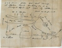
483 acre plot of Little Hell Hole Swamp, includes islands and surrounding property owners doesn't include land detail. Names associated with this plat are H.S. Morrison, Isaac Bishop, W.C. Miller, W.J. Ball, and Anderson. Notable geographic locations include St. Stephens Parish, Hog Pen Island, Little Hell Hole Swamp, and Berkeley County.
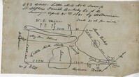
480 acre lot called Little Hell Hole Swamp, includes two islands and surrounding property owners, doesn't include land type. Names associated with this plat are H. Morrison, W.C. Miller, W.J. Ball, Issac Bishop and Anderson. Notable geographic locations include Hog Pen Island, Berkeley County, St. Stephen's Parish, and Little Hell Hole Swamp.
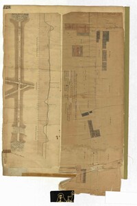
Page 224 of the City Engineer's Plat Book with one plat. The plat features lots and structures belonging to a refining company. It also shows several streams, a right-of-way for a rail line, America Street, Hanover Street, Centre Street, and Meeting Street.
Page 174 of the City Engineer's Plat Book with two plats. Plat 1 shows lots and structures located between King Street and Meeting Street. Plat 2 features a lot located on Nassau Street, near where it intersects with Stewart Street.
Page 156 of the City Engineer's Plat Book with five plats. Plat 1 shows lots and structures located on the east side of Rutledge Street. Plat 2 features a lot located on the intersection of Coming Street and Warren Street. Plat 3 shows lots and structures located on Morris Street. Plat 4 shows lots and structures located on King Street. Plat 4 shows lots and structures on and near the intersection of Calhoun Street and Lucas Street.
Page 152 of the City Engineer's Plat Book with three plats. Plat 1 shows lots and structures located on King Street. Plat 2 shows lots located on Luhn's Court, near where it intersects with Smith Street. Plat 3 shows lots and structures located on and near the intersection of Morris Street and King Street.
Page 142 of the City Engineer's Plat Book with four plats. Plat 1 shows lots and structures located on the corner of Meeting Street and Burns Lane, with one lot labeled "Property of Charleston High School." Plat 2 shows lots located on Pitt Street. Plat 3 shows lots and structures located on Pitt Street. Plat 4 shows land located between Broad Street and Wentworth Street, and between Lynch Street and the Ashley River. Plat 4 also shows a line labelled "Low Water Mark of Ashley River," Comings Creek, and a "City Mud Flat, lying North of Creek."
Page 121 of the City Engineer's Plat Book with six plats. Plat 1 shows lots located near the intersection of Washington Street and Society Street. Plat 2 shows lots located on East Bay Street. Plat 3 shows lots and structures located near the intersection of Wall Street and Minority Street. Plat 4 shows lots located between Concord Street and Wharf Street. Plat 5 shows lots and buildings on Cumberland Street. Plat 6 shows lots and structures located on and near Broad Street.
Page 115 of the City Engineer's Plat Book with four plats. Plat 1 shows land located near Broad Street, Short Street, Franklin Street, and Queen Street. Plat 2 shows lots and structures located on King Street. Plat 3 shows lots and structures located on Franklin Street. Plat 4 shows lots and structures located on Queen Street.
Page 110 of the City Engineer's Plat Book with three plats. Plat 1 shows lots located near the corner of Champney Street and Exchange Street, including labels for brick buildings, a label reading "EAST SHORE TERMINAL." Plat 2 shows lots and structures located near South Bay Street, between Church Street and Meeting Street. Plat 3 shows lots and some structures located near the intersection of Bogard Street and Percy Street.
Plat contains land on the Santee River; acreage unknown. No structures are included. Names associated with this plat are S.G. Staney, A.M. Rickenbacher, and Fred J. Smith. Notable geographic locations include the Santee River.
Page 190 of the City Engineer's Plat Book with two plats. Plat 1 shows lots located along Addison's Court, between Meeting Street and a lot owned by the South Carolina Rail Road. Plat 2 shows lots along Kennedy Street, near Line Street and a stretch of Marsh.
Page 170 of the City Engineer's Plat Book with four plats. Plat 1 shows lots located between King Street and Meeting Street, and between Romney Street and Grove Street. Plat 2 shows lots located between King Street and Meeting Street, and between Brigade Street and Mount Pleasant Street. Plat 4 shows lots located on Butler Street, near its intersection with Russell Street. Plat 5 features a lot labelled "Reservoir," located between Hanover Street and America Street.
Page 204 of the City Engineer's Plat Book with one plat. The plat shows lots and structures located near the intersection of Meeting Street and Broad Street.
Page 194 of the City Engineer's Plat Book with three plats. Plat 1 shows lots located near the intersection of Line Street and Comming Street. Plat 2 shows lots and structures located near Chesnut Street. Plat 3 shows lots and structures located on and near Calhoun Street, between Meeting Street and Anson Street.
Page 179 of the City Engineer's Plat Book with two plats. Plat 1 shows lots located on and near Hinloch Court and Meeting Street. Plat 2 shows lots located between Moultrie Street and Price Street.
Page 173 of the City Engineer's Plat Book with five plats. Plat 1 shows lots and structures located near the intersection of Meeting Street and Brigade Street. Plat 2 shows lots located between Meeting Street and Lee Street, and includes a lot labeled "German Cemetery." Plat 3 shows lots located between Cunnington Avenue and Wiliman Street, and between Meeting Street and Lee Street, and shows a lot labeled "4th Brigade." Plat 4 shows lots located near Brigade Street. Plat 5 features lots located in the Village of Hampstead, between Bay Street and Town Creek.
Page 177 of the City Engineer's Plat Book with two plats. Plat 1 shows lots located between Meeting Street and King Street, near Russell Street, "Rumney" Street, and Poinsett Street. Plat 2 shows lots, structures, and streams located near Hanover Street, America Street, and Payne Street.
Page 169 of the City Engineer's Plat Book with three plats. Plat 1 shows lots and structures on and near Dehon Street, between King Street and Meeting Street. Plat 2 shows lots located between King Street and Meeting Street, south of Romney Street. Plat 3 shows lots and structures located between Chapel Street and Charlotte Street, near where they intersect with Elizabeth Street. One lot is labelled "St. Luke's Church."
Page 157 of the City Engineer's Plat Book with two plats. Plat 1 features a lot of land located on the South Side of Line Street. Plat 2 shows lots located on and near the intersection of Spring Street and Kracke's Court.
Page 154 of the City Engineer's Plat Book with three plats. Plat 1 shows lots and structures located between Radcliffe Street and Warren Street, near where they intersect with Coming Street. Plat 2 shows lots and structures located between Thomas Street and Smith Street. Plat 3 shows lots and structures located near the intersection of St. Philips Street and Vanderhorst Street. Plat 3 also includes labels reading "Kitchen building," and "Lot of the Irish Volunteers."
Page 136 of the City Engineer's Plat Book with seven plats. Plat 1 shows lots and structures located on and near the intersection of Liberty Street and St. Philips Street. Plat 2 shows lots located on Archdale Street, near Bennett's Mill Pond. Plat 3 shows lots and structures located on and near the intersection of Rutledge Street and Montague Street. Plat 4 shows lots and structures located on Archdale Street, including a building labelled "Hope Engine House." Plat 5 shows a lot located along Clifford Alley, near a lot labelled "Unitarian Church." Plat 6 shows lots located along King Street. Plat 7 shows lots located on and near Calhoun Street, located between Smith Street and Rutledge Street.
Page 138 of the City Engineer's Plat Book with three plats. Plat 1 features a lot located on Hasell Street, with a large building labelled "St. Mary's Church." Plat 2 shows lots and structures located between Rutledge Street and Trapmann Street, and between Queen Street and Broad Street. Plat 3 features a lot located on Radcliffe Street, between Rutledge Street and Smith Street.
Page 109 of the City Engineer's Plat Book with six plats. Plat 1 shows lots located near the intersection of Exchange Street and Champney Street. Plat 2 shows lots and some buildings located on Church Street. Plat 3 shows lots located along Elliott Street, between East Bay and Church Street. Plat 4 shows lots and structures located near the corner of Church Street and Atlantic Street. Plat 5 shows lots and structures located near the corner of Church Street and Atlantic Street. Plat 6 shows lots and structures located near the intersection of East Bay Street and Guignard Street.
Plan of approximately 1500 acres on Black River near Georgetown part now belonging to Kinloch and Gadsden. Names associated with this plat are Gadsden, Kinloch, Alston, Thomas Gadsden, James Lloyd, and Morreau [?] Sarrazin.
Page 228 of the City Engineer's Plat Book with two plats. Plat 1 shows the ground elevation near Mount Pleasant Street, between the Ashley River Marsh and the Cooper River Marsh. It also shows where Mount Pleasant Street intersects with Meeting Street and King Street. Plat 2 shows lots and structures located on and near Magazine Street, between Franklin Street and Smith Street.
Page 213 of the City Engineer's Plat Book with two plats. Plat 1 features lots located between Savage Street and Chisolm Street, and between Tradd Street and Broad Street. Plat 1 also shows New Street, Rutledge Avenue, Lynch Street, Trapmann Street, and a lot labelled "Chisolm Mill Property." Plat 2 shows Calhoun Street's intersections with Lynch Street and Ashley Street.
Page 117 of the City Engineer's Plat Book with two plats. Plat 1 shows lots located near the Cooper River. Plat 2 shows marshlands, bodies of water, and lots located near the Ashley River.
Page 180 of the City Engineer's Plat Book with one plat. The plat shows lots located on and near Brigade Street, Lee Street, the City Boundary, and the "N.E.R.R. Right of Way."
Page 166 of the City Engineer's Plat Book with five plats. Plat 1 shows lots and structures located near the intersection of Columbus Street and Meeting Street. Plat 2 features lots located along Moultrie Street, between Meeting Street and Russel Street. Plat 2 also shows King Street and Hampton Street. Plat 3 shows lots located between Meeting Street and a line labeled "South Carolina R. R. Company," near Romney Street, Addison Street, and Poinsett Street. Plat 4 shows a lot located on the north side of Amherst Street. Plat 5 shows lots located near the intersection of Bay Street and Blake Street.
Page 144 of the City Engineer's Plat Book with five plats. Plat 1 shows lots on and near the Cooper River channel, near Boundary Street, Charlotte Street, Washington Street, and Alexander Street. Plat 1 also shows a creek and a stretch of marshland. Plat 2 shows lots located near the intersection of South Street and America Street. Plat 3 features structures located on the intersection of South Street and America Street. Plat 4 shows lots and structures located at the intersection of President Street and Cannon's Court. Plat 5 shows lots located between Drake Street, America Street, and Alexander Street.
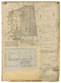
Page 134 of the City Engineer's Plat Book with eleven plats. Plat 1 shows lots and structures located on Lynch Street. Plat 2 shows a lot located on Wentworth Street, with a building labelled "Charleston Engine House." Plat 3 shows lots located near the intersection of Calhoun Street and Ogier Street. Plat 4 shows lots located on Ogier Street. Plat 5 shows lots located on Ogier Street, near its intersection with Calhoun Street. Plat 6 shows lots located along Clifford Alley, near where it intersects with Archdale Street. Plat 7 shows lots located near the intersection of Calhoun Street and Ogier Street. Plat 8 shows lots located near the intersection of Vanderhorst Street and Ogier Street. Plat 9 shows lots located near the intersection of Calhoun Street and Ogier Street. Plat 10 shows lots located on and near Boundary Street, near where it intersects with St. Philips Street. Plat 11 features a lot owned by "The Unitarian Church," located on the intersection of Archdale Street and Clifford Alley.
Page 139 of the City Engineer's Plat Book with five plats. Plat 1 shows a lot and structures located at the corner of Calhoun Street and Alexander Street. Plat 2 shows lots located on Queen Street, near where it intersects with Back Street. Plat 3 shows lots located on and near Mazyck Street, near its intersection with Magazine Street. Plat 3 also shows lots labelled "Roper Hospital Lot," and "City Lot." Plat 4 shows lots located between Vanderhorst Street and Boundary Street, and between Coming Street and Pitt Street.
Page 137 of the City Engineer's Plat Book with six plats. Plat 1 shows lots located on and near Mazyck Street, between Short Street and King Street. Plat 2 shows lots located on and near the intersection of Pitt Street and Montague Street. Plat 3 features a lot located on the intersection of Archdale Street and Berresford Street. Plat 4 features a lot located at the intersection of Queen Street and Meeting Street. Plat 5 shows a lot located at the intersection of Queen Street and King Street. Plat 6 shows lots located on and near the intersection of Mazyck Street and Magazine Street, including one labelled "Roper Hospital Lot."
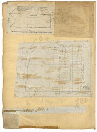
Page 123 of the City Engineer's Plat Book with six plats. Plat 1 shows lots and structures located on and near Calhoun Street, between Anson Street and Meeting Street. Plat 2 shows lots and structures located between East Bay Street and Cooper River. Plat 3 shows lots and buildings located near Meeting Street. Plat 4 shows lots near a road, and has a large hole in the middle. Plat 5 shows lots and buildings located on Beaufain Street. Plat 5 shows lots located near an intersection, and has several holes in the paper.
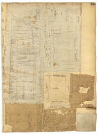
Page 122 of the City Engineer's Plat Book with three plats. Plat 1 shows lots and structures on Meeting Street. Plat 2 shows lots and structures located near the intersection of Anson Street and Laurens Street. Plat 3 shows lots located between Moultrie Street and Huger Street, near Rutledge Avenue.