Search Home
Search in
search for
Simple Search
Page Content Search
Title Search
Creator Search
Subject Search
Search
search icon
Search
Search Constraints
Start Over
You searched for:
Media Type
Maps
✖
Remove constraint Media Type: Maps
Subject (Geographic)
Charleston (S.C.)
✖
Remove constraint Subject (Geographic): Charleston (S.C.)
Date Range (beta)
Unknown
✖
Remove constraint Date Range (beta): Unknown
« Previous |
1
-
10
of
16
|
Next »
Sort
by Date (Oldest)
Relevance
Title
Date (Newest)
Date (Oldest)
Number of results to display per page
10
per page
10
per page
20
per page
50
per page
100
per page
View results as:
list icon
List
masonry icon
Masonry
Search Results
Charleston Farm Plat
Hickory Hill Plat
St. Andrew's Parish Plat
Sandy Island Plat
Ansonborough Beautification Plans
Map of the Ansonborough Rehabilitation Project
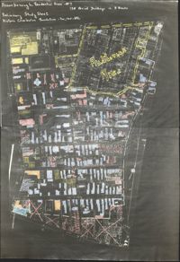
Preliminary Study Sheet
Ansonborough Rehabilitation Project
Ansonborough map
City Engineers's Plat Book, 1671-1951, Page 254
« Previous
Next »
1
2
Limit your search
Collection
City Engineers's Plat Book, 1671-1951
7
Ansonborough Rehabilitation Project
5
John McCrady Plats and Deeds Collection
4
Contributing Institution
City of Charleston
7
The Charleston Archive at CCPL
7
Historic Charleston Foundation
5
South Carolina Historical Society
4
Media Type
Maps
✖
[remove]
16
Subject (Topic)
Cadastral maps
7
Surveys
7
Conveyancing--South Carolina
4
Maps
4
Neighborhoods--Conservation and restoration--South Carolina--Charleston
4
Surveying--South Carolina
4
Historic preservation--South Carolina--Charleston
3
Neighborhood planning--South Carolina--Charleston
3
Historic buildings--Conservation and restoration--South Carolina--Charleston
1
Neighborhoods--South Carolina--Charleston
1
Subject (Geographic)
Charleston (S.C.)
✖
[remove]
16
Ashley River (S.C.)
1