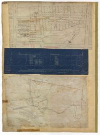
Page 198 of the City Engineer's Plat Book with three plats. Plat 1 shows land between President Street and Rutledge Street, and also shows Ashley Street, Boignard Street, Kennedy Street, Payne Street, Rosemont Street, and Krackes Street. Plat 2 shows lots along Mount Street, between Rutledge Street and Payne Street. Plat 3 shows land between "Town Creek" and Meeting Street, and also shows some marshland and a lot labelled "Roman Catholic Cemetery."
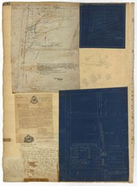
Page 200 of the City Engineer's Plat Book with three plats and two letters written to C.S. Gadsden. Plat 1 shows lots located near President Street, between Spring Street and Line Street, and includes Boigard Street and a projected Kennedy Street. Plat 2 shows lots near President Street, between Line Street and Kennedy Street. Plat 3 shows lots between Line Street and Spring Street, near Rutledge Street.
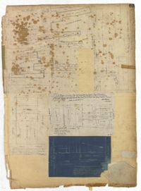
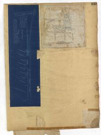
Page 204 of the City Engineer's Plat Book with one plat. The plat shows lots and structures located near the intersection of Meeting Street and Broad Street.
Page 65 of the City Engineer's Plat Book with six plats. Plat 1 shows wharves and other structures located near the intersection of East Bay Street and Elliott Street, and also shows a building labelled "Old Post Office." Plat 2 features a wharf on the Cooper River, and shows several structures. Plat 3 shows wharves and brick storehouses located near the intersection of Prioleau Street and Queen Street. Plat 4 shows lots near the intersection of Bull Street and Smith Street. Plat 5 shows lots and structures located near the intersection of King Street and Morris Street. Plat 6 shows land located along a stretch of Coming Street, between Race Street and Sumter Street.
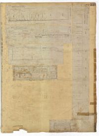
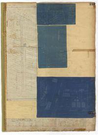
Page 221 of the City Engineer's Plat Book with six plats. Plat 1 shows lots along Payne Street, between Mount Street and Fishburne Street. Plat 2 shows lots along Lucas Street, near its intersections with Doughty Street and Mill Street, including a lot labelled "City Hospital." Plat 3 shows lots located along Kirkland Lane, between Wentworth Street and Beaufain Street. Plat 4 shows lots located near the intersection of Gadsden Street and Beaufain Street. Plat 5 shows lots located along Lightwood Alley, between Meeting Street and Church Street. Plat 6 shows a lot and building located on Cannon Street, Between Coming Street and a label reading "Church."
Page 223 of the City Engineer's Plat Book with five plats. Plat 1 shows lots and structures along Poinsett Street, near where it intersects with King Street. Plat 2 shows lots located on Sans Souci Street, near where it intersects with King Street. Plat 3 shows lots located on Line Street, including a lot labelled "City Stables." Plat 4 shows lots along King Street, near where it intersects with Moultrie Street. Plat 5 shows lots and structures located near the intersection of King Street and Romney Street.
Page 227 of the City Engineer's Plat Book with two plats. Plat 1 shows lots and structures located on Grove Street, between King Street and Russell Street. Plat 2 features a "Plot of Ground Surrounding Charleston Colored Industrial School." Plat 2 also shows Fishburne Street, Mount Street, Congress Street, and President Street.
Page 230 of the City Engineer's Plat Book with one plat. The Plat features lots located between Chinquapin Street and President Street, and between Bee Street and Spring Street. It also shows several structures, Pine Street, and Chesnut Street. One lot is labelled "Vegetable Garden."
Page 233 of the City Engineer's Plat Book with one plat. The plat features a stretch of marshland located east of Bay Street. The plat also shows America Street, Cooper Street, Blake Street, several creeks, and land labelled "Magazine."
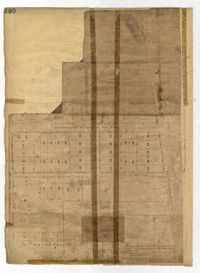
Page 234 of the City Engineer's Plat Book with one plat. The plat shows lots and structures located on Mill Street, President Street, Lucas Street, and Sixth Street. It also shows a lot labelled "U. S. Arsenal."