Search
« Previous |
101 - 150 of 934
|
Next »
Search Results
Description:
Responses to parking questionnaire by Hugh Lane (Citizens and Southern Bank).
Description:
Map of area bounded by Wentworth, Meeting, and Hasell Street.
Description:
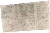
Map of area bounded by Horlbeck Alley, Meeting, and Queen Street.
Description:
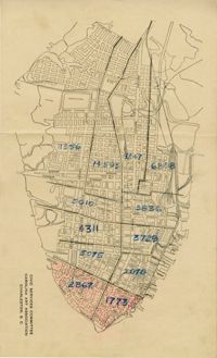
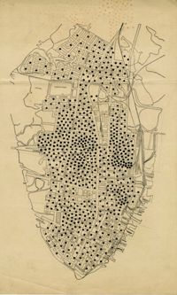
Map of peninsula.
Description:
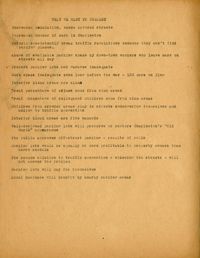
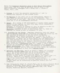
Key points related to city planning, of "what we want to present."
Description:
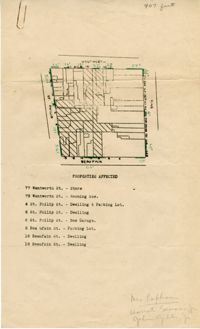
Map of area bounded by Beaufain, St. Philip, Wentworth, and King Street.
Description:
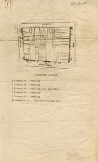
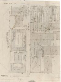
Map of area bounded by Wentworth, King, Liberty, and St. Philip Street.
Description:
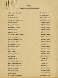
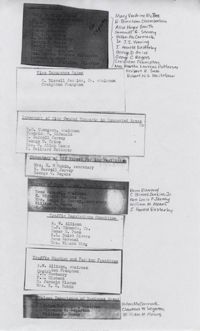
Membership list of the Charleston Real Estate Exchange.
Description:
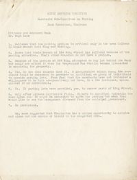
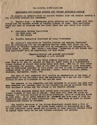
Memorandum for guiding traffic and parking for the committee on "Traffic Studies and Parking Practices," chaired by A.W. Allison.
Description:
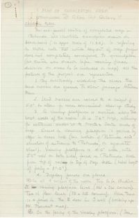
Description of the layout and format of the map of Charleston for the Charleston Metropolitan Area Exhibit at the Gibbes Art Gallery rotunda.
Description:
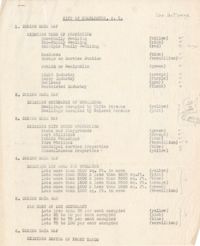
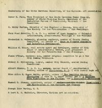
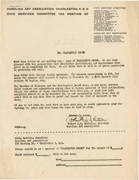
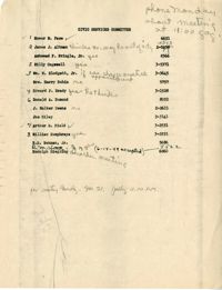
Membership list for the Civic Services Committee of the Carolina Art Association.
Description:
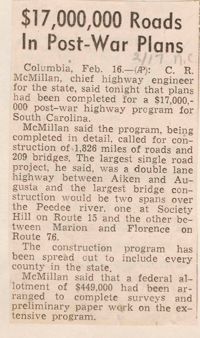
Article entitled "$17,000,000 Roads in Post-War Plans" regarding the building of roads.
Description:
Letter from Robert Whitelaw soliciting sponsorship for "Charleston Grows."
Description:
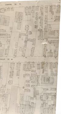
Map (not color-coded) of area between Coming Street and St. Philip Street near Morris Brown A.M.E. Church.
Description:
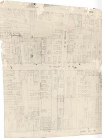
Map (not color-coded) of area where Bogard Street meets St. Philip Street, bounded by King Street.
Description:
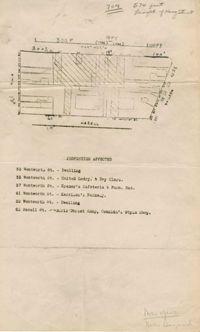
Map (not color-coded) of area on Mary Street at Southern Railroad Freight Depot.
Description:
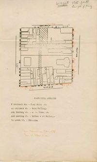
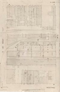
Map (not color-coded) of area bounded by King Street, Ann Street, Meeting Street, and John Street
Description:
Map (not color-coded) of area around Woolfe Street at the Southern Ice Co.
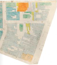
Description:
Color-coded map of area where Liberty Street meets St. Philip Street.
Description:
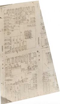
Map (not color-coded) of area between Radcliffe Street and Warren Street at St. Patrick's Catholic School.
Description:
Map (not color-coded) of area between King Street and Meeting Street at Hutson Street (SC Military Academy).
Description:
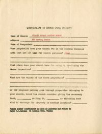
Church owned property questionnaire filled out for Citadel Square Baptist Church located on 328 Meeting Street.
Description:
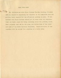
Memorandum from Robert N.S. Whitelaw regarding a meeting he had with Major Lanneau about organizing the support of churches in congested areas.
Description:
Assignment of individuals to various aspects of the parking and traffic surveys: cultural assets, fire insurance rates, inventory of City owned property in congested areas, inventory of off-street parking facilities, survey of land values, traffic regulations committee, traffic studies and parking practices, and values experience of business areas. Also included, a description of "value experience of business areas" committee.
Description:
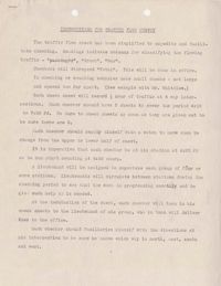
A document entitled "Instructions for Traffic Flow Survey." This document gives instruction on how to complete a traffic survey, and the intersections where the Charleston Boy Scouts needed to be.
Description:
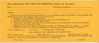
Blank Civic Services Committee Patron Membership form.
Description:
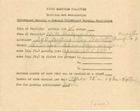
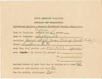
Off-street parking facilities survey filled out for M.P. Headquarters with hand drawn map of parking on back.
Description:
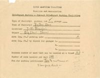
Off-street parking facilities survey filled out for Market and Hayne Service Station Inc.
Description:
List of underwriters for "Charleston Grows."
Description:
Attendance list for a CSC meeting on Nov. 21, 1949.
Description:
Notes on "The Regional Planning of Banbury and District."
Description:
Notes from "Housing for the Machine Age" by Clarence Arthur Perry.
Description:
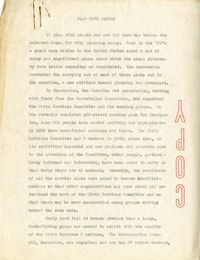
A speech entitled "Plan with People."
Description:
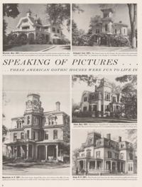
Clipping "These American Gothic Houses were Fun to Live In," featuring photographs of American Gothic houses in Massachusetts, Vermont, and New Hampshire.
Description:
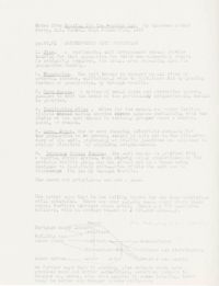
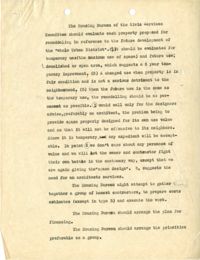
Document describing the Housing Bureau of the Civic Services Committee.
Description:
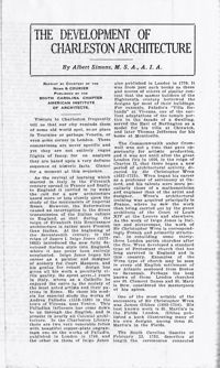
Article "The Development of Charleston Architecture" by Albert Simons that appeared in the News & Courier, published by the SC Chapter, American Institute of Architects.
Description:
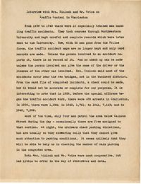
Summary of an interview done with Mrs. Kinloch and Mr. Grice regarding parking and traffic conditions between 1939 and 1943.
Description:
Map of peninsula.
Description:
List of city owned property in congested traffic areas compiled by the committee on "Inventory of City Owned Property in Congested Areas."
Description:
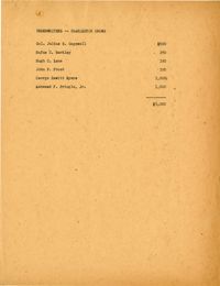
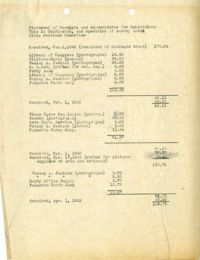
Statement of Receipts and expenditures for the "This is Charleston" Exhibition.
Description:
"General Plan" for "Map of Charleston Area" exhibit at the Gibbes Art Gallery.
Description:
Report entitled "Objectives of the Carolina Art Association."
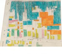
Description:
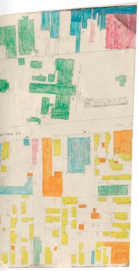
Color-coded map of area between Meeting Street and King Street, bisected by Horlbeck Alley..
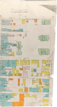
Description:
Color-coded map of area around St. Philip Street at Calhoun Street near the Charleston Orphan House.
Description:
Color-coded map of Archdale Street where Clifford Street, Beresford, and Princess intersect.
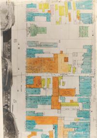
Description:
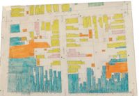
Color-coded map of area bounded by Wentworth Street, Meeting Street, Market Street, and King Street.
Description:
Color-coded map of area around St. Philip Street near the Charleston Orphan House.
Description:
Notes from "Permanent Recreation Areas in Real Estate Developments" by Mary Beattie Brady.
Description:
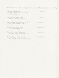
Document listing foundations that have made grants for community and regional planning.
Description:
Off-street parking facilities survey filled out for Southern Railroad.