Search
« Previous |
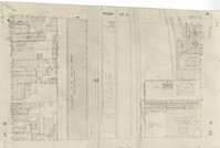
1 - 50 of 75
|
Next »
Search Results
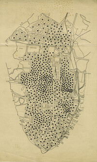
- Description:
- Map of peninsula.
- Date:
- 1945
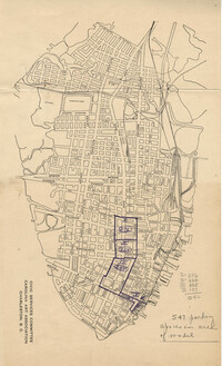
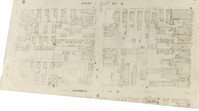
- Description:
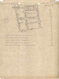
- Map of Area 1 bounded by George Street, St. Philip Street, Vanderhorst Street, Hutson Street, and Meeting Street assigned to Mrs. T W. Thornhill.
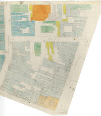
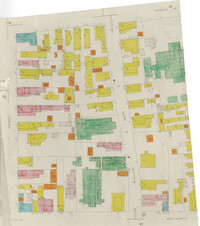
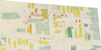
- Description:
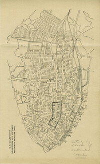
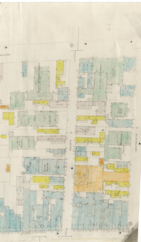
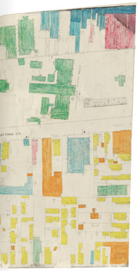
- Color-coded map of area bounded by Wentworth Street, Meeting Street, Market Street, and King Street.
- Date:
- 1942
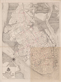
- Description:
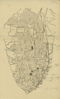
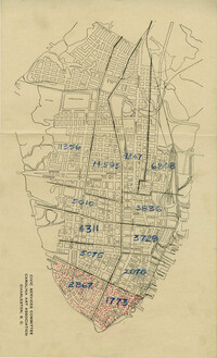
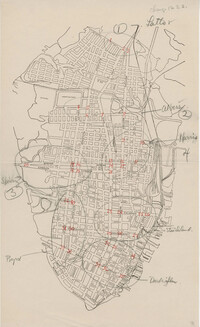
- Map of the Charleston peninsula showing the traffic count locations for the Metropolitan Council Traffic Survey.
- Date:
- 1945-01-16
- Description:
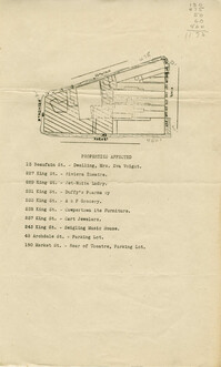
- Map of area bounded by Archdale, Market, King and Beaufain Streets.
- Description:
- Map of area bounded by Jacob's Alley, Queen, King, and Archdale Street.
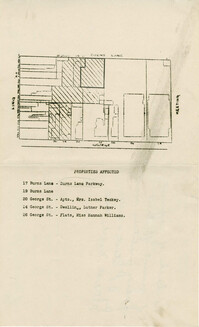
- Description:
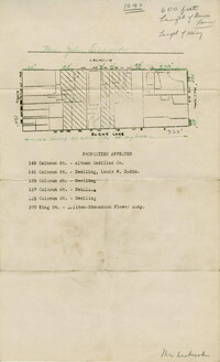
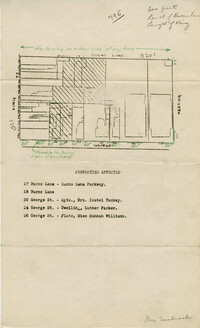
- Map of area bounded by Burns Lane, Meeting, Calhoun, and King Street.
- Description:
- Map of peninsula.
- Description:
- Map of peninsula.
- Description:
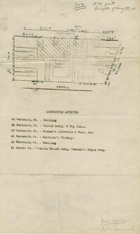
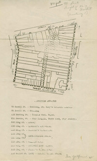
- Map of area bounded by Wentworth, Meeting, and Hasell Street.
- Description:
- Map of area bounded by Horlbeck Alley, Meeting, and Queen Street.
- Description:
- Map of peninsula.
- Description:
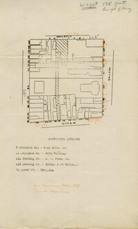
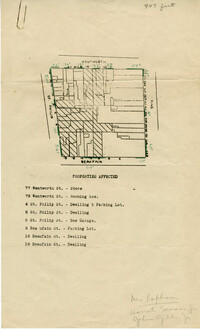
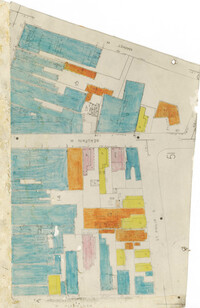
- Map of area bounded by Beaufain, St. Philip, Wentworth, and King Street.
- Description:
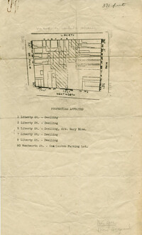
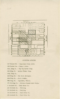
- Map of area bounded by Wentworth, King, Liberty, and St. Philip Street.
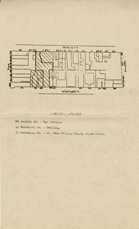
- Description:
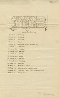
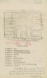
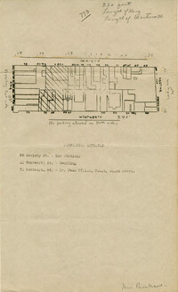
- Map of area bounded by Society, Meeting, George, and King Street.
- Description:
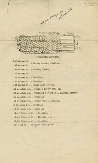
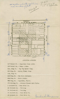
- Map of area bounded by Market, King, Princess, and Archdale Street.
- Description:
- Map of area bounded by Jacob's Alley, Archdale, Clifford, and King Street.
- Description:
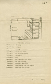
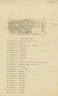
- Map of area bounded by Clifford, King, Beresford, and Archdale Street.
- Description:
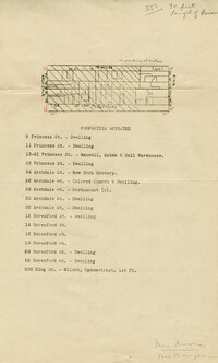
- Map of area bounded by Princess, King, Beresford, and Archdale Street.
- Description:
- Map of area bounded by Liberty, King, George, and St. Philip Street.
- Description:
- Map of area bounded by Hasell, Meeting, King and Market Street.
- Description:
- Map of area bounded by Horlbeck Alley, King, Market, and Meeting Street.
- Description:
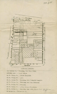
- Map of area bounded by George, King, Calhoun, and St. Philip Street.
- Description:
- Map of area bounded by Wentworth, King, Beaufain, and St. Philip Street.
- Description:
- Map of area bounded by Burns Lane, George, Meeting, and King Street.
- Description:
- Map of area bounded by Society, Meeting, Wentworth, and King Street.
- Description:
- Color-coded map of area between Society Street and Wentworth Street at Meeting Street..
- Description:
- Map of area bounded by Market Street, Meeting Street, Horlbeck Street, and King Street.
- Date:
- 1944
- Description:
- Color-coded map of area bounded by Wentworth Street, Coming Street, George Street, and Glebe Street.
- Description:
- Map of area bounded by Society Street, Meeting Street, Wentworth Street, and King Street.
- Description:
- Map of area bounded by George Street, King Street, Burns Lane, and Meeting Street.
- Description:
- Color-coded map of area near where Market Street and Beaufain Street meet..
- Description:
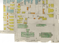
- Color-coded map of area bounded by Broad Street, Legare Street, and Queen Street.
- Description:
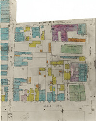
- Color-coded map of area bounded by Meeting Street, Broad Street, Queen Street, and King Street.
- Description:
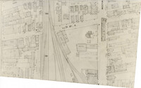
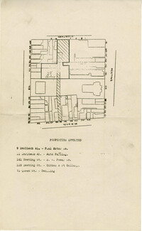
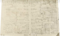
- Map (not color-coded) of area around Reid Street and Meeting Street
- Description:
- Color-coded map of area around Vanderhorst Street, near a police station and St. Paul's Episcopal Church.
- Description:
- Map (not color-coded) of area between Cannon Street ad Spring Street
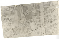
- Description:
- Map (not color-coded) of area around Woolfe Street at the Southern Ice Co.
- Description:
- Map (not color-coded) of area between King Street and Meeting Street at Hutson Street (SC Military Academy).
- Date:
- 1945
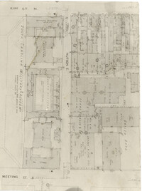
- Description:
- Map of Area 2 bounded by George Street, Meeting Street, Philip Street, Beaufain Street, and Hasell Street assigned to Mrs. Thornhill and Mrs. Taft.
- Description:
- Color-coded map of area around St. Philip Street near the Charleston Orphan House.
- Date:
- 1942
- Description:
- Map of the Charleston peninsula showing the traffic count locations for the Metropolitan Council Traffic Survey.
- Description:
- Map of area bounded by Horlbeck Street, Meeting Street, and Queen Street.
- Date:
- 1945-01-16
- Description:
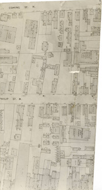
- Map (not color-coded) of area between Coming Street and St. Philip Street near Morris Brown A.M.E. Church.
- Description:
- Map (not color-coded) of area where St. Philip Street meets Morris Street.
- Description:
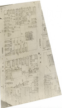
- Map (not color-coded) of area between Radcliffe Street and Warren Street at St. Patrick's Catholic School.
- Description:
- Map (not color-coded) of area on Mary Street at Southern Railroad Freight Depot.