Search
« Previous |
1 - 20 of 63
|
Next »
Search Results
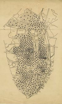
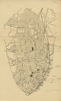
- Description:
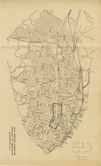
- Map of peninsula.
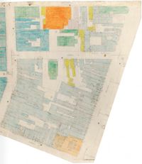
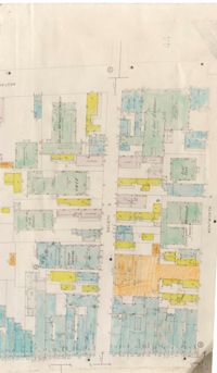
- Description:
- Color-coded map of area bounded by Wentworth Street, Meeting Street, Market Street, and King Street.
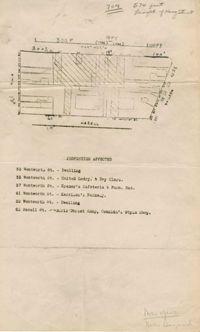
- Description:
- Map of area bounded by Beaufain, St. Philip, Wentworth, and King Street.
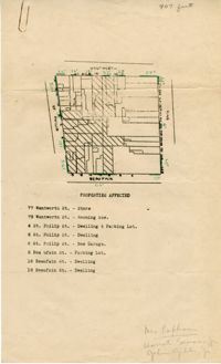
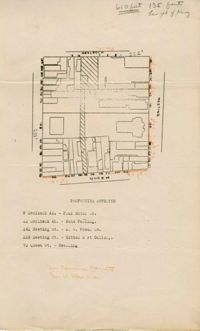
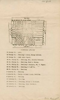
- Description:
- Map of area bounded by Wentworth, King, Liberty, and St. Philip Street.
- Description:
- Map of area bounded by Archdale, Market, King and Beaufain Streets.
- Description:
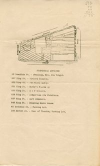
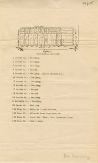
- Map of area bounded by Jacob's Alley, Queen, King, and Archdale Street.
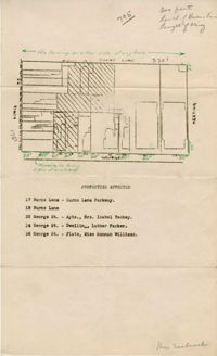
- Description:
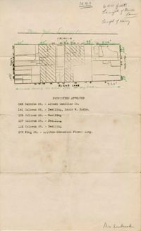
- Map of area bounded by Burns Lane, Meeting, Calhoun, and King Street.
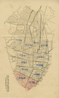
- Description:
- Map of peninsula.
- Description:
- Map of peninsula.
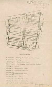
- Description:
- Map of area bounded by Wentworth, Meeting, and Hasell Street.
- Description:
- Map of area bounded by Horlbeck Alley, Meeting, and Queen Street.
- Description:
- Map of peninsula.
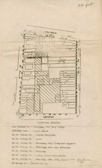
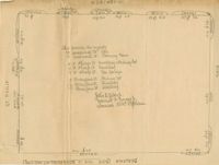
- Description:
- Map of area bounded by George, King, Calhoun, and St. Philip Street.
- Description:
- Map of area bounded by Wentworth, King, Beaufain, and St. Philip Street.
- Description:
- Map of area bounded by Burns Lane, George, Meeting, and King Street.
- Description:
- Map of area bounded by Society, Meeting, Wentworth, and King Street.
- Description:
- Color-coded map of area between Society Street and Wentworth Street at Meeting Street..
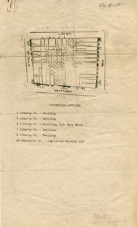
- Description:
- Map of area bounded by Liberty, King, George, and St. Philip Street.
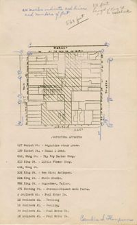
- Description:
- Map of area bounded by Hasell, Meeting, King and Market Street.
- Description:
- Map of area bounded by Horlbeck Alley, King, Market, and Meeting Street.