Search
« Previous |
61 - 70 of 75
|
Next »
Search Results
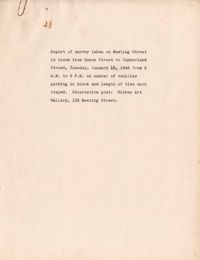
- Date:
- 1945-01-16
- Description:
- Map of area bounded by Wentworth Street, St. Philip Street, Beaufain Street, and King Street.
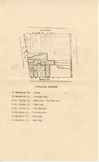
- Description:
- Map (not color-coded) of area where St. Philip Street meets Morris Street.
- Description:
- Map (not color-coded) of area between Cannon Street ad Spring Street
- Description:
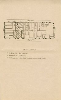
- Map of area bounded by Society Street, Meeting Street, Wentworth Street, and King Street.
- Description:
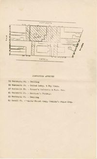
- Map of area bounded by Wentworth Street, Meeting Street, Hasell Street, and King Street.
- Description:
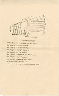
- Map of area bounded by Archdale Street, Beaufain Street, King Street, and Market Street.
- Description:
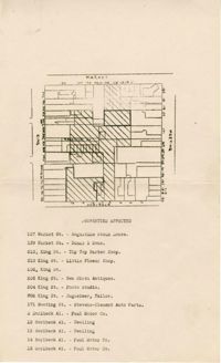
- Map of area bounded by Market Street, Meeting Street, Horlbeck Street, and King Street.
- Description:
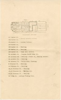
- Map of area bounded by Market Street, King Street, Princess Street, and Archdale Street.
- Description:
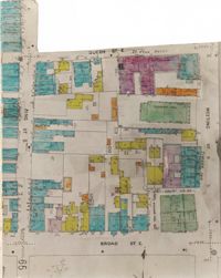
- Color-coded map of area bounded by Meeting Street, Broad Street, Queen Street, and King Street.