Search
« Previous |
31 - 40 of 75
|
Next »
Search Results
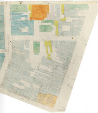
- Description:
- Color-coded map of area bounded by Wentworth Street, Meeting Street, Market Street, and King Street.
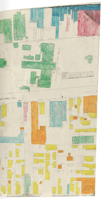
- Description:
- Color-coded map of area around St. Philip Street near the Charleston Orphan House.
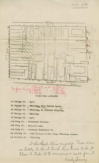
- Description:
- Map of area bounded by Society, Meeting, George, and King Street.
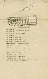
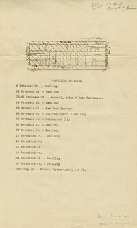
- Description:
- Map of area bounded by Market, King, Princess, and Archdale Street.
- Description:
- Map of area bounded by Jacob's Alley, Archdale, Clifford, and King Street.
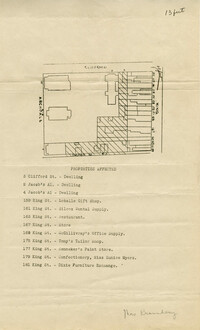
- Description:
- Map of area bounded by Clifford, King, Beresford, and Archdale Street.
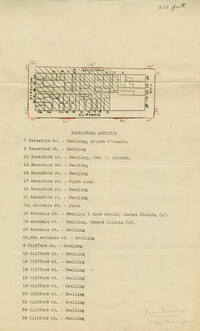
- Description:
- Map of area bounded by Princess, King, Beresford, and Archdale Street.
- Date:
- 1942
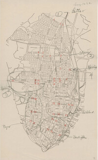
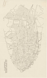
- Description:
- Map of the Charleston peninsula showing the traffic count locations for the Metropolitan Council Traffic Survey.
- Date:
- 1942
- Description:
- Map of the Charleston peninsula showing the traffic count locations for the Metropolitan Council Traffic Survey.
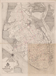
- Description:
- Map of the Charleston peninsula.