Search
« Previous |
21 - 30 of 75
|
Next »
Search Results
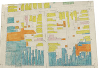
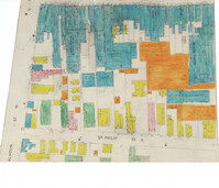
Description:
Color-coded map of area where Liberty Street meets St. Philip Street.
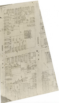
Description:
Map (not color-coded) of area between Radcliffe Street and Warren Street at St. Patrick's Catholic School.
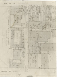
Description:
Map (not color-coded) of area between King Street and Meeting Street at Hutson Street (SC Military Academy).
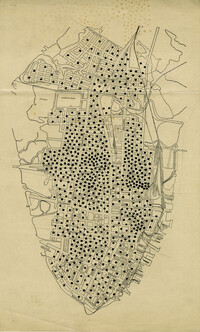
Description:
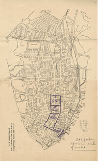
Map of peninsula.
Date:
1945
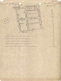
Description:
Map of Area 1 bounded by George Street, St. Philip Street, Vanderhorst Street, Hutson Street, and Meeting Street assigned to Mrs. T W. Thornhill.
Date:
1945
Description:
Map of Area 3 bounded by Beaufain Street, Hasell Street, Meeting Street, Broad Street, Legare Street, and Archdale Street assigned to Ferdinanda Waring.
Date:
1945
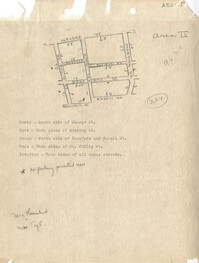
Description:
Map of Area 2 bounded by George Street, Meeting Street, Philip Street, Beaufain Street, and Hasell Street assigned to Mrs. Thornhill and Mrs. Taft.
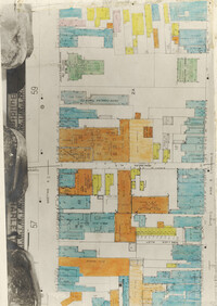
Description:
Color-coded map of area between Meeting Street and King Street, bisected by Horlbeck Alley..
Description:
Color-coded map of area around St. Philip Street at Calhoun Street near the Charleston Orphan House.
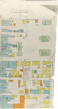
Description:
Color-coded map of Archdale Street where Clifford Street, Beresford, and Princess intersect.