Search
« Previous |
21 - 40 of 75
|
Next »
Search Results
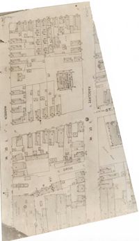
- Description:
- Map (not color-coded) of area between Radcliffe Street and Warren Street at St. Patrick's Catholic School.
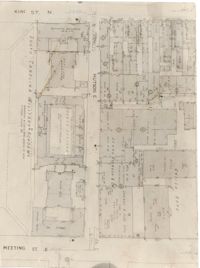
- Description:
- Map (not color-coded) of area between King Street and Meeting Street at Hutson Street (SC Military Academy).
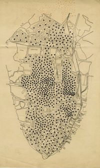
- Description:
- Map of peninsula.
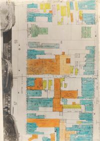
- Description:
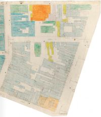
- Color-coded map of area between Meeting Street and King Street, bisected by Horlbeck Alley..
- Description:
- Color-coded map of area around St. Philip Street at Calhoun Street near the Charleston Orphan House.
- Description:
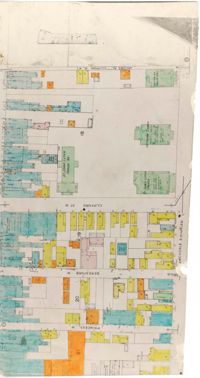
- Color-coded map of Archdale Street where Clifford Street, Beresford, and Princess intersect.
- Description:
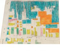
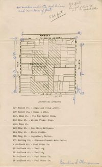
- Color-coded map of area bounded by Wentworth Street, Meeting Street, Market Street, and King Street.
- Description:
- Color-coded map of area around St. Philip Street near the Charleston Orphan House.
- Description:
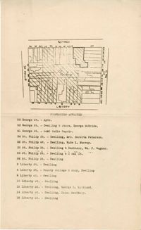
- Map of area bounded by Society, Meeting, George, and King Street.
- Description:
- Map of area bounded by Market, King, Princess, and Archdale Street.
- Description:
- Map of area bounded by Jacob's Alley, Archdale, Clifford, and King Street.
- Description:
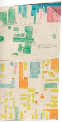
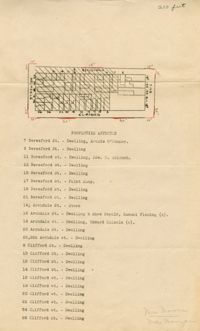
- Map of area bounded by Clifford, King, Beresford, and Archdale Street.
- Description:
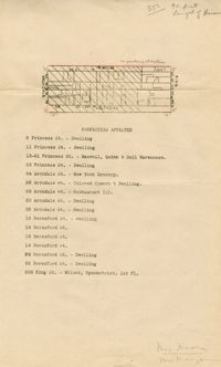
- Map of area bounded by Princess, King, Beresford, and Archdale Street.
- Description:
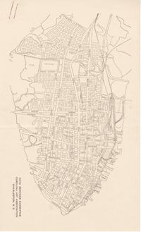
- Map of the Charleston peninsula.
- Description:
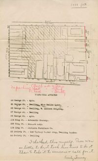
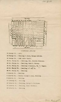
- Map of area bounded by Liberty, King, George, and St. Philip Street.
- Description:
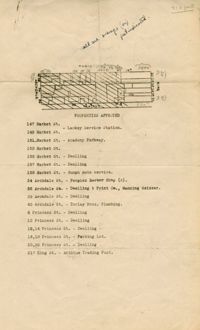
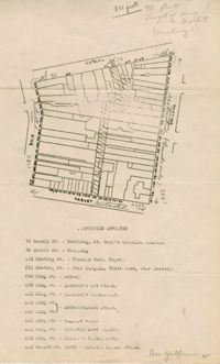
- Map of area bounded by Hasell, Meeting, King and Market Street.
- Description:
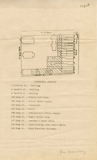
- Map of area bounded by Horlbeck Alley, King, Market, and Meeting Street.
- Description:
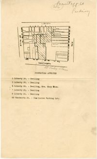
- Map of area bounded by Wentworth Street, St. Philip Street, Liberty Street, and King Street.
- Description:
- Map of area bounded by George Street, King Street, Liberty Street, and St. Philip Street.
- Description:
- Map of area bounded by Horlbeck Street, Meeting Street, and Queen Street.