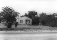
House on site affected by the widening of State Road 13 (Remount Road). Surveyor notations on back of photo: "Dkt.: 10.562. Property owner: William M. Nelson. Tract: 111. Date: Jul. 19, 1967." [See collection description for explanation of surveyor notations.]
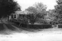
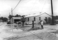
House on site affected by the widening of State Road 13 (Remount Road). Surveyor notations on back of photo: "Dkt.: 10.562. Property owner: Lolie Driggers. Tract: 80. Date: Jul. 19, 1967." [See collection description for explanation of surveyor notations.]
House on site affected by the widening of State Road 13 (Remount Road). Surveyor notations on back of photo: "Dkt.: 10.562. Property owner: Melbry Grimes. Tract: 91. Date: Jul. 19, 1967." [See collection description for explanation of surveyor notations.]
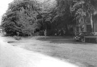
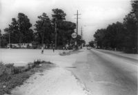
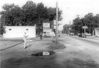
Site affected by the widening of State Road 13 (Remount Road). Surveyor notations on back of photo: "Dkt.: 10.562. Property owner: Elizabeth Gilmoor. Tract: 107. Date: Jul. 19, 1967." [See collection description for explanation of surveyor notations.]
Law Offices of William Chrisanthis, on site affected by the widening of State Road 13 (Remount Road). Surveyor notations on back of photo: "Dkt.: 10.562. Property owner: Ethel Barnes Morris. Tract: 22. Date: Jul. 12, 1967." [See collection description for explanation of surveyor notations.]
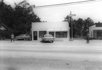
Building (industrial use?) on site affected by the widening of State Road 13 (Remount Road). Texaco and Gulf gas stations in background, across street). Surveyor notations on back of photo: "Dkt.: 10.562. Property owner: A.G. Boone Co. Tract: 15. Date: Jul. 12, 1967." [See collection description for explanation of surveyor notations.]
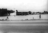
A&P store and parking lot, on site affected by the widening of State Road 13 (Remount Road). Surveyor notations on back of photo: "Dkt.: 10.562. Property owner: S.S. and B. Inc. Tract: 31. Date: Jul. 12, 1967." [See collection description for explanation of surveyor notations.]
A&P parking lot, on site affected by the widening of State Road 13 (Remount Road). Surveyor notations on back of photo: "Dkt.: 10.562. Property owner: S.S. and B. Inc. Tract: 31. Date: Jul. 12, 1967." [See collection description for explanation of surveyor notations.]
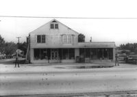
Bowers Hardware, on site affected by the widening of State Road 13 (Remount Road). Surveyor notations on back of photo: "Dkt.: 10.562. Property owner: J.R. Herrin. Tract: 82. Date: Jul. 19, 1967." [See collection description for explanation of surveyor notations.]
Lot next to McBride TV and Roy's Barber Shop, on site affected by the widening of State Road 13 (Remount Road). Atlantic gas Station: across the street. Surveyor notations on back of photo: "Dkt.: 10.562. Property owner: Pearl T. Leiderman. Tract: 40. Date: Jul. 19, 1967." [See collection description for explanation of surveyor notations.]