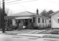
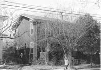
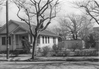
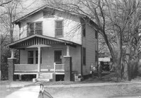
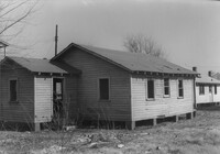
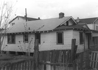
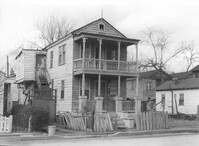
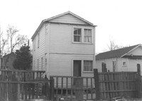
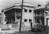
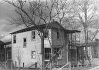
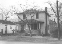
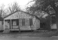
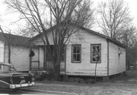
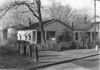
House on site by the construction of Interstate 26 (I-26). Address: 1211 King Street. Surveyor notations on back of photo: "Dkt.: 10.503. Property owner: Albert M. Jones, et al. Tract: 17. Station: 5895+00 Lt. Date: Feb. 19, 1963. In R/W - Bought." [See collection description for explanation of surveyor notations.]
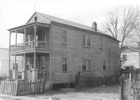
House (rear view) on site by the construction of Interstate 26 (I-26). Address: 1211 King Street. Surveyor notations on back of photo: "Dkt.: 10.503. Property owner: Albert M. Jones, et al. Tract: 17. Station: 5895+00 Lt. Date: Feb. 19, 1963. In R/W - Bought." [See collection description for explanation of surveyor notations.]
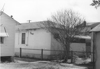
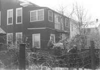
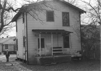
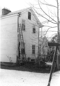
House (rear view) on site by the construction of Interstate 26 (I-26). Address: 1211 King Street (rear). Surveyor notations on back of photo: "Dkt.: 10.503. Property owner: Albert M. Jones, et al. Tract: 17. Station: 5894+75 Lt. Date: Feb. 19, 1963. In R/W - Bought." [See collection description for explanation of surveyor notations.]
House (rear view) on site by the construction of Interstate 26 (I-26). Address: 1211 King Street (rear). Surveyor notations on back of photo: "Dkt.: 10.503. Property owner: Albert M. Jones, et al. Tract: 17. Station: 5894+75 Lt. Date: Feb. 19, 1963. In R/W - Bought." [See collection description for explanation of surveyor notations.]
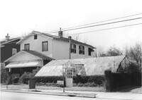
Greenhouse-like structure (plant nursery) on site by the construction of Interstate 26 (I-26). Address: 1205 King Street. Surveyor notations on back of photo: "Dkt.: 10.503. Property owner: Gladys Hardy. Tract: 18. Station: 5895+50 on CL. Date: Feb. 19, 1963. In R/W - Bought." [See collection description for explanation of surveyor notations.]
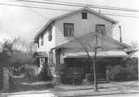
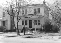
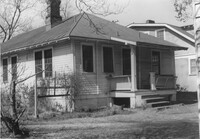
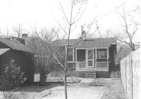
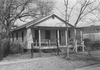
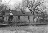
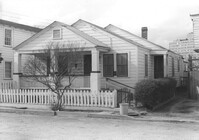
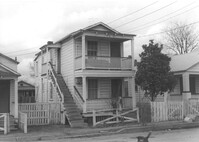
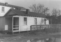
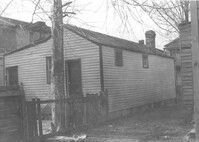
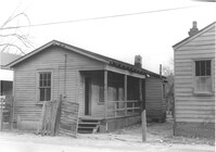
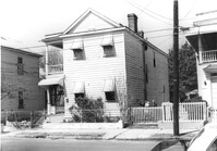
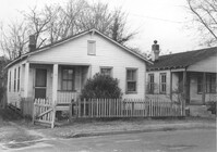
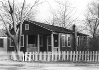
House on site by the construction of Interstate 26 (I-26). Address: 1201 King Street. Surveyor notations on back of photo: "Dkt.: 10.503. Property owner: Gladys Hardy. Tract: 18. Station: 5895+65 Rt. Date: Feb. 19, 1963. In R/W - Bought." [See collection description for explanation of surveyor notations.]
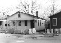
House (corner view, rear) on site by the construction of Interstate 26 (I-26). Address: 1201 King Street. Surveyor notations on back of photo: "Dkt.: 10.503. Property owner: Gladys Hardy. Tract: 18. Station: 5895+65 Rt. Date: Feb. 19, 1963. In R/W - Bought." [See collection description for explanation of surveyor notations.]
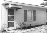
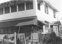
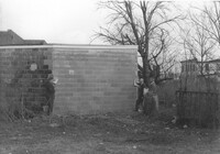
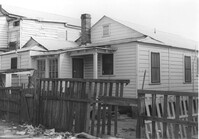
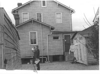
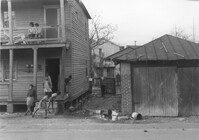
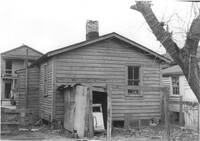
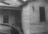
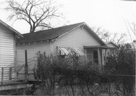
Backyard and structure on site affected by the construction of Interstate 26 (I-26). Address: 1201 King Street. Surveyor notations on back of photo: "Dkt.: 10.503. Property owner: Gladys Hardy. Tract: 18. Station: 5895+00 Rt. Date: Feb. 19, 1963. In R/W - Bought." [See collection description for explanation of surveyor notations.]
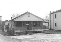
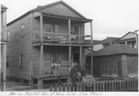
House (rear view) and backyard garden on site affected by the construction of Interstate 26 (I-26). Address: 1199 King Street. Surveyor notations on back of photo: "Dkt.: 10.503. Property owner: Nancy J. Wandell. Tract: 19. Station: 5895+85 Rt. Date: Feb. 19, 1963." [See collection description for explanation of surveyor notations.]
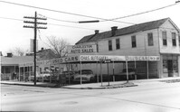
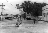
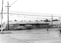
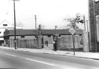
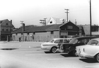
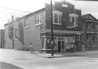
Corner of Meeting Street and Cooper Street. Charleston Auto Sales (510 Meeting Street) and Infinger's Shoe Store (508 Meeting Street), on site affected by the construction of the Crosstown. Surveyor notations on back of photo: "Dkt.: 10.518. Property owner: Robert L. Knoth. Tract: 14. Station: 5962+85 CL of Line 3 of the S.B. lane of Route 17. Date: Mar. 6, 1963. In R/W - Bought. [See collection description for explanation of surveyor notations.]
House on site affected by the construction of Interstate 26 (I-26). Address: 1199 King Street. Surveyor notations on back of photo: "Dkt.: 10.503. Property owner: Nancy J. Wandell. Tract: 19. Station: 5895+85 Rt. Date: Feb. 19, 1963." [See collection description for explanation of surveyor notations.]
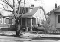
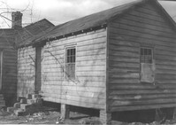
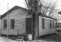
House on site affected by the construction of Interstate 26 (I-26). Address: 1197 King Street. Surveyor notations on back of photo: "Dkt.: 10.503. Property owner: Katherine A. Singleton. Tract: 20. Station: 5896+15 Rt. Date: Feb. 19, 1963. Proximity." [See collection description for explanation of surveyor notations.]
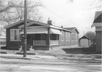
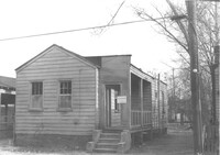
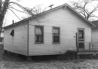
House on site affected by the construction of Interstate 26 (I-26). Address: 1194 King Street. Surveyor notations on back of photo: "Dkt.: 10.503. Property owner: J.B. Hodges. Tract: 21. Station: 5897+60 Rt. Date: Feb. 19, 1963. In R/W - Bought." [See collection description for explanation of surveyor notations.]
House (rear view) on site affected by the construction of Interstate 26 (I-26). Address: 1194 King Street. Surveyor notations on back of photo: "Dkt.: 10.503. Property owner: J.B. Hodges. Tract: 21. Station: 5897+60 Rt. Date: Feb. 19, 1963. In R/W - Bought." [See collection description for explanation of surveyor notations.]
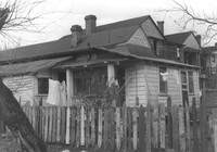
House (rear view) and structure (obscured by trees) on site affected by the construction of Interstate 26 (I-26). Address: 1200 King Street. Surveyor notations on back of photo: "Dkt.: 10.503. Property owner: William R. Nelson. Tract: 22. Station: 5897+40 Rt. Date: Feb. 19, 1963. In R/W - Bought." [See collection description for explanation of surveyor notations.]
House on site affected by the construction of Interstate 26 (I-26). Address: 1200 King Street. Surveyor notations on back of photo: "Dkt.: 10.503. Property owner: William R. Nelson. Tract: 22. Station: 5897+40 Rt. Date: Feb. 19, 1963. In R/W - Bought." [See collection description for explanation of surveyor notations.]
House on site affected by the construction of Interstate 26 (I-26). Address: 1202 King Street. Surveyor notations on back of photo: "Dkt.: 10.503. Property owner: Gertrude E. Cone. Tract: 23. Station: 5897+30 on CL. Date: Feb. 19, 1963. In R/W - Bought." [See collection description for explanation of surveyor notations.]
House (at rear of property?) on site affected by the construction of Interstate 26 (I-26). Address: 1202 King Street. Surveyor notations on back of photo: "Dkt.: 10.503. Property owner: Gertrude E. Cone. Tract: 23. Station: 5897+30 on CL. Date: Feb. 19, 1963. In R/W - Bought." [See collection description for explanation of surveyor notations.]
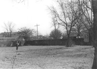
Lot on site affected by the construction of Interstate 26 (I-26). Address: 1204 King Street. Surveyor notations on back of photo: "Dkt.: 10.503. Property owner: Francis Hartnett. Tract: 24. Station: 5897+10 Rt. & Lt. Date: Feb. 19, 1963. In R/W - Bought." [See collection description for explanation of surveyor notations.]
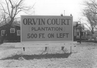
Sign for Orvin Court (Plantation) on lot, dwellings in background, on site affected by the construction of Interstate 26 (I-26). Address: 1204 King Street. Surveyor notations on back of photo: "Dkt.: 10.503. Property owner: Francis Hartnett. Tract: 24. Station: 5896+50 Lt. Date: Feb. 19, 1963. In R/W - Bought." [See collection description for explanation of surveyor notations.]
Gulf gas station, on site affected by the widening of State Road 13 (Remount Road). Arrow Restaurant and Trucker's Billiard Academy across the street. Surveyor notations on back of photo: "Dkt.: 10.562. Property owner: E.R. Gassman. Tract: 1. Date: Jul. 12, 1967." [See collection description for explanation of surveyor notations.]
Renken Boat Co, on site affected by the widening of Route 171 (Folly Road). Surveyor notations on back of photo: "Dkt.: 10.494. Property owner: Renken Finance Co. Tract: 19. Station: 157+00 Lt. Date: Mar. 21, 1962. Proximity. [See collection description for explanation of surveyor notations.]
Structure on site affected by the construction of the Crosstown. Address: 510 Meeting Street. Surveyor notations on back of photo: "Dkt.: 10.518. Property owner: Robert L. Knoth. Tract: 14. Station: 5963+55 Rt. Line 3, S.B. lane of Route 17. Date: Mar. 6, 1963. Damage. [See collection description for explanation of surveyor notations.]
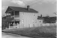
House on site affected by the construction of Interstate 26 (I-26). Address: 28 San Souci Street. Surveyor notations on back of photo: "Dkt.: 10.503. Property owner: Acme Realty Co. Tract: 25. Station: 5898+60 Rt. Date: Feb. 19, 1963. In R/W - Bought." [See collection description for explanation of surveyor notations.]
House (rear view) on site affected by the construction of Interstate 26 (I-26). Address: 28 Sans Souci Street. Surveyor notations on back of photo: "Dkt.: 10.503. Property owner: Acme Realty Co. Tract: 25. Station: 5898+60 Rt. Date: Feb. 19, 1963. In R/W - Bought." [See collection description for explanation of surveyor notations.]
House on site affected by the construction of Interstate 26 (I-26). Address: 26 Sans Souci Street. Surveyor notations on back of photo: "Dkt.: 10.503. Property owner: Annie E. Koger. Tract: 26. Station: 5898+85 Rt. Date: Feb. 19, 1963. In R/W - Bought." [See collection description for explanation of surveyor notations.]
House (side view) on site affected by the construction of Interstate 26 (I-26). Address: 26 Sans Souci Street. Railroad tracks in foreground. Surveyor notations on back of photo: "Dkt.: 10.503. Property owner: Annie E. Koger. Tract: 26. Station: 5898+85 Rt. Date: Feb. 19, 1963. In R/W - Bought." [See collection description for explanation of surveyor notations.]
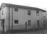
Part of a brick structure on lot, on site affected by the construction of Interstate 26 (I-26). Address: 1129 Meeting Street (rear). Surveyor notations on back of photo: "Dkt.: 10.503. Property owner: Coca Cola Bottling Co. Tract: 28. Station: 5899+05 Lt. Date: Feb. 19, 1963. Owner cleared R/W." [See collection description for explanation of surveyor notations.]
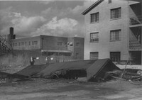
Construction debris and neighboring buildings on site affected by the construction of Interstate 26 (I-26). Address: 1220 King Street. Coca Cola Bottling Co. building (1129 Meeting Street) in background. Surveyor notations on back of photo: "Dkt.: 10.503. Property owner: House of God. Tract: 31. Station: 5900+30 Lt. Date: Feb. 19, 1963. In R/W - Bought." [See collection description for explanation of surveyor notations.]
House on site affected by the construction of Interstate 26 (I-26). Address: 14 Wood Street. Surveyor notations on back of photo: "Dkt.: 10.503. Property owner: Walter K. Brown. Tract: 32. Station: 5900+10 Lt. Date: Feb. 19, 1963. In R/W - Bought." [See collection description for explanation of surveyor notations.]
House (rear view) on site affected by the construction of Interstate 26 (I-26). Address: 14 Wood Street. Surveyor notations on back of photo: "Dkt.: 10.503. Property owner: Walter K. Brown. Tract: 32. Station: 5900+10 Lt. Date: Feb. 19, 1963. In R/W - Bought." [See collection description for explanation of surveyor notations.]
House on site affected by the construction of Interstate 26 (I-26). Address: 15 Wood Street. Railroad tracks nearby. Surveyor notations on back of photo: "Dkt.: 10.503. Property owner: Abe Finklestein, et al. Tract: 33. Station: 5900+75 Lt. Date: Feb. 19, 1963. In R/W - Bought." [See collection description for explanation of surveyor notations.]
House (rear view) on site affected by the construction of Interstate 26 (I-26). Address: 15 Wood Street. Surveyor notations on back of photo: "Dkt.: 10.503. Property owner: Abe Finklestein, et al. Tract: 33. Station: 5900+75 Lt. Date: Feb. 19, 1963. In R/W - Bought." [See collection description for explanation of surveyor notations.]
Buildings and lot on site affected by the construction of the Crosstown. Address: 620 King Street. Surveyor notations on back of photo: "Dkt.: 10.518. Property owner: News & Courier. Tract: 15. Station: 8+00 Lt. Line Street (Line #2) to 9+00 Lt. Date: Mar. 6, 1963. [Zero] Fence. [See collection description for explanation of surveyor notations.]
House (rear view) on site affected by the construction of Interstate 26 (I-26). 9 Wood Street. Surveyor notations on back of photo: "Dkt.: 10.503. Property owner: Janie Washington. Tract: 34. Station: 5901+00 Lt. Date: Feb. 19, 1963. In R/W - Bought." [See collection description for explanation of surveyor notations.]
House on site affected by the construction of Interstate 26 (I-26). Address: 9 Wood Street. Surveyor notations on back of photo: "Dkt.: 10.503. Property owner: Janie Washington. Tract: 34. Station: 5901+00 Lt. Date: Feb. 19, 1963. In R/W - Bought." [See collection description for explanation of surveyor notations.]
House on site affected by the construction of Interstate 26 (I-26). Address: 7 Wood Street. Surveyor notations on back of photo: "Dkt.: 10.503. Property owner: Janie Washington. Tract: 34. Station: 5901+00 Lt. Date: Feb. 19, 1963. In R/W - Bought." [See collection description for explanation of surveyor notations.]
House (corner view, rear) on site affected by the construction of Interstate 26 (I-26). 7 Wood Street. Surveyor notations on back of photo: "Dkt.: 10.503. Property owner: Janie Washington. Tract: 34. Station: 5901+00 Lt. Date: Feb. 19, 1963. In R/W - Bought." [See collection description for explanation of surveyor notations.]
House on site affected by the construction of Interstate 26 (I-26). Address: 10 Lenox Street. Surveyor notations on back of photo: "Dkt.: 10.503. Property owner: Benjamin Thompson. Tract: 37. Station: 5901+50 Lt. Date: Feb. 19, 1963. In R/W - Bought." [See collection description for explanation of surveyor notations.]
House on site affected by the construction of Interstate 26 (I-26). Address: 10 Lenox Street. Surveyor notations on back of photo: "Dkt.: 10.503. Property owner: Benjamin Thompson. Tract: 37. Station: 5901+50 Lt. Date: Feb. 19, 1963. In R/W - Bought." [See collection description for explanation of surveyor notations.]
House on site affected by the construction of Interstate 26 (I-26). Address: 12 Lenox Street. Joseph Floyd Manor (Mount Pleasant Street and King Street) in background. Surveyor notations on back of photo: "Dkt.: 10.503. Property owner: Harry Thompson. Tract: 38. Station: 5901+50 Lt. Date: Feb. 19, 1963. In R/W - Bought." [See collection description for explanation of surveyor notations.]
House (rear view) on site affected by the construction of Interstate 26 (I-26). Address: 12 Lenox Street. Surveyor notations on back of photo: "Dkt.: 10.503. Property owner: Harry Thompson. Tract: 38. Station: 5901+50 Lt. Date: Feb. 19, 1963. In R/W - Bought." [See collection description for explanation of surveyor notations.]
House (rear view) on site affected by the construction of Interstate 26 (I-26). Address: 14 Lenox Street. Surveyor notations on back of photo: "Dkt.: 10.503. Property owner: Harry Thompson. Tract: 38. Station: 5901+50 Rt. Date: Feb. 19, 1963. In R/W - Bought." [See collection description for explanation of surveyor notations.]
House on site affected by the construction of Interstate 26 (I-26). Address: 14 Lenox street. Surveyor notations on back of photo: "Dkt.: 10.503. Property owner: Harry Thompson. Tract: 38. Station: 5901+50 Rt. Date: Feb. 19, 1963. In R/W - Bought." [See collection description for explanation of surveyor notations.]
Buildings and parking lot on site affected by the construction of the Crosstown. Address: 626 King Street. Surveyor notations on back of photo: "Dkt.: 10.518. Property owner: Sands & Co. Tract: 16. Station: 9+50 Lt. Line Street (Line #2). Date: Mar. 6, 1963." [See collection description for explanation of surveyor notations.]
House on site affected by the construction of Interstate 26 (I-26). Address: 16 Lenox Street. Surveyor notations on back of photo: "Dkt.: 10.503. Property owner: Harry Thompson. Tract: 38. Station: 5901+50 Rt. Date: Feb. 19, 1963. In R/W - Bought." [See collection description for explanation of surveyor notations.]
House (rear view?) on site affected by the construction of Interstate 26 (I-26). Address: 16 Lenox Street. Surveyor notations on back of photo: "Dkt.: 10.503. Property owner: Harry Thompson. Tract: 38. Station: 5901+50 Rt. Date: Feb. 19, 1963. In R/W - Bought." [See collection description for explanation of surveyor notations.]
House on site affected by the construction of Interstate 26 (I-26). Address: 5 Lenox Street. Surveyor notations on back of photo: "Dkt.: 10.503. Property owner: Estelle Thompson. Tract: 40. Station: 5902+60 Lt. Date: Feb. 19, 1963. In R/W - Bought." [See collection description for explanation of surveyor notations.]
House (rear view) on site affected by the construction of Interstate 26 (I-26). Address: 5 Lenox Street. Surveyor notations on back of photo: "Dkt.: 10.503. Property owner: Estelle Thompson. Tract: 40. Station: 5902+60 Lt. Date: Feb. 19, 1963. In R/W - Bought." [See collection description for explanation of surveyor notations.]
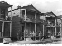
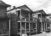
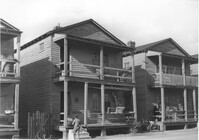
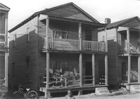
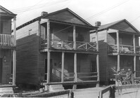
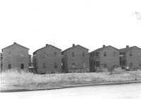
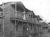
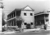
Houses on site affected by the construction of Interstate 26 (I-26). Address: 30 Brigade Street. Neighboring houses on either side also in photo. Written on border of photo: Men on projected R/W of Main Line (see plans). Surveyor notations on back of photo: "Dkt.: 10.503. Property owner: Gussie Feldman, et al. Tract: 41. Station: 5904+15 Rt. Date: Feb. 19, 1963. In R/W - Bought." [See collection description for explanation of surveyor notations.]
Houses (rear view) on site affected by the construction of Interstate 26 (I-26). Address: within the range of 20-32 Brigade Street. Surveyor notations on back of photo: "Dkt.: 10.503. Property owner: Gussie Feldman, et al. Tract: 41. Station: 5904+15 Rt. Date: Feb. 19, 1963. In R/W - Bought." [See collection description for explanation of surveyor notations.]
Houses on site affected by the construction of Interstate 26 (I-26). Address: within the range of 20-32 Brigade Street. Surveyor notations on back of photo: "Dkt.: 10.503. Property owner: Gussie Feldman, et al. Tract: 41. Station: 5904+15 Rt. Date: Feb. 19, 1963. In R/W - Bought." [See collection description for explanation of surveyor notations.]
Houses on site affected by the construction of Interstate 26 (I-26). Address: within the range of 20-32 Brigade Street. Surveyor notations on back of photo: "Dkt.: 10.503. Property owner: Gussie Feldman, et al. Tract: 41. Station: 5904+20 Rt. Date: Feb. 19, 1963. In R/W - Bought." [See collection description for explanation of surveyor notations.]
Houses on site affected by the construction of Interstate 26 (I-26). Address: 24 Brigade Street. Neighboring houses on either side also in photo. Surveyor notations on back of photo: "Dkt.: 10.503. Property owner: Gussie Feldman, et al. Tract: 41. Station: 5904+30 Lt. Date: Feb. 19, 1963. In R/W - Bought." [See collection description for explanation of surveyor notations.]
Houses on site affected by the construction of Interstate 26 (I-26). Address: within the range of 20-32 Brigade Street. Surveyor notations on back of photo: "Dkt.: 10.503. Property owner: Gussie Feldman. Tract: 41. Station: 5904+35 Lt. Date: Feb. 19, 1963. In R/W - Bought." [See collection description for explanation of surveyor notations.]
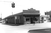
Building, on site affected by the construction of the Crosstown. Address: 626 King Street. Front facade has stepped parapet. View of street corner, with directional signage for Routes 78, 17, 52. Surveyor notations on back of photo: "Dkt.: 10.518. Property owner: Sands & Co. Tract: 16. Station: 9+50 Lt. Line Street (Line #2). Date: Mar. 6, 1963." [See collection description for explanation of surveyor notations.]
Houses on site affected by the construction of Interstate 26 (I-26). Address: within the range of 20-32 Brigade Street. Handwritten on border of photo: Men on projected R/W of main line (see plans). Surveyor notations on back of photo: "Dkt.: 10.503. Property owner: Gussie Feldman. Tract: 41. Station: 5904+35 Lt. Date: Feb. 19, 1963. In R/W - Bought." [See collection description for explanation of surveyor notations.]
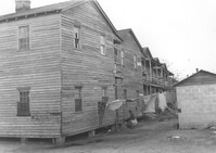
Houses and neighboring shed/garage on site affected by the construction of Interstate 26 (I-26). Address: within the range of 20-32 Brigade Street. Surveyor notations on back of photo: "Dkt.: 10.503. Property owner: Gussie Feldman. Tract: 41. Station: 5904+35 Lt. Date: Feb. 19, 1963. In R/W - Bought." [See collection description for explanation of surveyor notations.]
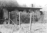
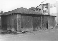
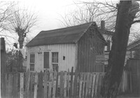
Shed or garage on site affected by the construction of Interstate 26 (I-26). Address: within the range of 20-32 Brigade Street. Surveyor notations on back of photo: "Dkt.: 10.503. Property owner: Gussie Feldman, et al.. Tract: 41. Station: 5903+92 Lt. (in Brigade St. R/W). Date: Feb. 19, 1963. In R/W - Bought." [See collection description for explanation of surveyor notations.]
Structure (shed?) on site affected by the construction of Interstate 26 (I-26). Address: within the range of 20-32 Brigade Street. Surveyor notations on back of photo: "Dkt.: 10.503. Property owner: Gussie Feldman. Tract: 41. Station: 5903+92 Lt. Date: Feb. 19, 1963. In R/W - Bought." [See collection description for explanation of surveyor notations.]
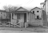
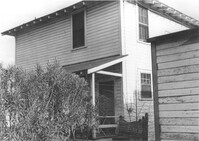
House on site affected by the construction of Interstate 26 (I-26). Address: 1085 Meeting Street. Surveyor notations on back of photo: "Dkt.: 10.503. Property owner: Gussie Feldman. Tract: 41. Station: 5903+50 Lt. (In Brigade Street R/W.) Date: Feb. 19, 1963. In R/W - Bought." [See collection description for explanation of surveyor notations.]
House (rear view) on site affected by the construction of Interstate 26 (I-26). Address: 1085 Meeting Street. Surveyor notations on back of photo: "Dkt.: 10.503. Property owner: Gussie Feldman. Tract: 41. Station: 5903+50 Lt. Date: Feb. 19, 1963. In R/W - Bought." [See collection description for explanation of surveyor notations.]
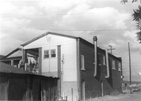
Laundromat / Half Hour Laundry on site affected by the construction of Interstate 26 (I-26). Address: 1085 Meeting Street. View of street corner. Surveyor notations on back of photo: "Dkt.: 10.503. Property owner: Gussie Feldman. Tract: 41. Station: 5903+50 Lt. Date: Feb. 19, 1963. In R/W - Bought." [See collection description for explanation of surveyor notations.]
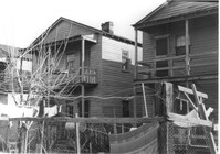
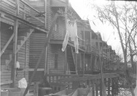
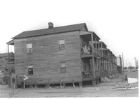
Row of houses (rear view) on site affected by the construction of Interstate 26 (I-26). Address: 20-32 Brigade Street. Surveyor notations on back of photo: "Dkt.: 10.503. Property owner: Gussie Feldman. Tract: 41. Station: 5904±20 Rt. & Lt. Date: Feb. 19, 1963. In R/W - Bought. (Rear of buildings fronting Brigade Street.)" [See collection description for explanation of surveyor notations.]
Row of houses on Brigade Street, on site affected by the construction of Interstate 26 (I-26). Address: 10-18 J Place [between Lenox and Brigade]. (See Sheet 1 of 1951 Sanborn Map.) Surveyor notations on back of photo: "Dkt.: 10.503. Property owner: Gussie Feldman. Tract: 41. Station: 5903+50 Rt. & Lt. In R/W - Bought." [See collection description for explanation of surveyor notations.]
Row of houses (rear view) on site affected by the construction of Interstate 26 (I-26). Address: 16-18 J Place [between Lenox and Brigade]. (See Sheet 1 of 1951 Sanborn Map.) Surveyor notations on back of photo: "Dkt.: 10.503. Property owner: Gussie Feldman. Tract: 41. Station: 5903+50 Rt. & Lt. In R/W - Bought." [See collection description for explanation of surveyor notations.]
House on site affected by the construction of the Crosstown. Address: 94 Sheppard Street. Surveyor notations on back of photo: "Dkt.: 10.518. Property owner: Alice Davis. Tract: 17. Station: 30+55 Lt. Sheppard Street. Date: Mar. 6, 1963. Proximity. [See collection description for explanation of surveyor notations.]
Row of houses on site affected by the construction of Interstate 26 (I-26). Address: 10-14 J Place [between Lenox and Brigade]. (See Sheet 1 of 1951 Sanborn Map.) Surveyor notations on back of photo: "Dkt.: 10.503. Property owner: Gussie Feldman. Tract: 41. Station: 5903+50 Rt. & Lt. In R/W - Bought." [See collection description for explanation of surveyor notations.]
Row of houses on site affected by the construction of Interstate 26 (I-26). Address: 20-32 Brigade Street. Surveyor notations on back of photo: "Dkt.: 10.503. Property owner: Gussie Feldman. Tract: 41. Station: 5904+30 Rt. In R/W - Bought." [See collection description for explanation of surveyor notations.]
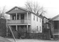
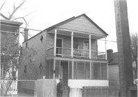
House on site affected by the construction of Interstate 26 (I-26). Address: 11 Brigade Street. Surveyor notations on back of photo: "Dkt.: 10.503. Property owner: Ada Williams. Tract: 42. Station: 5905+20 Rt. Date: Feb. 19, 1963. In R/W - Bought." [See collection description for explanation of surveyor notations.]
House on site affected by the construction of Interstate 26 (I-26). Address: 11 Brigade Street. Surveyor notations on back of photo: "Dkt.: 10.503. Property owner: Ada Williams. Tract: 42. Station: 5905+20 Rt. Date: Feb. 19, 1963. In R/W - Bought." [See collection description for explanation of surveyor notations.]
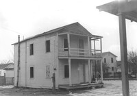
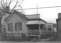
House (freedman's cottage?) on site affected by the construction of Interstate 26 (I-26). Address: 10 Brigade Street. Surveyor notations on back of photo: "Dkt.: 10.503. Property owner: Nathan Williams. Tract: 43. Station: 5905+30 Rt. Date: Feb. 19, 1963. In R/W - Bought." [See collection description for explanation of surveyor notations.]
House (rear view) on site affected by the construction of Interstate 26 (I-26). Address: 10 Brigard Street. Surveyor notations on back of photo: "Dkt.: 10.503. Property owner: Nathan Williams. Tract: 43. Station: 5905+30 Rt. Date: Feb. 19, 1963. In R/W - Bought." [See collection description for explanation of surveyor notations.]
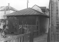
Dwelling or outbuilding on site affected by the construction of Interstate 26 (I-26). Address: 9 Brigade Street. Surveyor notations on back of photo: "Dkt.: 10.503. Property owner: Gussie Feldman, et al. Tract: 44. Station: 5905+30 Rt. Date: Feb. 19, 1963. In R/W - Bought." [See collection description for explanation of surveyor notations.]
House (freedman's cottage) on site affected by the construction of Interstate 26 (I-26). Address: 9 Brigade Street. Surveyor notations on back of photo: "Dkt.: 10.503. Property owner: Gussie Feldman, et al. Tract: 44. Station: 5905+30 Rt. Date: Feb. 19, 1963. In R/W - Bought." [See collection description for explanation of surveyor notations.]
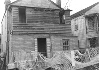
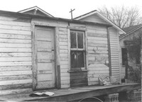
House (freedman's cottage) on site affected by the construction of Interstate 26 (I-26). Address: 8 Brigade Street. Surveyor notations on back of photo: "Dkt.: 10.503. Property owner: Gussie Feldman, et al. Tract: 44-A. Station: 5905+00 Rt. & Lt. Date: Feb. 19, 1963. In R/W - Bought." [See collection description for explanation of surveyor notations.]
House (freedman's cottage) (rear view) on site affected by the construction of Interstate 26 (I-26). Address: 8 Brigade Street. Surveyor notations on back of photo: "Dkt.: 10.503. Property owner: Gussie Feldman, et al. Tract: 44-A. Station: 5905+00 Rt. & Lt. Date: Feb. 19, 1963. In R/W - Bought." [See collection description for explanation of surveyor notations.]
House on site affected by the construction of the Crosstown. Address: 96 Sheppard Street. Surveyor notations on back of photo: "Dkt.: 10.518. Property owner: Celia McFadden. Tract: 18. Station: 30+10 Lt. Sheppard Street. Date: Mar. 6, 1963. In R/W - Bought. [See collection description for explanation of surveyor notations.]
House on site affected by the construction of Interstate 26 (I-26). Address: 7 Brigade Street. Surveyor notations on back of photo: "Dkt.: 10.503. Property owner: Idella C. Calvin. Tract: 45. Station: 5905+20 Lt. Date. Date: Feb. 19, 1963. In R/W - Bought." [See collection description for explanation of surveyor notations.]
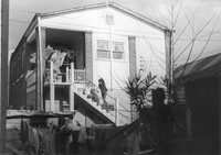
Small dwelling on site affected by the construction of Interstate 26 (I-26). Address: 7 Brigade Street. Surveyor notations on back of photo: "Dkt.: 10.503. Property owner: Idella C. Calvin. Tract: 45. Station: 5905+50 Lt. Date. Date: Feb. 19, 1963. In R/W - Bought." [See collection description for explanation of surveyor notations.]
House (freedman's cottage) on site affected by the construction of Interstate 26 (I-26). Address: 7 Brigade Street. Surveyor notations on back of photo: "Dkt.: 10.503. Property owner: Idella C. Calvin. Tract: 45. Station: 5905+20 Lt. Date: Feb. 19, 1963. In R/W - Bought." [See collection description for explanation of surveyor notations.]
House on site affected by the construction of Interstate 26 (I-26). Address: 5 Brigade Street. Surveyor notations on back of photo: "Dkt.: 10.503. Property owner: Maybelle Taylor. Tract: 46. Station: 5905+00 Lt. Date: Feb. 19, 1963. In R/W - Bought." [See collection description for explanation of surveyor notations.]
House (rear view) on site affected by the construction of Interstate 26 (I-26). Address: 5 Brigade Street. Surveyor notations on back of photo: "Dkt.: 10.503. Property owner: Maybelle Taylor. Tract: 46. Station: 5905+00 Lt. Date: Feb. 19, 1963. In R/W - Bought." [See collection description for explanation of surveyor notations.]
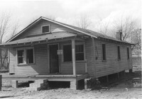
House on site affected by the construction of Interstate 26 (I-26). Address: 2 Maple Street. Surveyor notations on back of photo: "Dkt.: 10.503. Property owner: Ida Breibart. Tract: 47. Station: 5906+05 Lt. Date: Feb. 19, 1963. In R/W - Bought." [See collection description for explanation of surveyor notations.]
House (rear view) on site affected by the construction of Interstate 26 (I-26). Address: 2 Maple Street. Surveyor notations on back of photo: "Dkt.: 10.503. Property owner: Ida Breibart. Tract: 47. Station: 5906+05 Lt. Date: Feb. 19, 1963. In R/W - Bought." [See collection description for explanation of surveyor notations.]
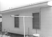
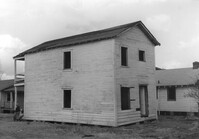
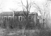
Structure on site affected by the construction of Interstate 26 (I-26). Address: 4 Maple Street. Surveyor notations on back of photo: "Dkt.: 10.503. Property owner: Frank Donnelly, et al. Tract: 48. Station: 5906+10 Lt. Date: Feb. 19, 1963. In R/W - Bought." [See collection description for explanation of surveyor notations.]
House on site affected by the construction of Interstate 26 (I-26). Address: 4 Maple Street. Surveyor notations on back of photo: "Dkt.: 10.503. Property owner: Frank Donnelly, et al. Tract: 48. Station: 5906+10 Lt. Date: Feb. 19, 1963. In R/W - Bought." [See collection description for explanation of surveyor notations.]
House on site affected by the construction of Interstate 26 (I-26). Address: 6 Maple Street. Surveyor notations on back of photo: "Dkt.: 10.503. Property owner: Atlantic Coast Life Ins. Co., et al. Tract: 49. Station: 5906+25 Lt. on CL. Date: Feb. 19, 1963. In R/W - Bought." [See collection description for explanation of surveyor notations.]
House on site affected by the construction of the Crosstown. Address: 96 Sheppard Street. Surveyor notations on back of photo: "Dkt.: 10.518. Property owner: Celia McFadden. Tract: 18. Station: 30+10 Lt. Sheppard Street. Date: Mar. 6, 1963. In R/W - Bought. [See collection description for explanation of surveyor notations.]
Portion of house (rear view) on site affected by the construction of Interstate 26 (I-26). Address: 6 Maple Street. Surveyor notations on back of photo: "Dkt.: 10.503. Property owner: Atlantic Coast Life Ins. Co., et al. Tract: 49. Station: 5906+25 Lt. on CL. Date: Feb. 19, 1963. In R/W - Bought." [See collection description for explanation of surveyor notations.]
House (rear view) on site affected by the construction of Interstate 26 (I-26). Address: 8 Maple Street. Surveyor notations on back of photo: "Dkt.: 10.503. Property owner: Atlantic Coast Life Ins. Co., et al. Tract: 50. Station: 5906+30 Rt. Date: Feb. 19, 1963. In R/W - Bought." [See collection description for explanation of surveyor notations.]
House on site affected by the construction of Interstate 26 (I-26).Address: 8 Maple Street. Surveyor notations on back of photo: "Dkt.: 10.503. Property owner: Atlantic Coast Life Ins. Co., et al. Tract: 50. Station: 5906+30 Rt. Date: Feb. 19, 1963. In R/W - Bought." [See collection description for explanation of surveyor notations.]
House on site affected by the construction of Interstate 26 (I-26). Address: 10 Maple Street. Surveyor notations on back of photo: "Dkt.: 10.503. Property owner: Gertrude C. Tindall, Est. Tract: 51. Station: 5906+40 Rt. Date: Feb. 19, 1963. In R/W - Bought." [See collection description for explanation of surveyor notations.]
House (rear view) on site affected by the construction of Interstate 26 (I-26). Address: 10 Maple Street. Surveyor notations on back of photo: "Dkt.: 10.503. Property owner: Gertrude C. Tindall, Est. Tract: 51. Station: 5906+40 Rt. Date: Feb. 19, 1963. In R/W - Bought." [See collection description for explanation of surveyor notations.]
House (rear view) on site affected by the construction of Interstate 26 (I-26). Address: 12 Maple Street. Surveyor notations on back of photo: "Dkt.: 10.503. Property owner: Atlantic Coast Life Ins. Co., et al. Tract: 52. Station: 5906+45 Rt. Date: Feb. 19, 1963. In R/W - Bought." [See collection description for explanation of surveyor notations.]
House on site affected by the construction of Interstate 26 (I-26). Address: 12 Maple Street. Surveyor notations on back of photo: "Dkt.: 10.503. Property owner: Atlantic Coast Life Ins. Co., et al. Tract: 52. Station: 5906+45 Rt. Date: Feb. 19, 1963. In R/W - Bought." [See collection description for explanation of surveyor notations.]
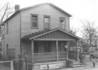
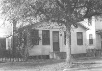
House on site affected by the construction of Interstate 26 (I-26). Address: 13 Maple Street. Surveyor notations on back of photo: "Dkt.: 10.503. Property owner: Aliene Cox Tindall. Tract: 53. Station: 5907+65 Rt. Date: Feb. 19, 1963. In R/W - Bought." [See collection description for explanation of surveyor notations.]
House (rear view) on site affected by the construction of Interstate 26 (I-26). Address: 13 Maple Street. Surveyor notations on back of photo: "Dkt.: 10.503. Property owner: Aliene Cox Tindall. Tract: 53. Station: 5907+65 Rt. Date: Feb. 19, 1963. In R/W - Bought." [See collection description for explanation of surveyor notations.]
House on site affected by the construction of Interstate 26 (I-26). Address: 11 Maple Street. Surveyor notations on back of photo: "Dkt.: 10.503. Property owner: James L. Tyler. Tract: 54. Station: 5907+50 Rt. Date: Feb. 19, 1963. In R/W - Bought." [See collection description for explanation of surveyor notations.]
House on site affected by the construction of the Crosstown. Address: 96 Sheppard Street. Surveyor notations on back of photo: "Dkt.: 10.518. Property owner: Celia McFadden. Tract: 18. Station: 30+10 Lt. Sheppard Street. Date: Mar. 6, 1963. In R/W - Bought. [See collection description for explanation of surveyor notations.]