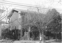
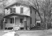
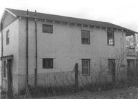
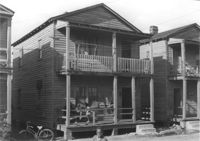
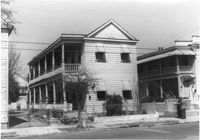
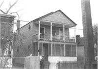
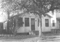
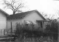
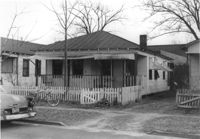
House on site affected by the construction of Interstate 26 (I-26). Address: 1199 King Street. Surveyor notations on back of photo: "Dkt.: 10.503. Property owner: Nancy J. Wandell. Tract: 19. Station: 5895+85 Rt. Date: Feb. 19, 1963." [See collection description for explanation of surveyor notations.]
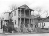
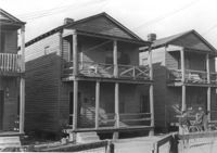
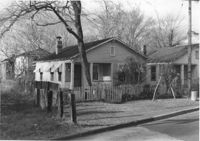
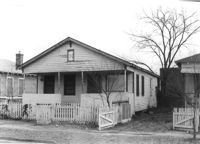
House on site affected by the construction of Interstate 26 (I-26). Address: 1197 King Street. Surveyor notations on back of photo: "Dkt.: 10.503. Property owner: Katherine A. Singleton. Tract: 20. Station: 5896+15 Rt. Date: Feb. 19, 1963. Proximity." [See collection description for explanation of surveyor notations.]
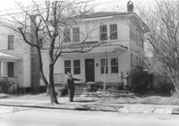
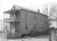
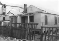
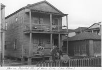
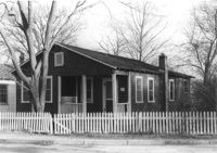
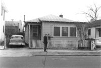
House on site affected by the construction of Interstate 26 (I-26). Address: 1194 King Street. Surveyor notations on back of photo: "Dkt.: 10.503. Property owner: J.B. Hodges. Tract: 21. Station: 5897+60 Rt. Date: Feb. 19, 1963. In R/W - Bought." [See collection description for explanation of surveyor notations.]
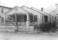
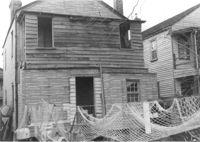
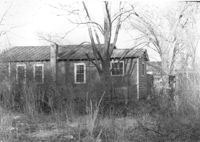
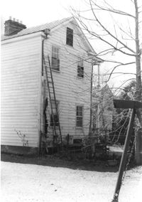
House (rear view) on site affected by the construction of Interstate 26 (I-26). Address: 1194 King Street. Surveyor notations on back of photo: "Dkt.: 10.503. Property owner: J.B. Hodges. Tract: 21. Station: 5897+60 Rt. Date: Feb. 19, 1963. In R/W - Bought." [See collection description for explanation of surveyor notations.]
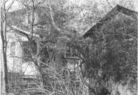
House (rear view) and structure (obscured by trees) on site affected by the construction of Interstate 26 (I-26). Address: 1200 King Street. Surveyor notations on back of photo: "Dkt.: 10.503. Property owner: William R. Nelson. Tract: 22. Station: 5897+40 Rt. Date: Feb. 19, 1963. In R/W - Bought." [See collection description for explanation of surveyor notations.]
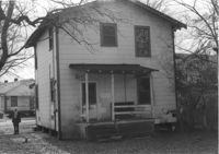
House on site affected by the construction of Interstate 26 (I-26). Address: 1200 King Street. Surveyor notations on back of photo: "Dkt.: 10.503. Property owner: William R. Nelson. Tract: 22. Station: 5897+40 Rt. Date: Feb. 19, 1963. In R/W - Bought." [See collection description for explanation of surveyor notations.]
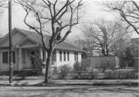
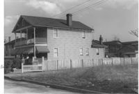
House on site affected by the construction of Interstate 26 (I-26). Address: 1202 King Street. Surveyor notations on back of photo: "Dkt.: 10.503. Property owner: Gertrude E. Cone. Tract: 23. Station: 5897+30 on CL. Date: Feb. 19, 1963. In R/W - Bought." [See collection description for explanation of surveyor notations.]
House (at rear of property?) on site affected by the construction of Interstate 26 (I-26). Address: 1202 King Street. Surveyor notations on back of photo: "Dkt.: 10.503. Property owner: Gertrude E. Cone. Tract: 23. Station: 5897+30 on CL. Date: Feb. 19, 1963. In R/W - Bought." [See collection description for explanation of surveyor notations.]
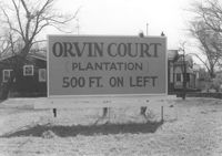
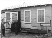
Sign for Orvin Court (Plantation) on lot, dwellings in background, on site affected by the construction of Interstate 26 (I-26). Address: 1204 King Street. Surveyor notations on back of photo: "Dkt.: 10.503. Property owner: Francis Hartnett. Tract: 24. Station: 5896+50 Lt. Date: Feb. 19, 1963. In R/W - Bought." [See collection description for explanation of surveyor notations.]
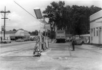
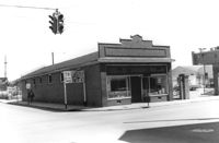
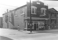
Gulf gas station, on site affected by the widening of State Road 13 (Remount Road). Arrow Restaurant and Trucker's Billiard Academy across the street. Surveyor notations on back of photo: "Dkt.: 10.562. Property owner: E.R. Gassman. Tract: 1. Date: Jul. 12, 1967." [See collection description for explanation of surveyor notations.]
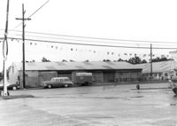
Renken Boat Co, on site affected by the widening of Route 171 (Folly Road). Surveyor notations on back of photo: "Dkt.: 10.494. Property owner: Renken Finance Co. Tract: 19. Station: 157+00 Lt. Date: Mar. 21, 1962. Proximity. [See collection description for explanation of surveyor notations.]
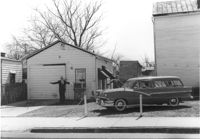
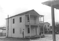
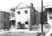
Structure on site affected by the construction of the Crosstown. Address: 510 Meeting Street. Surveyor notations on back of photo: "Dkt.: 10.518. Property owner: Robert L. Knoth. Tract: 14. Station: 5963+55 Rt. Line 3, S.B. lane of Route 17. Date: Mar. 6, 1963. Damage. [See collection description for explanation of surveyor notations.]
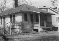
House on site affected by the construction of Interstate 26 (I-26). Address: 28 San Souci Street. Surveyor notations on back of photo: "Dkt.: 10.503. Property owner: Acme Realty Co. Tract: 25. Station: 5898+60 Rt. Date: Feb. 19, 1963. In R/W - Bought." [See collection description for explanation of surveyor notations.]
House (rear view) on site affected by the construction of Interstate 26 (I-26). Address: 28 Sans Souci Street. Surveyor notations on back of photo: "Dkt.: 10.503. Property owner: Acme Realty Co. Tract: 25. Station: 5898+60 Rt. Date: Feb. 19, 1963. In R/W - Bought." [See collection description for explanation of surveyor notations.]
House on site affected by the construction of Interstate 26 (I-26). Address: 26 Sans Souci Street. Surveyor notations on back of photo: "Dkt.: 10.503. Property owner: Annie E. Koger. Tract: 26. Station: 5898+85 Rt. Date: Feb. 19, 1963. In R/W - Bought." [See collection description for explanation of surveyor notations.]
House (side view) on site affected by the construction of Interstate 26 (I-26). Address: 26 Sans Souci Street. Railroad tracks in foreground. Surveyor notations on back of photo: "Dkt.: 10.503. Property owner: Annie E. Koger. Tract: 26. Station: 5898+85 Rt. Date: Feb. 19, 1963. In R/W - Bought." [See collection description for explanation of surveyor notations.]
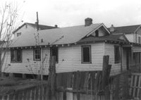
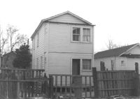
House on site affected by the construction of Interstate 26 (I-26). Address: 14 Wood Street. Surveyor notations on back of photo: "Dkt.: 10.503. Property owner: Walter K. Brown. Tract: 32. Station: 5900+10 Lt. Date: Feb. 19, 1963. In R/W - Bought." [See collection description for explanation of surveyor notations.]
House (rear view) on site affected by the construction of Interstate 26 (I-26). Address: 14 Wood Street. Surveyor notations on back of photo: "Dkt.: 10.503. Property owner: Walter K. Brown. Tract: 32. Station: 5900+10 Lt. Date: Feb. 19, 1963. In R/W - Bought." [See collection description for explanation of surveyor notations.]
House on site affected by the construction of Interstate 26 (I-26). Address: 15 Wood Street. Railroad tracks nearby. Surveyor notations on back of photo: "Dkt.: 10.503. Property owner: Abe Finklestein, et al. Tract: 33. Station: 5900+75 Lt. Date: Feb. 19, 1963. In R/W - Bought." [See collection description for explanation of surveyor notations.]
House (rear view) on site affected by the construction of Interstate 26 (I-26). Address: 15 Wood Street. Surveyor notations on back of photo: "Dkt.: 10.503. Property owner: Abe Finklestein, et al. Tract: 33. Station: 5900+75 Lt. Date: Feb. 19, 1963. In R/W - Bought." [See collection description for explanation of surveyor notations.]
Buildings and lot on site affected by the construction of the Crosstown. Address: 620 King Street. Surveyor notations on back of photo: "Dkt.: 10.518. Property owner: News & Courier. Tract: 15. Station: 8+00 Lt. Line Street (Line #2) to 9+00 Lt. Date: Mar. 6, 1963. [Zero] Fence. [See collection description for explanation of surveyor notations.]
House (rear view) on site affected by the construction of Interstate 26 (I-26). 9 Wood Street. Surveyor notations on back of photo: "Dkt.: 10.503. Property owner: Janie Washington. Tract: 34. Station: 5901+00 Lt. Date: Feb. 19, 1963. In R/W - Bought." [See collection description for explanation of surveyor notations.]
House on site affected by the construction of Interstate 26 (I-26). Address: 9 Wood Street. Surveyor notations on back of photo: "Dkt.: 10.503. Property owner: Janie Washington. Tract: 34. Station: 5901+00 Lt. Date: Feb. 19, 1963. In R/W - Bought." [See collection description for explanation of surveyor notations.]
House on site affected by the construction of Interstate 26 (I-26). Address: 7 Wood Street. Surveyor notations on back of photo: "Dkt.: 10.503. Property owner: Janie Washington. Tract: 34. Station: 5901+00 Lt. Date: Feb. 19, 1963. In R/W - Bought." [See collection description for explanation of surveyor notations.]
House (corner view, rear) on site affected by the construction of Interstate 26 (I-26). 7 Wood Street. Surveyor notations on back of photo: "Dkt.: 10.503. Property owner: Janie Washington. Tract: 34. Station: 5901+00 Lt. Date: Feb. 19, 1963. In R/W - Bought." [See collection description for explanation of surveyor notations.]
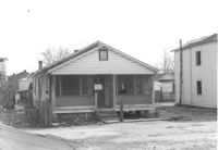
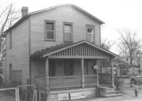
House on site affected by the construction of Interstate 26 (I-26). Address: 10 Lenox Street. Surveyor notations on back of photo: "Dkt.: 10.503. Property owner: Benjamin Thompson. Tract: 37. Station: 5901+50 Lt. Date: Feb. 19, 1963. In R/W - Bought." [See collection description for explanation of surveyor notations.]
House on site affected by the construction of Interstate 26 (I-26). Address: 10 Lenox Street. Surveyor notations on back of photo: "Dkt.: 10.503. Property owner: Benjamin Thompson. Tract: 37. Station: 5901+50 Lt. Date: Feb. 19, 1963. In R/W - Bought." [See collection description for explanation of surveyor notations.]
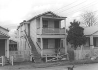
House on site affected by the construction of Interstate 26 (I-26). Address: 12 Lenox Street. Joseph Floyd Manor (Mount Pleasant Street and King Street) in background. Surveyor notations on back of photo: "Dkt.: 10.503. Property owner: Harry Thompson. Tract: 38. Station: 5901+50 Lt. Date: Feb. 19, 1963. In R/W - Bought." [See collection description for explanation of surveyor notations.]
House (rear view) on site affected by the construction of Interstate 26 (I-26). Address: 12 Lenox Street. Surveyor notations on back of photo: "Dkt.: 10.503. Property owner: Harry Thompson. Tract: 38. Station: 5901+50 Lt. Date: Feb. 19, 1963. In R/W - Bought." [See collection description for explanation of surveyor notations.]
House (rear view) on site affected by the construction of Interstate 26 (I-26). Address: 14 Lenox Street. Surveyor notations on back of photo: "Dkt.: 10.503. Property owner: Harry Thompson. Tract: 38. Station: 5901+50 Rt. Date: Feb. 19, 1963. In R/W - Bought." [See collection description for explanation of surveyor notations.]
House on site affected by the construction of Interstate 26 (I-26). Address: 14 Lenox street. Surveyor notations on back of photo: "Dkt.: 10.503. Property owner: Harry Thompson. Tract: 38. Station: 5901+50 Rt. Date: Feb. 19, 1963. In R/W - Bought." [See collection description for explanation of surveyor notations.]
Buildings and parking lot on site affected by the construction of the Crosstown. Address: 626 King Street. Surveyor notations on back of photo: "Dkt.: 10.518. Property owner: Sands & Co. Tract: 16. Station: 9+50 Lt. Line Street (Line #2). Date: Mar. 6, 1963." [See collection description for explanation of surveyor notations.]
House on site affected by the construction of Interstate 26 (I-26). Address: 16 Lenox Street. Surveyor notations on back of photo: "Dkt.: 10.503. Property owner: Harry Thompson. Tract: 38. Station: 5901+50 Rt. Date: Feb. 19, 1963. In R/W - Bought." [See collection description for explanation of surveyor notations.]
House (rear view?) on site affected by the construction of Interstate 26 (I-26). Address: 16 Lenox Street. Surveyor notations on back of photo: "Dkt.: 10.503. Property owner: Harry Thompson. Tract: 38. Station: 5901+50 Rt. Date: Feb. 19, 1963. In R/W - Bought." [See collection description for explanation of surveyor notations.]
House on site affected by the construction of Interstate 26 (I-26). Address: 5 Lenox Street. Surveyor notations on back of photo: "Dkt.: 10.503. Property owner: Estelle Thompson. Tract: 40. Station: 5902+60 Lt. Date: Feb. 19, 1963. In R/W - Bought." [See collection description for explanation of surveyor notations.]
House (rear view) on site affected by the construction of Interstate 26 (I-26). Address: 5 Lenox Street. Surveyor notations on back of photo: "Dkt.: 10.503. Property owner: Estelle Thompson. Tract: 40. Station: 5902+60 Lt. Date: Feb. 19, 1963. In R/W - Bought." [See collection description for explanation of surveyor notations.]
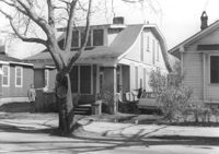
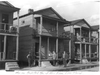
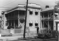
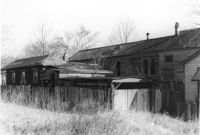
Houses on site affected by the construction of Interstate 26 (I-26). Address: 30 Brigade Street. Neighboring houses on either side also in photo. Written on border of photo: Men on projected R/W of Main Line (see plans). Surveyor notations on back of photo: "Dkt.: 10.503. Property owner: Gussie Feldman, et al. Tract: 41. Station: 5904+15 Rt. Date: Feb. 19, 1963. In R/W - Bought." [See collection description for explanation of surveyor notations.]
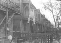
Houses (rear view) on site affected by the construction of Interstate 26 (I-26). Address: within the range of 20-32 Brigade Street. Surveyor notations on back of photo: "Dkt.: 10.503. Property owner: Gussie Feldman, et al. Tract: 41. Station: 5904+15 Rt. Date: Feb. 19, 1963. In R/W - Bought." [See collection description for explanation of surveyor notations.]
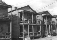
Houses on site affected by the construction of Interstate 26 (I-26). Address: within the range of 20-32 Brigade Street. Surveyor notations on back of photo: "Dkt.: 10.503. Property owner: Gussie Feldman, et al. Tract: 41. Station: 5904+15 Rt. Date: Feb. 19, 1963. In R/W - Bought." [See collection description for explanation of surveyor notations.]
Houses on site affected by the construction of Interstate 26 (I-26). Address: within the range of 20-32 Brigade Street. Surveyor notations on back of photo: "Dkt.: 10.503. Property owner: Gussie Feldman, et al. Tract: 41. Station: 5904+20 Rt. Date: Feb. 19, 1963. In R/W - Bought." [See collection description for explanation of surveyor notations.]
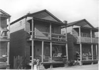
Houses on site affected by the construction of Interstate 26 (I-26). Address: 24 Brigade Street. Neighboring houses on either side also in photo. Surveyor notations on back of photo: "Dkt.: 10.503. Property owner: Gussie Feldman, et al. Tract: 41. Station: 5904+30 Lt. Date: Feb. 19, 1963. In R/W - Bought." [See collection description for explanation of surveyor notations.]
Houses on site affected by the construction of Interstate 26 (I-26). Address: within the range of 20-32 Brigade Street. Surveyor notations on back of photo: "Dkt.: 10.503. Property owner: Gussie Feldman. Tract: 41. Station: 5904+35 Lt. Date: Feb. 19, 1963. In R/W - Bought." [See collection description for explanation of surveyor notations.]
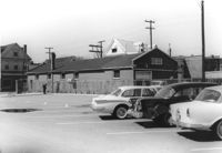
Building, on site affected by the construction of the Crosstown. Address: 626 King Street. Front facade has stepped parapet. View of street corner, with directional signage for Routes 78, 17, 52. Surveyor notations on back of photo: "Dkt.: 10.518. Property owner: Sands & Co. Tract: 16. Station: 9+50 Lt. Line Street (Line #2). Date: Mar. 6, 1963." [See collection description for explanation of surveyor notations.]
Houses on site affected by the construction of Interstate 26 (I-26). Address: within the range of 20-32 Brigade Street. Handwritten on border of photo: Men on projected R/W of main line (see plans). Surveyor notations on back of photo: "Dkt.: 10.503. Property owner: Gussie Feldman. Tract: 41. Station: 5904+35 Lt. Date: Feb. 19, 1963. In R/W - Bought." [See collection description for explanation of surveyor notations.]
Houses and neighboring shed/garage on site affected by the construction of Interstate 26 (I-26). Address: within the range of 20-32 Brigade Street. Surveyor notations on back of photo: "Dkt.: 10.503. Property owner: Gussie Feldman. Tract: 41. Station: 5904+35 Lt. Date: Feb. 19, 1963. In R/W - Bought." [See collection description for explanation of surveyor notations.]
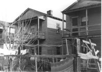
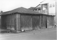
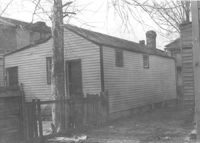
Shed or garage on site affected by the construction of Interstate 26 (I-26). Address: within the range of 20-32 Brigade Street. Surveyor notations on back of photo: "Dkt.: 10.503. Property owner: Gussie Feldman, et al.. Tract: 41. Station: 5903+92 Lt. (in Brigade St. R/W). Date: Feb. 19, 1963. In R/W - Bought." [See collection description for explanation of surveyor notations.]
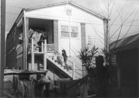
House on site affected by the construction of Interstate 26 (I-26). Address: 1085 Meeting Street. Surveyor notations on back of photo: "Dkt.: 10.503. Property owner: Gussie Feldman. Tract: 41. Station: 5903+50 Lt. (In Brigade Street R/W.) Date: Feb. 19, 1963. In R/W - Bought." [See collection description for explanation of surveyor notations.]
House (rear view) on site affected by the construction of Interstate 26 (I-26). Address: 1085 Meeting Street. Surveyor notations on back of photo: "Dkt.: 10.503. Property owner: Gussie Feldman. Tract: 41. Station: 5903+50 Lt. Date: Feb. 19, 1963. In R/W - Bought." [See collection description for explanation of surveyor notations.]
Laundromat / Half Hour Laundry on site affected by the construction of Interstate 26 (I-26). Address: 1085 Meeting Street. View of street corner. Surveyor notations on back of photo: "Dkt.: 10.503. Property owner: Gussie Feldman. Tract: 41. Station: 5903+50 Lt. Date: Feb. 19, 1963. In R/W - Bought." [See collection description for explanation of surveyor notations.]
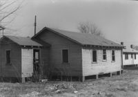
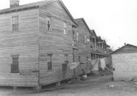
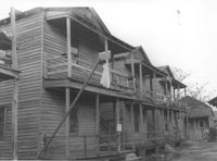
Row of houses (rear view) on site affected by the construction of Interstate 26 (I-26). Address: 20-32 Brigade Street. Surveyor notations on back of photo: "Dkt.: 10.503. Property owner: Gussie Feldman. Tract: 41. Station: 5904±20 Rt. & Lt. Date: Feb. 19, 1963. In R/W - Bought. (Rear of buildings fronting Brigade Street.)" [See collection description for explanation of surveyor notations.]
Row of houses on Brigade Street, on site affected by the construction of Interstate 26 (I-26). Address: 10-18 J Place [between Lenox and Brigade]. (See Sheet 1 of 1951 Sanborn Map.) Surveyor notations on back of photo: "Dkt.: 10.503. Property owner: Gussie Feldman. Tract: 41. Station: 5903+50 Rt. & Lt. In R/W - Bought." [See collection description for explanation of surveyor notations.]
Row of houses (rear view) on site affected by the construction of Interstate 26 (I-26). Address: 16-18 J Place [between Lenox and Brigade]. (See Sheet 1 of 1951 Sanborn Map.) Surveyor notations on back of photo: "Dkt.: 10.503. Property owner: Gussie Feldman. Tract: 41. Station: 5903+50 Rt. & Lt. In R/W - Bought." [See collection description for explanation of surveyor notations.]
House on site affected by the construction of the Crosstown. Address: 94 Sheppard Street. Surveyor notations on back of photo: "Dkt.: 10.518. Property owner: Alice Davis. Tract: 17. Station: 30+55 Lt. Sheppard Street. Date: Mar. 6, 1963. Proximity. [See collection description for explanation of surveyor notations.]
Row of houses on site affected by the construction of Interstate 26 (I-26). Address: 10-14 J Place [between Lenox and Brigade]. (See Sheet 1 of 1951 Sanborn Map.) Surveyor notations on back of photo: "Dkt.: 10.503. Property owner: Gussie Feldman. Tract: 41. Station: 5903+50 Rt. & Lt. In R/W - Bought." [See collection description for explanation of surveyor notations.]
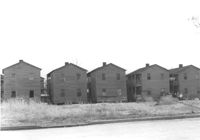
Row of houses on site affected by the construction of Interstate 26 (I-26). Address: 20-32 Brigade Street. Surveyor notations on back of photo: "Dkt.: 10.503. Property owner: Gussie Feldman. Tract: 41. Station: 5904+30 Rt. In R/W - Bought." [See collection description for explanation of surveyor notations.]
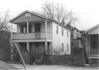
House on site affected by the construction of Interstate 26 (I-26). Address: 11 Brigade Street. Surveyor notations on back of photo: "Dkt.: 10.503. Property owner: Ada Williams. Tract: 42. Station: 5905+20 Rt. Date: Feb. 19, 1963. In R/W - Bought." [See collection description for explanation of surveyor notations.]
House on site affected by the construction of Interstate 26 (I-26). Address: 11 Brigade Street. Surveyor notations on back of photo: "Dkt.: 10.503. Property owner: Ada Williams. Tract: 42. Station: 5905+20 Rt. Date: Feb. 19, 1963. In R/W - Bought." [See collection description for explanation of surveyor notations.]
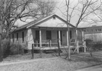
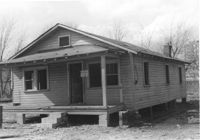
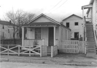
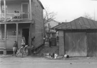
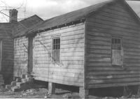
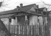
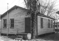
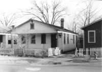
House (freedman's cottage?) on site affected by the construction of Interstate 26 (I-26). Address: 10 Brigade Street. Surveyor notations on back of photo: "Dkt.: 10.503. Property owner: Nathan Williams. Tract: 43. Station: 5905+30 Rt. Date: Feb. 19, 1963. In R/W - Bought." [See collection description for explanation of surveyor notations.]
House (rear view) on site affected by the construction of Interstate 26 (I-26). Address: 10 Brigard Street. Surveyor notations on back of photo: "Dkt.: 10.503. Property owner: Nathan Williams. Tract: 43. Station: 5905+30 Rt. Date: Feb. 19, 1963. In R/W - Bought." [See collection description for explanation of surveyor notations.]
Dwelling or outbuilding on site affected by the construction of Interstate 26 (I-26). Address: 9 Brigade Street. Surveyor notations on back of photo: "Dkt.: 10.503. Property owner: Gussie Feldman, et al. Tract: 44. Station: 5905+30 Rt. Date: Feb. 19, 1963. In R/W - Bought." [See collection description for explanation of surveyor notations.]
House (freedman's cottage) on site affected by the construction of Interstate 26 (I-26). Address: 9 Brigade Street. Surveyor notations on back of photo: "Dkt.: 10.503. Property owner: Gussie Feldman, et al. Tract: 44. Station: 5905+30 Rt. Date: Feb. 19, 1963. In R/W - Bought." [See collection description for explanation of surveyor notations.]
House (freedman's cottage) on site affected by the construction of Interstate 26 (I-26). Address: 8 Brigade Street. Surveyor notations on back of photo: "Dkt.: 10.503. Property owner: Gussie Feldman, et al. Tract: 44-A. Station: 5905+00 Rt. & Lt. Date: Feb. 19, 1963. In R/W - Bought." [See collection description for explanation of surveyor notations.]
House (freedman's cottage) (rear view) on site affected by the construction of Interstate 26 (I-26). Address: 8 Brigade Street. Surveyor notations on back of photo: "Dkt.: 10.503. Property owner: Gussie Feldman, et al. Tract: 44-A. Station: 5905+00 Rt. & Lt. Date: Feb. 19, 1963. In R/W - Bought." [See collection description for explanation of surveyor notations.]
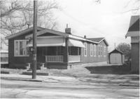
House on site affected by the construction of the Crosstown. Address: 96 Sheppard Street. Surveyor notations on back of photo: "Dkt.: 10.518. Property owner: Celia McFadden. Tract: 18. Station: 30+10 Lt. Sheppard Street. Date: Mar. 6, 1963. In R/W - Bought. [See collection description for explanation of surveyor notations.]
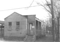
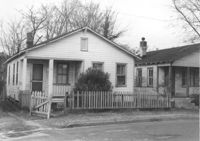
House on site affected by the construction of Interstate 26 (I-26). Address: 7 Brigade Street. Surveyor notations on back of photo: "Dkt.: 10.503. Property owner: Idella C. Calvin. Tract: 45. Station: 5905+20 Lt. Date. Date: Feb. 19, 1963. In R/W - Bought." [See collection description for explanation of surveyor notations.]
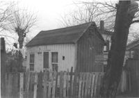
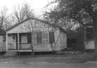
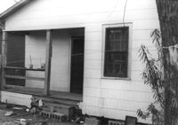
Small dwelling on site affected by the construction of Interstate 26 (I-26). Address: 7 Brigade Street. Surveyor notations on back of photo: "Dkt.: 10.503. Property owner: Idella C. Calvin. Tract: 45. Station: 5905+50 Lt. Date. Date: Feb. 19, 1963. In R/W - Bought." [See collection description for explanation of surveyor notations.]
House (freedman's cottage) on site affected by the construction of Interstate 26 (I-26). Address: 7 Brigade Street. Surveyor notations on back of photo: "Dkt.: 10.503. Property owner: Idella C. Calvin. Tract: 45. Station: 5905+20 Lt. Date: Feb. 19, 1963. In R/W - Bought." [See collection description for explanation of surveyor notations.]
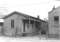
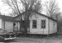
House on site affected by the construction of Interstate 26 (I-26). Address: 5 Brigade Street. Surveyor notations on back of photo: "Dkt.: 10.503. Property owner: Maybelle Taylor. Tract: 46. Station: 5905+00 Lt. Date: Feb. 19, 1963. In R/W - Bought." [See collection description for explanation of surveyor notations.]
House (rear view) on site affected by the construction of Interstate 26 (I-26). Address: 5 Brigade Street. Surveyor notations on back of photo: "Dkt.: 10.503. Property owner: Maybelle Taylor. Tract: 46. Station: 5905+00 Lt. Date: Feb. 19, 1963. In R/W - Bought." [See collection description for explanation of surveyor notations.]
House on site affected by the construction of Interstate 26 (I-26). Address: 2 Maple Street. Surveyor notations on back of photo: "Dkt.: 10.503. Property owner: Ida Breibart. Tract: 47. Station: 5906+05 Lt. Date: Feb. 19, 1963. In R/W - Bought." [See collection description for explanation of surveyor notations.]
House (rear view) on site affected by the construction of Interstate 26 (I-26). Address: 2 Maple Street. Surveyor notations on back of photo: "Dkt.: 10.503. Property owner: Ida Breibart. Tract: 47. Station: 5906+05 Lt. Date: Feb. 19, 1963. In R/W - Bought." [See collection description for explanation of surveyor notations.]
House on site affected by the construction of Interstate 26 (I-26). Address: 4 Maple Street. Surveyor notations on back of photo: "Dkt.: 10.503. Property owner: Frank Donnelly, et al. Tract: 48. Station: 5906+10 Lt. Date: Feb. 19, 1963. In R/W - Bought." [See collection description for explanation of surveyor notations.]
House on site affected by the construction of Interstate 26 (I-26). Address: 6 Maple Street. Surveyor notations on back of photo: "Dkt.: 10.503. Property owner: Atlantic Coast Life Ins. Co., et al. Tract: 49. Station: 5906+25 Lt. on CL. Date: Feb. 19, 1963. In R/W - Bought." [See collection description for explanation of surveyor notations.]
House on site affected by the construction of the Crosstown. Address: 96 Sheppard Street. Surveyor notations on back of photo: "Dkt.: 10.518. Property owner: Celia McFadden. Tract: 18. Station: 30+10 Lt. Sheppard Street. Date: Mar. 6, 1963. In R/W - Bought. [See collection description for explanation of surveyor notations.]
Portion of house (rear view) on site affected by the construction of Interstate 26 (I-26). Address: 6 Maple Street. Surveyor notations on back of photo: "Dkt.: 10.503. Property owner: Atlantic Coast Life Ins. Co., et al. Tract: 49. Station: 5906+25 Lt. on CL. Date: Feb. 19, 1963. In R/W - Bought." [See collection description for explanation of surveyor notations.]
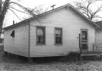
House (rear view) on site affected by the construction of Interstate 26 (I-26). Address: 8 Maple Street. Surveyor notations on back of photo: "Dkt.: 10.503. Property owner: Atlantic Coast Life Ins. Co., et al. Tract: 50. Station: 5906+30 Rt. Date: Feb. 19, 1963. In R/W - Bought." [See collection description for explanation of surveyor notations.]
House on site affected by the construction of Interstate 26 (I-26).Address: 8 Maple Street. Surveyor notations on back of photo: "Dkt.: 10.503. Property owner: Atlantic Coast Life Ins. Co., et al. Tract: 50. Station: 5906+30 Rt. Date: Feb. 19, 1963. In R/W - Bought." [See collection description for explanation of surveyor notations.]
House on site affected by the construction of Interstate 26 (I-26). Address: 10 Maple Street. Surveyor notations on back of photo: "Dkt.: 10.503. Property owner: Gertrude C. Tindall, Est. Tract: 51. Station: 5906+40 Rt. Date: Feb. 19, 1963. In R/W - Bought." [See collection description for explanation of surveyor notations.]
House (rear view) on site affected by the construction of Interstate 26 (I-26). Address: 10 Maple Street. Surveyor notations on back of photo: "Dkt.: 10.503. Property owner: Gertrude C. Tindall, Est. Tract: 51. Station: 5906+40 Rt. Date: Feb. 19, 1963. In R/W - Bought." [See collection description for explanation of surveyor notations.]
House (rear view) on site affected by the construction of Interstate 26 (I-26). Address: 12 Maple Street. Surveyor notations on back of photo: "Dkt.: 10.503. Property owner: Atlantic Coast Life Ins. Co., et al. Tract: 52. Station: 5906+45 Rt. Date: Feb. 19, 1963. In R/W - Bought." [See collection description for explanation of surveyor notations.]
House on site affected by the construction of Interstate 26 (I-26). Address: 12 Maple Street. Surveyor notations on back of photo: "Dkt.: 10.503. Property owner: Atlantic Coast Life Ins. Co., et al. Tract: 52. Station: 5906+45 Rt. Date: Feb. 19, 1963. In R/W - Bought." [See collection description for explanation of surveyor notations.]
House on site affected by the construction of Interstate 26 (I-26). Address: 13 Maple Street. Surveyor notations on back of photo: "Dkt.: 10.503. Property owner: Aliene Cox Tindall. Tract: 53. Station: 5907+65 Rt. Date: Feb. 19, 1963. In R/W - Bought." [See collection description for explanation of surveyor notations.]
House (rear view) on site affected by the construction of Interstate 26 (I-26). Address: 13 Maple Street. Surveyor notations on back of photo: "Dkt.: 10.503. Property owner: Aliene Cox Tindall. Tract: 53. Station: 5907+65 Rt. Date: Feb. 19, 1963. In R/W - Bought." [See collection description for explanation of surveyor notations.]
House on site affected by the construction of Interstate 26 (I-26). Address: 11 Maple Street. Surveyor notations on back of photo: "Dkt.: 10.503. Property owner: James L. Tyler. Tract: 54. Station: 5907+50 Rt. Date: Feb. 19, 1963. In R/W - Bought." [See collection description for explanation of surveyor notations.]
House on site affected by the construction of the Crosstown. Address: 96 Sheppard Street. Surveyor notations on back of photo: "Dkt.: 10.518. Property owner: Celia McFadden. Tract: 18. Station: 30+10 Lt. Sheppard Street. Date: Mar. 6, 1963. In R/W - Bought. [See collection description for explanation of surveyor notations.]
House (rear view) on site affected by the construction of Interstate 26 (I-26). Address: 11 Maple Street. Surveyor notations on back of photo: "Dkt.: 10.503. Property owner: James L. Tyler. Tract: 54. Station: 5907+50 Rt. Date: Feb. 19, 1963. In R/W - Bought." [See collection description for explanation of surveyor notations.]
House (rear view) on site affected by the construction of Interstate 26 (I-26). Address: 9 Maple Street. Surveyor notations on back of photo: "Dkt.: 10.503. Property owner: Kiki Zicoupolis, et al. Tract: 55. Station: 5907+45 CL. Date: Feb. 19, 1963. In R/W - Bought." [See collection description for explanation of surveyor notations.]
House on site affected by the construction of Interstate 26 (I-26). Address: 9 Maple Street. Surveyor notations on back of photo: "Dkt.: 10.503. Property owner: Kiki Zicoupolis, et al. Tract: 55. Station: 5907+45 CL. Date: Feb. 19, 1963. In R/W - Bought." [See collection description for explanation of surveyor notations.]
House on site affected by the construction of Interstate 26 (I-26). Address: 7 Maple Street. Surveyor notations on back of photo: "Dkt.: 10.503. Property owner: James M. Knox. Tract: 56. Station: 5907+45 Lt. Date: Feb. 19, 1963. In R/W - Bought." [See collection description for explanation of surveyor notations.]
House (side view, rear) on site affected by the construction of Interstate 26 (I-26). Address: 7 Maple Street. Surveyor notations on back of photo: "Dkt.: 10.503. Property owner: James M. Knox. Tract: 56. Station: 5907+45 Lt. Date: Feb. 19, 1963. In R/W - Bought." [See collection description for explanation of surveyor notations.]
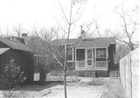
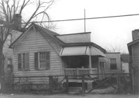
House on site affected by the construction of Interstate 26 (I-26).Address: 5 Maple Street. Surveyor notations on back of photo: "Dkt.: 10.503. Property owner: Harry B. Chassereau. Tract: 57. Station: 5907+35 Lt. Date: Feb. 19, 1963." [See collection description for explanation of surveyor notations.]
House (rear view) on site affected by the construction of Interstate 26 (I-26). Address: 5 Maple Street. Surveyor notations on back of photo: "Dkt.: 10.503. Property owner: Harry B. Chassereau. Tract: 57. Station: 5907+35 Lt. Date: Feb. 19, 1963." [See collection description for explanation of surveyor notations.]
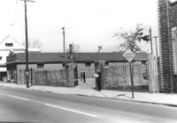
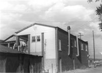
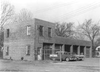
Commercial building with 6 bays (garage?) on site affected by the construction of Interstate 26 (I-26). Address: 739 Meeting Street. Surveyor notations on back of photo: "Dkt.: 10.503. Property owner: Alton M. Silver. Tract: 58. Station: 5908+15 Lt. Date: Feb. 20, 1963. In R/W - Bought." [See collection description for explanation of surveyor notations.]
Side view of commercial building with 6 bays (garage?) on site affected by the construction of Interstate 26 (I-26). Address: 739 Meeting Street. Surveyor notations on back of photo: "Dkt.: 10.503. Property owner: Alton M. Silver. Tract: 58. Station: 5908+15 Lt. Date: Feb. 20, 1963. In R/W - Bought." [See collection description for explanation of surveyor notations.]
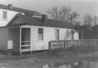
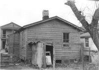
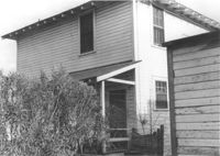
House-like structure on site affected by the construction of Interstate 26 (I-26). Address: 739 Meeting Street. Surveyor notations on back of photo: "Dkt.: 10.503. Property owner: George E. Williams. Tract: 60. Station: 5909+30 Rt. Date: Feb. 20, 1963. In R/W - Bought." [See collection description for explanation of surveyor notations.]
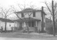
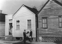
Street corner and houses on site affected by the construction of the Crosstown. Address: 100 Sheppard Street. Surveyor notations on back of photo: "Dkt.: 10.518. Property owner: M.J. Christine Butt, Est. Tract: 19. Station: 29+40 Lt. Sheppard Street. Date: Mar. 6, 1963. In R/W - Bought. [See collection description for explanation of surveyor notations.]
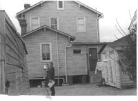
House-like structure (rear view) and neighboring structures on site affected by the construction of Interstate 26 (I-26). Address: 739 Meeting Street. Surveyor notations on back of photo: "Dkt.: 10.503. Property owner: George E. Williams. Tract: 60. Station: 5909+30 Rt. Date: Feb. 20, 1963. In R/W - Bought." [See collection description for explanation of surveyor notations.]
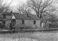
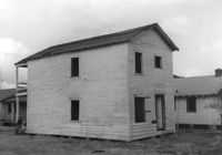
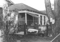
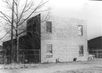
House-like structure in dilapidated condition (side view) on site affected by the construction of Interstate 26 (I-26). Dirt lot in foreground. Address: 739 Meeting Street. Surveyor notations on back of photo: "Dkt.: 10.503. Property owner: Eula Chitwood. Tract: 61. Station: 5909+30 Rt. Date: Feb. 20, 1963. In R/W - Bought." [See collection description for explanation of surveyor notations.]
Houses (freedman's cottages) on site affected by the construction of Interstate 26 (I-26). Address: 12-14 Riker Street. Surveyor notations on back of photo: "Dkt.: 10.503. Property owner: Jesse Williams. Tract: 62. Station: 5910+40 Lt. Date: Feb. 20, 1963. In R/W - Bought." [See collection description for explanation of surveyor notations.]
Houses (freedman's cottages) (rear view) on site affected by the construction of Interstate 26 (I-26). Address: 12-14 Riker Street. Surveyor notations on back of photo: "Dkt.: 10.503. Property owner: Jesse Williams. Tract: 62. Station: 5910+40 Lt. Date: Feb. 20, 1963. In R/W - Bought." [See collection description for explanation of surveyor notations.]