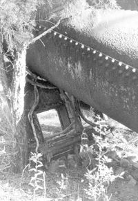
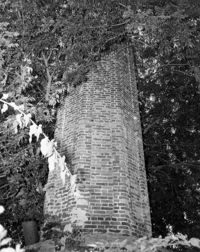
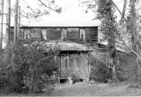
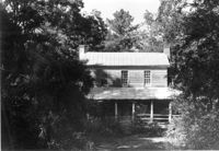
Fairlawn Plantation (Hugh Rose Plantation), Off of Guerins Bridge Road, adjacent to the Francis Marion National Forest. Detail View of Steam Engine for Rice Mill.;6.5" x 10" B/W photo. Box 19, Folder: Charleston County: Christ Church: Fairlawn Plantation. One copy.
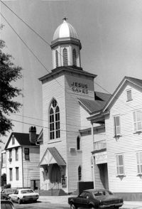
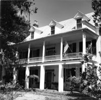
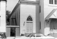
Central Baptist Church, 26 Radcliffe Street. View of SW (Front and Side) elevation. Charleston, S.C.;10" x 6.5" B/W photo. Box 9, Folder 2-1-156. One copy.
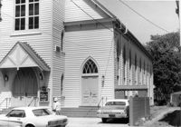
Central Baptist Church, 26 Radcliffe Street. View of SW (Side and Front) elevation. Charleston, S.C.;6.5" x 10" B/W photo. Box 9, Folder 2-1-156. One copy.
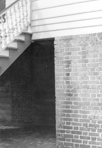
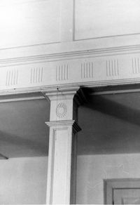
San Souci House, 206 San Souci Street. Detail View of Piers. SW (Front and Side) elevation. Charleston, S.C.;10" x 6.5" B/W photo. Box 8, Folder 2-1-149. One copy.
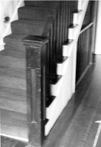
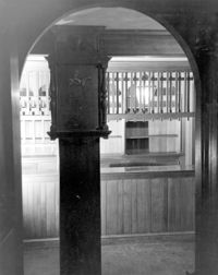
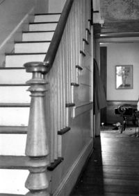
San Souci House, 206 San Souci Street. Interior View - 1st Floor. Detail of Newel Post. Charleston, S.C.;10" x 6.5" B/W photo. Box 8, Folder 2-1-149. One copy.
Dock Street Theater, 135 Church Street. Interior View - Ballroom. View after restoration, SW elevation. Charleston, S.C.;8" x 10" B/W photo. Box 6, Folder 2-1-32. One copy.
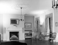
Marshlands Plantation, Fort Sumter Drive. Main House - Interior View. West Front Room, Detail of Mantle. SW elevation. James Island, S.C.;10" x 8" B/W photo. Box 11, Folder 2-4-3. One copy.
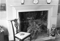
Seaside Plantation (Locksley Hall), off of Cypress Bottom Road. Interior View - 2nd Floor, West Bedroom. Detail of fireplace, East elevation. Edisto Island, S.C.;7" x 5" B/W photo. Box 11, Folder 2-3-12. One copy.
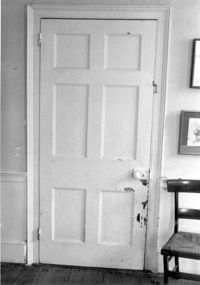
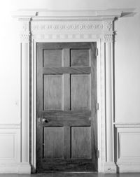
Seaside Plantation (Locksley Hall), off of Cypress Bottom Road. Interior View - 2nd Floor, West Bedroom. Detail of door, West elevation. Edisto Island, S.C.;5" x 7" B/W photo. Box 11, Folder 2-3-12. One copy.
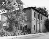
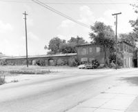
S.C. Railroad Car Shop (AAA Downtown Storage), 44 Line Street. Detail View of SW elevation Charleston, S.C.;8" x 10" B/W photo. Box 18, Folder: Charleston: 44 Line Street, South Carolina Car Shop. Two copies
S.C. Railroad Car Shop (AAA Downtown Storage), 44 Line Street. View of SW elevation Charleston, S.C.;8" x 10" B/W photo. Box 18, Folder: Charleston: 44 Line Street, South Carolina Car Shop. One copy.
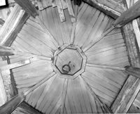
S.C. Railroad Car Shop (AAA Downtown Storage), 44 Line Street. Unidentified detail. Charleston, S.C.;10" x 8" B/W photo. Box 18, Folder: Charleston: 44 Line Street, South Carolina Car Shop. One copy.
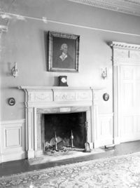
Marshlands Plantation, Fort Sumter Drive. Main House - Interior View. West Front Room, Detail of Door and Crown Molding. NW elevation. James Island, S.C.;10" x 8" B/W photo. Box 11, Folder 2-4-3. One copy.
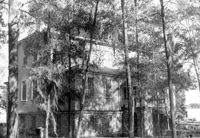
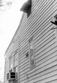
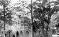
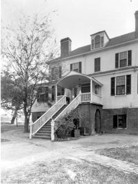
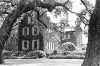
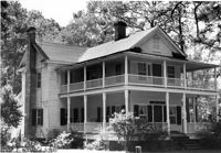
Marshlands Plantation, Fort Sumter Drive. Main House - View of NE (Side and Rear) elevation. James Island, S.C.;6.5" x 10" (and 3" x 5") B/W photo. Box 11, Folder 2-4-3. Two copies.
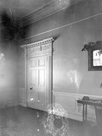
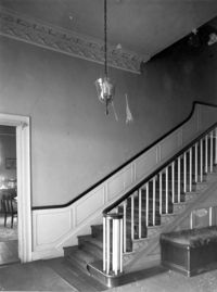
Marshlands Plantation, Fort Sumter Drive. Main House - Interior View. Staircase. NW elevation. James Island, S.C.;10" x 8" B/W photo. Box 11, Folder 2-4-3. One copy.
Dock Street Theater, 135 Church Street. Interior View - Ballroom. View before restoration, NE elevation. Charleston, S.C.;6.5" x 10" B/W photo. Box 6, Folder 2-1-32. One copy.
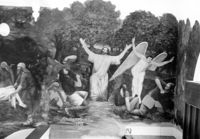
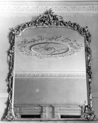
Dock Street Theater, 135 Church Street. Interior View - Ballroom. Detail View of Mirror, West elevation. Charleston, S.C.;10" x 8" B/W photo. Box 6, Folder 2-1-32. One copy.
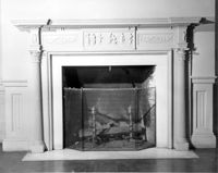
Dock Street Theater, 135 Church Street. Interior View - Green Room. Detail of Mantle, South elevation. Charleston, S.C.;8" x 10" B/W photo. Box 6, Folder 2-1-32. One copy.
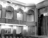
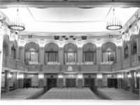
Dock Street Theater, 135 Church Street. Interior View - Auditorium. Detail of Box Seats, NW elevation. Charleston, S.C.;8" x 10" B/W photo. Box 6, Folder 2-1-32. One copy.
Dock Street Theater, 135 Church Street. Interior View - Green Room. Detail of Door, South elevation. Charleston, S.C.;10" x 8" B/W photo. Box 6, Folder 2-1-32. One copy.
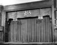
Dock Street Theater, 135 Church Street. Interior View - Auditorium. View of Stage, North elevation. Charleston, S.C.;8" x 10" B/W photo. Box 6, Folder 2-1-32. One copy.
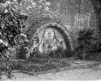
Dock Street Theater, 135 Church Street. Detail View of Fountain on Patio. East elevation. Charleston, S.C.;8" x 10" B/W photo. Box 6, Folder 2-1-32. One copy.
Dock Street Theater, 135 Church Street. Interior View - Auditorium. View from Stage, South elevation. Charleston, S.C.;8" x 10" B/W photo. Box 6, Folder 2-1-32. One copy.
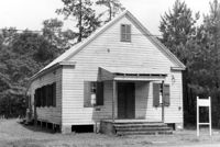
Old Lincolnville Town Hall (Williams Graded School), near intersection of East Randolph Street and East Pinckney Street. View of South (Front) elevation. Lincolnville, S.C.;6.5" x 10" B/W photo. Box 17, Folder 2-15-2. Two copies.
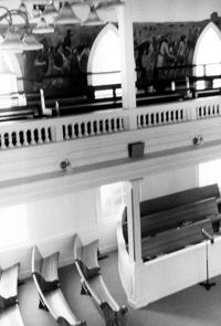
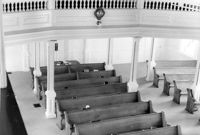
Central Baptist Church, 26 Radcliffe Street. Interior View - Balcony and Pews. NE (Rear and Side) elevation. Charleston, S.C.;10" x 6.5" B/W photo. Box 9, Folder 2-1-156. One copy.
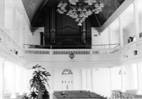
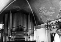
Central Baptist Church, 26 Radcliffe Street. Interior View - Organ and Side. NE (Rear and Side) elevation. Charleston, S.C.;6.5" x 10" B/W photo. Box 9, Folder 2-1-156. One copy.
Central Baptist Church, 26 Radcliffe Street. Interior View - Side and Rear. NE (Rear and Side) elevation. Charleston, S.C.;10" x 6.5" B/W photo. Box 9, Folder 2-1-156. One copy.
S.C. Railroad Car Shop (AAA Downtown Storage), 44 Line Street. Interior View - Unidentified Detail. Charleston, S.C.;8" x 10" B/W photo. Box 18, Folder: Charleston: 44 Line Street, South Carolina Car Shop. One copy.
S.C. Railroad Car Shop (AAA Downtown Storage), 44 Line Street. Interior View. Charleston, S.C.;8" x 10" B/W photo. Box 18, Folder: Charleston: 44 Line Street, South Carolina Car Shop. One copy.
Marshlands Plantation, Fort Sumter Drive. Main House - View of NW (Rear and Side) elevation. James Island, S.C.;3" x 5" B/W photo. Box 11, Folder 2-4-3. One copy.
Central Baptist Church, 26 Radcliffe Street. View of SE (Side and Front) elevation. Charleston, S.C.;6.5" x 10" B/W photo. Box 9, Folder 2-1-156. One copy.
Seaside Plantation (Locksley Hall), off of Cypress Bottom Road. Interior View - 1st Floor, Front Hall. South elevation. Edisto Island, S.C.;5" x 7" B/W photo. Box 11, Folder 2-3-12. One copy.
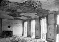
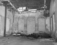
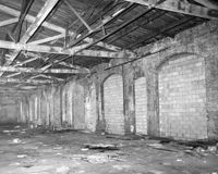
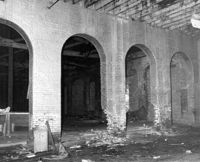
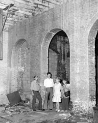
S.C. Railroad Car Shop (AAA Downtown Storage), 44 Line Street. Interior View showing damage to brick arches. Charleston, S.C.;8" x 10" B/W photo. Box 18, Folder: Charleston: 44 Line Street, South Carolina Car Shop. One copy.
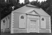
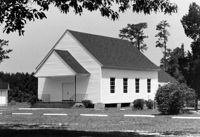
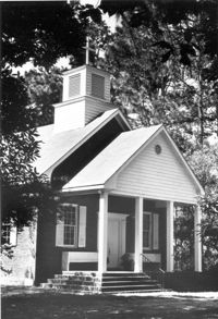
St. James Church, Goose Creek; Vestry Lane (off of Snake River Road, S.C. State Road 208). View of Front and Side elevation. Goose Creek, SC.;6.5" x 9.5" B/W photo. Box 2, Folder 1-5-1. One copy.
Marshlands Plantation, Fort Sumter Drive. Main House - View of NW (Rear) elevation. James Island, S.C.;10" x 8" B/W photo. Box 11, Folder 2-4-3. One copy.
S.C. Railroad Car Shop (AAA Downtown Storage), 44 Line Street. Interior View. Charleston, S.C.;10" x 8" B/W photo. Box 18, Folder: Charleston: 44 Line Street, South Carolina Car Shop. Two copies.
Church of the Redeemer (Pineville Chapel), Matilda Circle. Detail View of Window Sash and Shutter Dog - SE (Front) elevation. Pineville Historic District. Pineville, SC.;6.5" x 9.5" B/W photo. Box 3, Folder 1-9-1 (I). One copy.
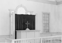
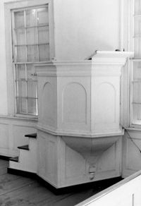
Church of the Redeemer (Pineville Chapel), Matilda Circle. Interior View - Detail of Chancel. SSE (Front and Side) elevation. Pineville Historic District. Pineville, SC.;6.5" x 9.5" B/W photo. Box 3, Folder 1-9-1 (I). One copy.
Church of the Redeemer (Pineville Chapel), Matilda Circle. Interior View - Detail of Pulpit. SSE (Front and Side) elevation. Pineville Historic District. Pineville, SC.;9.5" x 6.5" B/W photo. Box 3, Folder 1-9-1 (I). One copy.
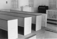
Church of the Redeemer (Pineville Chapel), Matilda Circle. Interior View - Detail of Pews. NNE (Side and Rear) elevation. Pineville Historic District. Pineville, SC.;6.5" x 9.5" B/W photo. Box 3, Folder 1-9-1 (I). One copy.
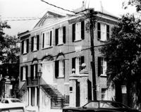
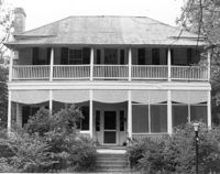
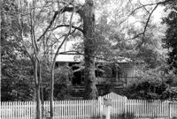
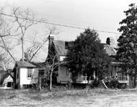
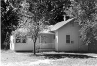
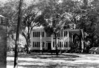
Rockville Historic District - Julia Evelina Whaley House (Marc Tolbert House), Grace Chapel Road. View of SE (Side and Front) elevation. House destroyed by fire in 1984. Wadmalaw Island, S.C.;10" x 8" B/W photo. Box 20, Folder: Charleston County: Wadmalaw Island: Julia Evelina Whaley House. Five copies.
Church of the Redeemer (Pineville Chapel), Matilda Circle. Interior View - Detail of Column and Molding on Balcony. West (Rear) elevation. Pineville Historic District. Pineville, SC.;9.5" x 6.5" B/W photo. Box 3, Folder 1-9-1 (I). One copy.
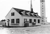
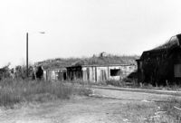
U.S. Coast Guard Historical District, I'on Avenue. Garage - View of NE (Side and Rear) elevation. Sullivans Island, S.C.;6.5" x 10" (and 3.5" x 5") B/W photo. Box 16, Folder 2-13-1. Two copies.
U.S. Coast Guard Historical District, I'on Avenue. Garage - View of South (Side) elevation. Sullivans Island, S.C.;6.5" x 10" (and 3.5" x 5") B/W photo. Box 16, Folder 2-13-1. Two copies.
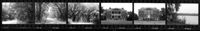
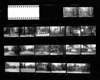
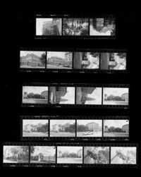
Ashley River Historic District (Highway 61 Historical District). Contact Sheet 6 - Views of Ashley Hall Plantation, Old St. Andrews Parish Church, and Ashley River Road. Charleston, S.C.;1" x 9" B/W photo. Box 20, Folder: Miscellaneous Photos: Scanned Contact Sheets. One copy.
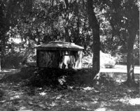
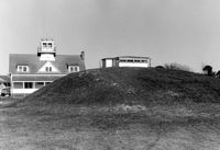
U.S. Coast Guard Historical District, I'on Avenue. Bunker - View of South (Rear) elevation. Sullivans Island, S.C.;6.5" x 10" (and 3.5" x 5") B/W photo. Box 16, Folder 2-13-1. Two copies.
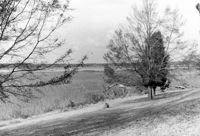
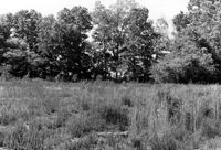
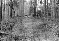
Stono River Rebellion Site (Cato's Rebellion Site), North Side of U.S. Highway 17, west of the Wallace River. View looking North. Hollywood, S.C.;6.5" x 10" B/W photo. Box 16, Folder 2-11-16. One copy.
Ashley River Historic District (Highway 61 Historical District). Contact Sheet 6 - Views of Drayton Hall and Ashley River Road. Charleston, S.C.;1" x 9" B/W photo. Box 20, Folder: Miscellaneous Photos: Scanned Contact Sheets. One copy.
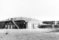
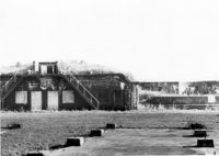
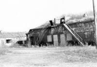
Battery Gadsden (Charleston County Public Library, Edgar Allen Poe Branch), 1921 I'on Avenue. View of East Wing and 2nd Gun Platform from East end, NW (Front and Side) elevation. Sullivans Island, S.C.;6.5" x 10" B/W photo. Box 16, Folder 2-13-6. One copy.
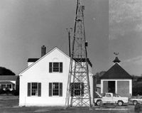
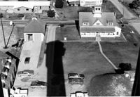
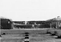
U.S. Coast Guard Historical District, I'on Avenue. Aerial View - South elevation. Sullivans Island, S.C.;6.5" x 10" (and 3.5" x 5") B/W photo. Box 16, Folder 2-13-1. Two copies.
Battery Gadsden (Charleston County Public Library, Edgar Allen Poe Branch), 1921 I'on Avenue. View of East Wing and 2nd Gun Platform from East end, North (Front) elevation. Sullivans Island, S.C.;6.5" x 10" B/W photo. Box 16, Folder 2-13-6. One copy.
Battery Gadsden (Charleston County Public Library, Edgar Allen Poe Branch), 1921 I'on Avenue. View of all three Wings, NW (Side and Front) elevation - looking East. Sullivans Island, S.C.;6.5" x 10" B/W photo. Box 16, Folder 2-13-6. One copy.
Battery Gadsden (Charleston County Public Library, Edgar Allen Poe Branch), 1921 I'on Avenue. View of 2nd Gun Platform from East end, North (Front) elevation. Sullivans Island, S.C.;6.5" x 10" B/W photo. Box 16, Folder 2-13-6. One copy.
Battery Gadsden (Charleston County Public Library, Edgar Allen Poe Branch), 1921 I'on Avenue. View of West Wing, North (Front) elevation - looking East. Sullivans Island, S.C.;6.5" x 10" B/W photo. Box 16, Folder 2-13-6. One copy.
Charles Stevens House (Northampton Plantation House), 2008 Pinopolis Road. View of Front (?) elevation. Pinopolis, S.C.;6.5" x 9.5" B/W photo. Box 3, Folder 1-9-1 (I). One copy.
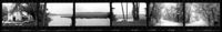
Stallsville. Contact Sheet with multiple views of various houses, commercial buildings, and roads. Summerville, S.C.;8" x 10" B/W photo. Box 3, Folder 3-1-1. One copy.
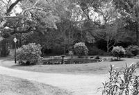
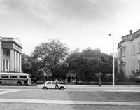
Washington Square Park, NE corner of Broad and Meeting Streets. View of West (Meeting Street) elevation. Charleston, S.C.;8" x 10" B/W photo. Box 5, Folder 2-1-8. One copy.
Robert Marion, Sr. House. View of Front elevation. Pinville Historic District. St. Stephen, S.C.;8" x 10" B/W photo. Box 3, Folder 1-9-1 (I). One copy.
Charleston County Courthouse, 77 Meeting Street. Contact Sheet - Views of the Courthouse and Washington Square Park. Charleston, S.C.;10" x 8" B/W photo. Box 5, Folder 2-1-8. One copy.
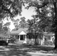
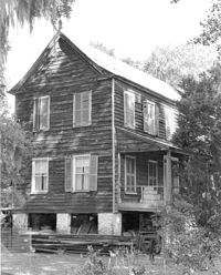
John Henry Porcher House (Percival Porcher House?). View of North (Front) elevation. Pinopolis, S.C.;6.5" x 9.5" B/W photo. Box 4, Folder 1-10-1 (III). Two copies.
John Henry Porcher House (Percival Porcher House?). View of West (Side) elevation. Pinopolis, S.C.;6.5" x 9.5" B/W photo. Box 4, Folder 1-10-1 (III). Two copies.
How Tavern. View of NE (Front and Side) elevation. Cainhoy (Huger vicinity, Lewisville, Louisville), S.C.;8" x 10" B/W photo. Box 4, Folder 1-12-3. One copy.
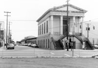
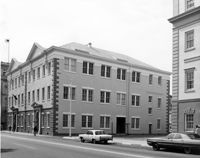
Charleston County Courthouse, 77 Meeting Street. View of NE (Side and Front) elevation. Charleston, S.C.;8" x 10" B/W photo. Box 5, Folder 2-1-8. One copy.
Martha M. Porcher House, ca. 1901 - Pivotal to Historic District. View of Side and Front elevations. Pinopolis Historic District South. Pinopolis, S.C.;5" x 7" B/W photo. Box 3, Folder 1-10-1 (II). One copy.
Louis H. Harvey House, ca. 1909 - Pivotal to Historic District. View of Front and Side elevations. Pinopolis Historic District South. Pinopolis, S.C.;5" x 7" B/W photo. Box 3, Folder 1-10-1 (II). One copy.
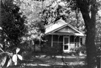
Unidentified House, ca. Early 20th century - Contributory to Historic District. Front and Side elevation. Pinopolis, S.C.;5" x 7" B/W photo. Box 3, Folder 1-10-1 (II). One copy.
W.K. Fishburne House, ca. 1911 - Pivotal to Historic District. View of Front and Side elevations. Pinopolis, S.C.;5" x 7" B/W photo. Box 3, Folder 1-10-1 (II). Three copies.
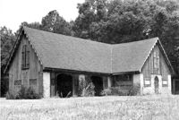
Trinity Episcopal Church, ca. 1844 - Contributory to Historic District. View of Front elevation. Pinopolis, S.C.;5" x 7" B/W photo. Box 3, Folder 1-10-1 (II). One copy.
Unidentified House, ca. 1980 - Non-contributory to Historic District. Front and Side elevations. Pinopolis, S.C.;5" x 7" B/W photo. Box 3, Folder 1-10-1 (II). One copy.
William Robertson House, ca. 1844 - Pivotal to Historic District. View of Front elevation. Pinopolis, S.C.;5" x 7" B/W photo. Box 3, Folder 1-10-1 (II). One copy.
Unidentified House, ca. 1920 - Contributory to Historic District. Front elevation. Pinopolis Historic District South. Pinopolis, S.C.;5" x 7" B/W photo. Box 3, Folder 1-10-1 (II). One copy.
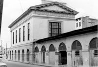
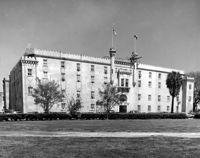
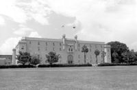
Old Citadel (South Carolina State Arsenal, Embassy Suites Hotel), 337 Meeting Street. View of SW (Front and Side) elevation. Charleston, S.C.;3.5" x 5" B/W photo. Box 5, Folder 2-1-5. Two copies.
Old Citadel (South Carolina State Arsenal, Embassy Suites Hotel), 337 Meeting Street. View of SW (Front and Side) elevation. Charleston, S.C.;8" x 10" B/W photo. Box 5, Folder 2-1-5. Three copies.