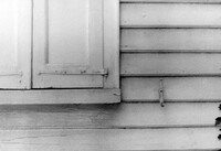
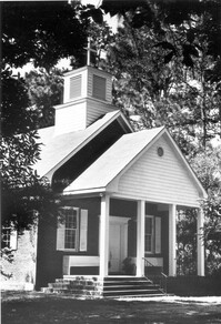
Church of the Redeemer (Pineville Chapel), Matilda Circle. Detail View of Window Sash and Shutter Dog - SE (Front) elevation. Pineville Historic District. Pineville, SC.;6.5" x 9.5" B/W photo. Box 3, Folder 1-9-1 (I). One copy.
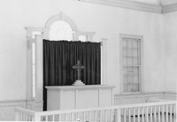
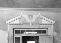
Church of the Redeemer (Pineville Chapel), Matilda Circle. Interior View - Detail of Chancel. SSE (Front and Side) elevation. Pineville Historic District. Pineville, SC.;6.5" x 9.5" B/W photo. Box 3, Folder 1-9-1 (I). One copy.
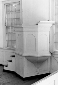
Church of the Redeemer (Pineville Chapel), Matilda Circle. Interior View - Detail of Pulpit. SSE (Front and Side) elevation. Pineville Historic District. Pineville, SC.;9.5" x 6.5" B/W photo. Box 3, Folder 1-9-1 (I). One copy.
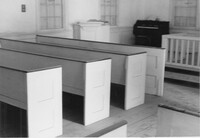
Church of the Redeemer (Pineville Chapel), Matilda Circle. Interior View - Detail of Pews. NNE (Side and Rear) elevation. Pineville Historic District. Pineville, SC.;6.5" x 9.5" B/W photo. Box 3, Folder 1-9-1 (I). One copy.
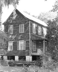
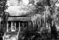
Rockville Historic District - Julia Evelina Whaley House (Marc Tolbert House), Grace Chapel Road. View of SE (Side and Front) elevation. House destroyed by fire in 1984. Wadmalaw Island, S.C.;10" x 8" B/W photo. Box 20, Folder: Charleston County: Wadmalaw Island: Julia Evelina Whaley House. Five copies.
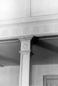
Church of the Redeemer (Pineville Chapel), Matilda Circle. Interior View - Detail of Column and Molding on Balcony. West (Rear) elevation. Pineville Historic District. Pineville, SC.;9.5" x 6.5" B/W photo. Box 3, Folder 1-9-1 (I). One copy.
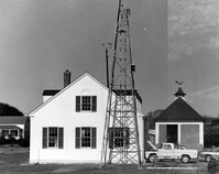
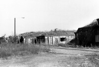
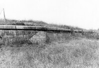
U.S. Coast Guard Historical District, I'on Avenue. Garage - View of NE (Side and Rear) elevation. Sullivans Island, S.C.;6.5" x 10" (and 3.5" x 5") B/W photo. Box 16, Folder 2-13-1. Two copies.
U.S. Coast Guard Historical District, I'on Avenue. Garage - View of South (Side) elevation. Sullivans Island, S.C.;6.5" x 10" (and 3.5" x 5") B/W photo. Box 16, Folder 2-13-1. Two copies.
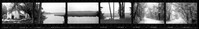
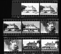
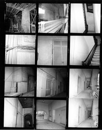
Ashley River Historic District (Highway 61 Historical District). Contact Sheet 6 - Views of Ashley Hall Plantation, Old St. Andrews Parish Church, and Ashley River Road. Charleston, S.C.;1" x 9" B/W photo. Box 20, Folder: Miscellaneous Photos: Scanned Contact Sheets. One copy.
U.S. Coast Guard Historical District, I'on Avenue. Bunker - View of South (Rear) elevation. Sullivans Island, S.C.;6.5" x 10" (and 3.5" x 5") B/W photo. Box 16, Folder 2-13-1. Two copies.
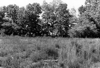
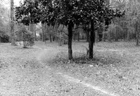
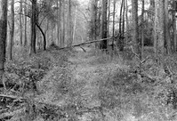
Stono River Rebellion Site (Cato's Rebellion Site), North Side of U.S. Highway 17, west of the Wallace River. View looking North. Hollywood, S.C.;6.5" x 10" B/W photo. Box 16, Folder 2-11-16. One copy.
Ashley River Historic District (Highway 61 Historical District). Contact Sheet 6 - Views of Drayton Hall and Ashley River Road. Charleston, S.C.;1" x 9" B/W photo. Box 20, Folder: Miscellaneous Photos: Scanned Contact Sheets. One copy.
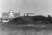
Battery Gadsden (Charleston County Public Library, Edgar Allen Poe Branch), 1921 I'on Avenue. View of East Wing and 2nd Gun Platform from East end, NW (Front and Side) elevation. Sullivans Island, S.C.;6.5" x 10" B/W photo. Box 16, Folder 2-13-6. One copy.
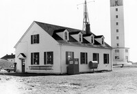
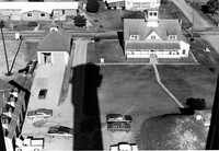
U.S. Coast Guard Historical District, I'on Avenue. Aerial View - South elevation. Sullivans Island, S.C.;6.5" x 10" (and 3.5" x 5") B/W photo. Box 16, Folder 2-13-1. Two copies.
Battery Gadsden (Charleston County Public Library, Edgar Allen Poe Branch), 1921 I'on Avenue. View of East Wing and 2nd Gun Platform from East end, North (Front) elevation. Sullivans Island, S.C.;6.5" x 10" B/W photo. Box 16, Folder 2-13-6. One copy.
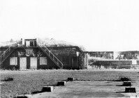
Battery Gadsden (Charleston County Public Library, Edgar Allen Poe Branch), 1921 I'on Avenue. View of all three Wings, NW (Side and Front) elevation - looking East. Sullivans Island, S.C.;6.5" x 10" B/W photo. Box 16, Folder 2-13-6. One copy.
Battery Gadsden (Charleston County Public Library, Edgar Allen Poe Branch), 1921 I'on Avenue. View of 2nd Gun Platform from East end, North (Front) elevation. Sullivans Island, S.C.;6.5" x 10" B/W photo. Box 16, Folder 2-13-6. One copy.
Battery Gadsden (Charleston County Public Library, Edgar Allen Poe Branch), 1921 I'on Avenue. View of West Wing, North (Front) elevation - looking East. Sullivans Island, S.C.;6.5" x 10" B/W photo. Box 16, Folder 2-13-6. One copy.
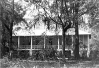
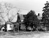
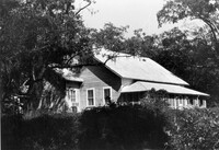
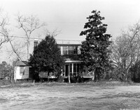
Charles Stevens House (Northampton Plantation House), 2008 Pinopolis Road. View of Front (?) elevation. Pinopolis, S.C.;6.5" x 9.5" B/W photo. Box 3, Folder 1-9-1 (I). One copy.
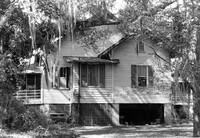
Stallsville. Contact Sheet with multiple views of various houses, commercial buildings, and roads. Summerville, S.C.;8" x 10" B/W photo. Box 3, Folder 3-1-1. One copy.
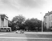
Washington Square Park, NE corner of Broad and Meeting Streets. View of West (Meeting Street) elevation. Charleston, S.C.;8" x 10" B/W photo. Box 5, Folder 2-1-8. One copy.
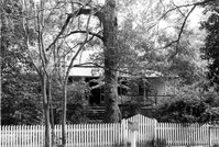
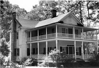
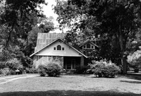
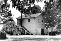
Robert Marion, Sr. House. View of Front elevation. Pinville Historic District. St. Stephen, S.C.;8" x 10" B/W photo. Box 3, Folder 1-9-1 (I). One copy.
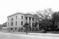
Charleston County Courthouse, 77 Meeting Street. Contact Sheet - Views of the Courthouse and Washington Square Park. Charleston, S.C.;10" x 8" B/W photo. Box 5, Folder 2-1-8. One copy.
John Henry Porcher House (Percival Porcher House?). View of North (Front) elevation. Pinopolis, S.C.;6.5" x 9.5" B/W photo. Box 4, Folder 1-10-1 (III). Two copies.
John Henry Porcher House (Percival Porcher House?). View of West (Side) elevation. Pinopolis, S.C.;6.5" x 9.5" B/W photo. Box 4, Folder 1-10-1 (III). Two copies.
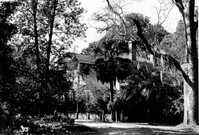
How Tavern. View of NE (Front and Side) elevation. Cainhoy (Huger vicinity, Lewisville, Louisville), S.C.;8" x 10" B/W photo. Box 4, Folder 1-12-3. One copy.
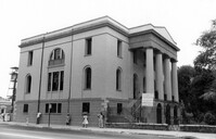
Charleston County Courthouse, 77 Meeting Street. View of NE (Side and Front) elevation. Charleston, S.C.;8" x 10" B/W photo. Box 5, Folder 2-1-8. One copy.
Martha M. Porcher House, ca. 1901 - Pivotal to Historic District. View of Side and Front elevations. Pinopolis Historic District South. Pinopolis, S.C.;5" x 7" B/W photo. Box 3, Folder 1-10-1 (II). One copy.
Louis H. Harvey House, ca. 1909 - Pivotal to Historic District. View of Front and Side elevations. Pinopolis Historic District South. Pinopolis, S.C.;5" x 7" B/W photo. Box 3, Folder 1-10-1 (II). One copy.
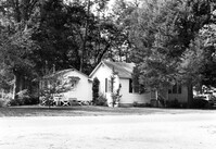
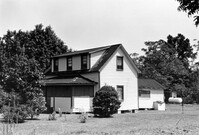
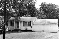
Unidentified House, ca. Early 20th century - Contributory to Historic District. Front and Side elevation. Pinopolis, S.C.;5" x 7" B/W photo. Box 3, Folder 1-10-1 (II). One copy.
W.K. Fishburne House, ca. 1911 - Pivotal to Historic District. View of Front and Side elevations. Pinopolis, S.C.;5" x 7" B/W photo. Box 3, Folder 1-10-1 (II). Three copies.
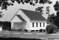
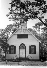
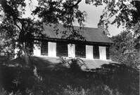
Trinity Episcopal Church, ca. 1844 - Contributory to Historic District. View of Front elevation. Pinopolis, S.C.;5" x 7" B/W photo. Box 3, Folder 1-10-1 (II). One copy.
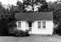
Unidentified House, ca. 1980 - Non-contributory to Historic District. Front and Side elevations. Pinopolis, S.C.;5" x 7" B/W photo. Box 3, Folder 1-10-1 (II). One copy.
William Robertson House, ca. 1844 - Pivotal to Historic District. View of Front elevation. Pinopolis, S.C.;5" x 7" B/W photo. Box 3, Folder 1-10-1 (II). One copy.
Unidentified House, ca. 1920 - Contributory to Historic District. Front elevation. Pinopolis Historic District South. Pinopolis, S.C.;5" x 7" B/W photo. Box 3, Folder 1-10-1 (II). One copy.
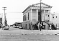
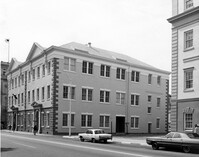
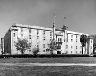
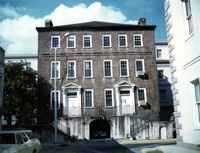
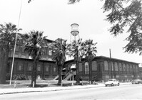
Old Citadel (South Carolina State Arsenal, Embassy Suites Hotel), 337 Meeting Street. View of SW (Front and Side) elevation. Charleston, S.C.;3.5" x 5" B/W photo. Box 5, Folder 2-1-5. Two copies.
Old Citadel (South Carolina State Arsenal, Embassy Suites Hotel), 337 Meeting Street. View of SW (Front and Side) elevation. Charleston, S.C.;8" x 10" B/W photo. Box 5, Folder 2-1-5. Three copies.
Edward O. Hall House, ca. 1898 - Pivotal to Historic District. View of Front elevation. Pinopolis Historic District South. Pinopolis, S.C.;5" x 7" B/W photo. Box 3, Folder 1-10-1 (II). One copy.
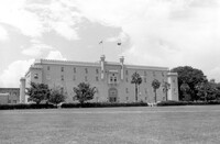
Old Citadel (South Carolina State Arsenal, Embassy Suites Hotel), 337 Meeting Street. View of NE (Rear and Side) elevation. Charleston, S.C.;8" x 10" B/W photo. Box 5, Folder 2-1-5. Two copies.
Old Citadel (South Carolina State Arsenal, Embassy Suites Hotel), 337 Meeting Street. View of NE (Rear and Side) elevation. Charleston, S.C.;8" x 10" B/W photo. Box 5, Folder 2-1-5. One copy.
Pinopolis Methodist Church, ca. 1900 - Pivotal to Historic District. View of Front elevation. Pinopolis Historic District South. Pinopolis, S.C.;7" x 5" B/W photo. Box 3, Folder 1-10-1 (II). One copy.
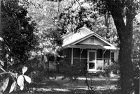
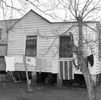
Unidentified House (ca. post-1922) - Contributory to Historic District. View of Front elevation. McClellanville Historic District. McClellanville, S.C.;6.5" x 10" B/W photo. Box 14, Folder 2-10-5. One copy.
Unidentified House (ca. post-1922) - Contributory to Historic District. View of Front elevation. McClellanville Historic District. McClellanville, S.C.;6.5" x 10" B/W photo. Box 14, Folder 2-10-5. One copy.
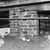
Barnwell House (Prospect Hill Plantation), Sugar Hill Road. Interior View - Detail of Architrave. Hollywood, S.C.;8" x 10" B/W photo. Box 16, Folder 2-11-5. One copy.
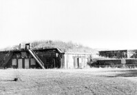
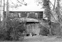
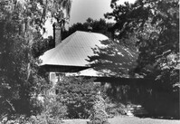
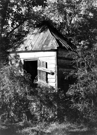
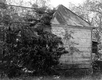
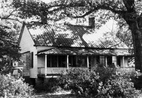
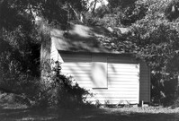
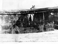
Barnwell House (Prospect Hill Plantation), Sugar Hill Road. Outbuilding - View of Side elevation. Hollywood, S.C.;10" x 8" B/W photo. Box 16, Folder 2-11-5. One copy.
Barnwell House (Prospect Hill Plantation), Sugar Hill Road. Outbuilding - View of Side elevation. Hollywood, S.C.;10" x 8" B/W photo. Box 16, Folder 2-11-5. One copy.
Barnwell House (Prospect Hill Plantation), Sugar Hill Road. Outbuilding - View of Side elevation. Hollywood, S.C.;8" x 10" B/W photo. Box 16, Folder 2-11-5. One copy.
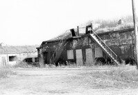
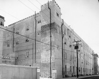
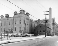
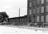
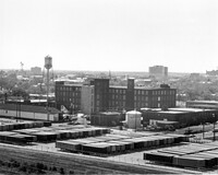
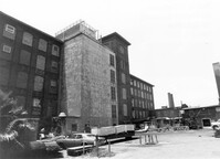
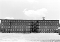
Cigar Factory, 701 East Bay Street. View of single story addition to main building, NW (Rear) elevation, looking South. Charleston, S.C.;7" x 10" B/W photo. Box 9, Folder 2-1-221. One copy.
Unidentified House, ca. Mid 20th century - Non-contributory to Historic District. Front and Side elevations. Pinopolis, S.C.;5" x 7" B/W photo. Box 3, Folder 1-10-1 (II). One copy.
Cigar Factory, 701 East Bay Street. General View of Main Entrance (from Columbus Street), South (Side) elevation. Charleston, S.C.;7" x 10" B/W photo. Box 9, Folder 2-1-221. One copy.
John Grant House, ca. 1901 - Pivotal to Historic District. View of front and Side elevations. Pinopolis Historic District South. Pinopolis, S.C.;5" x 7" B/W photo. Box 3, Folder 1-10-1 (II). One copy.
Post Office Building, ca. 1970 - Non-contributory to Historic District. Front and Side elevations. Pinopolis, S.C.;5" x 7" B/W photo. Box 3, Folder 1-10-1 (II). One copy.
Isaac Porcher Office, ca. 1844 - Pivotal to Historic District. View of Side elevation. Pinopolis, S.C.;5" x 7" B/W photo. Box 3, Folder 1-10-1 (II). One copy.
C.M. Loftan House (ca. 1911), Oak Street. View of Front elevation. McClellanville Historic District. McClellanville, S.C.;6.5" x 10" B/W photo. Box 14, Folder 2-10-5. One copy.
How Tavern. View of North (Front) elevation. Cainhoy (Huger vicinity, Lewisville, Louisville), S.C.;8" x 10" B/W photo. Box 4, Folder 1-12-3. One copy.
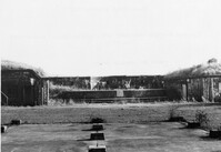
Battery Gadsden (Charleston County Public Library, Edgar Allen Poe Branch), 1921 I'on Avenue. View of West Wing and 4th Gun Platform from East end, South (Rear) elevation. Sullivans Island, S.C.;6.5" x 10" B/W photo. Box 16, Folder 2-13-6. One copy.
Battery Gadsden (Charleston County Public Library, Edgar Allen Poe Branch), 1921 I'on Avenue. View of 4th Gun Platform from East end? West, (Side) elevation. Sullivans Island, S.C.;6.5" x 10" B/W photo. Box 16, Folder 2-13-6. One copy.
Battery Gadsden (Charleston County Public Library, Edgar Allen Poe Branch), 1921 I'on Avenue. View of East Wing, North (Front) elevation - looking West. Sullivans Island, S.C.;6.5" x 10" B/W photo. Box 16, Folder 2-13-6. One copy.
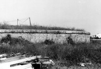
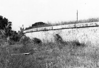
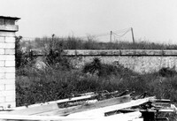
Battery Gadsden (Charleston County Public Library, Edgar Allen Poe Branch), 1921 I'on Avenue. View of Retaining Wall around Glacis, West elevation. Sullivans Island, S.C.;6.5" x 10" B/W photo. Box 16, Folder 2-13-6. One copy.
Battery Gadsden (Charleston County Public Library, Edgar Allen Poe Branch), 1921 I'on Avenue. View of Retaining Wall around Glacis, South elevation. Sullivans Island, S.C.;6.5" x 10" B/W photo. Box 16, Folder 2-13-6. One copy.
Battery Gadsden (Charleston County Public Library, Edgar Allen Poe Branch), 1921 I'on Avenue. View of Retaining Wall around Glacis, South elevation. Sullivans Island, S.C.;6.5" x 10" B/W photo. Box 16, Folder 2-13-6. One copy.
Cigar Factory, 701 East Bay Street. General View of NE (Front and Side) elevation. Charleston, S.C.;8" x 10" B/W photo. Box 9, Folder 2-1-221. One copy.
Cigar Factory, 701 East Bay Street. View of East (Front) elevation, looking North. Charleston, S.C.;7" x 10" B/W photo. Box 9, Folder 2-1-221. One copy.
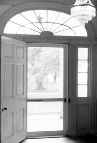
The Grove Plantation (Ernest F. Hollings ACE Basin National Wildlife Refuge). Interior View - 2nd Floor. Detail of Front Door. Adams Run, S.C.;10" x 6.5" B/W photo. Box 15, Folder 2-11-1. One copy.
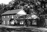
The Grove Plantation (Ernest F. Hollings ACE Basin National Wildlife Refuge). View of the North (Rear) elevation. Adams Run, S.C.;6.5" x 10" B/W photo. Box 15, Folder 2-11-1. One copy.
The Grove Plantation (Ernest F. Hollings ACE Basin National Wildlife Refuge). View of East (Side) elevation. Adams Run, S.C.;6.5" x 10" B/W photo. Box 15, Folder 2-11-1. One copy.
The Grove Plantation (Ernest F. Hollings ACE Basin National Wildlife Refuge). View of West (Side) elevation. Adams Run, S.C.;6.5" x 10" B/W photo. Box 15, Folder 2-11-1. One copy.
Cathedral of St. Luke and St. Paul, 126 Coming Street. Contact Sheet 8 - Views of Educational Building and Church. Charleston, S.C.;1" x 6" B/W photo. Box 20, Folder: Miscellaneous Photos: Scanned Contact Sheets. One copy.
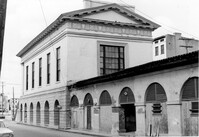
Fireproof Building (South Carolina Historical Society), 100 Meeting Street. View of SW (Side and Front) elevation. Charleston, S.C.;3.5" x 5" B/W photo. Box 5, Folder 2-1-1. One copy.
Fireproof Building (South Carolina Historical Society), 100 Meeting Street. View of SW (Front and Side) elevation. Charleston, S.C.;3.5" x 5" B/W photo. Box 5, Folder 2-1-1. One copy.
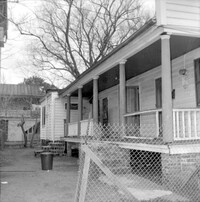
Unidentified House (ca. 20th century) - Non-contributory to Historic District. View of Side and Front elevation. McClellanville Historic District. McClellanville, S.C.;6.5" x 10" B/W photo. Box 14, Folder 2-10-5. Three copies.
Unidentified House (ca. 20th century) - Non-contributory to Historic District. View of Front and Side elevation. McClellanville Historic District. McClellanville, S.C.;6.5" x 10" B/W photo. Box 14, Folder 2-10-5. One copy.
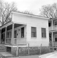
Unidentified House (ca. 20th century) - Non-contributory to Historic District. View of Front elevation. McClellanville Historic District. McClellanville, S.C.;6.5" x 10" B/W photo. Box 14, Folder 2-10-5. One copy.