Magnolia Cemetery, Huguenin Avenue and Algonquin Road. Chapel - View of Side and Rear elevation. Charleston, S.C.;10" x 8" B/W photo. Box 5, Folder 2-1-3. One copy.
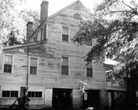
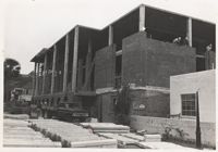
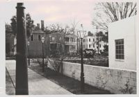
Wagener House, 6 Green Way, during construction of the Robert Scott Small Library. Built circa 1817 and nearly demolished in 1971 to make way for the new library. Three women alumnae of the College prevented its destruction. It is believed to be named after Hancke F. Wagener, a professor of languages in the late 1800's.
Wagener House, 6 Green Way, during construction of the Robert Scott Small Library. Built circa 1817 and nearly demolished in 1971 to make way for the new library. Three women alumnae of the College prevented its destruction. It is believed to be named after Hancke F. Wagener, a professor of languages in the late 1800's.
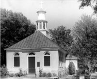
Christ Church (Christ Episcopal Church), 2304 U.S. Highway 17. View of North (Front) elevation. Mount Pleasant, S.C.;8" x 10" B/W photo. Box 10, Folder 2-2-6. One copy.
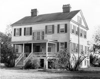
Oakland Plantation (Youghall Plantation), 1164 Porcher Bluff Road. Main House - View of SW (Side and Rear) elevation. Mount Pleasant, S.C.;10" x 8" B/W photo. Box 10, Folder 2-2-10. One copy.
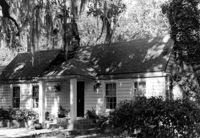
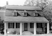
Oakland Plantation (Youghall Plantation), 1164 Porcher Bluff Road. Kitchen House - View of NE (Front) elevation. Mount Pleasant, S.C.;6.5" x 10" B/W photo. Box 10, Folder 2-2-10. One copy.
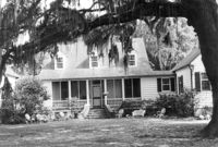
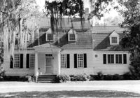
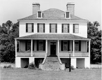
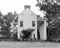
Oakland Plantation (Youghall Plantation), 1164 Porcher Bluff Road. Main House - View of North (Front) elevation. Mount Pleasant, S.C.;6.5" x 10" B/W photo. Box 10, Folder 2-2-10. One copy.
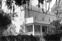
Oakland Plantation (Youghall Plantation), 1164 Porcher Bluff Road. Main House - View of South (Rear) elevation. Mount Pleasant, S.C.;6.5" x 10" B/W photo. Box 10, Folder 2-2-10. One copy.
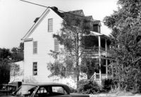
Dean Hall Plantation - Overseers House. View of East (Front) elevation. Oakley, SC. NOTE: Property relocated to Moncks Corner, S.C.;8" x 10" B/W photo. Box 2, Folder 1-8-9. One copy.
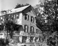
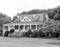
Captain Peter Lewis House, 206 Live Oak Drive. View of West (Side) elevation. Mount Pleasant, S.C.;6.5" x 10" B/W photo. Box 13, Folder 2-8-12. Two copies.
Secessionville Manor (Secessionville Plantation), Battallion Drive. View of NE (Side and Waterfront) elevation. Charleston, S.C.;6.5" x 10" B/W photo. Box 12, Folder 2-4-6. One copy.
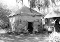
Oakland Plantation (Youghall Plantation), 1164 Porcher Bluff Road. Smoke House - View of NE (Front and Side) elevation. Mount Pleasant, S.C.;6.5" x 10" B/W photo. Box 10, Folder 2-2-10. One copy.
Dean Hall Plantation - Overseers House. View of North (Side) elevation. Oakley, SC. NOTE: Property relocated to Moncks Corner, S.C.;8" x 10" B/W photo. Box 2, Folder 1-8-9. One copy.
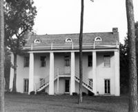
Windsor Plantation (Little Edisto Plantation, Ashwood Plantation), S.C. Hwy. 174. View of SE (Rear and Side) elevation. Edisto Island, S.C.;8" x 10" B/W photo. Box 11, Folder 2-3-18. One copy.
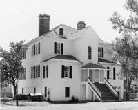
McLeod Plantation, 325 Country Club Drive. Main House - View of NE (Rear and Side) elevation. Charleston, S.C.;6.5" x 10" B/W photo. Box 12, Folder 2-4-5. One copy.
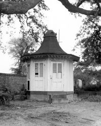
Magnolia Cemetery, Huguenin Avenue and Algonquin Road. Pump House and Gazebo - View of NW (Front and Side) elevation. Charleston, S.C.;8" x 10" B/W photo. Box 5, Folder 2-1-3. One copy.
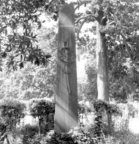
Magnolia Cemetery, Huguenin Avenue and Algonquin Road. William B. Smith Mausoleum. View of Side and Front elevation. Charleston, S.C.;8" x 8" B/W photo. Box 5, Folder 2-1-3. One copy.
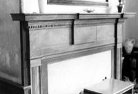
Lawson's Pond Plantation, Lawson Pond Lane. Interior View - Detail of mantle in East Front Room. NW elevation. Cross, SC.;6.5" x 9.5" B/W photo. Box 2, Folder 1-4-3. One copy.
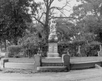
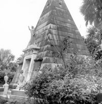
Magnolia Cemetery, Huguenin Avenue and Algonquin Road. Tombstone of Micah Jenkins. View of Front elevation. Charleston, S.C.;8" x 8" B/W photo. Box 5, Folder 2-1-3. One copy.
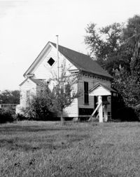
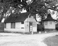
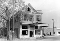
Firetag's Store (Mappus' Store, Six Mile Store) - View of NE (Front and Side) elevation. North Charleston, S.C.;6.5" x 10" B/W photo. Box 5, Folder 2-1-7. One copy.
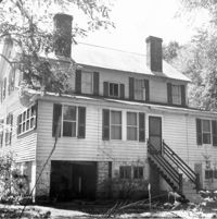
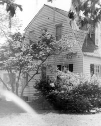
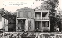
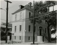
Wagener House, 6 Green Way, before renovation and relocation. Built circa 1817 and nearly demolished in 1971 to make way for the Robert Scott Small Library. Three women alumnae of the College prevented its destruction. It is believed to be named after Hancke F. Wagener, a professor of languages in the late 1800's.
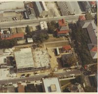
Aerial view of the College of Charleston campus in 1971. Construction of the Robert Scott Small Library visible in lower left. Buildings due east of library (towards top of photo) razed for Maybank Hall and other construction. College Street, then allowing vehicular traffic, runs on west side of library site. Randolph Hall, with Green St. (also with vehicles) running along its north side, visible on far right.
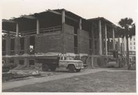
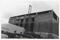
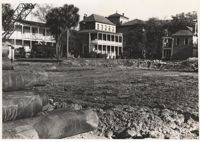
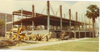
View of Robert Scott Small Library site after construction has begun. 6 Green Way (Wagener House) on left. 10 Green Way (Aiken House) and 9 College Way in background.
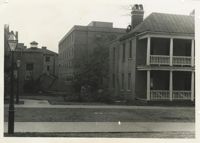
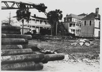
Photograph of construction site of the Robert Scott Small Library, 175 Calhoun St. House on far left demolished for Maybank Hall. 4 Green Way, Randolph Hall and 6 Green Way visible in background.
Wagener House, 6 Green Way, during construction of the Robert Scott Small Library. Built circa 1817 and nearly demolished in 1971 to make way for the new library. Three women alumnae of the College prevented its destruction. It is believed to be named after Hancke F. Wagener, a professor of languages in the late 1800's.
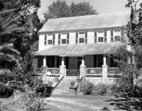
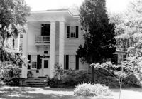
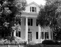
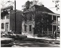
Barnard Elliott House, 58 George St. Built in 1803 by planter Barnard Elliott. Purchased by the College in 1971 and restored by Albert Simons. Currently houses the John M. Rivers Communications Museum. Black and white, 20x25 cm.