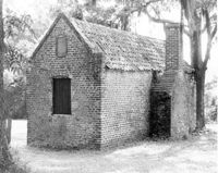
Boone Hall Plantation, Oak Avenue. Slave Cabin - View of SW (Side and Rear) elevation. Mount Pleasant, S.C.;8" x 10" B/W photo. Box 10, Folder 2-2-5. One copy.
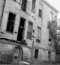
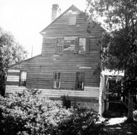
Shaw Community Center, 22 Mary Street. Main Building - View of South (Rear) elevation. Charleston, S.C. (NOTE: Structure demolished in 1974);8.25" x 7.5" B/W photo. Box 6, Folder 2-1-13. One copy.
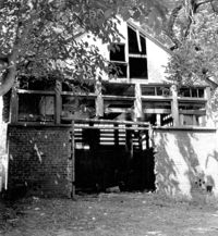
Shaw Community Center, 22 Mary Street. Coach House - View of NW elevation. Charleston, S.C. (NOTE: Structure demolished in 1974);8.25" x 7.5" B/W photo. Box 6, Folder 2-1-13. One copy.
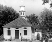
Christ Church Episcopal - Adams Run, State Highway 174. View of West (Front) elevation. Hollywood, S.C.;10" x 8" B/W photo. Box 16, Folder 2-11-12. One copy.
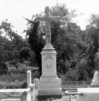
Magnolia Cemetery, Huguenin Avenue and Algonquin Road. Monument of Emma Heyward Haskell. Charleston, S.C.;8" x 8" B/W photo. Box 5, Folder 2-1-3. One copy.
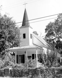
Christ Church (Christ Episcopal Church), 2304 U.S. Highway 17. View of North (Front) elevation. Mount Pleasant, S.C.;8" x 10" B/W photo. Box 10, Folder 2-2-6. One copy.
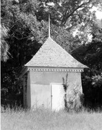
Bleak Hall Plantation, S.C. Hwy. 174. Smoke House - View of SW (Front) elevation. Edisto Island, S.C.;10" x 8" B/W photo. Box 10, Folder 2-3-2. One copy.
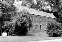
Boone Hall Plantation, Oak Avenue. Gin House - View of NE (Front) elevation, looking East. Mount Pleasant, S.C.;6.5" x 10" B/W photo. Box 10, Folder 2-2-5. One copy.
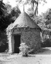
Boone Hall Plantation, Oak Avenue. Smoke House - View of NW (Front and Side) elevation. Mount Pleasant, S.C.;10" x 8" B/W photo. Box 10, Folder 2-2-5. One copy.