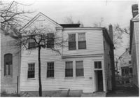
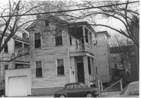
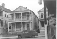
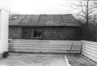
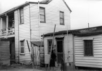
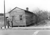
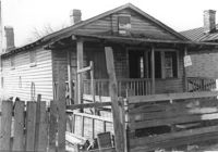
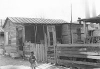
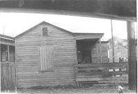
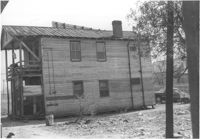
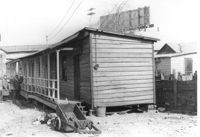
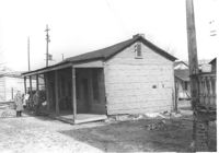
House on site affected by the construction of Interstate 26 (I-26). Address: 270 St. Philip Street. Surveyor notations on back of photo: "Dkt.: 10.517. Property owner: William H. Steedley. Tract: 114. Station: 25+40 Rt. Southbound Lane Route 17. Date: March 5, 1963. In R/W - Bought." [See collection description for explanation of surveyor notations.]
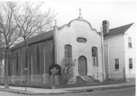
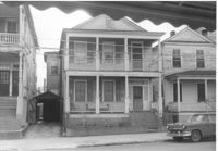
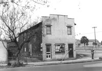
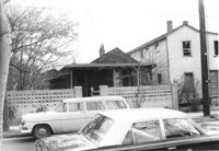
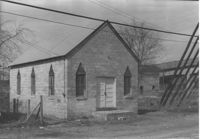
Advent Church of Charleston, on site affected by the construction of Interstate 26 (I-26). Address: 272 St. Philip Street. View of street corner. Surveyor notations on back of photo: "Dkt.: 10.517. Property owner: Advent Church of Charleston. Tract: 115. Station: 25+60 Lt. Southbound Lane Route 17. Date: March 5, 1963. In R/W - Bought." [See collection description for explanation of surveyor notations.]
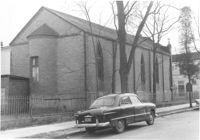
Advent Church of Charleston (corner view, rear), on site affected by the construction of Interstate 26 (I-26). Address: 272 St. Philip Street. Surveyor notations on back of photo: "Dkt.: 10.517. Property owner: Advent Church of Charleston. Tract: 115. Station: 25+60 Lt. Southbound Lane Route 17. Date: March 5, 1963. In R/W - Bought." [See collection description for explanation of surveyor notations.]
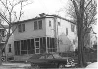
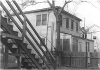
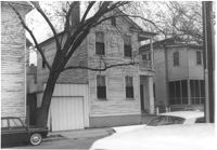
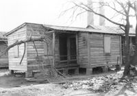
House on site affected by the construction of Interstate 26 (I-26). Address: 69 Fishburne Street. Surveyor notations on back of photo: "Dkt.: 10.517. Property owner: Ben F. Yancy, et al. Tract: 116. Station: 26+30 CL Southbound Lane Route 17. Date: March 5, 1963. In R/W - Bought." [See collection description for explanation of surveyor notations.]
House (corner view, rear) on site affected by the construction of Interstate 26 (I-26). Address: 69 Fishburne Street. Surveyor notations on back of photo: "Dkt.: 10.517. Property owner: Ben F. Yancy, et al. Tract: 116. Station: 26+30 CL Southbound Lane Route 17. Date: March 5, 1963. In R/W - Bought." [See collection description for explanation of surveyor notations.]
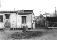
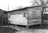
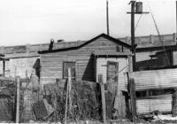
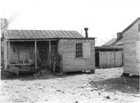
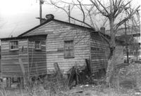
House on site affected by the construction of Interstate 26 (I-26). Address: 68 Fishburne Street. Surveyor notations on back of photo: "Dkt.: 10.517. Property owner: Annie F. Moessner. Tract: 117. Station: 26+55 Lt. Southbound Lane Route 17. Date: March 5, 1963. Proximity." [See collection description for explanation of surveyor notations.]
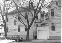
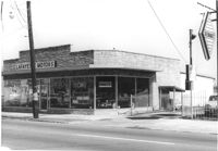
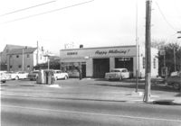
Lafayette Motors (Used Cars), on site affected by the construction of Interstate 26 (I-26). Address: 683 King Street. View of street corner (King Street and Fishburne Street. Surveyor notations on back of photo: "Dkt.: 10.517. Property owner: Hewitt Oil Co. Tract: 118. Station: 27+09 Lt. Southbound Lane Route 17. Date: March 5, 1963. Proximity." [See collection description for explanation of surveyor notations.]
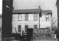
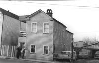
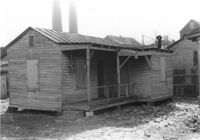
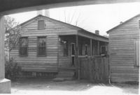
House on site affected by the construction of the Crosstown. Address: 55 Lee Street. Surveyor notations on back of photo: "Dkt.: 10.518. Property owner: Augustus G. Purvis. Tract: 49. Station: 45+55 Lt. N.B. lane Route 17. Date: Mar. 6, 1963. In R/W - Bought." [See collection description for explanation of surveyor notations.]
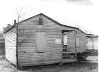
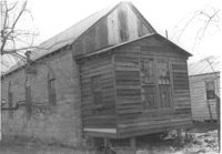
House on site affected by the construction of Interstate 26 (I-26). Address: 67 Fishburne Street. Surveyor notations on back of photo: "Dkt.: 10.517. Property owner: H.H. Rabens. Tract: 119 & 120. Station: 26+60 CL Southbound Lane Route 17. Date: March 5, 1963. In R/W - Bought." [See collection description for explanation of surveyor notations.]
House on site affected by the construction of Interstate 26 (I-26). Address: 67 Fishburne Street. Surveyor notations on back of photo: "Dkt.: 10.517. Property owner: H.H. Rabens. Tract: 119 & 120. Station: 26+60 CL Southbound Lane Route 17. Date: March 5, 1963. In R/W - Bought." [See collection description for explanation of surveyor notations.]
House (corner view, rear) on street corner, on site affected by the construction of Interstate 26 (I-26). Address: 681 King Street. Surveyor notations on back of photo: "Dkt.: 10.517. Property owner: H.H. Rabens. Tract: 119 & 120. Station: 27+00 Rt. Southbound Lane Route 17. Date: March 5, 1963. In R/W - Bought." [See collection description for explanation of surveyor notations.]
House on street corner, on site affected by the construction of Interstate 26 (I-26). Address: 681 King Street. View of street corner. Surveyor notations on back of photo: "Dkt.: 10.517. Property owner: H.H. Rabens. Tract: 119 & 120. Station: 27+00 Rt. Southbound Lane Route 17. Date: March 5, 1963. In R/W - Bought." [See collection description for explanation of surveyor notations.]
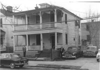
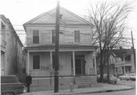
House on site affected by the construction of Interstate 26 (I-26). Address: 679 King Street. Surveyor notations on back of photo: "Dkt.: 10.517. Property owner: Meta B. Williamson. Tract: 121. Station: 27+00 Rt. Southbound Lane Route 17. Date: March 5, 1963. In R/W - Bought." [See collection description for explanation of surveyor notations.]
House on site affected by the construction of Interstate 26 (I-26). Address: 679 King Street. Surveyor notations on back of photo: "Dkt.: 10.517. Property owner: Meta B. Williamson. Tract: 121. Station: 27+00 Rt. Southbound Lane Route 17. Date: March 5, 1963. In R/W - Bought." [See collection description for explanation of surveyor notations.]
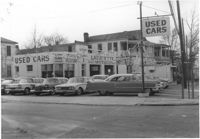
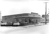
Lafayette Motors, on site affected by the construction of Interstate 26 (I-26). Address: 680 King Street. Surveyor notations on back of photo: "Dkt.: 10.517. Property owner: Raymond A. Wittschen. Tract: 122. Station: 28+35 Lt. Southbound Lane Route 17. Date: March 5, 1963. Proximity." [See collection description for explanation of surveyor notations.]
Lafayette Motors, on site affected by the construction of Interstate 26 (I-26). Address: 680 King Street. Surveyor notations on back of photo: "Dkt.: 10.517. Property owner: Raymond A. Wittschen. Tract: 122. Station: 28+35 Lt. Southbound Lane Route 17. Date: March 5, 1963. Proximity." [See collection description for explanation of surveyor notations.]
Lafayette Motors (rear view), on site affected by the construction of Interstate 26 (I-26). Address: 680 King Street. Surveyor notations on back of photo: "Dkt.: 10.517. Property owner: Raymond A. Wittschen. Tract: 122. Station: 28+35 Lt. Southbound Lane Route 17. Date: March 5, 1963. Proximity." [See collection description for explanation of surveyor notations.]
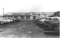
Lafayette Motors Service Dept., on site affected by the construction of Interstate 26 (I-26). Address: 680 King Street. Surveyor notations on back of photo: "Dkt.: 10.517. Property owner: Raymond A. Wittschen. Tract: 122. Station: 29±00 Lt. Southbound Lane Route 17. Date: March 5, 1963. Proximity." [See collection description for explanation of surveyor notations.]
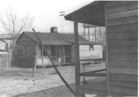
House (side view) on site affected by the construction of the Crosstown. Address: 55 Lee Street. Surveyor notations on back of photo: "Dkt.: 10.518. Property owner: Augustus G. Purvis. Tract: 49. Station: 45+55 Lt. N.B. lane Route 17. Date: Mar. 6, 1963. In R/W - Bought." [See collection description for explanation of surveyor notations.]
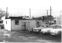
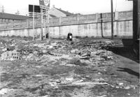
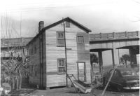
Lot with railroad tracks in foreground, behind Lafayette Motors, on site affected by the construction of Interstate 26 (I-26). Address: 680 King Street. Surveyor notations on back of photo: "Dkt.: 10.517. Property owner: Raymond A. Wittschen. Tract: 122. Station: 31± to 32± Rt. & Lt. Southbound Lane Route 17. Date: March 5, 1963." [See collection description for explanation of surveyor notations.]
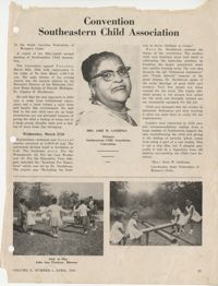
Page from The Palmettoan, Volume 2, Issue 1 from April 1963. The page includes a report from 58th annual meeting of the Southeastern Child Association by Amie W. Gathings and a photo with greetings and welcome from the Mary McLeod Bethune Federated Club of Seneca, South Carolina to the 54th annual meeting of the Federation.
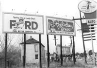
Lot with billboards on site affected by the construction of the Crosstown. Address: 53 Lee Street. Surveyor notations on back of photo: "Dkt.: 10.518. Property owner: Turner Advertising Co. Tract: 50. Station: 46+00 Rt. N.B. lane Route 17. Date: Mar. 6, 1963. In R/W." [See collection description for explanation of surveyor notations.]
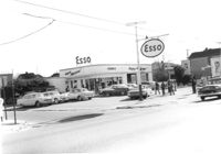
Esso (Humble) gas station on site affected by the construction of the Crosstown. Address: 53 Lee Street (corner of Lee Street and Aiken Street). Surveyor notations on back of photo: "Dkt.: 10.518. Property owner: Humble Oil Refining Co. Tract: 51. Station: 46+65 Lt. N.B. lane Route 17. Date: Mar. 6, 1963. In R/W - Bought." [See collection description for explanation of surveyor notations.]
Esso (Humble) gas station (corner view) on site affected by the construction of the Crosstown. Address: 53 Lee Street (corner of Lee Street and Aiken Street). Surveyor notations on back of photo: "Dkt.: 10.518. Property owner: Humble Oil Refining Co. Tract: 51. Station: 46+65 Lt. N.B. lane Route 17. Date: Mar. 6, 1963. In R/W - Bought." [See collection description for explanation of surveyor notations.]
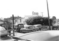
Cars in lot behind Esso (Humble) gas station on site affected by the construction of the Crosstown. Address: 53 Lee Street (corner of Lee Street and Aiken Street). Surveyor notations on back of photo: "Dkt.: 10.518. Property owner: Humble Oil Refining Co. Tract: 51. Station: 46+65 Lt. N.B. lane Route 17. Date: Mar. 6, 1963. In R/W - Bought." [See collection description for explanation of surveyor notations.]
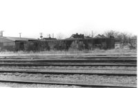
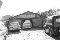
Structure (garage?) and cars in lot on site affected by the construction of the Crosstown. Address: 51 Aiken Street. Surveyor notations on back of photo: "Dkt.: 10.518. Property owner: Julia M. Pritchard. Tract: 52. Station: 46+50 Rt. N.B. lane Route 17. Date: Mar. 6, 1963. In R/W - Bought." [See collection description for explanation of surveyor notations.]
Lot on site affected by the construction of the Crosstown. Address: 51 Aiken Street. Surveyor notations on back of photo: "Dkt.: 10.518. Property owner: Julia M. Pritchard. Tract: 52. Station: 46+50 Rt. N.B. lane Route 17. Date: Mar. 7, 1963. In R/W - Bought." [See collection description for explanation of surveyor notations.]
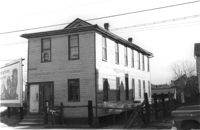
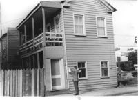
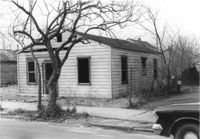
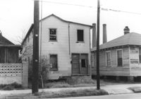
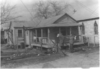
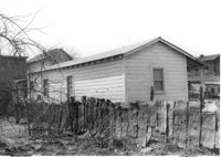
House on site affected by the construction of the Crosstown. Address: 55 Aiken Street. Surveyor notations on back of photo: "Dkt.: 10.518. Property owner: Julius Mitchell. Tract: 53. Station: 47+20 Rt. N.B. lane Route 17. Date: Mar. 7, 1963." [See collection description for explanation of surveyor notations.]
House on site affected by the construction of the Crosstown. Address: 55 Aiken Street. Surveyor notations on back of photo: "Dkt.: 10.518. Property owner: Julius Mitchell. Tract: 53. Station: 47+20 Rt. N.B. lane Route 17. Date: Mar. 7, 1963." [See collection description for explanation of surveyor notations.]
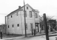
House (and neighboring buildings) on site affected by the construction of the Crosstown. Address: 60-58 Aiken Street. Public Telephone sign in foreground. Surveyor notations on back of photo: "Dkt.: 10.518. Property owner: Congaree Jenkins, Est. Tract: 54. Station: 48+00 Rt. N.B. lane Route 17. Date: Mar. 7, 1963." [See collection description for explanation of surveyor notations.]
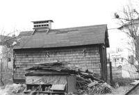
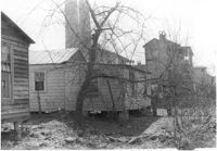
House (rear view) and outbuilding on site affected by the construction of the Crosstown. Address: 60-58 Aiken Street. Surveyor notations on back of photo: "Dkt.: 10.518. Property owner: Congaree Jenkins, Est. Tract: 54. Station: 48+00 Rt. N.B. lane Route 17. Date: Mar. 7, 1963." [See collection description for explanation of surveyor notations.]
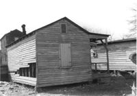
Outbuilding and lot on site affected by the construction of the Crosstown. Address: 60-58 Aiken Street. Surveyor notations on back of photo: "Dkt.: 10.518. Property owner: Congaree Jenkins, Est. Tract: 54. Station: 48+35 Rt. N.B. lane Route 17. Date: Mar. 7, 1963." [See collection description for explanation of surveyor notations.]
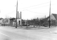
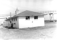
Sewer pump house on corner lot, on site affected by the construction of the Crosstown. Address: corner of Aiken Street and Lee Street (SE corner). View of street corner. Surveyor notations on back of photo: "Dkt.: 10.518. Property owner: City of Charleston. Tract: 56. Station: 48+00 Lt. N.B. lane Route 17. Date: Mar. 7, 1963. Sewage pumping station." [See collection description for explanation of surveyor notations.]
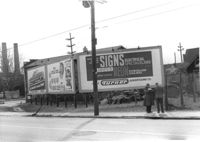
Billboards on lot, on site affected by the construction of the Crosstown. Address: corner of Lee Street and America Street (SW corner). Surveyor notations on back of photo: "Dkt.: 10.518. Property owner: Turner Advertising Co. Tract: 57. Station: 49+30 Rt. S.B. lane Route 17. Date: Mar. 7, 1963. Signs." [See collection description for explanation of surveyor notations.]
Corner grocery store on site affected by the construction of the Crosstown. Address: 121 America Street. View of street corner (America Street and Lee Street). Surveyor notations on back of photo: "Dkt.: 10.518. Property owner: Vallie Talbert. Tract: 58. Station: 49+50 Lt. N.B. lane Route 17. Date: Mar. 7, 1963." [See collection description for explanation of surveyor notations.]
Side view of corner grocery store on site affected by the construction of the Crosstown. Address: 121 America Street. Surveyor notations on back of photo: "Dkt.: 10.518. Property owner: Vallie Talbert. Tract: 58. Station: 49+50 Lt. N.B. lane Route 17. Date: Mar. 7, 1963." [See collection description for explanation of surveyor notations.]
Shed/outbuilding on site affected by the construction of the Crosstown. Address: 121 America Street. Surveyor notations on back of photo: "Dkt.: 10.518. Property owner: Vallie Talbert. Tract: 58. Station: 48+87 Lt. N.B. lane Route 17. Date: Mar. 7, 1963. All in R/W." [See collection description for explanation of surveyor notations.]
House on site affected by the construction of the Crosstown. Address: 119 America Street. Surveyor notations on back of photo: "Dkt.: 10.518. Property owner: J.A. Barrineau. Tract; 59. Station: 49+55 Rt. N.B. lane Route 17. Date: Mar. 7, 1963. In R/W - Bought." [See collection description for explanation of surveyor notations.]
House (rear view) on site affected by the construction of the Crosstown. Address: 119 America Street. Surveyor notations on back of photo: "Dkt.: 10.518. Property owner: J.A. Barrineau. Tract; 59. Station: 49+55 Rt. N.B. lane Route 17. Date: Mar. 7, 1963. In R/W - Bought." [See collection description for explanation of surveyor notations.]
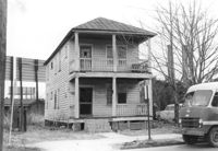
House (freedman's cottage) on site affected by the construction of the Crosstown. Address: 115 America Street. Surveyor notations on back of photo: "Dkt.: 10.518. Property owner: Jerusalem Baptist Church. Tract: 60. Station: 49+60 Rt. N.B. lane Route 17. Date: Mar. 7, 1963." [See collection description for explanation of surveyor notations.]
House (freedman's cottage) on site affected by the construction of the Crosstown. Address: 115 America Street. Surveyor notations on back of photo: "Dkt.: 10.518. Property owner: Jerusalem Baptist Church. Tract: 60. Station: 49+60 Rt. N.B. lane Route 17. Date: Mar. 7, 1963." [See collection description for explanation of surveyor notations.]
House (freedman's cottage) (rear view) on site affected by the construction of the Crosstown. Address: 115 America Street. Surveyor notations on back of photo: "Dkt.: 10.518. Property owner: Jerusalem Baptist Church. Tract: 60. Station: 49+10 Rt. N.B. lane Route 17. Date: Mar. 7, 1963." [See collection description for explanation of surveyor notations.]
House on site affected by the construction of the Crosstown. Address: 118 America Street. Surveyor notations on back of photo: "Dkt.: 10.518. Property owner: Thelma Brown. Tract: 61. Station: 50+75 Rt. N.B. lane Route 17. Date: Mar. 7, 1963. In R/W - Bought." [See collection description for explanation of surveyor notations.]
House (rear view) on site affected by the construction of the Crosstown. Address: 118 America Street. Surveyor notations on back of photo: "Dkt.: 10.518. Property owner: Thelma Brown. Tract: 61. Station: 50+75 Rt. N.B. lane Route 17. Date: Mar. 7, 1963. In R/W - Bought." [See collection description for explanation of surveyor notations.]
House (rear view) on site affected by the construction of the Crosstown. Address: 120 America Street. Surveyor notations on back of photo: "Dkt.: 10.518. Property owner: Geraldine M. Henry. Tract: 62. Station: 50+70 Rt. N.B. lane Route 17. Date: Mar. 7, 1963. In R/W - Bought." [See collection description for explanation of surveyor notations.]
House on site affected by the construction of the Crosstown. Address: 120 America Street. Surveyor notations on back of photo: "Dkt.: 10.518. Property owner: Geraldine M. Henry. Tract: 62. Station: 50+70 Rt. N.B. lane Route 17. Date: Mar. 7, 1963. In R/W - Bought." [See collection description for explanation of surveyor notations.]
House on site affected by the construction of the Crosstown. Address: 122 America Street. Surveyor notations on back of photo: "Dkt.: 10.518. Property owner: H.B. Lasaine, et al. Tract: 63. Station: 50+70 Lt. N.B. lane Route 17. Date: Mar. 7, 1963. In R/W - Bought." [See collection description for explanation of surveyor notations.]
House (rear view) on site affected by the construction of the Crosstown. Address: 122 America Street. Surveyor notations on back of photo: "Dkt.: 10.518. Property owner: H.B. Lasaine, et al. Tract: 63. Station: 50+70 Lt. N.B. lane Route 17. Date: Mar. 7, 1963. In R/W - Bought." [See collection description for explanation of surveyor notations.]
Billboards on lot, on site affected by the construction of the Crosstown. Address: 34-36 Lee Street. Surveyor notations on back of photo: "Dkt.: 10.518. Property owner: Turner Advertising. Tract: 65. Station: 51±45 Rt. & Lt. N.B. lane Route 17. Date: Mar. 7, 1963. Signs. [See collection description for explanation of surveyor notations.]
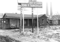
Lot on site affected by the construction of the Crosstown. Address: 32 Lee Street (south side of street). Sign for John P. Tankersley Insurance, East of Cooper. House/structure abuts lot; posted sign indicates it is closed by the Board of Health. Industrial smokestacks in background (Cigar Factory?). Surveyor notations on back of photo: "Dkt.: 10.518. Property owner: Clifton Iron. Tract: 68. Station: 52+35 Lt. N.B. lane Route 17. Date: Mar. 7, 1963. In R/W - Bought." [See collection description for explanation of surveyor notations.]
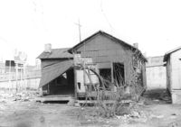
Rear of structure (see previous photo) on site affected by the construction of the Crosstown. Address: 32 Lee Street (south side of the street). Surveyor notations on back of photo: "Dkt.: 10.518. Property owner: Clifton Iron. Tract: 68. Station: 52+35 Lt. N.B. lane Route 17. Date: Mar. 7, 1963. In R/W - Bought." [See collection description for explanation of surveyor notations.]
Correspondence from Matthew J. Perry to Arthur Rose regarding entering the recipient's child in the Ellis Avenue Elementary School in Orangeburg, South Carolina.
Transcriptions of Rabbi Padoll’s typewritten and handwritten sermons and addresses from his various rabbinates, including Charleston’s Kahal Kadosh Beth Elohim. A civil rights advocate, Padoll discusses ongoing struggles for social justice, contemporary events such as the assassination of Robert F. Kennedy, and parables related to the Sabbath and holiday celebrations. Padoll stored his sermons in nine binders, and the transcriptions reflect this original order. Burton L. Padoll (1929-2004), was born to Leah and Charles Padoll in Canton, Ohio. Padoll attended the Hebrew Union College in Cincinnati, Ohio, where he was ordained in 1957 and received an honorary Doctorate of Divinity in 1982. After his ordination, Padoll served as assistant rabbi in Brookline, Massachusetts. In 1961, Padoll took a position as rabbi of Kahal Kadosh Beth Elohim (KKBE) in Charleston, South Carolina, where he served for six years. During this time, Padoll strongly advocated for civil rights and criticized Charleston's Jewish community for their failure to aid the struggle for racial equality. After leaving Charleston in 1967, Padoll moved to Peabody, Massachusetts, where he became the rabbi of Temple Beth Shalom in 1969 until his retirement in 1989. Padoll lived in Mount Jackson, Virginia, until his death in 2004.
House (rear view) on site affected by the construction of the Crosstown. Address: 39 Lee Street (south side of street). Surveyor notations on back of photo: "Dkt.: 10.518. Property owner: Yetta B. Rosen. Tract: 69. Station: 52+65 Lt. N.B. lane Route 17. Date: Mar. 7, 1963. In R/W - Bought." [See collection description for explanation of surveyor notations.]
House/structure on site affected by the construction of the Crosstown. Address: 39 Lee Street (south side of street). Posted sign indicates it is closed by the Board of Health. Surveyor notations on back of photo: "Dkt.: 10.518. Property owner: Yetta B. Rosen. Tract: 69. Station: 52+65 Lt. N.B. lane Route 17. Date: Mar. 7, 1963. In R/W - Bought." [See collection description for explanation of surveyor notations.]
Outbuilding on site affected by the construction of the Crosstown. Address: 39 Lee Street (south side of street). Industrial smokestacks in background (Cigar Factory?). Surveyor notations on back of photo: "Dkt.: 10.518. Property owner: Yetta B. Rosen. Tract: 69. Station: 52+70 Rt. N.B. lane Route 17. Date: Mar. 7, 1963. In R/W - Bought." [See collection description for explanation of surveyor notations.]
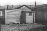
Outbuilding on site affected by the construction of the Crosstown. Address: 39 Lee Street (south side of street). Surveyor notations on back of photo: "Dkt.: 10.518. Property owner: Yetta B. Rosen. Tract: 69. Station: 52+70 Rt. N.B. lane Route 17. Date: Mar. 7, 1963. In R/W - Bought." [See collection description for explanation of surveyor notations.]
Lot on site affected by the construction of the Crosstown. Address: 1 Lee Street. Surveyor notations on back of photo: "Dkt.: 10.518. Property owner: Ada Hamilton. Tract: 67. Station: 52+05 Lt. N.B. lane Route 17. Date: Mar. 7, 1963." [See collection description for explanation of surveyor notations.]
House (freedman's cottage) on site affected by the construction of the Crosstown. Address: 2 Lee Street. Industrial smokestacks in background (Cigar Factory?). Surveyor notations on back of photo: "Dkt.: 10.518. Property owner: Kate R. Rosen. Tract: 70. Station: 53+00 Lt. N.B. lane Route 17. Date: Mar. 7, 1963. In R/W - Bought." [See collection description for explanation of surveyor notations.]
House (freedman's cottage) (rear view) on site affected by the construction of the Crosstown. Address: 2 Lee Street. Elevated roadway (presumably the off-ramp of the Grace Memorial Bridge) in background. Surveyor notations on back of photo: "Dkt.: 10.518. Property owner: Kate R. Rosen. Tract: 70. Station: 53+00 Lt. N.B. lane Route 17. Date: Mar. 7, 1963. In R/W - Bought." [See collection description for explanation of surveyor notations.]
House (freedman's cottage) on site affected by the construction of the Crosstown. Address: 2 Lee Street. Industrial smokestacks in background (Cigar Factory?). Surveyor notations on back of photo: "Dkt.: 10.518. Property owner: Kate R. Rosen. Tract: 70. Station: 53+00 Rt. N.B. lane Route 17. Date: Mar. 7, 1963. In R/W - Bought." [See collection description for explanation of surveyor notations.]
House (freedman's cottage) (rear view) on site affected by the construction of the Crosstown. Address: 2 Lee Street. Surveyor notations on back of photo: "Dkt.: 10.518. Property owner: Kate R. Rosen. Tract: 70. Station: 53+00 Rt. N.B. lane Route 17. Date: Mar. 7, 1963. In R/W - Bought." [See collection description for explanation of surveyor notations.]
House (freedman's cottage) on site affected by the construction of the Crosstown. Address: 2 Lee Street. Surveyor notations on back of photo: "Dkt.: 10.518. Property owner: Kate R. Rosen. Tract: 71. Station: 30+00 Rt. Lee St. survey. 53+30 CL N.B. lane Rt. 17. Date: Mar. 7, 1963. In R/W - Bought." [See collection description for explanation of surveyor notations.]
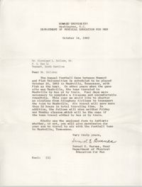
Correspondence from Samuel E. Barnes, Head of Department of Physical Education for Men for Howard University, to Cleveland Sellers regarding the Annual Football Game between Howard and Fisk Universities.
House (freedman's cottage) on site affected by the construction of the Crosstown. Address: 2 Lee Street. Posted sign indicates it is closed by the Board of Health. Surveyor notations on back of photo: "Dkt.: 10.518. Property owner: Kate R. Rosen. Tract: 71. Station: 30+00 Rt. Lee St. survey. 53+30 CL N.B. lane Rt. 17. Date: Mar. 7, 1963. In R/W - Bought." [See collection description for explanation of surveyor notations.]
House (freedman's cottage) (corner view, rear) on site affected by the construction of the Crosstown. Address: 2 Lee Street. Elevated roadway (presumably the off-ramp of the Grace Memorial Bridge) in background. Surveyor notations on back of photo: "Dkt.: 10.518. Property owner: Kate R. Rosen. Tract: 71. Station: 30+00 Rt. Lee St. survey. Date: Mar. 7, 1963. In R/W - Bought." [See collection description for explanation of surveyor notations.]
House (freedman's cottage) on site affected by the construction of the Crosstown. Address: 2 Lee Street. Surveyor notations on back of photo: "Dkt.: 10.518. Property owner: Kate R. Rosen. Tract: 71. Station: 30+00 Rt. Lee St. survey. Date: Mar. 7, 1963. In R/W - Bought." [See collection description for explanation of surveyor notations.]
House (freedman's cottage) on site affected by the construction of the Crosstown. Address: 6 Lee Street. Surveyor notations on back of photo: "Dkt.: 10.518. Property owner: William Parrineau, et al. Tract: 72. Station: 53+60 Lt. N.B. lane Route 17. 30+30Rt. Lee Street survey. Date: Mar. 7, 1963. In R/W - Bought." [See collection description for explanation of surveyor notations.]
House (freedman's cottage) (rear view) on site affected by the construction of the Crosstown. Address: 6 Lee Street. Elevated roadway (presumably the off-ramp of the Grace Memorial Bridge) in background. Surveyor notations on back of photo: "Dkt.: 10.518. Property owner: William Parrineau, et al. Tract: 72. Station: 53+60 Lt. N.B. lane Route 17. 30+30Rt. Lee Street survey. Date: Mar. 7, 1963. In R/W - Bought." [See collection description for explanation of surveyor notations.]
House on site affected by the construction of the Crosstown. Address: 7 Lee Street. Elevated roadway (presumably the off-ramp of the Grace Memorial Bridge) in background. Surveyor notations on back of photo: "Dkt.: 10.518. Property owner: Minnie Z. Kaufman. Tract: 74. Station: 30+90 Rt. Lee Street survey. Date: Mar. 7, 1963. In R/W - Bought." [See collection description for explanation of surveyor notations.]
House (side view) on site affected by the construction of the Crosstown. Address: 7 Lee Street. Elevated roadway (presumably the off-ramp of the Grace Memorial Bridge) in background. Surveyor notations on back of photo: "Dkt.: 10.518. Property owner: Minnie Z. Kaufman. Tract: 74. Station: 30+90 Rt. Lee Street survey. Date: Mar. 7, 1963. In R/W - Bought." [See collection description for explanation of surveyor notations.]
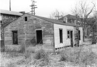
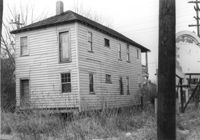
Building on site affected by the construction of the Crosstown. Address: 119 Drake Street (based on neighboring house number). Elevated roadway (presumably the off-ramp of the Grace Memorial Bridge) in background. Surveyor notations on back of photo: "Dkt.: 10.518. Property owner: Mt. Sinai Mission. Tract: 76. Station: 54+80 Rt. N.B. lane Route 17. Date: Mar. 7, 1963. In R/W - Bought." [See collection description for explanation of surveyor notations.]
Building (rear view) on site affected by the construction of the Crosstown. Address: 119 Drake Street (based on neighboring house number). Surveyor notations on back of photo: "Dkt.: 10.518. Property owner: Mt. Sinai Mission. Tract: 76. Station: 54+80 Rt. N.B. lane Route 17. Date: Mar. 7, 1963. In R/W - Bought." [See collection description for explanation of surveyor notations.]
House (freedman's cottage) on site affected by the construction of the Crosstown. Address: 117 Drake Street. Surveyor notations on back of photo: "Dkt.: 10.518. Property owner: Ida Green Jenkins. Tract: 77. Station: 54+80 Rt. Date: Mar. 7, 1963. In R/W - Bought." [See collection description for explanation of surveyor notations.]
House (rear view) on site affected by the construction of the Crosstown. Address: 117 Drake Street. Industrial smokestacks in background (Cigar Factory?). Surveyor notations on back of photo: "Dkt.: 10.518. Property owner: Ida Green Jenkins. Tract: 77. Station: 54+80 Rt. Date: Mar. 7, 1963. In R/W - Bought." [See collection description for explanation of surveyor notations.]
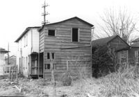
Building (corner view, rear) on site affected by the construction of the Crosstown. Address: 120 Drake Street (based on buildings across the street). Harrisson & Co. Fishing Tacking Hardware; see next photo. Elevated roadway (presumably the off-ramp of the Grace Memorial Bridge) in background. Surveyor notations on back of photo: "Dkt.: 10.518. Property owner: Frank J. Kelly. Tract: 78. Station: 55+60 Rt. N.B. lane Route 17. Date: Mar. 7, 1963." [See collection description for explanation of surveyor notations.]
Building (corner view, front) on site affected by the construction of the Crosstown. Address: 120 Drake Street (based on buildings across the street). Sign in front: Harrisson & Co. Fishing Tacking Hardware. Elevated roadway (presumably the off-ramp of the Grace Memorial Bridge) in background. Surveyor notations on back of photo: "Dkt.: 10.518. Property owner: Frank J. Kelly. Tract: 78. Station: 55+60 Rt. N.B. lane Route 17. Date: Mar. 7, 1963." [See collection description for explanation of surveyor notations.]
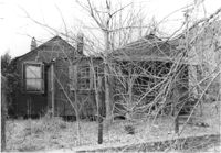
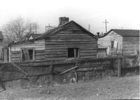
House (rear view) on site affected by the construction of the Crosstown. Address: 20 Cooper Street (based on 1951 Sanborn Map, perhaps behind 22 Cooper Street). Elevated roadway (presumably the off-ramp of the Grace Memorial Bridge) in background. Surveyor notations on back of photo: "Dkt.: 10.518. Property owner: Toots Brown. Tract: 79. Station: 54+25 Rt. N.B. lane Route 17. Date: Mar. 7, 1963. In R/W - Bought." [See collection description for explanation of surveyor notations.]
House on site affected by the construction of the Crosstown. Address: 20 Cooper Street (based on 1951 Sanborn Map, perhaps behind 22 Cooper Street). Surveyor notations on back of photo: "Dkt.: 10.518. Property owner: Toots Brown. Tract: 79. Station: 54+25 Rt. N.B. lane Route 17. Date: Mar. 7, 1963. In R/W - Bought." [See collection description for explanation of surveyor notations.]
House (freedman's cottage) on site affected by the construction of the Crosstown. Address: 28 Lee Street (28 1/3 Lee Street). Billboard from Photo 127 in background. Surveyor notations on back of photo: "Dkt.: 10.518. Property owner: Sara Johnson, et al. Tract: 81. Station: 53+45 Rt. N.B. lane Route 17. Date: Mar. 7, 1963." [See collection description for explanation of surveyor notations.]
House (freedman's cottage) on site affected by the construction of the Crosstown. Address: 28 Lee Street (28 1/3 Lee Street). Porch of neighboring house in foreground. Surveyor notations on back of photo: "Dkt.: 10.518. Property owner: Sara Johnson, et al. Tract: 81. Station: 53+45 Rt. N.B. lane Route 17. Date: Mar. 7, 1963." [See collection description for explanation of surveyor notations.]
House (freedman's cottage) on site affected by the construction of the Crosstown. Address: 30 Cooper Street (30 1/3 Cooper Street). Surveyor notations on back of photo: "Dkt.: 10.518. Property owner: Edna C. Parham. Tract: 82. Station: 52+70 Rt. N.B. lane Route 17. Date: Mar. 7, 1963." [See collection description for explanation of surveyor notations.]
Correspondence from Anna D. Kelly, Branch Director for Coming Street Y.W.C.A., to Dorothy I. Height, Bureau of Personnel and Training for the National Board of the Y.W.C.A., regarding Committee on Administration matters.
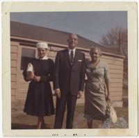
Color photograph of Honorable L. Harvard Bennett with family on Easter, 1963. Inscription on back of image: "Hon. L. Harvard Bennett; Radcliffe St., Chas.; Grad. Of Avery (1932?); Fed. Judge–Washington D.C."
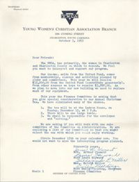
Correspondence from Irma R. Clement, Laura Heyward, Hildagarde L. Miller, and Emily Fielding of the Coming Street YWCA regarding membership and activity matters.
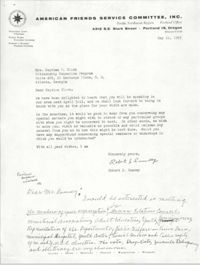
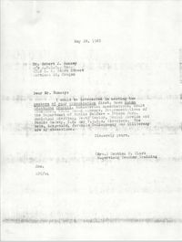
Correspondence from Robert J. Rumsey, Program Secretary for the American Friends Service Committee, Inc., to Septima P. Clark regardin a speaking opportunity.
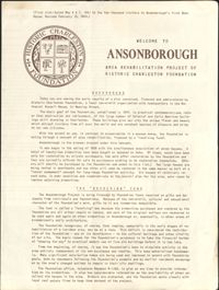
This four-page brochure includes background information on the Ansonborough Rehabilitation Project and Revolving Fund, photographs and information about Ansonborough homes, and a map of Ansonborough. Homes listed include 40 Society Street; 42 Society Street; 44 Society Street; 56 Society Street; 66 Anson Street; 63 Anson Street; 71 Anson Street; 72 Anson Street; 55 Laurens Street; 48 Laurens Street; 332 East Bay Street; and 329 East Bay Street.