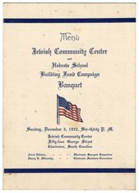
Program for the Jewish Community Center and Hebrew School Banquet for the Building Fund Campaign. The program includes a menu for the banquet, a schedule of events, lists members of the Steering Committee, and notes prayer led by Rabbi Dr. Jacob S. Raisin.
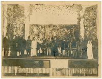
Photograph of twenty Avery students dressed in costume on stage for a production of Shakespeare's "Macbeth." Students wear chainmail, witches hats, and royal costume.
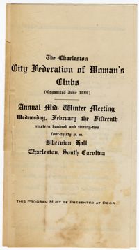
Program for the Charleston City Federation of Women's Clubs Annual Mid-Winter Meeting held at the Hibernian Hall in Charleston. The program includes the schedule of the event, a list of the City Federation officers, and notes "Mrs. J. S. Raisin" as the representative for the Council of Jewish Women.
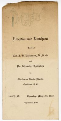
Program for the Charleston Zionist District Reception and Luncheon held at the Charleston Hotel. The Program includes a menu for the luncheon, a list of the members of the Keren Hayesod Committee, officers of the Charleston Zionist District, and notes Rabbi Dr. Jacob S. Raisin as the toastmaster.
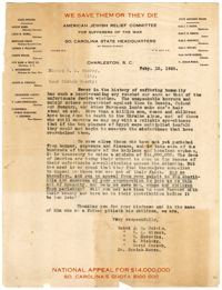
A letter to the Bishop W. A. Guerry from the State Advisory Board of the American Jewish Relief Committee requesting contribution towards the committee's work to aid Jewish sufferers of the war in Europe. Rabbi Dr. Jacob S. Raisin is listed as a member of the Advisory Board.
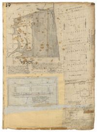
Page 35 of the City Engineer's Plat Book with five plats. Plat 1 shows land located near a creek with large portions marked with a different color. The plat shows a square labelled as "The Mall," and numerous streets, including Bay Street, Drake Street, America Street, Hanover Street, Columbus Street, Cooper Street, Blake Street, Amhurst Street, and Reid Street. There's also a stretch labelled as "Braggs Marsh." Plat 2 shows lots located between Congress Street and Mount Street, including a stretch of Hope Place. Plat 3 features a building labelled "Exchange," on East Bay Street, and near Gibbes Street and Champney Street. Plat 4 shows land with a partition wall and kitchen yards. Plat 5 shows land located near the "Citadel Athletic Field" and Grove Street.
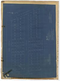
Page 202 of the City Engineer's Plat Book with one plat. The plat shows lots located between Brigade Street and Williman Street, and between Meeting Street and a strip of land labelled "Atlantic Coast Line R.R." It also shows Nassau Street and Doran Street.