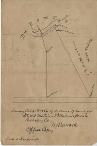
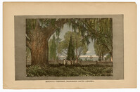
Office copy of a survey of 31 acres of land for Dr. R. H. Martin in Berkeley County. Notable geographic locations include Wappoo Road and Mill Tract. Names associated with this plat are R.H. Martin, G.G. DuPont, and W.B. Guerard.
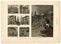
A newspaper article on the 1886 earthquake in Charleston. Several buildings are shown damaged, including St. Michael's Church, St. Philip's Church steeple, and Hibernian Hall. A street scene during the earthquake shows African Americans praying in the streets with several buildings on fire in the background.
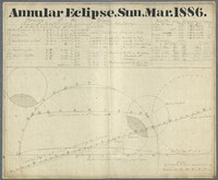
In this astronomical chart Gibbes provides a diagram and the elements for constructing the diagram. Those elements are hourly motion, declination, hourly motion in declination, horizontal parallax and semidiameter. Gibbes also provides the result times of the eclipse including the beginning, total, opposition, middle, end of total, general and duration of eclipse. The diagram shows the central path for the moon during the eclipse.
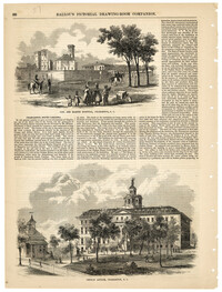
Illustrations of Charleston buildings from 1886 with accompanying article. The buildings shown are the Old Charleston Jail, the Marine Hospital, the Charleston Orphan House, Citadel Square Church, and the Roper Hospital. The article gives a detailed description about the interior of the Charleston Orphan House.
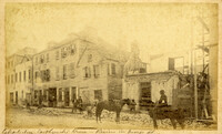
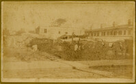
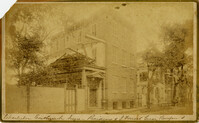
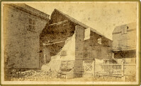
Caption: 'Cook's Earthquake Views of Charleston and Vicinity. Taken after the 31st of August, 1886. No.116, wreck in George Street.' Written on front, at bottom: 'Charleston Earthquake view - Ruins in George St.'
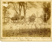
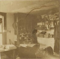
Caption: 'Charleston Earthquake. Photographs by Dr. E.P. Howland, taken on his visit to Charleston and the earthquake region of Ten Mile Hill and Summerville. Over 150 photographs were taken. Orphans and tents in which they lived.' Written on front, at bottom: 'Charleston Earthquake scene - orphans, standing the yard of the Orphan House.'
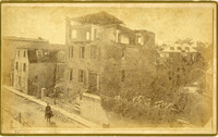
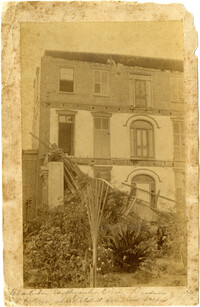
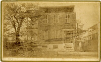
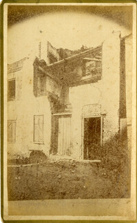
Written on reverse: 'House in which young Mr. Robson was killed. Two young ladies were buried in the ruins were rescued. Coming near Cannon.' Possibly from Cook's Earthquake Views, No.132, residence of J.N. Robson, from west. Written on front, at bottom: 'Charleston Earthquake view. Residence of Mr. J.N. Robson, whose eldest son was killed.' Charleston city directory for 1886 shows James N. Robson at 200 Coming Street.
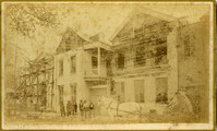
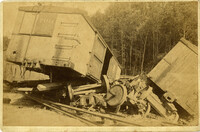
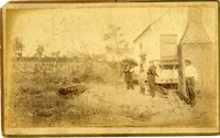
Caption: 'Cook's Earthquake Views of Charleston and Vicinity. Taken after the 31st of August, 1886. No.149, Robb's Lot.' Handwritten on reverse: ' Robb's Lot E. side [of] King bet[ween] Market & Horlbeck.'
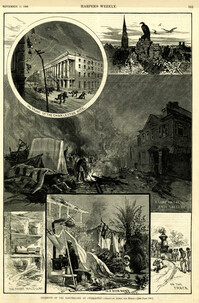
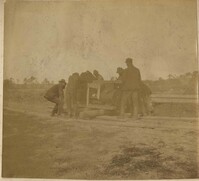
Main caption: 'Incidents of the Earthquake at Charleston.--drawn by Schell and Hogan.--[see page 590.]' Caption top left: 'In front of the Charleston Hotel.' Caption top right: 'looking over the roofs.' Caption middle: 'A camp on the East Battery.' Caption bottom left: 'The front wall gone.' Caption bottom center: 'In a rich man's garden.' Caption bottom right: ' On the track.' [full date September 11, 1886.]