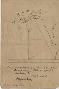
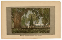
Office copy of a survey of 31 acres of land for Dr. R. H. Martin in Berkeley County. Notable geographic locations include Wappoo Road and Mill Tract. Names associated with this plat are R.H. Martin, G.G. DuPont, and W.B. Guerard.
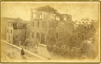
A newspaper article on the 1886 earthquake in Charleston. Several buildings are shown damaged, including St. Michael's Church, St. Philip's Church steeple, and Hibernian Hall. A street scene during the earthquake shows African Americans praying in the streets with several buildings on fire in the background.
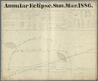
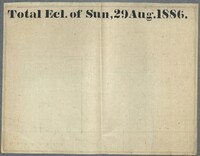
In this astronomical chart Gibbes provides a diagram and the elements for constructing the diagram. Those elements are hourly motion, declination, hourly motion in declination, horizontal parallax and semidiameter. Gibbes also provides the result times of the eclipse including the beginning, total, opposition, middle, end of total, general and duration of eclipse. The diagram shows the central path for the moon during the eclipse.
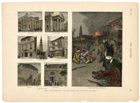
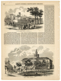
Illustrations of Charleston buildings from 1886 with accompanying article. The buildings shown are the Old Charleston Jail, the Marine Hospital, the Charleston Orphan House, Citadel Square Church, and the Roper Hospital. The article gives a detailed description about the interior of the Charleston Orphan House.