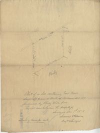
Plat of a land containing ten acres, minimal detail showing the surrounding property owners and two roads; Dills Bluff and unnamed public road. Names associated with this plat are Plenty White, Simons and Howe. Notable geographic locations include Dill's Bluff.
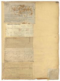
Page 119 of the City Engineer's Plat Book with five plats. Plat 1 shows land located between East Bay Street and the Cooper River. Plat 1 also shows Trott Street, Hasell Street, Concord Street, and Pinckney Street. Plat 2 features Bennett's Rice and Lumber Mills, near East Bay Street. Plat 3 features a plot on East Bay Street. Plat 4 features lots and structures located near Church Street and Market Street, and shows a lot labelled "Gas Company." Plat 5 shows lots located near the intersection of East Bay Street and Lodge Alley.
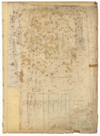
Page 59 of the City Engineer's Plat Book with two plats. Plat 1 shows lots on East Bay Street, between Pritchard Street and Rose Lane. Plat 2 shows a lot and buildings belonging to the Charleston Gas Light Company, located on Church Street.